

sPECIAL THANKS
Cal State Northridge
Chris Salvano, Geography Map Librarian
Jennie Quinonez-Skinner, Oviatt Library Reference Coordinator
UCLA
Andy Rutkowski, Geospatial Librarian, Charles E. Young Library
Getting the ball rolling
Greg Scarich, tracing his family history
and Maptime for providing material for this workshop
Let's explore
library tours

historic maps
name that map
or area of Los Angeles while introducing yourself

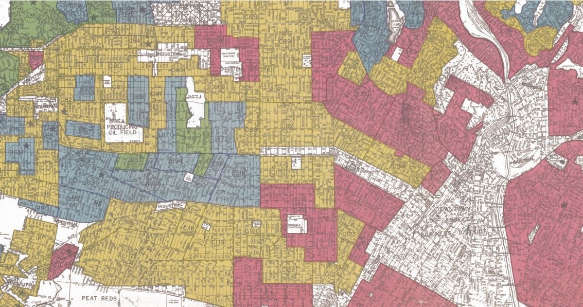
Home Owner's Loan Corporation
Security Map, 1939
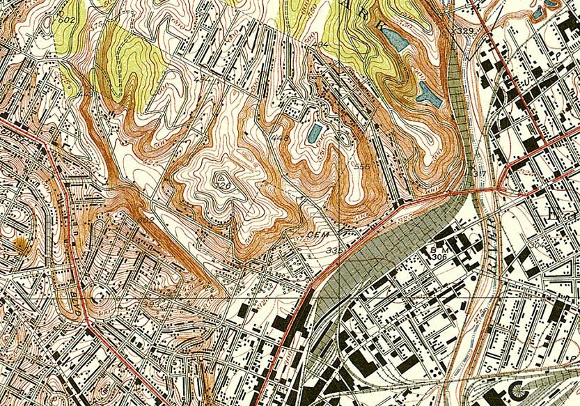
Chavez Ravine | Southern Pacific Rail Yard ,1928
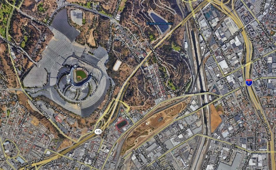
Dodger Stadium | Los Angeles Historic Park, 2017
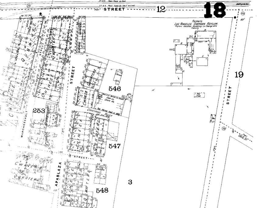
Chinatown 1894| Union Station,1941
Sanborn Fire Insurance Maps

We're going to talk about Georeferencing
which is the process of putting images of maps into a digital geographic context
Why might you want to do this?
You may not have access to the data used to make the map, but want to see the map in the context of other geographic data.
- Historic maps - what used to be here?
- Photos of non-current political district maps...snap a photo of that old map you see in a public building
- Maps from community development corporations, from old hand drawn annual reports and the like
- Zoning maps from small municipalities that don’t have a GIS department
- Community plan drafts handed out at public meetings (likely created in CAD/GIS, but without easy access to the consultant, etc.)
What are the possibilities of using georeferenced maps? Why take the time?
We can make Story Maps.
Some Examples
With today's digital tools we have ways of telling a story and reaching a wider audience
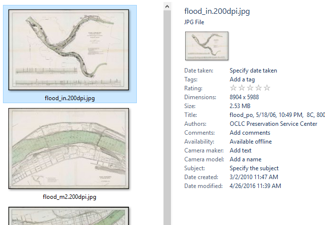
First, Let's find some images of maps!
historic map resources
Important!
Many historic maps are in the public domain.
However, always be cognizant of copyright and license when using the work of others.
New York Public Library (NYPL) Digital Collection: digitalcollections.nypl.org
NYPL includes some maps outside NYC. Search for “pennsylvania map” and check the “search only public domain” to see some great stuff! (and you can filter down by “place” once you are in the main search area.)
Also see buildinginspector.nypl.org and spacetime.nypl.org for some interesting historic mapping projects from the NYPL.
All the maps maps on these sites are stored as image files.
The files themselves contain no machine-readable geographic information.
If we want to view these maps in a geographic context, with other geographic data...
we need to georeference them
What does it mean to georeference an image?
First, let's talk about the basics of images on computers and maps.
A raster stores data in pixels

RASTER

On maps, pixels are powerful.
In Geographic Information Systems (GIS) software, the pixels of a raster can represent color, height, slope, direction...and many other classifications or gradients.

Geographically-referenced raster data is commonly encountered in:
-
satellite imagery
-
weather data
-
digital elevation model
Such rasters contain geographic reference information that describes where the pixels exist on the globe.
This info typically includes the coordinate system and some information about the raster's dimensions, in a standard format.
The historic images do not (yet) have this information.

Some references on coordinate systems:
Raster as a text file (ascii) with geo info:
Raster as a text file (ascii) with geo info:
Georeferencing
the process of giving non-geographic data the geographic attributes it needs to be shown in the correct location on a digital map
Read Esri's Fundamentals for georeferencing a raster dataset for a good conceptual overview
basic steps
to georeference
Image Space,
Coordinate Space

Identify Control Points
A little bit of art
to the science...
Find clearly-defined points of reference,
like buildings or intersections.
Avoid using "soft" references,
like shorelines.

Rectify
Save the image to coordinate space

Technically | source

stretch that map | source

how to georeference
with QGIS, Open Souce Geographic Information System
What we will do
- Familiarize with QGIS
- Adding Basemaps with OpenLayers Plugin
- Using the Georeferencer
- Geotiffs and where we can use them
- Generating Raster Tiles with the QTiles Plugin
- If there is time, Uploading Raster Tiles to Github
QGIS Interface (QGIS Training Manual)
1. Layers List | 2. Toolbars | 3. Map Canvas
4. Status Bar | 5. Side Toolbar

Adding Baselayers like OpenStreetMap, Google Maps
with the OpenLayers Plugin

Adding Baselayers like OpenStreetMap, Google Maps
with the OpenLayers Plugin

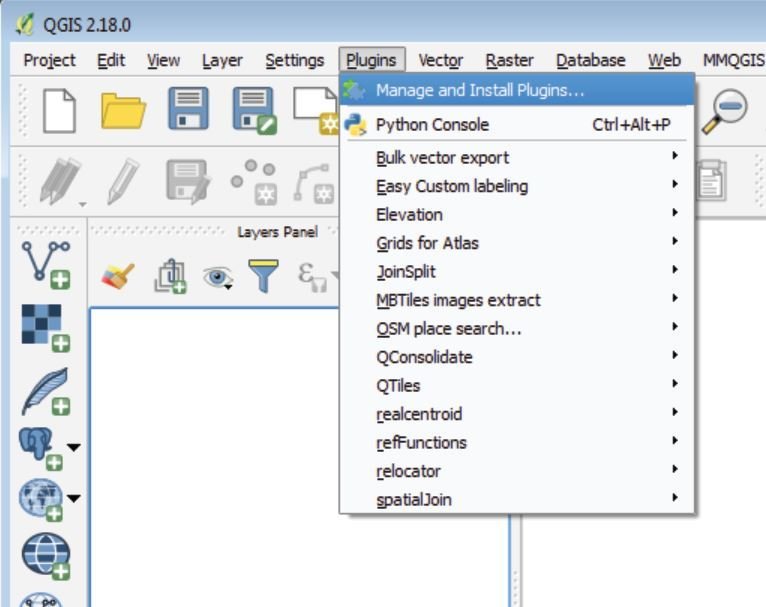
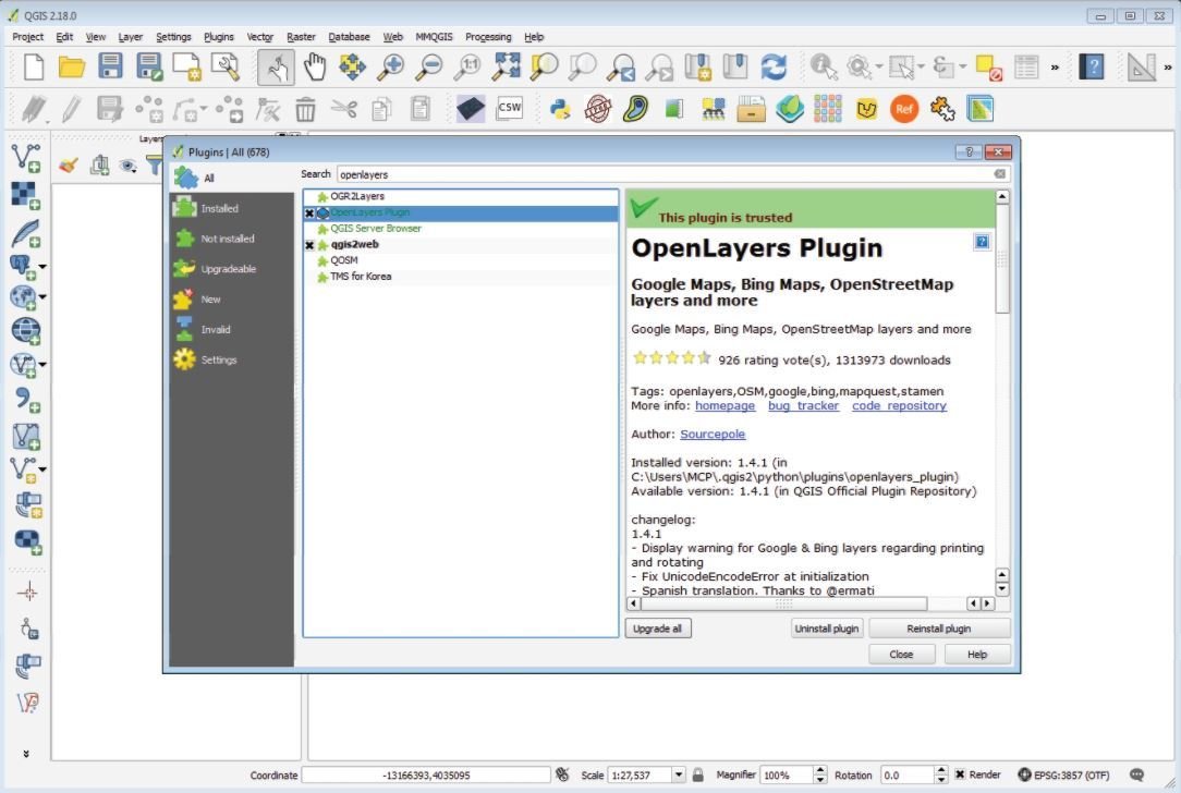
Installing OpenLayers to your QGIS
- Select the Plugins Tab, and select Manage and Install Plugins
- In the search bar of the window, type "Openlayers"
- At the bottom right of the window select install
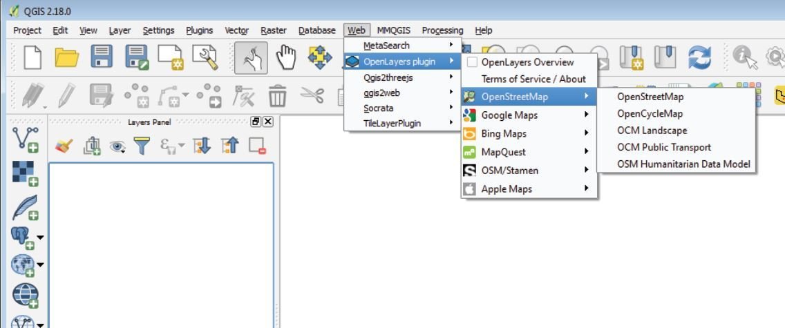
Loading basemaps to QGIS
- Select the Web tab and select "OpenLayers plugin"
- Select your desired map
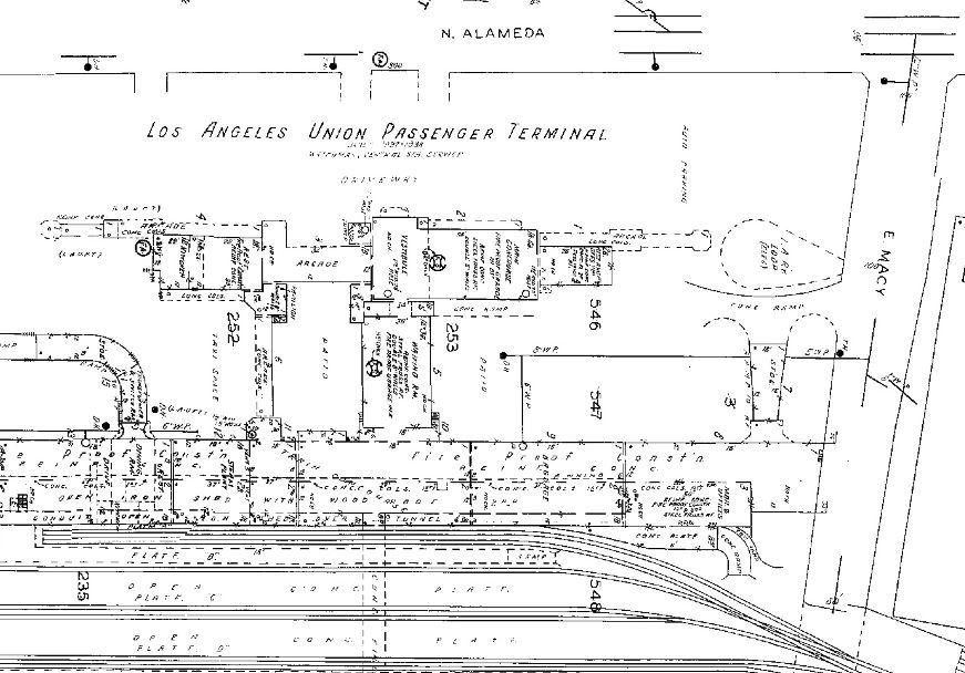
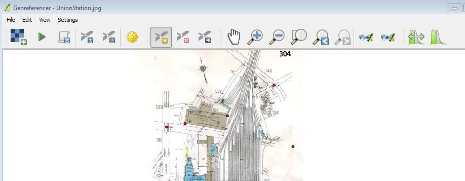
Georeferencing a scanned map
- Let's use start
- with Union Station

Georeferencing a scanned map
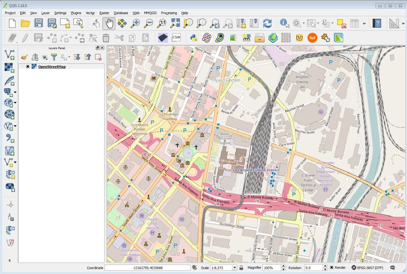
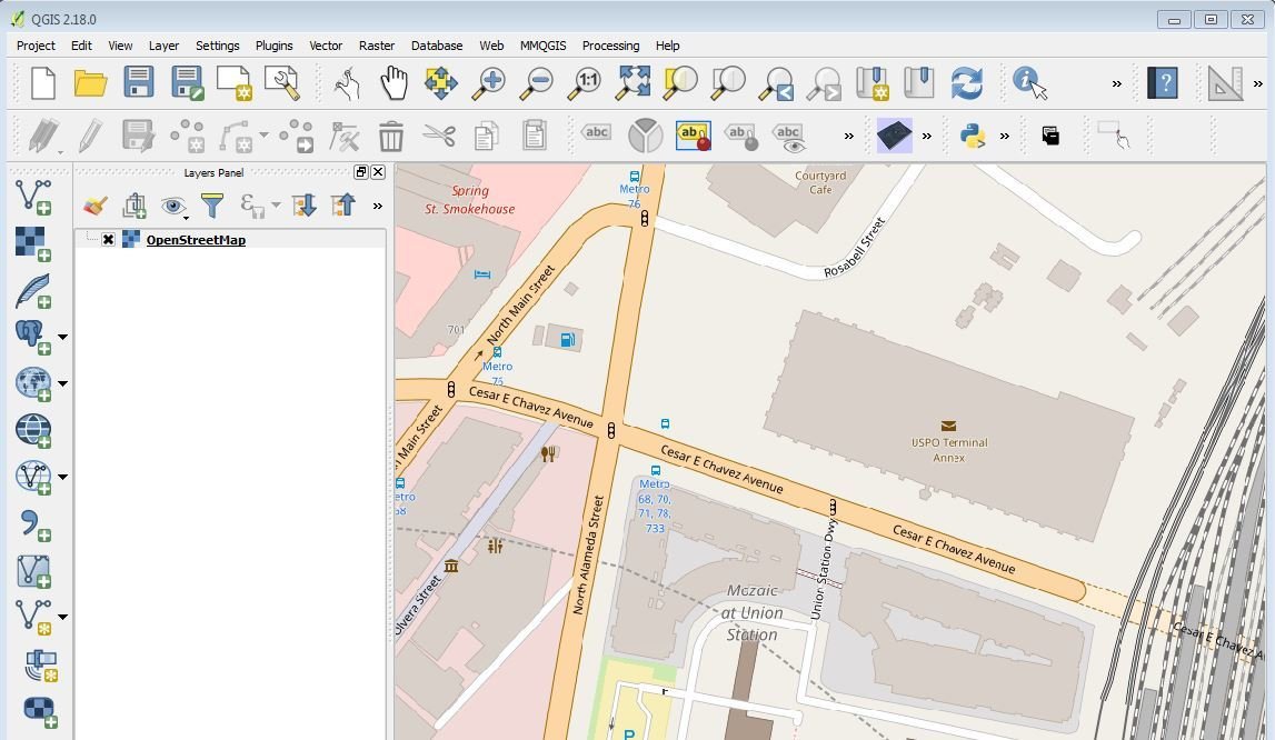
- Add a basemap to serve as the coordinate space
- Use OpenLayers and add OpenStreetMap
- Zoom over to Union Station
Georeferencing a scanned map
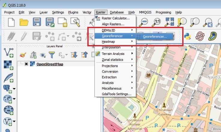
- Select the Raster Tab and select "Georeferencer"
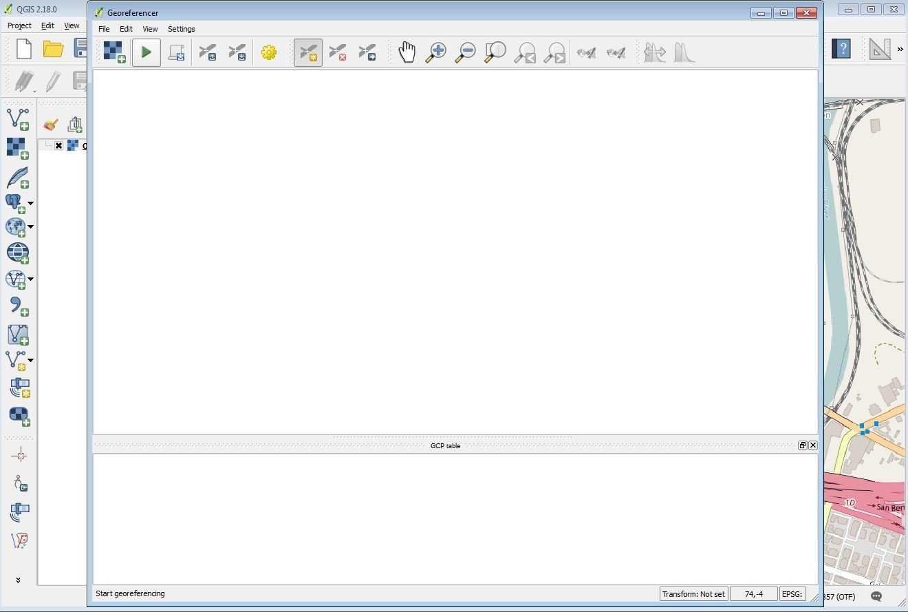
Georeferencing a scanned map
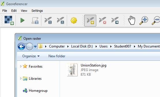
- Add the raster map of Union Station
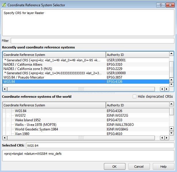
- Because we are going to make webmaps in the Coordinate Window, select WGS84
Georeferencing a scanned map
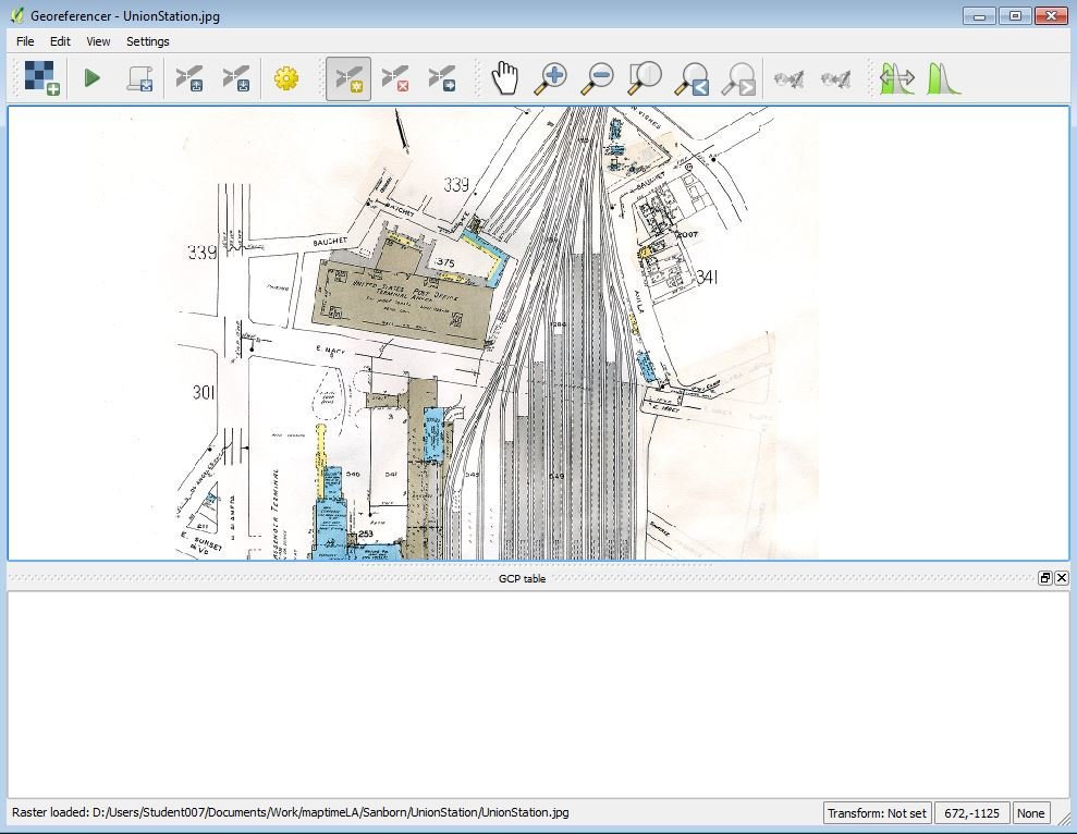
- Your map should be loaded into the map window
Georeferencing a scanned map
-
Find clearly-defined points of reference, like buildings or intersections.
-
Avoid using "soft" references, like shorelines.

Georeferencing a scanned map
-
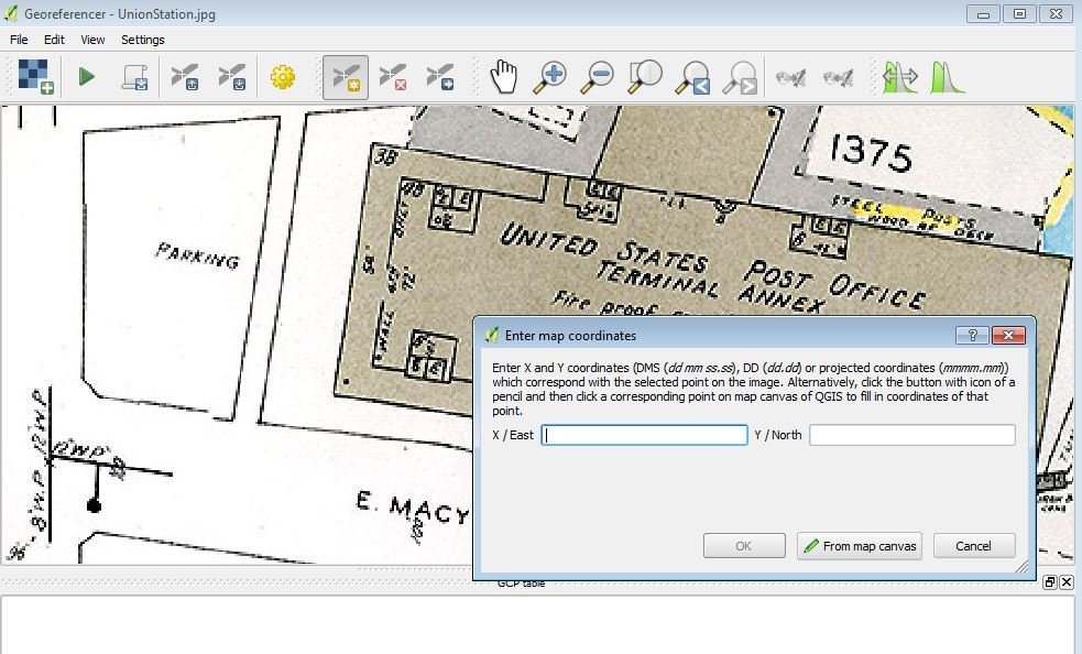
Let's start with the Post Office, click at the corner to open the map coordinate window.
-
To get the coordinates, select the "From map canvas"
Georeferencing a scanned map
-
In the basemap area, zoom and pan to the corner of the Post Office and click a the corner to obtain the coordinates for your georeferencer
Georeferencing a scanned map
-
Add as many control points as necessary to better rectify the image.

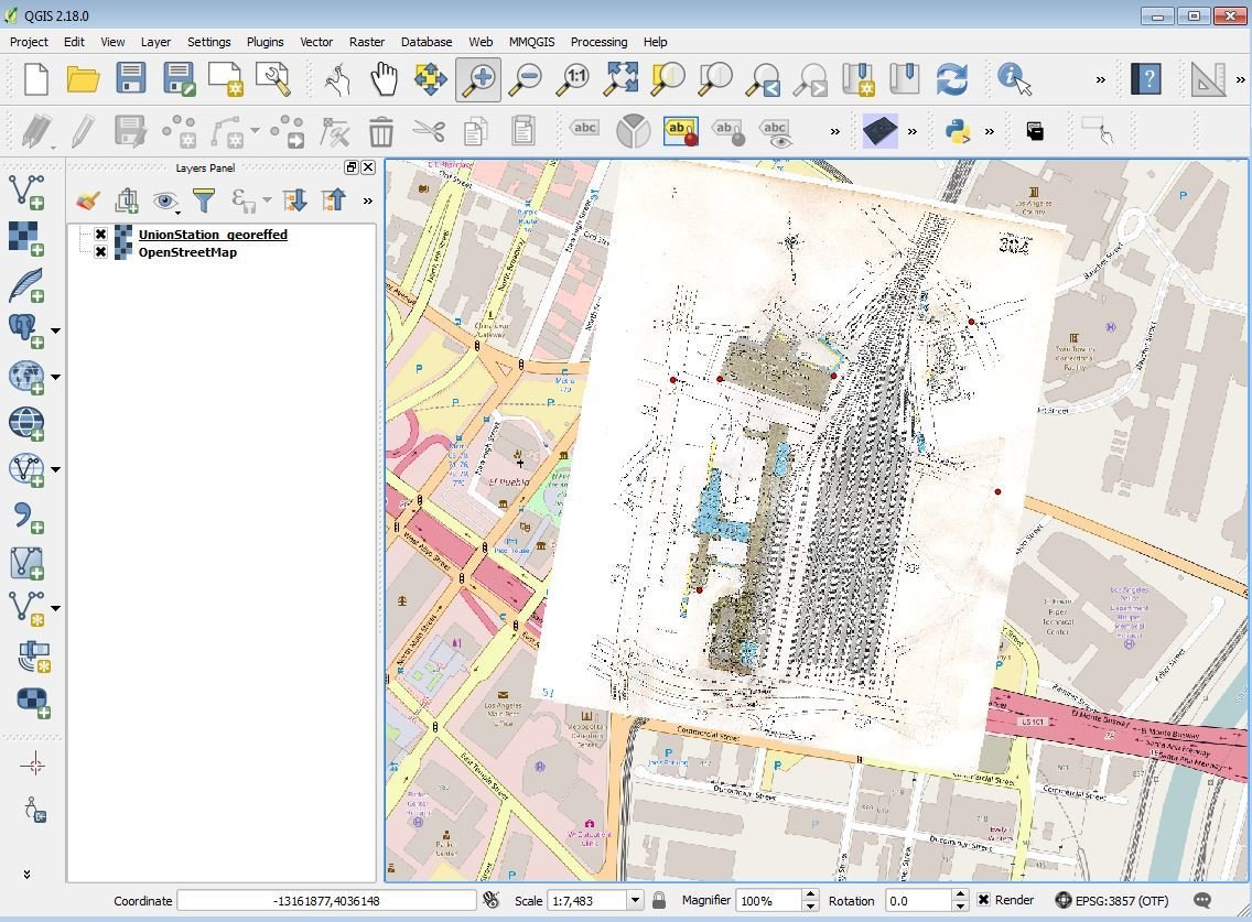
Georeferencing a scanned map
-
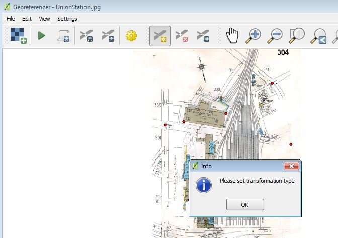
Now let start the georeference!
-
Hit the play button on the toolbar, it will ask you for select a transformation type.
Georeferencing a scanned map
-
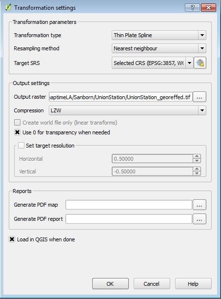
Basic settings include setting the transformation type to "Thin Plate Spline" to the nearest neighbor
-
Select the "Target SRS" to be WGS84
-
In the Output Raster, select the area where you want QGIS to save your georeferenced image.
-
Set the "Use 0 Transparency" if the image may get rotated.
-
Make sure the "Load in QGIS when done" is set to have the image load on your map in QGIS
Georeferencing a scanned map
-
After you hit OK, you be back to the georeferencer. Unless you have already made the transformation settings before, nothing has happened.
-
To begin georeferencing, hit the green play button.
Georeferencing a scanned map
-
Your image is now georeferenced!
-
You can now add additional layers for your projects or take the geotiff and load it into Google Earth, Mapbox and many other mapping tools.
Making webmaps with qgis
- What are webmaps?
- Using the QTILES plugin to generate tiles with Leaflet
- Using Github to host your maps and data
THANK YOU!!!
next up, Saturday May 20th in Downtown LA
How to make a Storymap!
Tools we'll be using

maptimeLA_historicmaps
By Omar Ureta


