Bunkum
The most important town that never existed
Thanks to:
- Iroquois County Historical Society
- Iroquois County Genealogical Society
- Iroquois County Clerk/Recorder
- Jasper County Surveyor
- Chicago Historical Society
- Chris Kaufmann
The NCHS "kit"
Bunkum and Brian
- My Medaryville project and Josiah Walden
- My first visit in 2010
- My encounter with the Old Chicago Road
- My lucky misunderstanding with Kay Babcock
I had questions
- Where did Bunkum get its name?
- Why was Gurdon Hubbard so important?
- Where does the Old Chicago Road meet Hubbard's Trail?
- Why did tiny Bunkum deserve an extensive Indiana road?
- Did Hubbard really live in Danville with Watch-e-kee?
- Is there anything left of Hubbard's Trail?
The timeframe
- Indiana and Illinois were in the Northwest Territory
- Treaty of St. Mary 1818
- Treaty of Tippecanoe 1832
- Treaty of Chicago 1833
- Transition from Native Americans to whites
- Presentation timeline: 1820s to about 1880
I. Bunkum as towns

Salem Ely wrote a history in 1918
Multiple towns on the site
- Important ford across Iroqouis
- Like Baum's Bridge over the Kankakee
- Existing Potawatomi Village there
- Iroquois County struck off from Vermilion, 1833
- May, 1835: Montgomery, first county seat
- April, 1836: Iroquois (East of Montgomery, not north!!)
- June 1836: Concord
Montgomery was abandoned
- Wrong side of tracks
- Lower ground
No one ever lived in the original Iroquois
Original Iroquois plat was vacated
Much of Montgomery plat also vacated
What about Bunkum!!??!!
- Has never been an official name
- Nobody knows for certain; hypotheses abound
- Named by fur trader Gurdon Hubbard
- Derived name from Buncombe County, North Carolina
- A derisive term shouted by a drunk traveler
- Easy to disprove the first two; hard to prove the last one
- The nickname applied to the general area

How name got to be Iroquois
- Town and PO were named Concord
- Railroad came through in 1871
- Named the station "Iroquois"
- PO changed name shortly thereafter
- Officially changed name in 1881 upon incorporation
- Full circle back to Hubbard's original name
If we don't know how or why, can we figure out when Bunkum was first used?

Ad in Jasper Banner
1857
Jasper County records first mention "Bunkum Road" in 1869
John Ade said that's where he was going in 1853
So the evidence points to the name arising around 1850
Some Views


Calaboose was moved in 1993

Entrance to Dunning Park

Bunkum School, painted by ??

Last RR depot is now a residence

Intersection in Iroquois
(Pickaminch, Pickamick,Pinkamink)

"The Miller House"

Prairie Dell Meeting House

II. People of Bunkum
Profiled today
- John Ade
- Drs. Spitler and Fowler
- Gurdon Saltonstall Hubbard
John Ade (1828-1914)
- Chapter V, "Morocco in 1853" in county history
- If this were just college days again!!
- Came from Cincinnati by invitation
- Ayres & Co. of Bunkum had branch in Morocco
- Moved to Morocco after a few weeks in Bunkum
- Wrote county history in 1911
We'll be looking at maps of places he discusses later on in the presentation
Dr. William Fowler (1811-1872)
- Very early doctor
- His son married Edward Sumner's daughter
- Their daughter Jennie endowed Caldwell Home in Earl Park
- "by mistreatment he was induced to commit suicide by taking morphine" at age 61
Dr. Daniel Spitler (1843-1884)
- Son of Newton County's Zachariah
- Practiced in Iroquois
- Died very young, buried in Buswell Cemetery
- Other Spitler family members were at Bunkum, too
Gurdon S. Hubbard (1802-1884)
- "Founder" of Bunkum (182?-1828)
- Prominent Danville businessman (1828-1834)
- "Father of Chicago" (1834-1884)
There is many conflicting assertions in accounts of his early life!!!!
Hubbard's Bunkum
- He was second white man in that area
- His precise arrival year is in some dispute
- 1821-1824 depending on the source
- Opened a trading post primarily for natives
- Employed by John Jacob Astor's US Fur operation
- Was the first farmer in Iroquois County
- Established Hubbard's Trail during his time in Bunkum
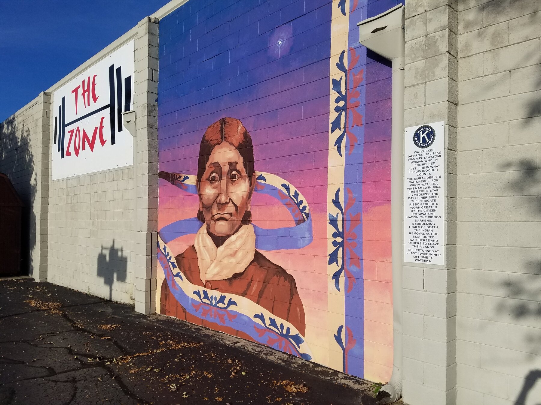
- Married Watch-e-kee, niece of Potawatomi chief Tamin
- Maybe started out near Middleport (Watseka), maybe not
Watch-e-kee Mural in Watseka
(Click for Findagrave page)

Historical marker on site of trading post
Stood approx. 1824-1860

There is a marker in Watseka; the Historical Society knew nothing about it
There actually have been two!

Hubbard's Landing, Smith St. @ River, Watseka 9/23/23


What the marker used to say!
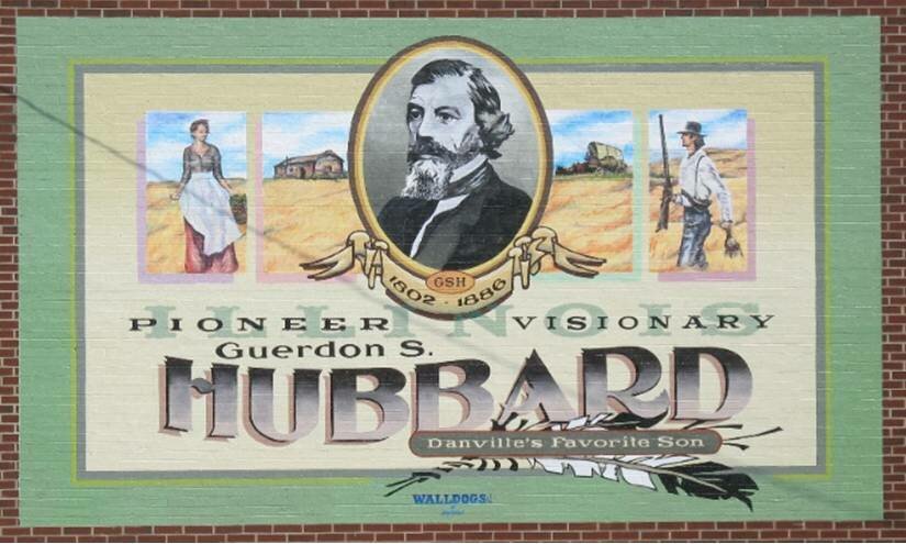
Hubbard in Danville
- He erected the first frame building there
- Moved there "permanently" in 1828
- Operated a trading post there, for the settlers
- Was elected to the state legislature while living there
- Hubbard's trail became Illinois 1, "Dixie Highway"
- In 1937 city celebrated his time there
- Plaque in Vermilion Co. courthouse
- Article in historical journal that year, too

Plaque at Vermilion County Courthouse


Hubbard at 28 ca. 1830
Hubbard Mural in Danville
Hubbard left for Chicago in 1834
- He was worried about moving to a smaller town
- He was first there in 1818, friend of Kinzie family
- Note that he was 16 years old!!
- Several sources: "He was the father of Chicago"
Hubbard's Chicago life truly seems stranger than fiction!!
His distinctions
- Provisioned Ft. Dearborn from the 1820s
- Built first warehouse in Chicago (Hubbard's Folly)
- Purchased 80 acres now in heart of "Loop"
- Operated first stockyards/slaughterhouse
- Our local land barons did that later, too!
- Was instrumental creating Illinois-Michigan canal

Historical marker near Chicago River

Map of Chicago ca. 1833
More Hubbard touts
- Formed first church
- Established first fire department
- Owned "Billy Caldwell's House"
- Calwell also known as "Sauganash"
- Was city's first insurance underwriter
- Wiped out financially by Great Chicago Fire
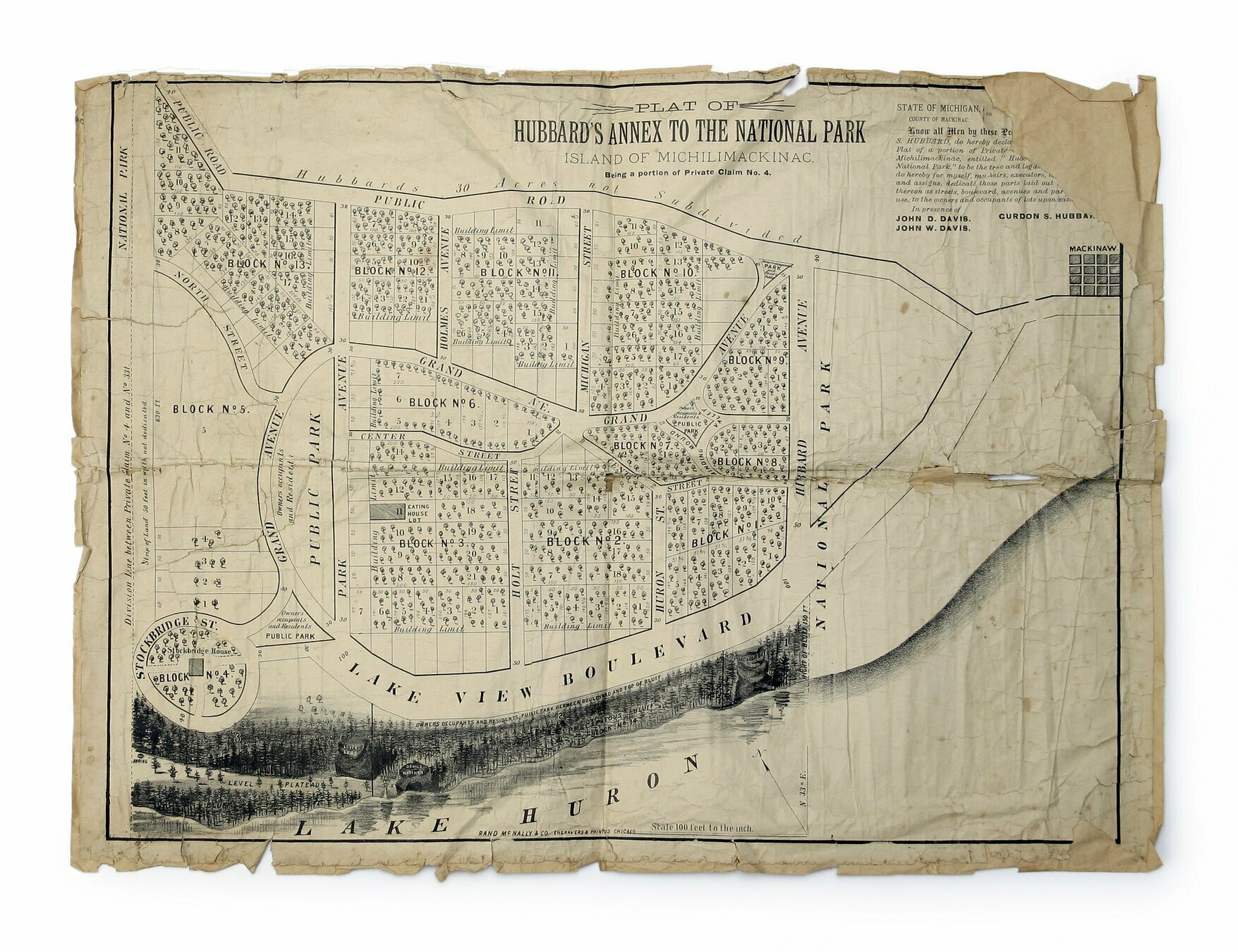
- Recovered by forming Mackinac annex
Hubbard's Annex to Mackinac Park
(click for larger image)
His autobiography is my primary source
His diary, basis of book, was lost
- Another maddening discrepancy
- Most sources say he lost it in fire
- Chicago Tribune story says he loaned it to business partner and it was never returned


Portrait from his autobiography
He laid out Hubbard's Trail
- Parts followed old Native American traces
- Illinois Highway 1 mostly follows it
- Went from just west of Vincennes to Chicago
- Connected to Indiana's "Old Chicago Road" near Sheldon
- This is the part that stole my heart
III. Early Traces, Trails and Roads
Just where is Bunkum?
Ade's Trip to Bunkum
- Cincinnati to Madison on boat
- Madison to Indianapolis by train
- Indianapolis to "hill 3 miles E of Lafayette" by train
- To Bunkum w/Mark Ayres in "two-horse carriage"
- First to Oxford
- Oxford to Parish Grove
-
Parish Grove to Sumner's Grove
- Sumner's Grove is Sugar Grove on map
- Sumner's Grove to Bunkum
I have some of these maps; almost all of them, and more are at
Lafayette to Oxford
(These maps Colton 1856)

Oxford to Parish Grove
Now it's The Old Chicago Road!!

Sumner's Grove to Bunkum
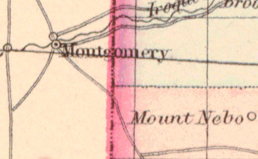

White's Grove not in Jefferson Twp
(Asher Adams 1865)

Iroquois through Newton Co. ca. 1856
(Baskin-Forster Atlas of Indiana Counties)
Some interesting road views

Colton's Map of Indiana, 1838

Note location of my gg-grandfather's farm!!
(He bought first parcel in 1862)

All roads lead to Crawfordsville!!!

Bunkum "Roads" ca. 1856
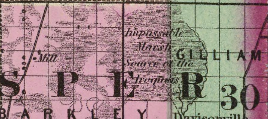
Impassable Swamp, Source of the Iroquois
(Asher and Adams, 1865)

Hubbard's Trail and Old Chicago Road

Remaining mile marker of Hubbard's Trail
Crete, IL

All roads lead to Bunkum, too!!
(1856 Warner & Beers Illinois)

1860 Map by Wilson
(A whole research project lurks here!!)
Guernsey's Map of Indiana 1933
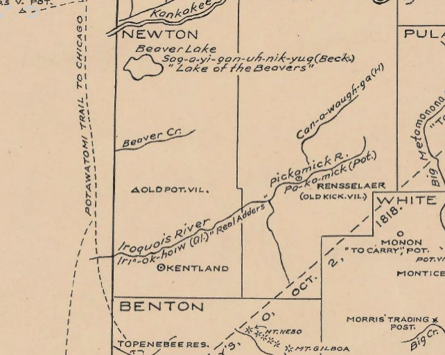
Focused on Native American Features

Colton's Indiana, 1856

Gray's Indiana, 1871

Johnson's Indiana, 1864

Tanner's Indiana, 1841

Asher and Adams 1865

Boynton's Indiana, 1838

Tanner's Indiana, 1846
TBD
- What year did Hubbard arrive in Bunkum?
- Can we prove the origin of the name?
- Did Watch-e-kee ever live in Danville?
- Where did the Chicago Road meet Hubbard's Trail?
- The mystery "year(s) in Middleport"


