
Brian Capouch
Chris Matthys
Quick bio
- Grew up on the Gehring muck farm in Jasper County
- Degrees in Spanish and Agricultural Engineering Technology
- Have worked as a crop consultant off and on
- 34 years teaching Computer Science at Saint Joseph's
- Since retirement, local history and historic restoration
- Currently restoring Sunny Crest, a farm estate in Benton County
My marshy past
-
Gehring Farms
- Pinkamink/Iroquois
- Elmer Gumz Farms
- Kankakee
- Zig-zagging across the 2nd Principal Meridian
- Arthur Gumz/Danny Overmyer
- Big Monon/Tippecanoe
Goals
- Examine the natural history of the Kankakee
- Introduce an amazing history of the river
- Note where places mentioned in the book are today
1. Natural History of the Kankakee
What do I mean "Kankakee?"
- The Kankakee Valley proper
- Iroquois and Yellow Rivers are tributaries
- Iroquois/Pinkamink "sort of" the same
Kankakee River/Marsh Stats
- Original fall approx 6" per mile
- Over 2000 bends, oxbows, and meanders, etc.
- Approx. 85 miles as the crow flies
- ~250 miles counting all the bends
- Marsh extent 400,000 acres (or more)
- 3-5 miles wide
Soil-forming forces in nature
- Glacial movement
- Fluvial (Flowing water)
- Lacustrine (Lakebeds)
- Aeolian (Wind)
Let's look at some recent history . . .
The Wisconsin glaciation began about 75,000 years ago
Reaching its maximum extent about 22,000 years ago

Glaciers advanced and retreated as the climate cooled and warmed
When glaciers stop, they leave end moraines

By this time the glacier is long gone
Huge amounts of meltwater were discharged below the end moraines
The meltwater carried with it materials swept up by the advance of the glacier
The material moved by glacial drainage is called outwash, and creates outwash plains

A glacier gone as far as it can go
The sandy outwash in the Kankakee Valley is notable for its massive extent
The meltwater also created many glacial lakes
The "lower" banks of glacial lakes were often formed by older end moraines
The Kankakee Torrent was a catastrophic flood ca 19,000 years ago
It was caused by a sudden breach in glacial Lake Chicago, precursor to Lake Michigan
It formed the basins for the later channels of the Kankakee and Illinois rivers
The canyons in Starved Rock State Park were formed by the Torrent

Meltwater then created Lake Kankakee about 14,000 years ago
Its bounds were (roughly) the Valparaiso Moraine to the north, and Iroquois Moraine to the south
The flat Kankakee's discharge was "dammed" by a limestone ridge near Momence, Illinois
(More about that in a bit . . . . . )

Summary of unique qualities
- Geologically recent (new land = good land)
- The torrent was responsible for basic shape of basin
- All four soil-forming processes seen in the Kankakee Valley
- The vast amount of sandy outwash is highly permeable
- This has led to some "wars"
- The glacial lakebeds were almost flat
- The rock ledge held back the water to create the marsh

Image courtesy of Kankakee River Basin Yellow River Basin Commission
In 1870, The Kankakee River Draining Company was formed
In 1882, John L. Campbell, Indiana's Chief Engineer, issued a report on the river

The biggest impediment was the Momence Ledge
But Indiana had no sovereignty there
A complex, contentious project
- Illinois asserted sovereignty, Indiana's locals revolted
- Various remonstrances, bills, lawsuits, etc.
- Indiana quietly bought easements in Illinois
- The ledge was finally cleared in 1893
- 8649' x 300' x 2.5'
- 66247 cubic yards of rock removed
The first 7 miles at the headlands were straightened in 1896, by private parties
The Upper Valley drained by 1906
- 1896: 7 mi. privately done
- Miller Ditch 7.75 mi.
- Kankakee Improvement Co. 5.5 mi.
- Place Ditch 9.1
- 1906: Kankakee River Reclamation Co. 16.7 mi.

The cutoff was the western boundaries of Starke and Laporte counties
Work was completed to the Illinois line by 1918
- Original 250 miles -> 80 miles river length
- 400,000 acres -> 30,000 marshland
- Illinois was hostile; left their side untouched

What's in the book?
- Beautiful verbal descriptions of the river and marsh
- Vignettes of a number of historical figures
- Descriptions of historical events and river life
- Much discussion about the natives and their doings
Material from this book appears to have been heavily borrowed, sometimes without attribution.
About Charles H. Bartlett
- Born in South Bend in 1853
- Family home was first brick house in South Bend
- Father Joseph was merchant
- Family were longtime Abolitionists
- His g-grandfather Josiah signed the Declaration of Indpendence
- Member of first class, South Bend High School
- Later principal of the school
- Longtime leading editor at Scribner's.
Courtesy St. Joseph Co. Public Library
The Bartlett House, built 1850
A few passages from the book
From Wild Honey
These conditions spread for the bees a feast that offered the first nectar sippings while the snows were on the hillside, and that continued to proffer their sweetness in their tinted cups until most of the autumn leaves were on the ground.
From The Flaming Sea
A wind-driven fire sweeping through the width and the breadth of the Kankakee resembles in many features the dreaded prairie-fires of the Western Plains.
From Legends of Lost Lake
The stream that in this manner loses itself in the Kankakee is known in our day as the Barkosky; now, however, a mere canal straight and deep. They have taken out all the sinuous curves and loops by which the ancient water-way crept from its source, Lost Lake.
Historical Personalities
Dr. Sandy Elicott
- "The wise old storyteller"
- Son and grandson of pioneer traders
- Could be called the protagonist
- His stories, retold, form the backbone of the book
- He may also have been a literary invention
A word about Topenebee
- Very early trading posts
- Married Kakima, sister of Topenebee
- Their adopted grandson was Chief Abram Burnett
- Abram's birth mother was Topenebee's neice
- Trading post is now archaeology site
- Burnettsville, Indiana named for his son Abraham
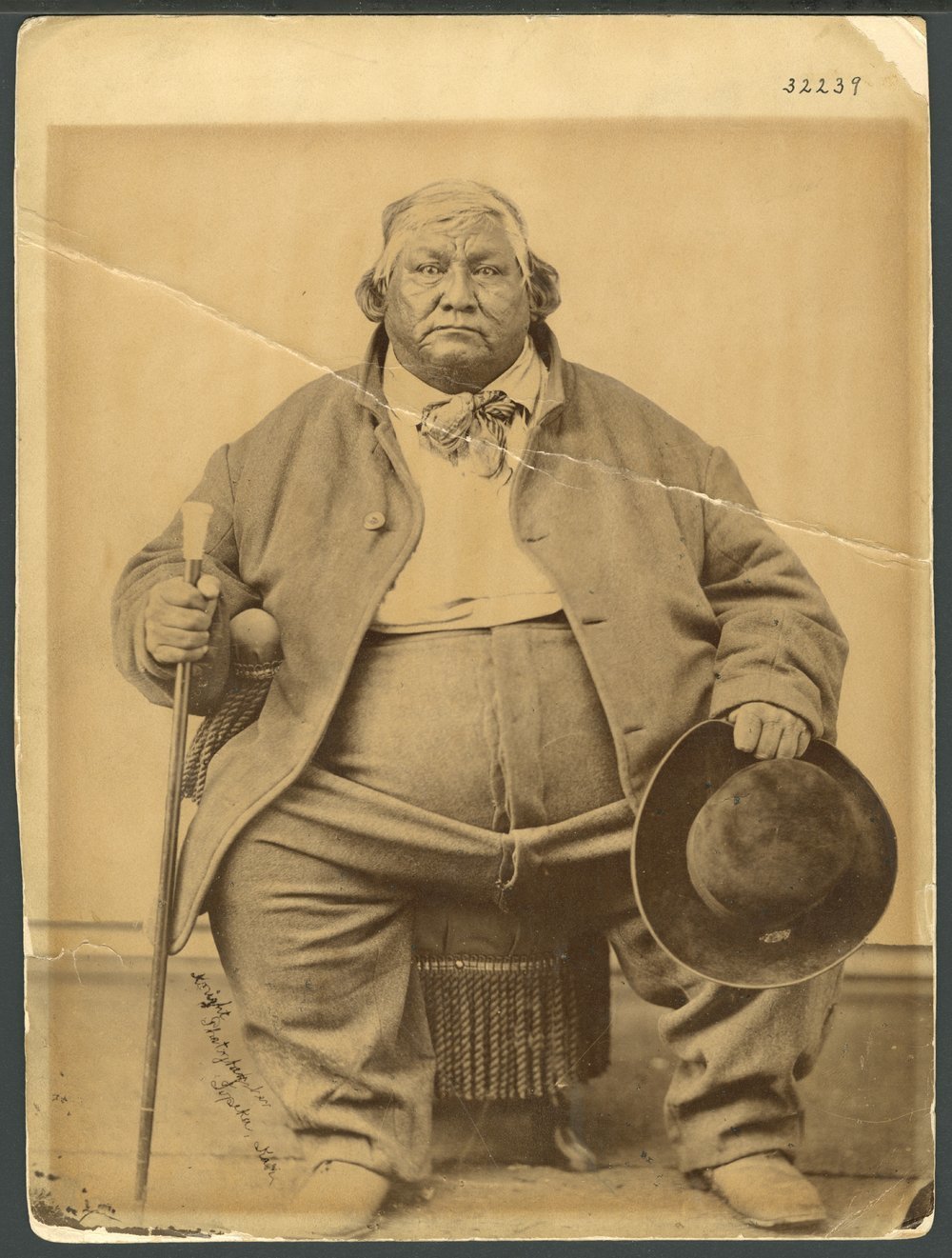
- Chief of the "Pokagon Band" for 42 years
- Married Elizabeth, daughter of Topenebee
- Their son Simon succeeded him
- Simon wrote 'The Red Man's Rebuke' in 1893
- Was an ardent advocate of assimilation
- Converted to Catholicism
- Negotiated special provisions in the Treaty of Chicago for his tribe
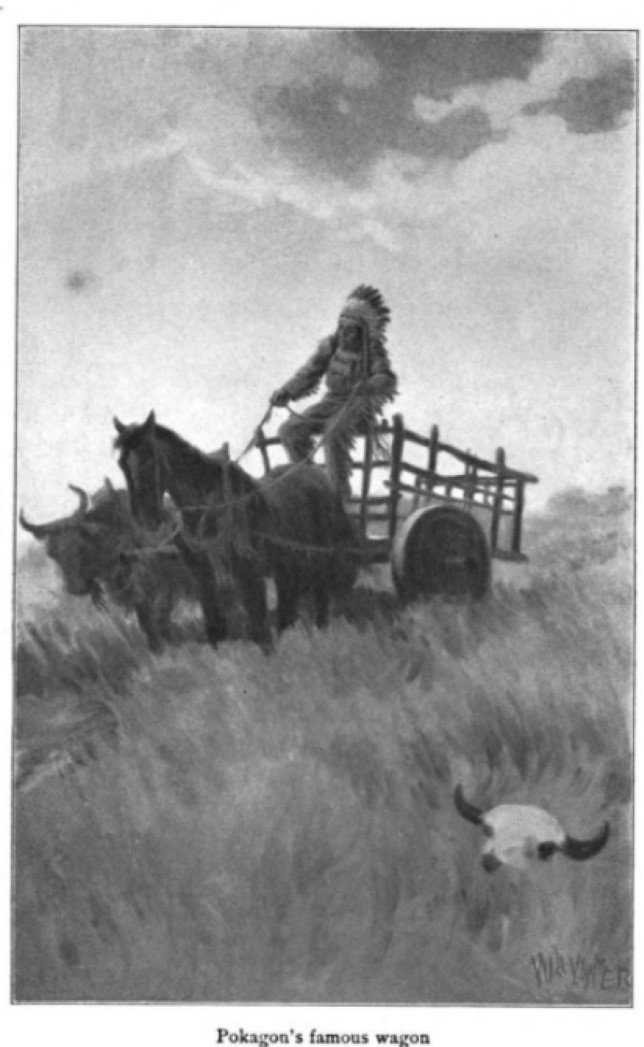
- Constructed a very curious conveyance
From Northwest Indiana Times
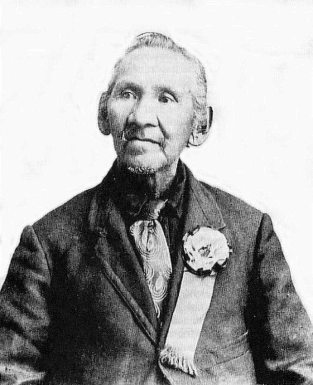
Image courtesy of Kankakee Valley Historical Society
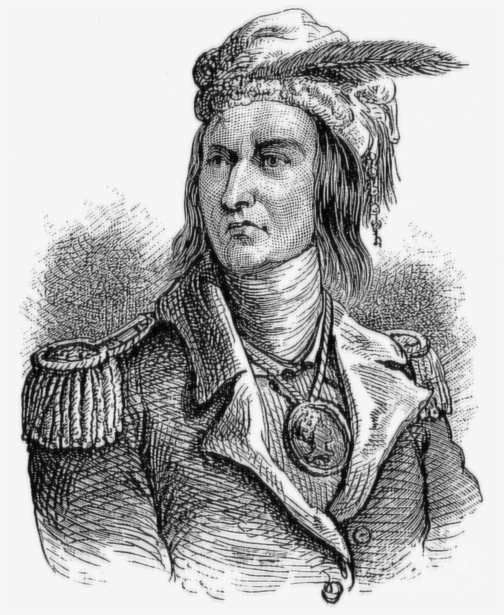
Native Americans in the area
- Pe-ash-a-way and Petapsco
- Topenebee and Black Partridge
- Tecumseh mentioned in very negative terms
- Tribes, their movements and affrays
- Comments on their nature and character
Sociological Observations
- Quiet and stoic
- Unusual relationship to time
- Sharing, even when starving
- Other specific oddities
- Swimming women
- Love children (and would steal to get them)
3. Where is it now??
Sleuthing out the locations
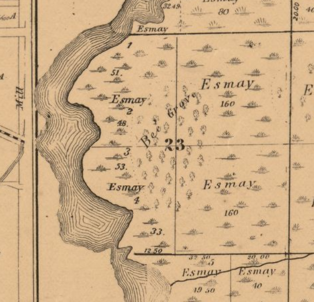
- Bee Grove
- The Parkovash
- The Kankakee/St. Joseph Portage
- Lost Lake
- The Barkosky
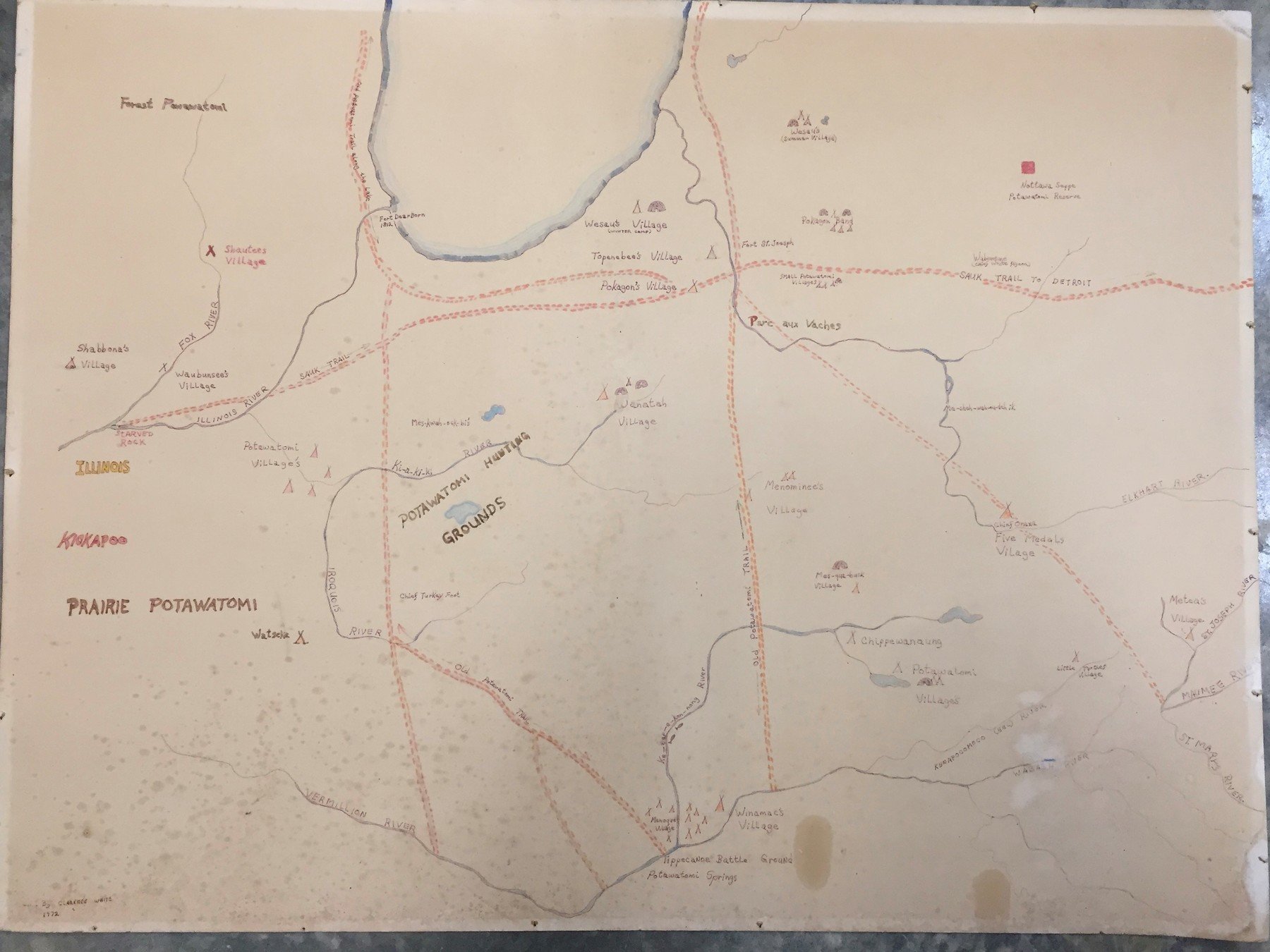
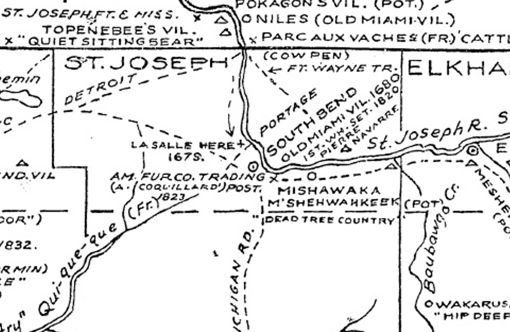
Clarence White map-1972
Map courtesy of Ėthë Bodwéwadmimwat
Pokagon Language Department
Map courtesy of Ėthë Bodwéwadmimwat
Pokagon Language Department
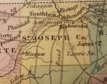
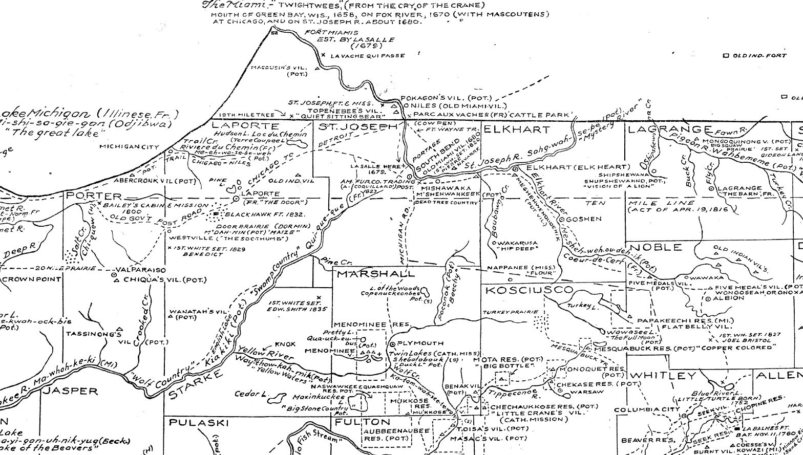
Tanner's 1841 Indiana
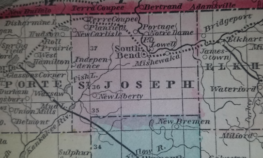
Tanner's 1850 Indiana
The Portage Route...
according to Bartlett

The Portage route according to
George Baker.

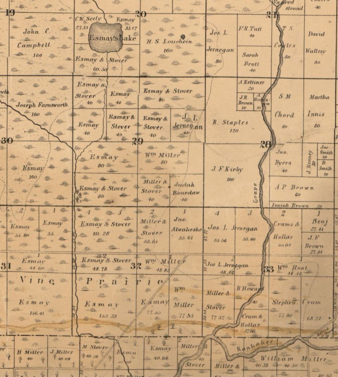
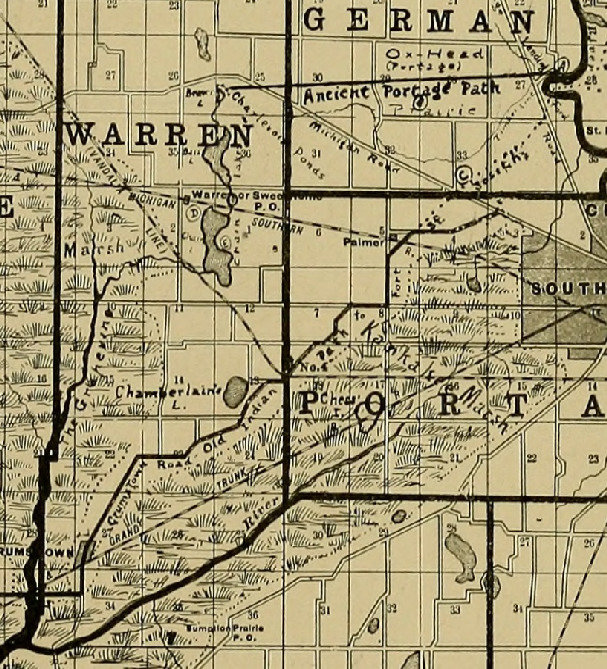
1863 Plat map.
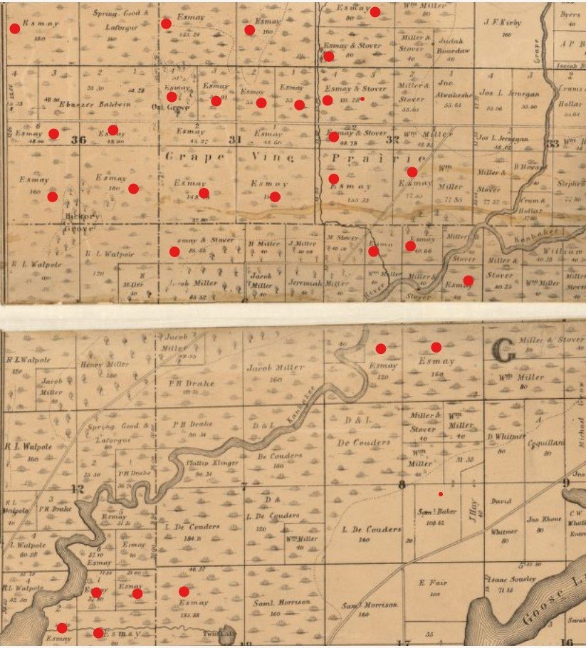
SOME of Caroline Esmay's land
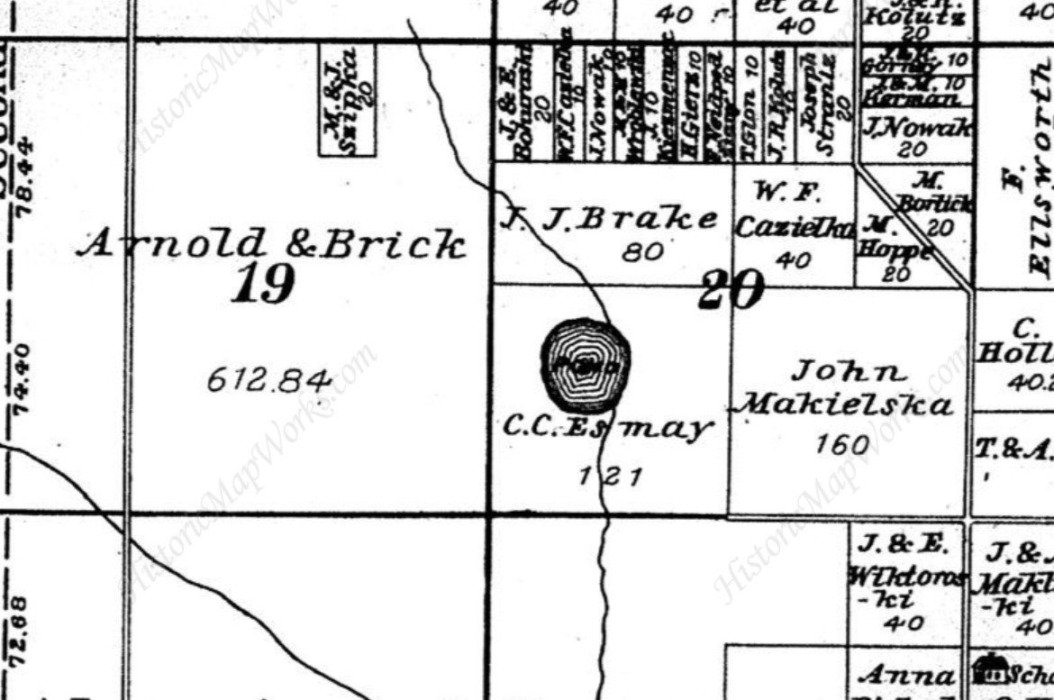
1895 County Plat map
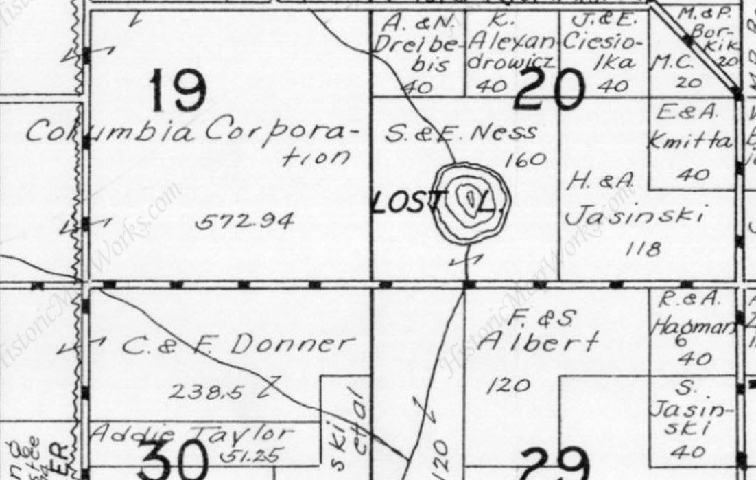
1945 Plat Map
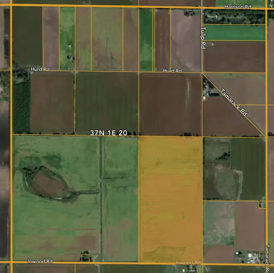
Lost Lake in 2022
Thank You!!
