How to Research
the History of Your
Old House
Part One:
Land and the Law
Primary Topics
- Legal Descriptions
- Conveyances
- Using the Recorders' Office
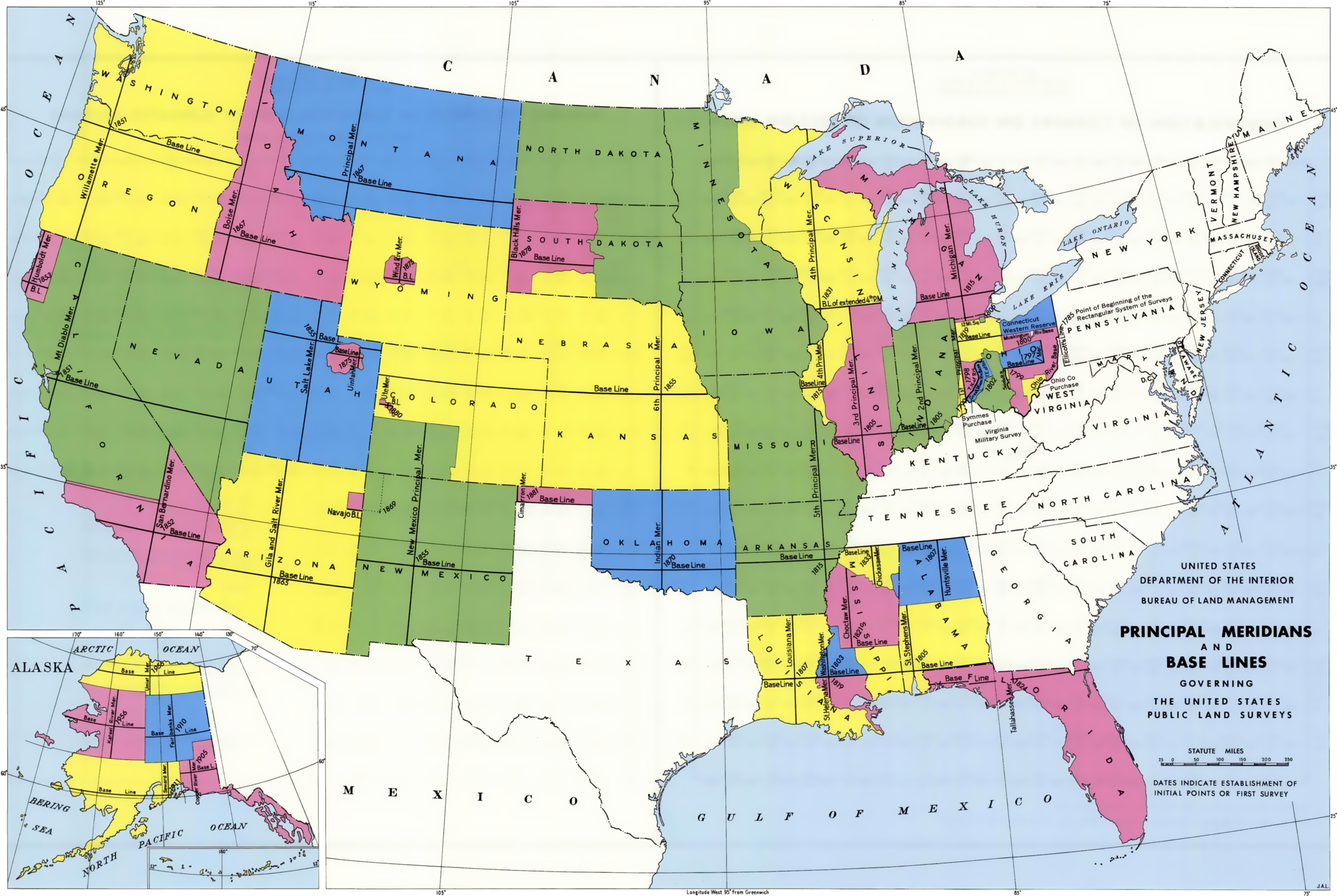
1. Legal Descriptions
What's an "acre?"
Key Points
- Based on Cartesian (X-Y) coordinates
- Basic unit is a section, one square mile, 640 acres
- A 6x6 array of sections is called a legal township
-
Not to be confused with a political township
- One has a name, the other a number
- Pulaski County's unique situation
-
Not to be confused with a political township
- Each township has a unique identifying number
- Range (East/West of meridian)
- Township (North/South of baseline)
- Each section in a township has a number, 1-36

e.g. Medaryville is in Sec 4, Twp 30N,R4W

Normal references are to
"aliquot parts"
- Based on halves and quarters
- "Nested," e.g. S1/2 NE1/4 NW1/4
- 20 acres
- Unwind from left to right

Land areas can also be platted
- A plat is a cadastral map, mapping geography to ownership
- Plats are always named
- e.g. "Medary Ville," "Elston's Second Addition"
- Broken up into blocks and/or lots
- Also show streets, alleys, public spaces, etc.
- Usually must be accepted by local government
- Descriptions will not include secion/township/range, etc.


Detail from Medaryville Plat
A Plat Book shows land ownership
- Land ownership is very dynamic
- Town and Country Publishing, LaPorte IN
- Old plat books are an enormously valuable resource


Detail from York Twp. Plat Map