GL 5 Communications and Flight Information

Rev 11/2024
Disclaimer
Students should use their textbooks, syllabus, and Airman Certification Standards (ACS) as their primary sources of information. EcFlight is an online training tool designed to simplify and enhance your ground school learning experience. However, it is not a substitute for FAA- or school-approved study materials. Before using these slides for study, always refer to your officially approved resources, such as the Jeppesen physical or electronic book and other FAA-approved materials.
Reference Books
- Pilot's Handbook of Aeronautical Knowledge(FAA-H-8083-25B). (2016). Oklahoma City, OK: United States Department of Transportation, Federal Aviation Administration, Airman Testing Standards Branch.
- Private Pilot Syllabus (10001292-002). (2012). Englewood, CO: Jeppesen.
- “When ATC Calls Traffic.” Senate Addresses Maintenance Tech Shortage - AOPA, AOPA, 5 Nov. 2000, www.aopa.org/news-and-media/all-news/2000/november/flight-training-magazine/when-atc-calls-traffic.
Index
Section A - ATC Services

Section B - Radio Procedures
Section C - Sources Of Flight Information
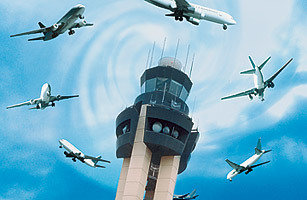
ATC Services
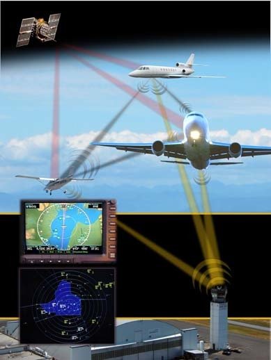
ADS-B
Automatic Dependent Surveillance Broadcast
- ADS-B allows pilots and air traffic controllers to "see" and control aircraft with more precision, and over a far larger percentage of the earth's surface that has ever been possible before.
Automatic - The aircraft automatically reports.
Dependent - Depends on WAAS GPS on board and an ADS-B.
Surveillance - Allows ATC to watch airplanes.
Broadcast - Aircraft position is broadcast.
There are two types of ADS-B:
- ADS-B IN
- ADS-B OUT
Since 2020 ADS-B OUT is mandatory for all aircraft if operating in class A, B, C, E at and above 10,000 ft but not below 2,500 ft.
FAA requirement for ADS-B
ADS-B OUT
It Broadcast your position. ATC needs this to track your position, ground track, altitude, ground speed, and ID to all ground receivers as well as other aircraft.
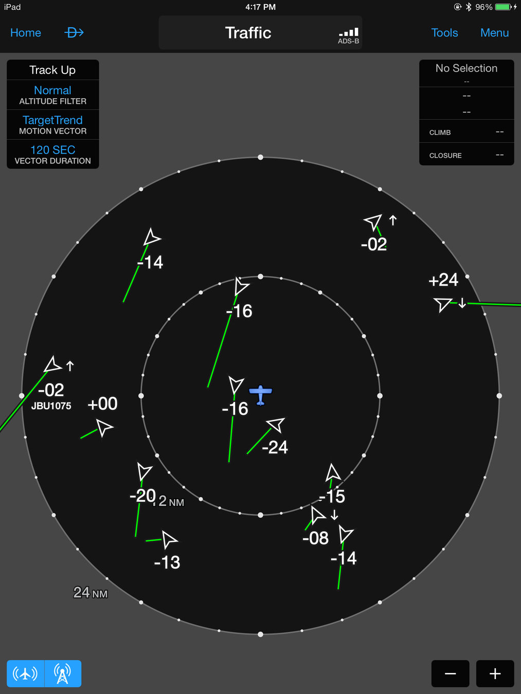
ADS-B IN
Requires a display in the aircraft and supplies weather, terrain, traffic and a detail moving map with topographical information that automatically displays a terrain advisory if the airplane is within 2 minutes or 300 ft of any obstacle.
987 MHZ universal access transceiver (UAT) Required
1090 - 1090 ES MHZ Required
FL 180
- Use only in the US. Targeted to General Aviation aircraft
- Includes Flight information service-broadcast (FIS-B), METAR, TAFs, TFRs.
- Detect aircraft that are transmitting on the same frequency also ground receivers.
- Accepted outside US
- no datalink weather unless 980 MHZ is also installed.
To avoid Frequency congestion, there are two different technologies:
Radar

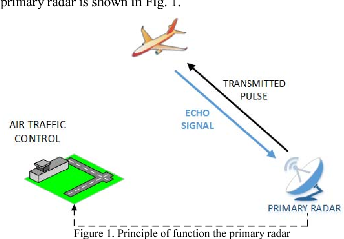
- Radar uses a synchronized radio transmitter and receiver to emit radio waves and process their reflections for display.
- Primary radar is a ground-based system used by ATC which transmits radio waves in a narrow beam by a rotating antenna.
- When the radio waves strike your aircraft, some of the waves are reflected back to the antenna and processed to provide an echo, which shows your aircraft’s location on a radarscope.
- The range of your aircraft is determined by measuring the time it takes for the radio waves to reach your aircraft and then return to the receiving antenna.
- The azimuth, or angle of your aircraft from the radar site, is determined by the position of the rotating antenna when the reflected portion of the radio wave is received. It is measured clockwise from north in a horizontal plane.
The air traffic control radar beacon system (ATCRBS), which sometimes is referred secondary radar, overcomes most of the limitations of primary radar. ATC typically uses secondary and primary radar together. The ATCRBS incorporates three components in addition to primary radar; a decoder, an interrogator, and a transponder.
The ATCRBS (Secondary Radar) incorporates three components in addition to primary radar:
1. Decoder
2. Interrogator
3. Transponder.
The FAA operates two basic radar systems:
FAA Radar services
- Airport surveillance radar
- Air route surveillance radar
Both use primary and secondary radar.
- They control direction and coordination of IFR traffic within specific terminal areas.
Airport Surveillance Radar
- Provide relatively short-range coverage in the airport vicinity.
- Approach and departure control manage traffic at airports with ASR.
The long-range radar equipment used in controlled airspace to manage traffic is the air route surveillance radar (ARSR) system.
Air Route Surveillance Radar
Battle Mountain Air Route Surveillance Radar
Air Route Surveillance Radar
Battle Mountain Air Route Surveillance Radar
Each station can monitor aircraft flying within a 200-mile radius of the antenna.
The direction and coordination of IFR traffic in the U.S. is assigned to Air route traffic control centers (ARTCCs). These centers are the authority for issuing IFR clearances and managing IFR traffic, however they also provide services to VFR pilots.
Although some stations can monitor aircraft as far away as 600 miles through the use of remote sites.
Any ATC radar facility can provide radar services for VFR aircraft.
VFR Radar Services
- Traffic Advisories
- safety alerts
- radar assistance
- sequencing and separation may be provided by ATC in radar areas.
This includes ARTCCs, as well as ASR facilities in terminal areas.
- ATC radar facilities provide traffic information to IFR aircraft. As a pilot of a VFR aircraft, you may request radar traffic information service, also called VFR radar advisory service.
Radar Traffic Information Service
- Intended to alert you to air traffic relevant to your flight. This service also is often referred to as flight following.
The basic purpose of VFR radar advisory service is to alert you to possible conflicting traffic, not to relieve you of your responsibility for collision avoidance.
Transponders
FAA requires that transponder must be tested every 24 calendars months for an operation in controlled airspace.
- The function selector of a typical transponder has several positions, which usually include OFF, SBY (STANDBY), ON, ALT (ALTITUDE), and TST (TEST).
- You can set up to 4,096 four-digit codes on your transponder
- The term squawk is used by the controller to assign your aircraft a code. There are some squawk codes that the pilot must keep in mind, in order to avoid any confusion
- 7700 - Emergency.
- 7600 - Lost communication.
- 7500 - Hijacked.
- 1200 - VFR Operations.
Flight Service Stations
Flight service stations (FSSs) are facilities that provide services to pilots like:
5. Relay clearance
7. VFR search and rescue services
4. File flight plans.
6. Enroute communication
2. Weather briefings
3. Airspace information
1. NOTAMS
Control Tower Services
- When, in the controller’s judgment, safety may be compromised ATC radar facilities issue safety alerts to participant aircraft.
Safety Alerts

- For example, you may receive a safety alert if you are in unsafe proximity to terrain, obstructions, or another aircraft.
ATC radar facilities may provide vectors to VFR aircraft in certain situations, information issued is advisory and the job of flying the aircraft safely remains with the pilot.
Radar Assistance to VFR aircraft
TRACON and ARTCC Services
- They are considered terminal facilities because they provide the link between the departure airport and the en route structure.
- Extends typically 30 nautical miles (NM) from the facility with a vertical extent of 10,000 feet; however, dimensions vary widely.
- Terminal facilities are approach controls and should be addressed as “Approach” except when directed to do otherwise (e.g., “Contact departure on 120.4.”).
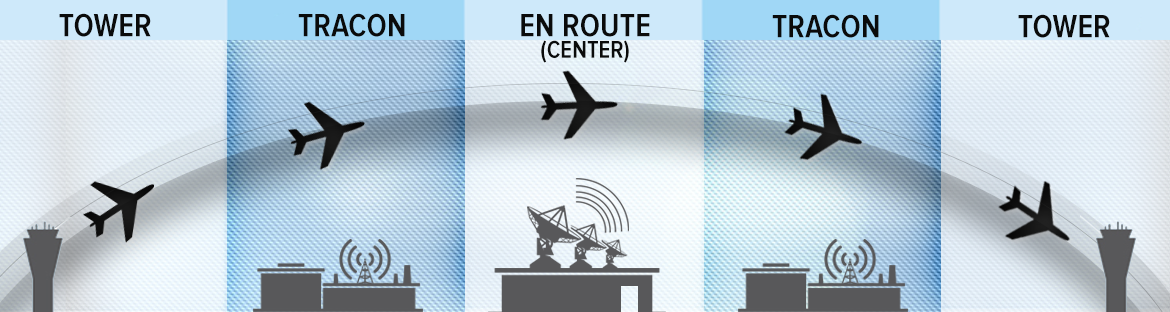
Air Route Traffic Control Center (ARTCC)
- ARTCC facilities are responsible for maintaining separation between IFR flights in the en route structure.
- Each ARTCC’s area of responsibility covers several states and is divided into sectors depending on the altitude.
- Separates IFR from VFR and give advisories to VFR aircraft on a workload basis.
Pilot Responsibilities
- During VFR conditions, is PIC responsibility to see and avoid. Even if you are under radar services.
Additional ARTCC services
- Weather information
- Safety Alerts
- Emergency Assistance
Provide:
Interpreting Traffic Advisories
Cessna Two-Seven Two-Eight-Charlie, traffic, twelve o'clock, four miles, opposite direction, Bonanza at eight thousand.
Understanding the nuances behind traffic calls and the three basic rules that govern air traffic controllers can help you to stay safe as you fly. The system is there to help you, so use it.
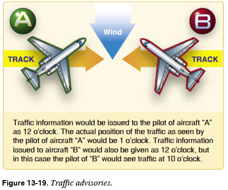
Respond to the controller with either "looking" if you do not see the other aircraft or "traffic in sight" if you do.
Radio Procedures
VHF Communication Equipment
- Communication radios in generally speaking use a portion of the very high frequency (VHF) range.
- Frequencies between 118.0 megahertz (MHz) and 135.975 MHz.
-
VHF antennas usually are the bent whip rods or plastic-encapsulated blade types that are mounted on top of the cabin.
-
Since communication radios usually combine a transmitter and receiver, they are called transceivers.
Using the Radio
Keep the radio transmission as brief as possible to help avoid frequency congestion.
Make sure that you receive the proper clearance before you taxi, takeoff or landing.
Phonetic Alphabet
Using Numbers on the Radio
Same way except the number nine It is spoken as "niner" to distinguish the word "nein" in German which means "no".
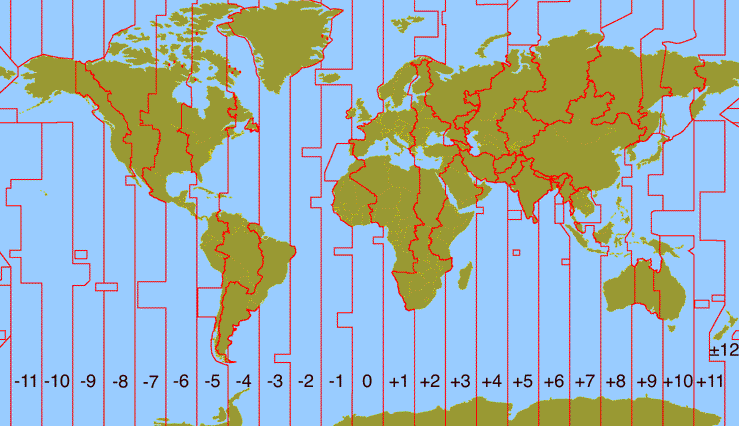
Coordinated Universal Time (UTC)
Referred also to Zulu time in aviation, places the entire world on a one-time standard.
It is the time at the 0° line of longitude which passes through Greenwich, England.
-
All of the 24 time zones around the world are based on this reference.
- In the United States, you add hours to convert local time to Zulu time and, to convert Zulu time to local time, you subtract hours.
Example: Colombia local Time: 10:00 - Zulu time (5) = 15:00 Zulu
Common Traffic Advisory Frequency
- When Operating At Uncontrolled Airports:
- Broadcast your position and intentions to other aircraft in the area on the common traffic advisory frequency (CTAF).
- It is important that all radio-equipped aircraft transmit and receive traffic information on a common frequency.
- You can receive airport advisories, and activate pilot-controlled lighting on the designated CTAF.
Common traffic advisory frequencies are listed in the Supplement chart, indicated on aeronautical charts, and may be obtained from the nearest FSS.
UNICOM
- A non-air traffic control private agency to provide advisory service at uncontrolled airports and to provide various non-flight services.
- In some airports, the UNICOM is used as the CTAF for self-announcement.
- You also can request information or services, such as refueling.
CTAF Procedures
For more information click here
- Make your initial call 10 miles from the airport.
- Report entering the downwind, base, and final legs of the traffic pattern.
- Entering and exiting a runway.
- Monitor and communicate on the CTAF from the time you start the engine, during taxi, and until 10 miles from the airport.
Controlled Airports
Responsible for providing the safe, orderly, and expeditious flow of air traffic at airports where the volume of aircraft requires such a service. You are required to get a clearance prior to operating in a movement area.
What is a movement area?
Movement Areas are Taxi ways and Runways. Pilots needs ATC clearance move the airplane.
ATC Facilities
- You need to establish communication with a control tower or approach control at a radar facility.
- Your initial call-up to ATC should include the name of the facility you are trying to contact, your full aircraft identification, and the request.
- An air traffic control clearance is an authorization by ATC for you to proceed under specified traffic conditions within controlled airspace. Its purpose is to prevent collisions between known aircraft.
Departures procedures
You must receive permission from ATC to taxi to the active runway and subsequently cleared for takeoff.
Clearance delivery
Established at busy airports primarily for ATC to relay clearances to departing IFR/VFR traffic
Ground Control
Ground control is an ATC function for the movement of aircraft on the airport surface.
Taxi clearance
Is an approval you must receive before you move.
Control Tower
After you complete the before takeoff checklist, you normally switch to tower in order to receive the clearance for takeoff

Reading Back Clearances
-
Read back entire Instructions
Example ATC:
"N123EC Straight out approve, runway 9R clear for taking off".
Readback Pilot:
"Straight out approve, runway 9R clear for taking off N123EC".
-
Acknowledge only the Information
Example ATC:
"N123EC Follow traffic, 2 O'clock on final 9R".
Read back from Pilot:
"Looking for traffic".
Lost Communication Procedures
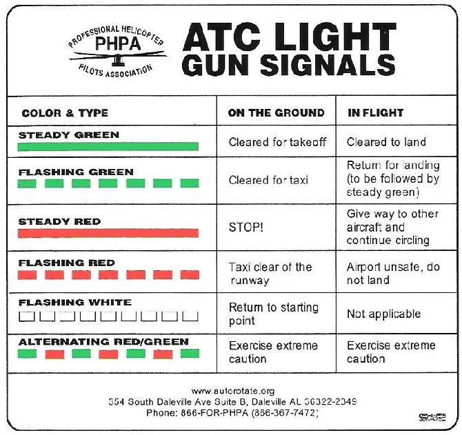
ATC will give you a series of light signals that you must comply with
What if we need to land at KTMB without comms?
If you are coming from the NW

Maintain 1500ft
If you are coming from the NW
Maintain 1500ft
Cross Parallels
If you are coming from the NW
Maintain 1500ft
Cross Parallels
Rock your wings
If you are coming from the NW
Maintain 1500ft
Cross Parallels
Rock your wings
Join downwind 9R/27L
Descend to pattern altitude
If you are coming from the NW
Maintain 1500ft
Cross Parallels
Rock your wings
Expect light gun signals

Join downwind 9R/27L
Descend to pattern altitude
If you are coming from the SW
Maintain 1500ft
If you are coming from the SW
Maintain 1500ft
Cross Parallels
If you are coming from the SW
Maintain 1500ft
Cross Parallels
Rock your wings
If you are coming from the SW
Maintain 1500ft
Cross Parallels
Rock your wings
Join downwind 9L/27R
Descend to pattern altitude
If you are coming from the SW
Maintain 1500ft
Cross Parallels
Rock your wings
Join downwind 9L/27R
Descend to pattern altitude
Expect light gun signals
Emergency Procedures
An emergency can be either a distress or an urgency condition.
The pilot may deviate from any rule listed on the FAR to comply with the emergency.
The frequency 121.5 is used across the country for an emergency. And, the squawk code 7700 will trigger an alarm to the radar facility.
Distress: Condition of imminent danger and of requiring immediate assistance, such as fire, mechanical failure, or structural failure.
Urgency: When we talk urgency situation, this means a possible emergency will occur, example: Low fuel, weather.
In a distress situation, using the word MAYDAY commands radio silence on the frequency in use.
When you hear the words PAN-PAN, the urgency situation in progress has priority over all other communication and warns other stations not to interfere with these transmissions
If you are lost, keep in mind, the Five C’s
Lost Procedures

C
C
C
C
C
Climb
Circle
Confess
Comply
Conserve
- Better radio and nav aid reception.
- Increased radar and DF coverage.
- Better view of the landmarks.
Climb
-
Around the area to look for landmarks on the chart and avoid areas of higher terrain.
Circle
- Confess that you are lost when contacting ATC or another ground facility.
- if your situation is threatening, clearly explain your problem, using the emergency frequency 121.5 MHz, if necessary. Then,
Confess
- Comply with assistance instructions. If not sure, ask for explanations. Never assume.
Comply
Conserve
- Consider reducing power setting to conserve fuel. In addition, ensure that the mixture is leaned properly to extend your range and endurance.
Emergency Locator Transmitters
-
(ELTs) are emergency signaling devices developed as a means of locating downed aircraft.
- Required for most general aviation airplanes, these electronic, battery-operated transmitters emit a distinctive audio tone on designated emergency frequencies, typically 243 MHz and 406 MHz. (Older ELTs transmit on 121.5 MHz.) If armed and subjected to crash-generated forces, ELTs are designed to activate automatically. The transmitters should operate continuously for at least 48 hours.
- ELTs must be check every 12 calendars months
- ELT battery be replaced, or recharged if the battery is rechargeable, after one-half of the battery’s useful life, or when the transmitter has been in use for more than one cumulative hour.
Sources of Flight Information
Locating Flight Information
There are multiple resources where you can find flight information such as:
- Supplement Chart publications.
- Aeronautical Charts
- FAR/AIM
- Websites such as the FAA.GOV or FAAsafety.gov
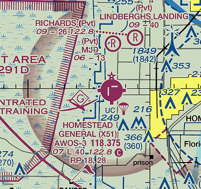
Aeronautical Charts
- Aeronautical charts are sources for are produced in electronic and printed formats.
- Aeronautical charts are sources for pilots to use for navigation references and topographic information.
- These charts are updated every 56 days.
- Primary VFR navigation reference and depict topographic information, visual landmarks, and airport data such as airspace boundaries, frequencies.
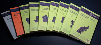
Chart Supplements
-
The seven volumes cover the conterminous United States, Puerto Rico, and the Virgin Islands. It also includes data that cannot be readily depicted in graphic form: e.g., airport hours of operation, types of fuel available, runway data, lighting codes, etc.
- The Supplement chart also provides a means for pilots to update visual navigation charts between editions dates; i.e., It is s published every 56 days while the VFR Sectional and Terminal Area Charts are generally revised every six months.
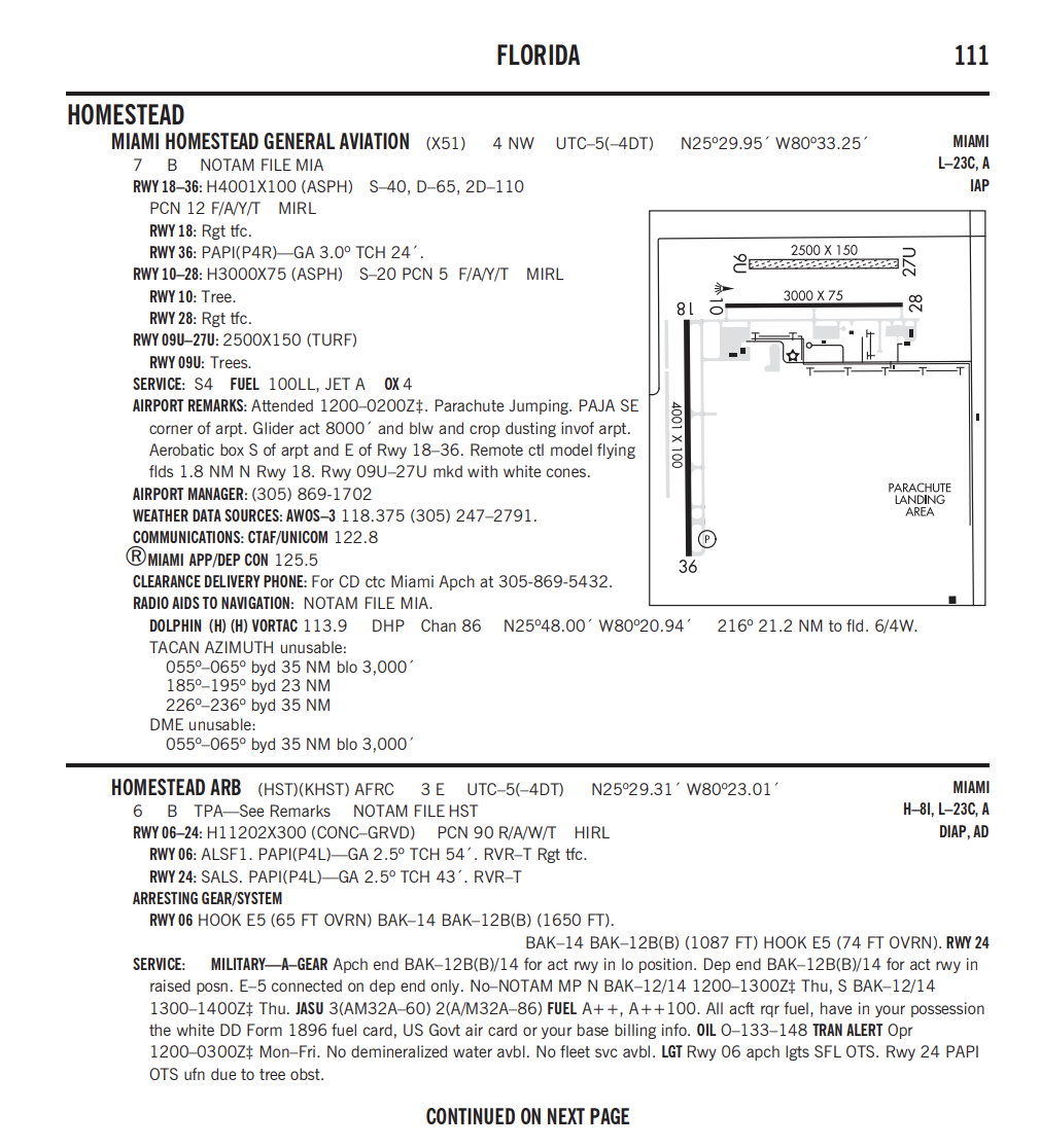
Airport/Facility Directory
The AF/D is a pilot's manual that contains data on public use and joint use airports, seaplane bases heliports, VFR airport sketches, NAVAIDs, communications data, weather data sources, airspace, special notices, and operational procedures.
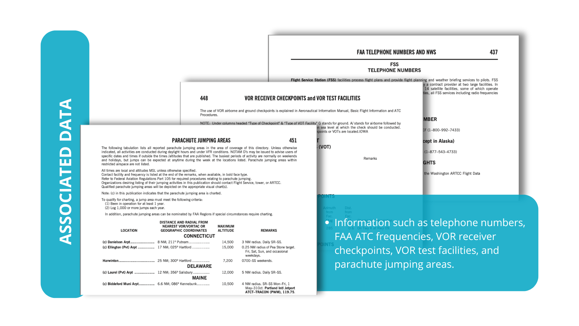
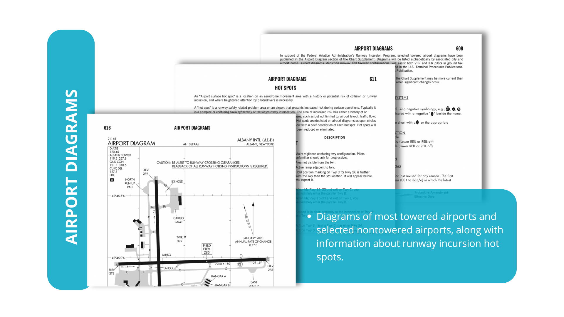
Notices, Associated Data, and Airport Diagrams
You have more important information in the other sections of the Chart Supplement as you prepare for flight:
- Notices
- Associated Data
- Airport Diagrams
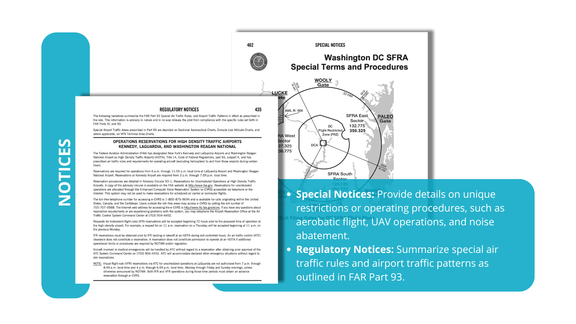
Notice to Airmen
NOTAMS
A NOTAM is a notice containing information essential to personnel concerned with flight operations but not known far enough in advance to be publicized by other means.
- NOTAMs indicate the real-time and abnormal status of the NAS impacting every user.
- NOTAMs concern the establishment, condition, or change of any facility, service, procedure or hazard in the NAS.
- NOTAMs have a unique language using special contractions to make communication more efficient
-
NOTAM (D)
- FDC NOTAMs
- Military NOTAMs
Type of NOTAMS
- International NOTAMs
-
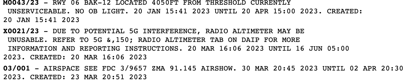
Information is disseminated for all airports listed in the Chart Supplement.
- Information includes such data as taxiway/Runway closures, personnel and equipment near or crossing runways, and airport lighting aids that do not affect instrument-approach criteria, such as a VASI.
NOTAMS (D)


(FDC) NOTAMS
- Used to advertise Temporary flight restrictions (TFRs) caused by such things as natural disasters or large-scale public events that may generate a congestion of air traffic over a site.
- FDC NOTAMs contain amendments to published IAPs and other current aeronautical charts.
Military NOTAMS
-
Any NOTAM that is part of the military NOTAM system which primarily includes NOTAMs on military airports and military airspace.
- Distributed to more than one country, they are published in ICAO format under guidelines established in Annex 15.
International NOTAMS
- Not every topic of a U.S. Domestic NOTAM is issued as an International NOTAM by the U.S. When possible, the U.S. International NOTAM will be linked to the appropriate U.S. Domestic NOTAM.
Federal Aviation Regulations (FARs)
The Federal Aviation Regulations (FARs) are rules prescribed by the Federal Aviation Administration (FAA) governing all aviation activities in the United States. The FARs are part of Title 14 of the Code of Federal Regulations (CFR).
Aeronautical Information Manual (AIM)
-
The Aeronautical Information Manual (AIM) is the FAA's official guide to basic flight information and Air traffic control (ATC) procedures.
-
The AIM contains the basic aeronautical knowledge information required to fly in the United States National Airspace System for VFR and IFR operations.
-
It also contains items of interest to pilots concerning health and medical facts, factors affecting flight safety, a pilot/controller glossary of terms used in the ATC System, and information on safety, accident, and hazard reporting.
Advisory Circulars
Informative in nature letter that provides guidance for compliance with Airworthiness, Pilot certification and operational standards within the FAR/AIM title CFR 14.