Plan Purpose
Regional
Mode Specific
Area & Neighborhood
Policy Plans
Community Building Diagnostics
-
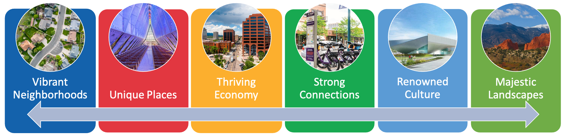
PlanCOS Themes
-
Planned development and future land use
-
Relevant policy and code
-
Competitive analysis of peer cities
How does Transportation Serve These Big Ideas?
Required Project Outcomes
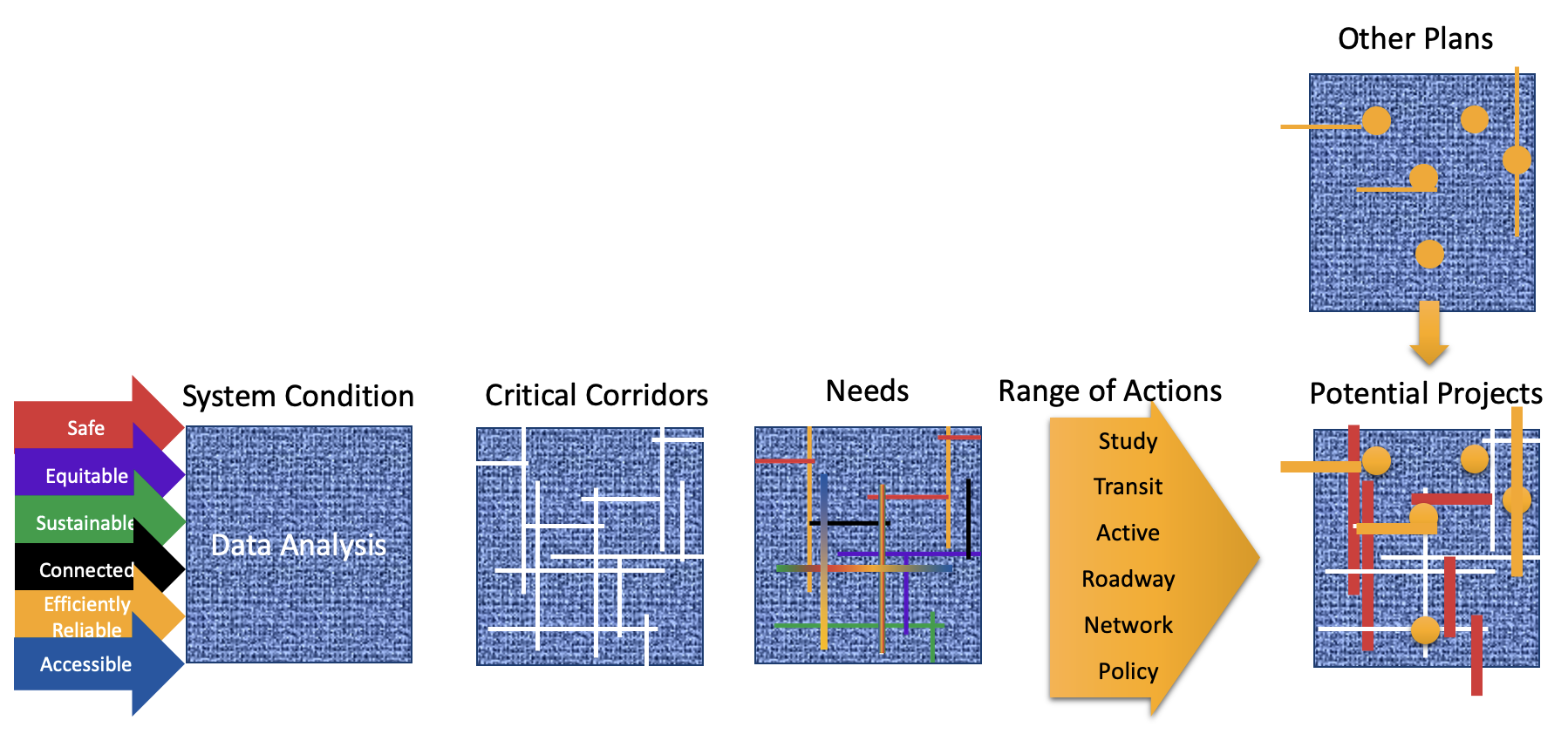
Data Driven Process
Identify needs and priorities for a 25-year planning horizon
Project list for potential PPRTA ballot initiative
Organizational and policy recommendations
Technology trends
Updated Major Thoroughfares Plan
Mobility Goal Framework
Create a transportation system that is more:


Safe
Equitable
Sustainable
Efficiently Reliable
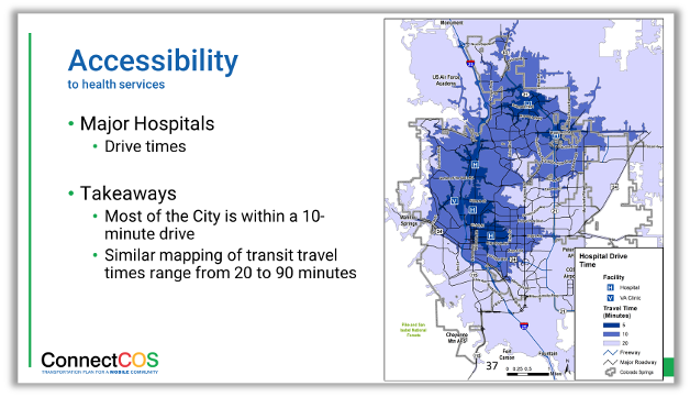
Accessible
Connected
State of the System Analysis
-
Technical Analysis
-
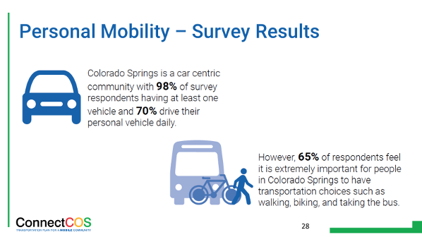
Public Input
State of the
System Analysis
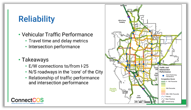
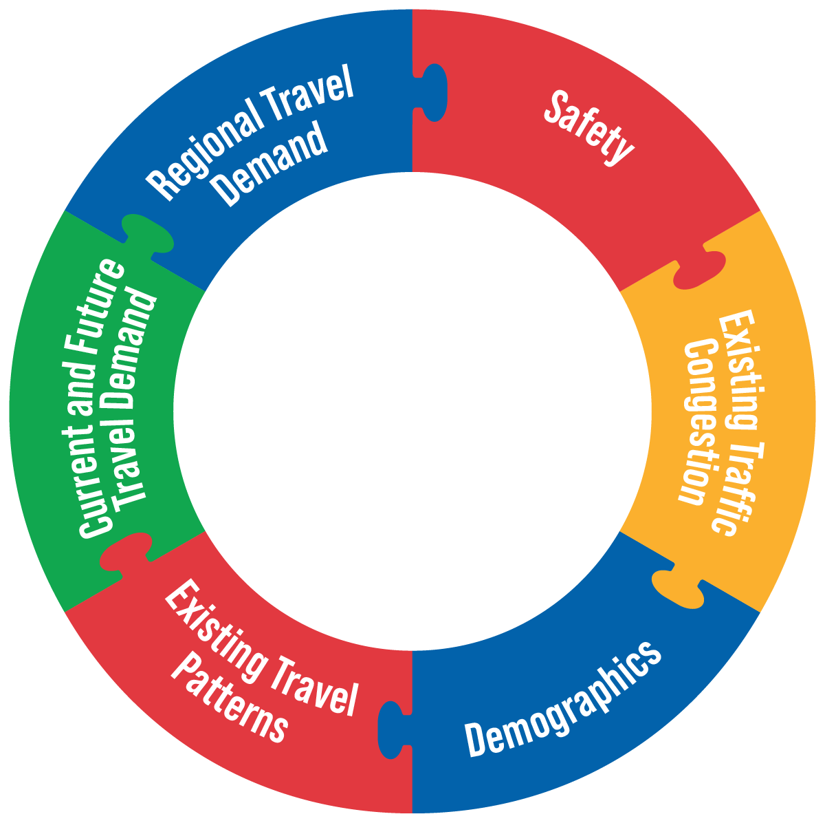
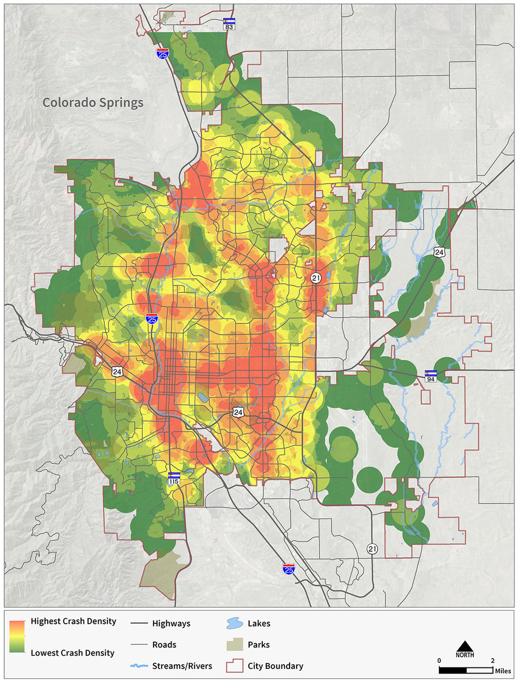
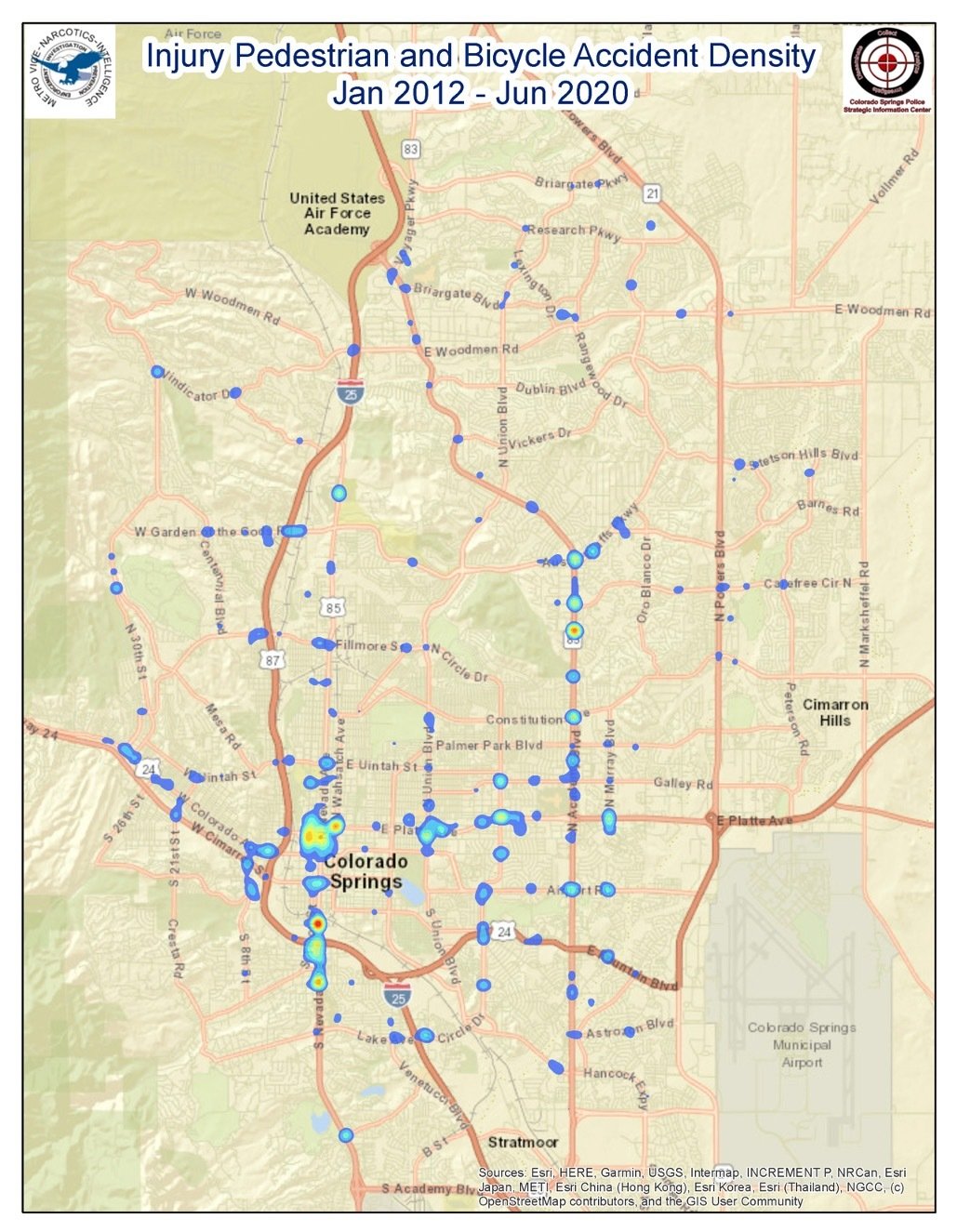
Safety

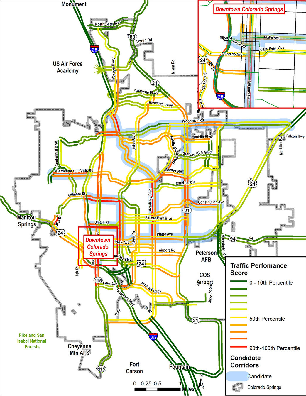
Existing Traffic Congestion
- Travel Time
- Vehicle Delay
- Intersection Performance
Traffic Performance
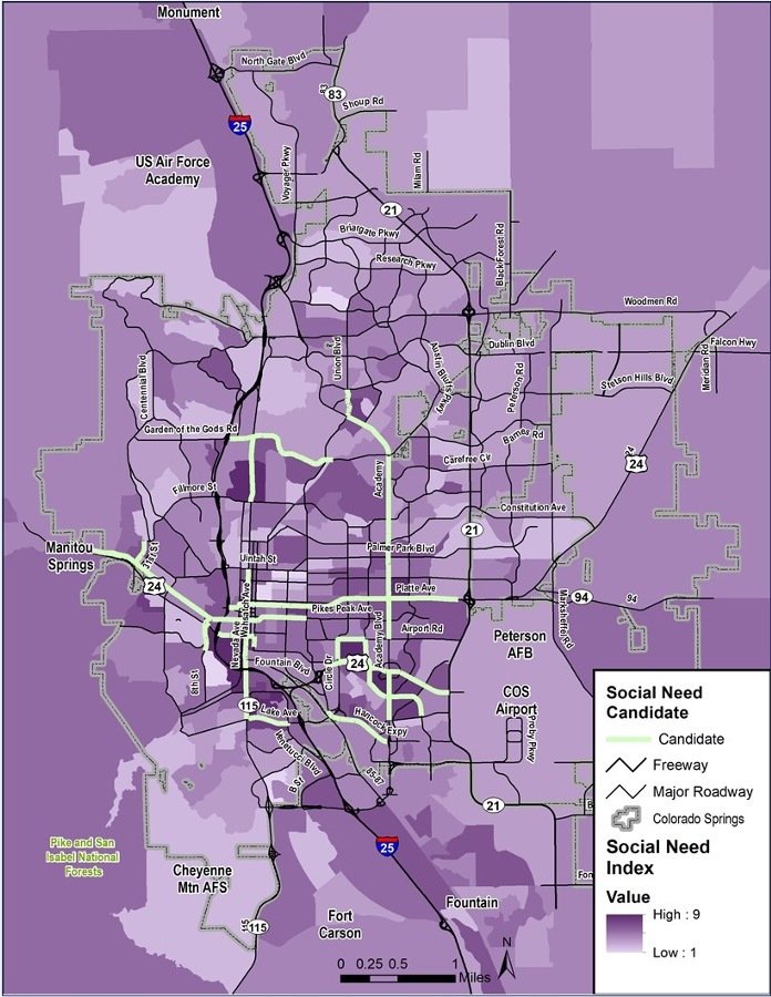
Social Need

- Housing + Transportation Costs as percent of income
Social Demographics
- Poverty ratio
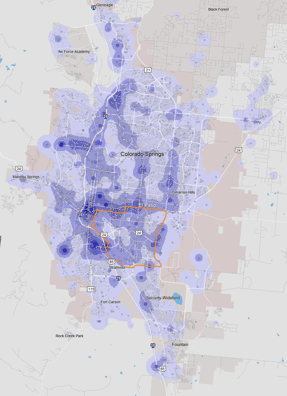
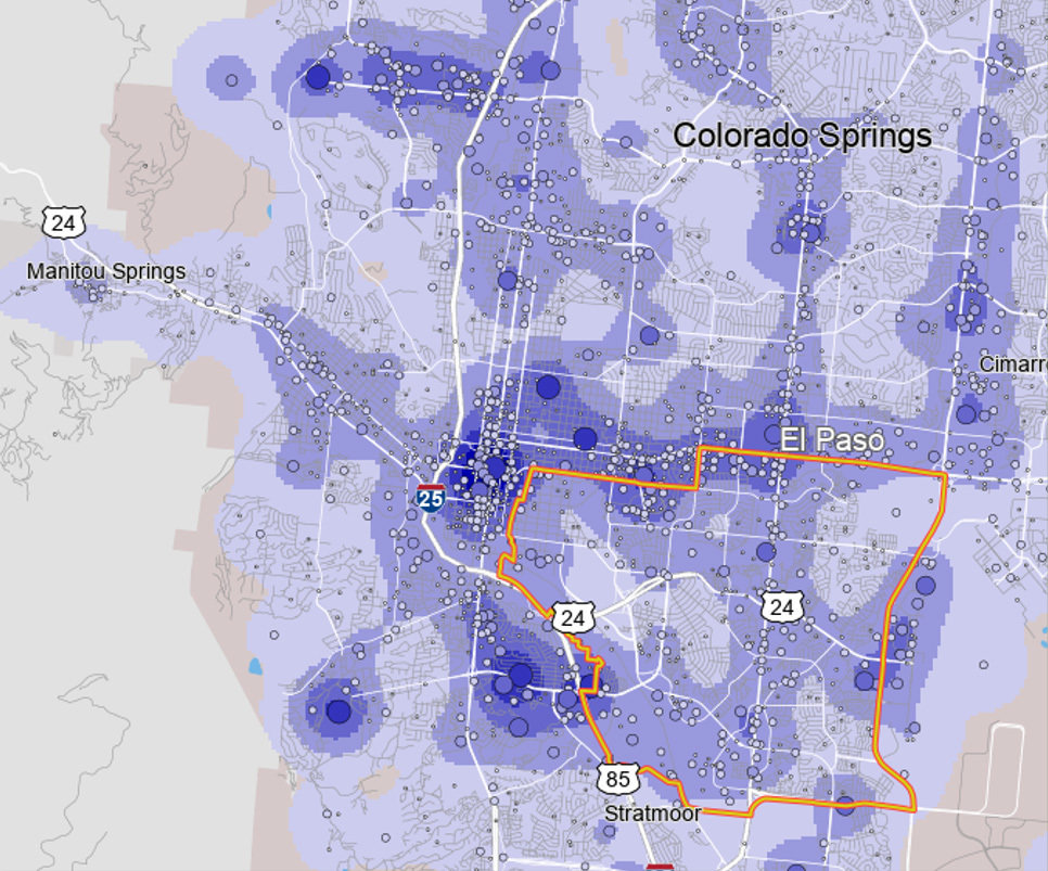
Existing Travel Patterns

Travel Demand: Next Level Transit
- Age
- Ability
- Vehicle availability
Transit Propensity
- Population Density
- Key Community Services
- Mobility Need
Future Travel Demand
Likelihood for change (PlanCOS based)
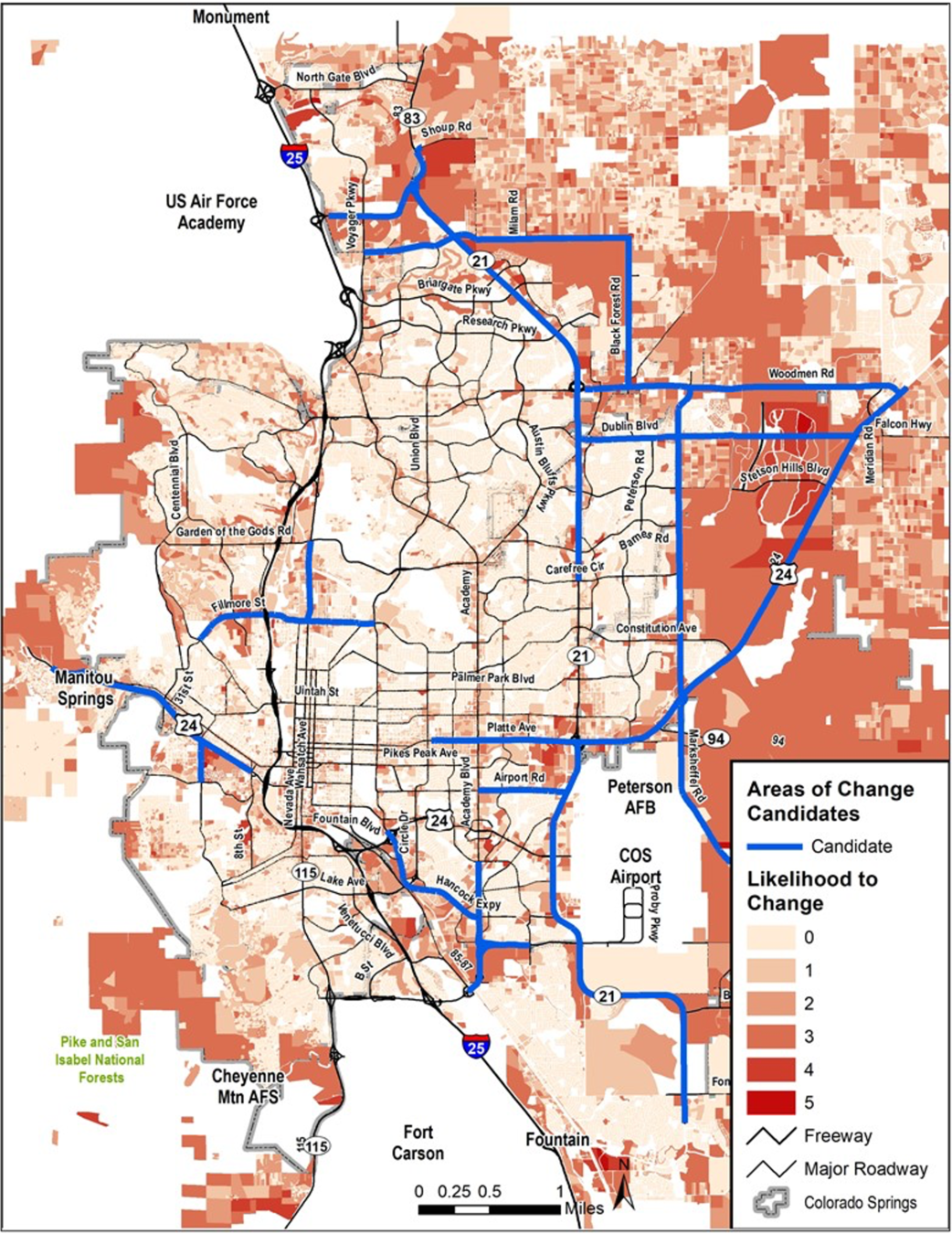
Critical Corridors
- The City’s primary travel corridors where improvements would be most beneficial
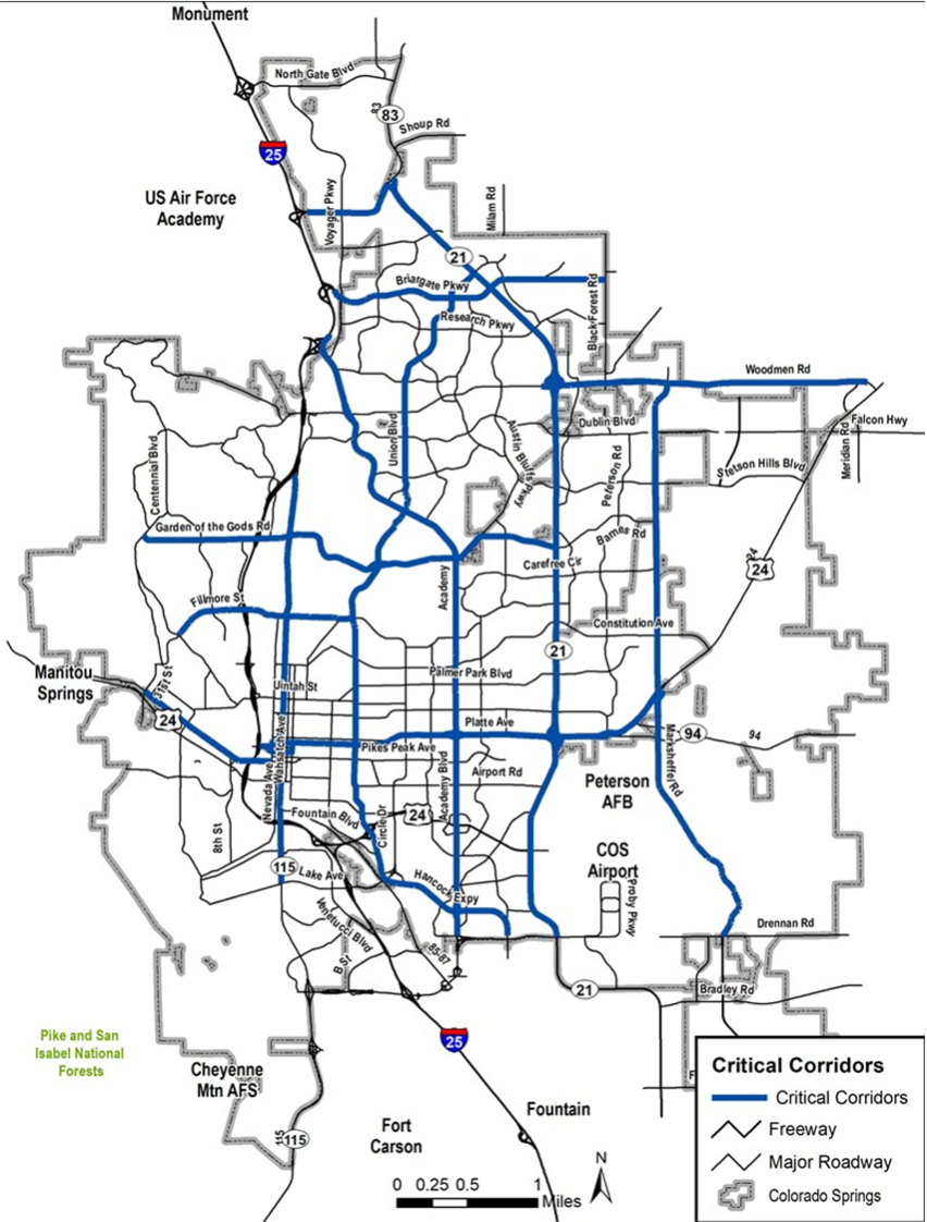
- Focus of more detailed evaluation and solution brainstorming
- ConnectCOS project list centers on these corridors
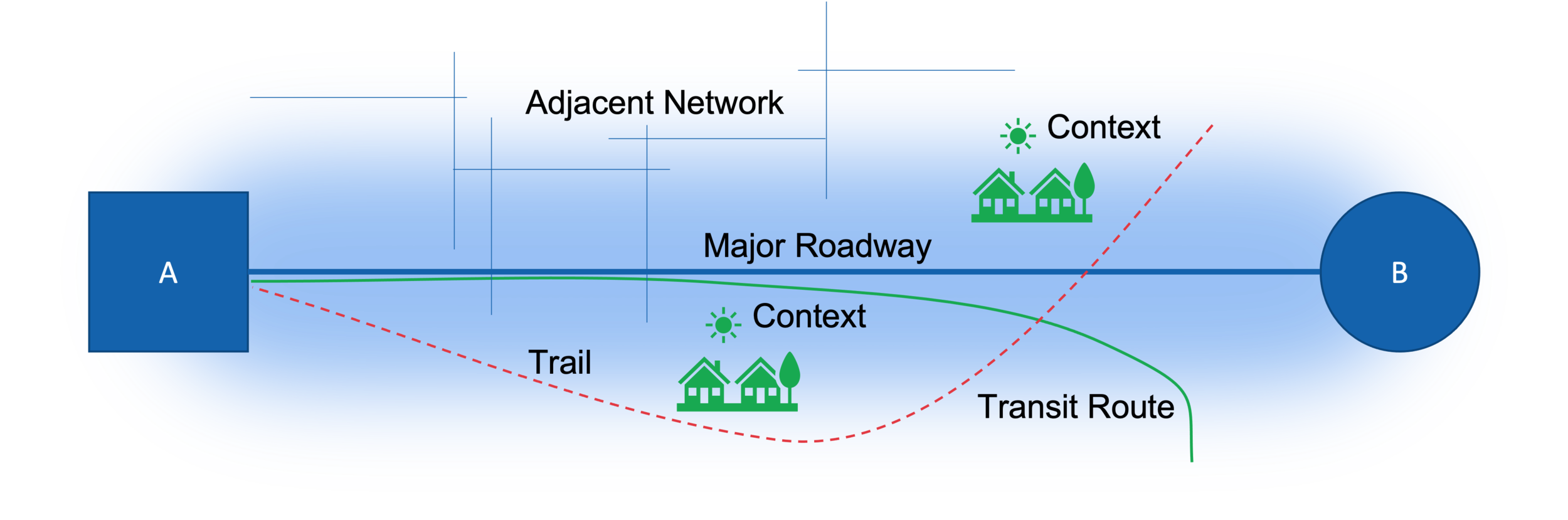
What is a Corridor?
- The area context and potential paths for travel that connect destinations
- Not just a named roadway
Project Development
Regional Travel Demand
- Trips external to Pikes Peak Region
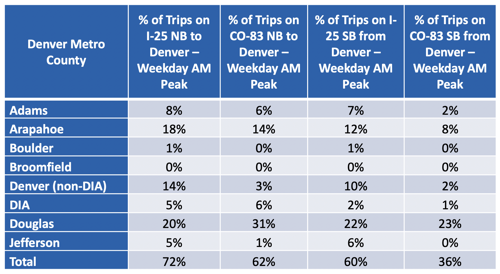
- Analysis of Specific Destinations (e.g. DIA)

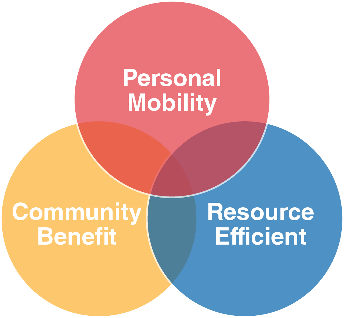
Transportation Investment Priorities
- Serve people
- Serve the community
- Resource stewardship
- Consistent with the goal framework and the themes of PlanCOS
More Information


Integrated Planning Process
- Increases transparency
- Targets investments to meet goals
- Reduces “blind spots” created by familiarity
ConnectCOS Needs Identification
- Economic designations/desired investment
- Current/future traffic conditions
- Infrastructure condition – bridges, pavement, sidewalk/ADA
- Wayfinding
- Land use/transportation compatibility
- Crash concerns – bike/ped, intersections
- Personal safety – bike, ped, transit
- Need for mobility options
- Multimodal network gaps – sidewalks, transit access, crossings
- Land uses – affordable housing, retail options

ConnectCOS Needs Identification
Functional Objectives
- Maintain and enhance east-west connectivity and capacity for current and future traffic as the primary function of the corridor, considering travel times, network connectivity, and activity centers served.

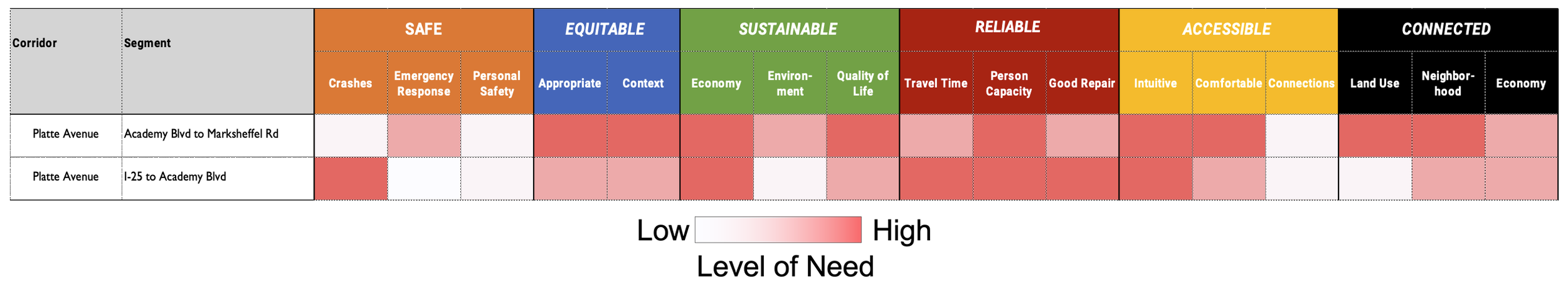
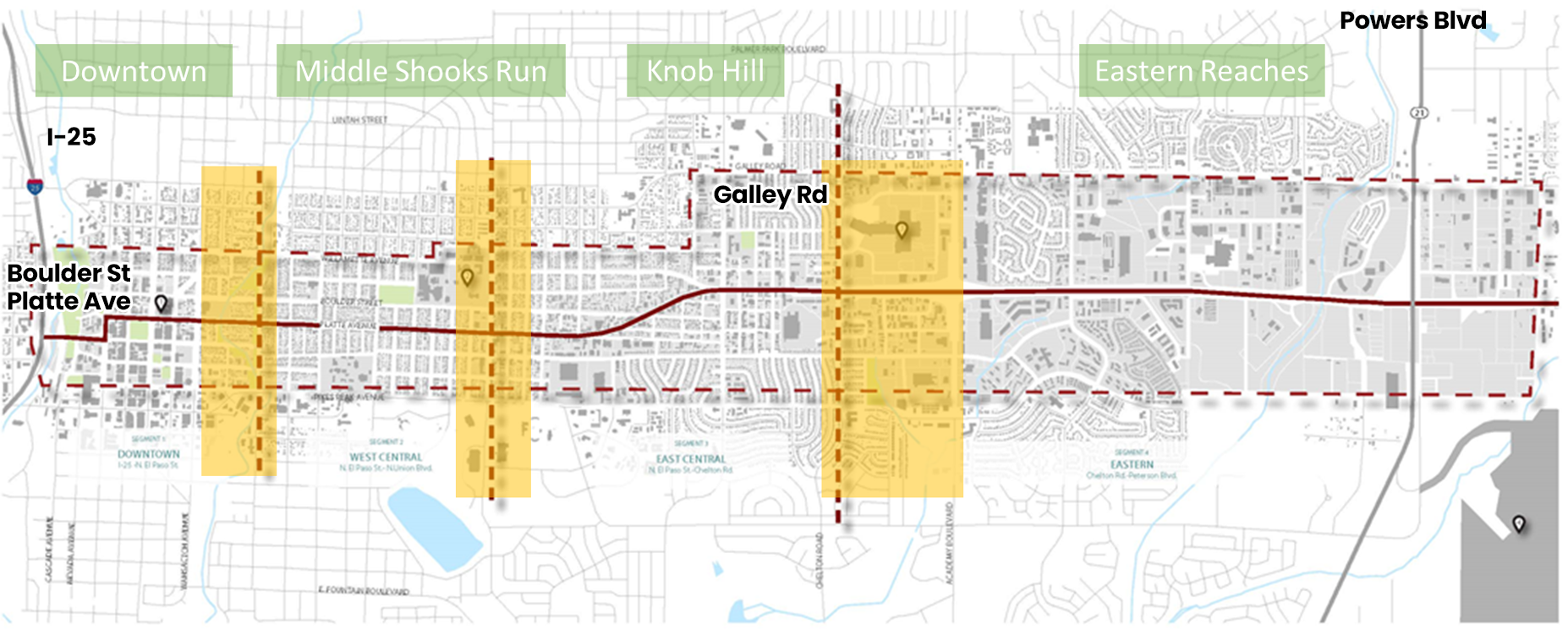
The Platte Avenue Corridor should…
- Support Downtown as a destination – while connectivity between I-25 and the eastern reaches is important, the character of the Downtown portion of the corridor should prioritize the vision for Downtown
- Establish a consistent identity for the corridor while integrating and enhancing the different character areas and the transitions between
- Integrate the corridor into the community to create an ‘Avenue’, visual connections, and context-specific placemaking opportunities
- Invest in the corridor to support the significant opportunity presented by Platte Ave to positively impact Citywide economic and equity outcomes
- Provide safe, efficient, and comfortable transportation options along and across the corridor to enhance mobility for those who drive, ride, walk, or roll
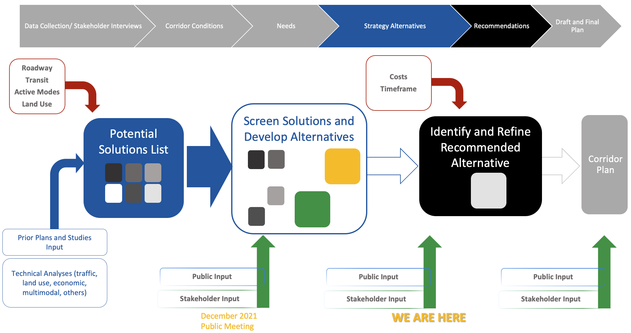
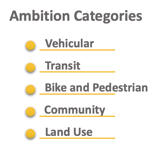
Developing Strategy Alternatives
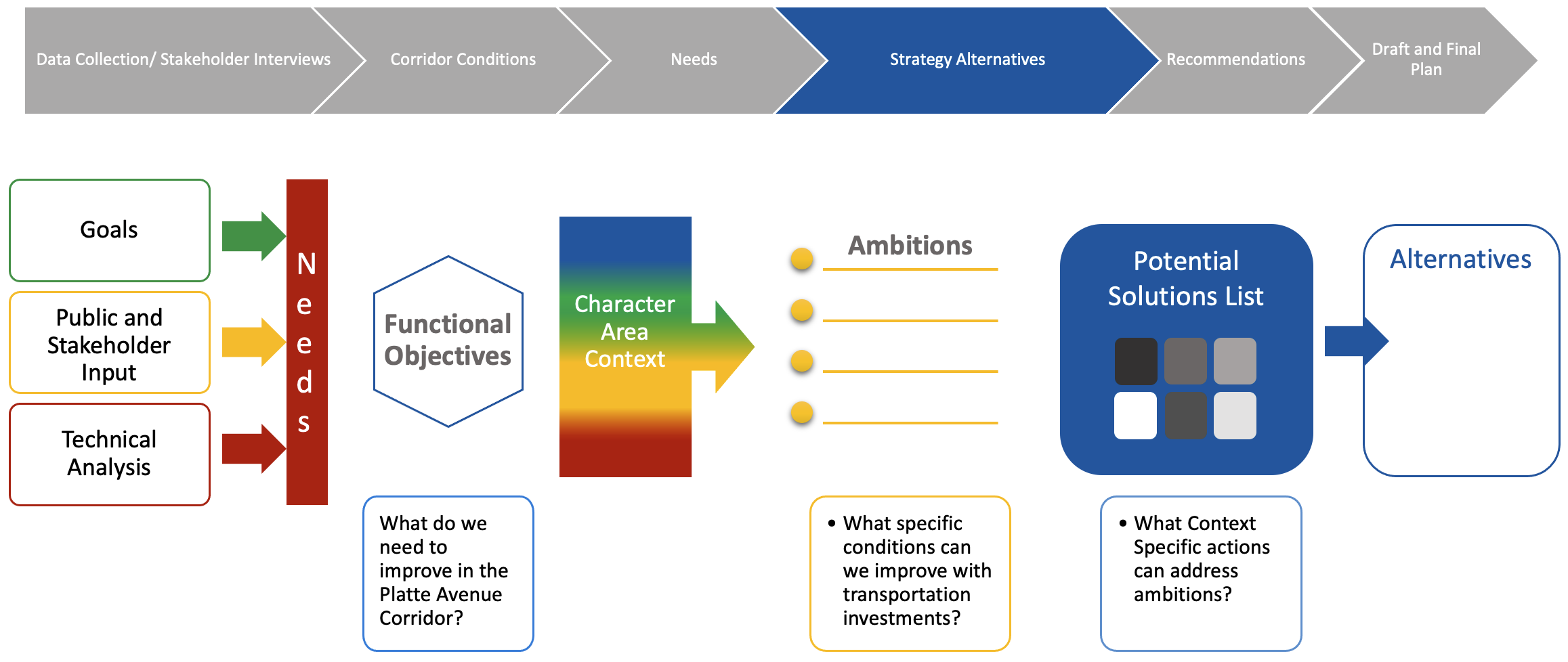
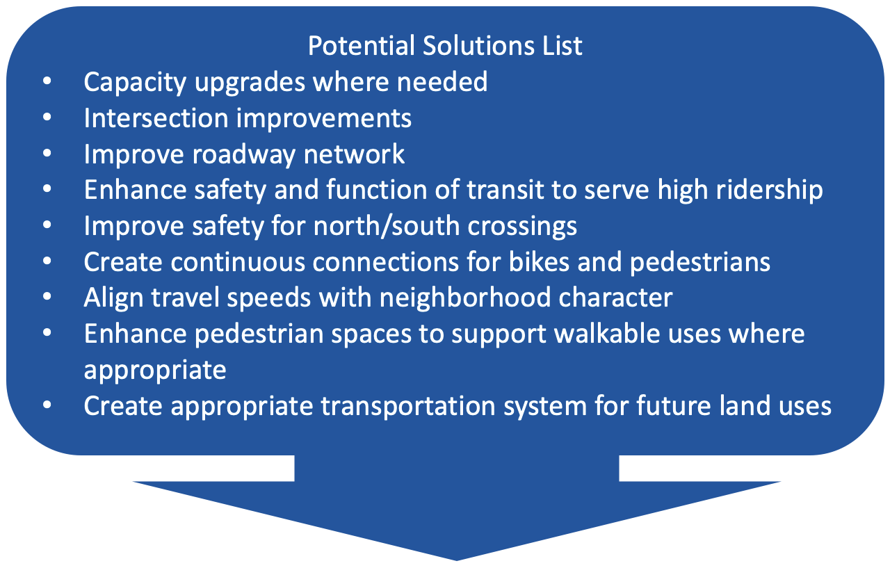
Potential Solutions


Alternatives Evaluation and Screening Process