Peter Keum
GISP
WTD Drone Program Lead/
GIS Analyst
Use of RPAS* for Wastewater Treatment Division
April 07, 2025
FAA Part 107 Certified Remote Pilot
Remotely Piloted Aircraft System*
So Let's Dive into the program
RPAS - Remotely Piloted Aircraft System
FAA Definition: Unmanned Aircraft (UA) system that is operated by a pilot via ground control or on-board computer.


-
Fly under 400 feet above ground level
-
Not to fly < 5 nautical miles around airport
-
Aircraft < 55 lbs.
-
Fly during daytime or night time operation with appropriate lighting
-
Fly visual line of sight ( VLOS)
-
No flight over non-participating people
FAA Part 107 Rule *
RPAS as Platform
Multi-rotors
Fixed-wing & VTOL

- Shorter flight time (< 45 min)
- Cover smaller area
- Highly maneuverable
- Less expensive
- Access to confined spaces
- Long flight time (+ 40min)
- Covers very large area

(vertical take-off & land)

1. Aircraft + Sensor (Data Collection)
2. Data Processing & Analyzing (GIS)
3. Information Products
=
+


1. Platform + Sensor (Data Collection)
2. Data Processing & Analyzing (GIS)
3. Information Products


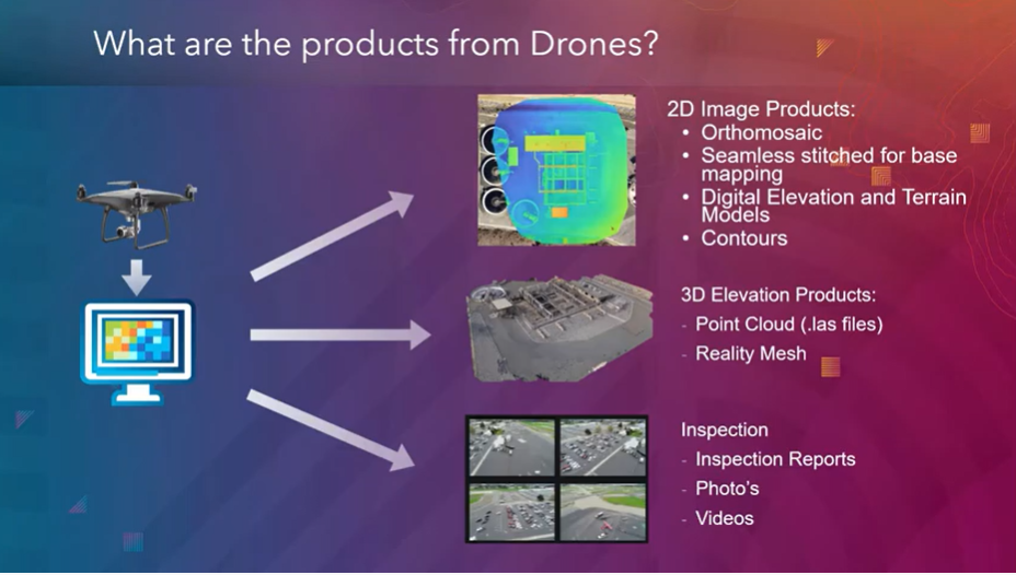
credit: Esri
GIS Integration


Drone

GIS
Great Combo?
&
Great combo !
GIS & DRONE


Why Use Drones?
3 E's
-
Easy
-
Efficient
-
Effective
Why Use Drones?
Easy - Simple with little effort
Efficient - Results without waste
Effective - Producing Results
Why Use Drones?
1. Easy - Simple with little effort

Automatic
Repeatable
Flight Control App
- Automate Flight Planning - Fly Consistently for overlapping images
- Can fly manually but it's like mowing with scissors


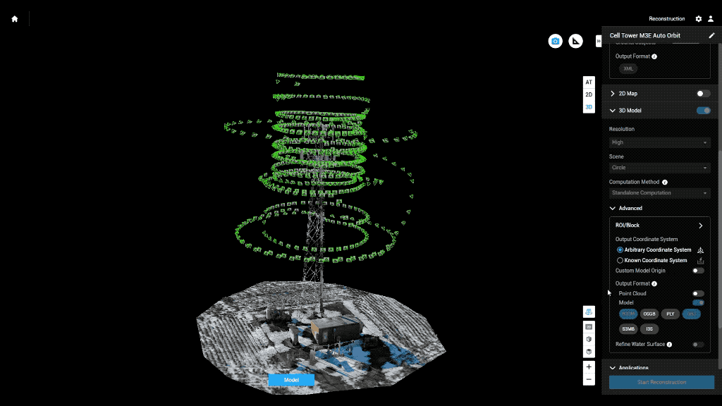
Example: Auto flight plan
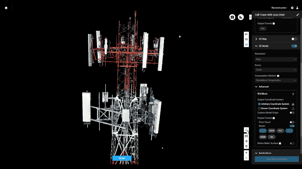
Result 3D Model
Why Use Drones?
2. Efficient - Results without waste
Safety of staffs
Save Time & $$

Data Processing - Efficient

- Cloud Storage & Cloud Data Processing
- Flight Planning from Desktop - fly on Mobile (controller)
- Cloud storage/Cloud Processing
- Centralized System
- Project Deliverables
Why Use Drones?
3. Effective - Producing Results


- Environmental Monitoring
Examples - Effective
August 2022
March 2022


April 2023
- Update 2D aerial map
Examples - Effective

- 1172 Photos
- 0.57in/px
- Update 2D aerial map
Examples - Effective


0.57 in/px
Sept 2023
3.0 in/px
2021 KC Aerial
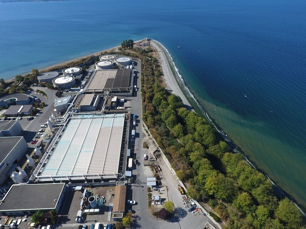
- Construction Site Monitoring
Examples - Effective

Examples - Integrating with GIS
Proof Of Concept
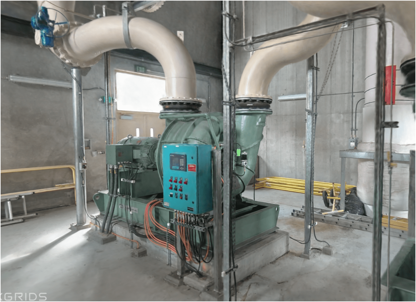
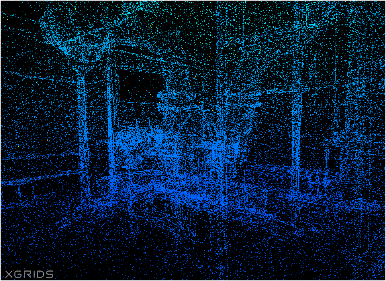
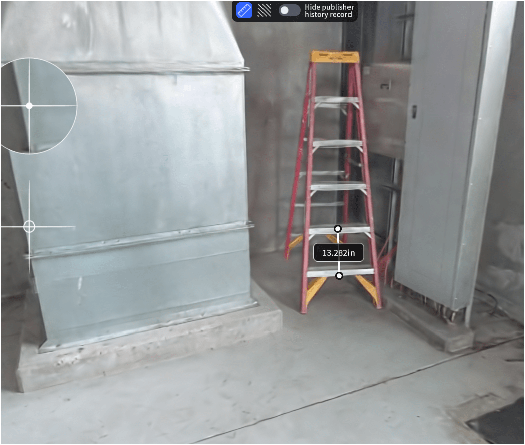
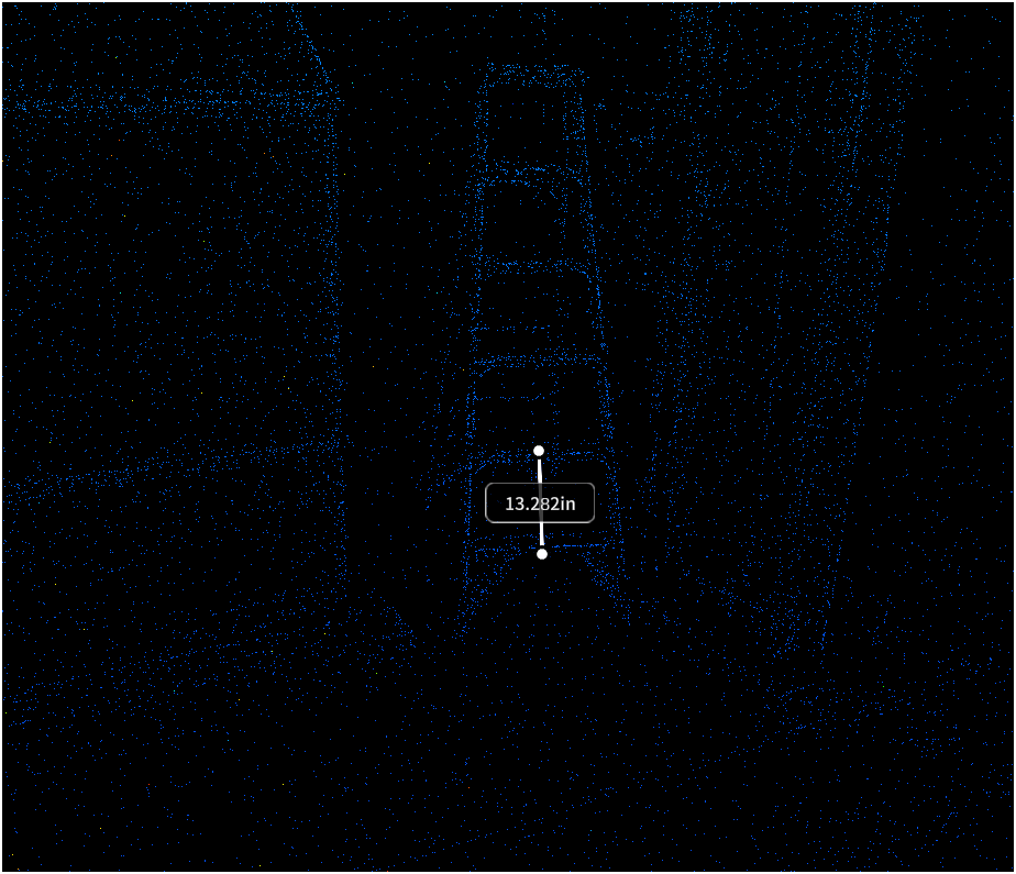
Lidar SLAM Handheld Unit
Video of Scan Path
Proof Of Concept
Lidar SLAM Handheld Unit
Examples

WHOA!
Proof Of Concept
Lidar SLAM Handheld Unit
Examples
Proof Of Concept
Lidar SLAM Handheld Unit
Examples

Summary of KC Wastewater Treatment Division RPAS Program

People
+
Technology
+
Organization
=
RPAS Program
King County WTD
August, 2016 - Approved of using 3rd party drone operator (ORM & PA)
April, 2021 - "permissible to operate drones indoor or in confined spaces for specialized uses, like inspections." - Offie Of Risk Management (ORM)
June, 2021 - Approved to Started RPAS Pilot Program in WTD
April 2025
- Four FAA Part 107 Drone Certified Pilots - WTD GIS Specialists (Jim, Patrick, Joe, and Peter)
- Helping other departments to stand up their own RPAS programs


Joe
Outdoor
Indoor
DJI Mavic 2 Pro < $1,800

DJI Mavic 2 Pro Ent. Adv ~ $6,500
DJI FPV w/ Modification ~ $1,300


Mavic 3 Ent
~ $3,800
20 MP/ 56x zoom
20 MP
12 MP/ 32x zoom
+ Thermal

WTD RPAS Dashboard


2021
June - Dec.
2023
Jan. - Nov.
Number of Flights
2022
Jan. - Dec.


+ 480 %

Where are we now?

Where are we heading?


Let's go find solution

Washington GIS Association Drone Special Interest Group


- Email Sign-up
- Resources
- Every 3rd Thursday
- ZOOM Meeting
- 165 Members

peter.keum@kingcounty.gov