Use of Drones for King County Wastewater Treatment
April 28 , 2025
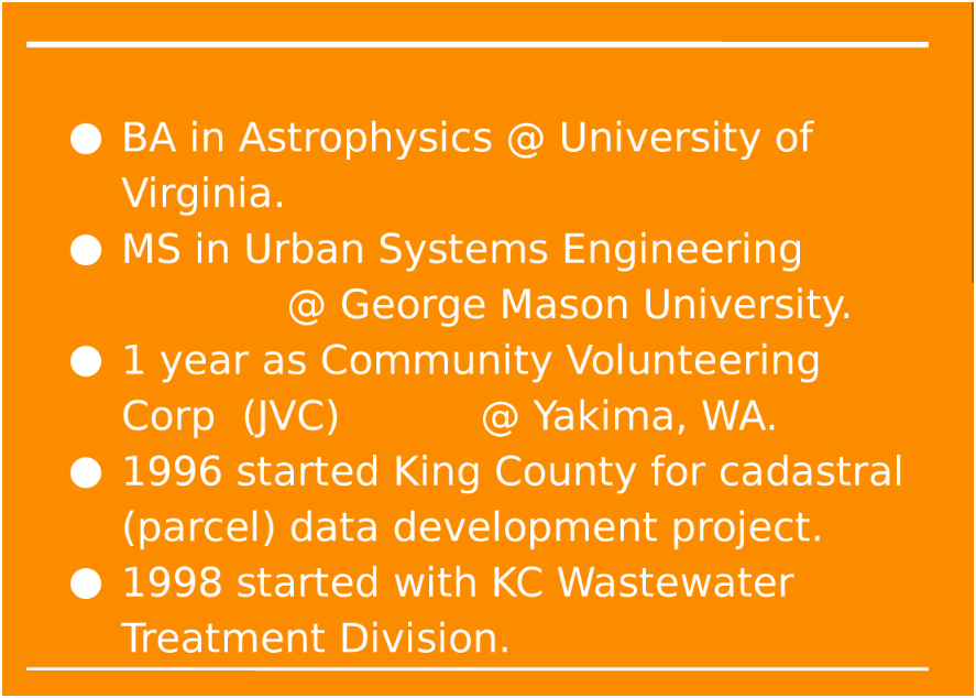
Peter Keum, FAA Part 107/GISP
King County Wastewater Treatment
Drone Program Lead/ GIS Analyst
Learning Objectives
- King County Wastewater GIS
- WTD Drone Program
- Integration of Drone with GIS


CUGOS

So Let's Dive In!
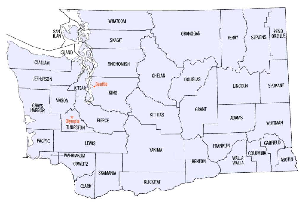
King County of Washington
- 2.3 Million People
- 12th Populus in the US
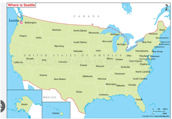
- Seattle is the Most populous city in the State
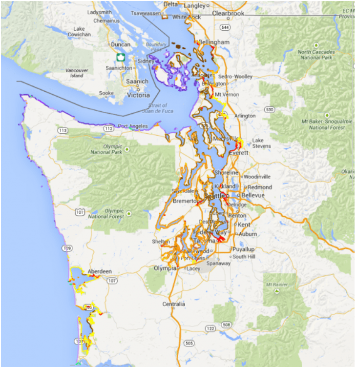


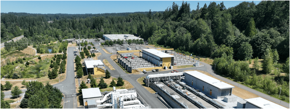
King County Wastewater Treatment by Numbers
-
2 million residents
-
424 square miles
-
383 miles sewer pipeline (2.5 inch to 14 ft)
-
74 facilities (PS & RS)
-
5 Treatment Plants: 180 MGD ~ Max. 900 MGD

Seattle, WA --> Medford, OR

WTD GIS Team
- 7 GIS Specialists

Supervisor
WTD GIS
Maintain Sewer GIS Data
-
FIRS (Facility Information Retrieval System) Data
- Maintenance Hole
- Pipes
- Pump Stations
- Regulator Stations
- Treatment Plants
- Outfalls
- Flow Monitors
- CP Stations
- Connection Points
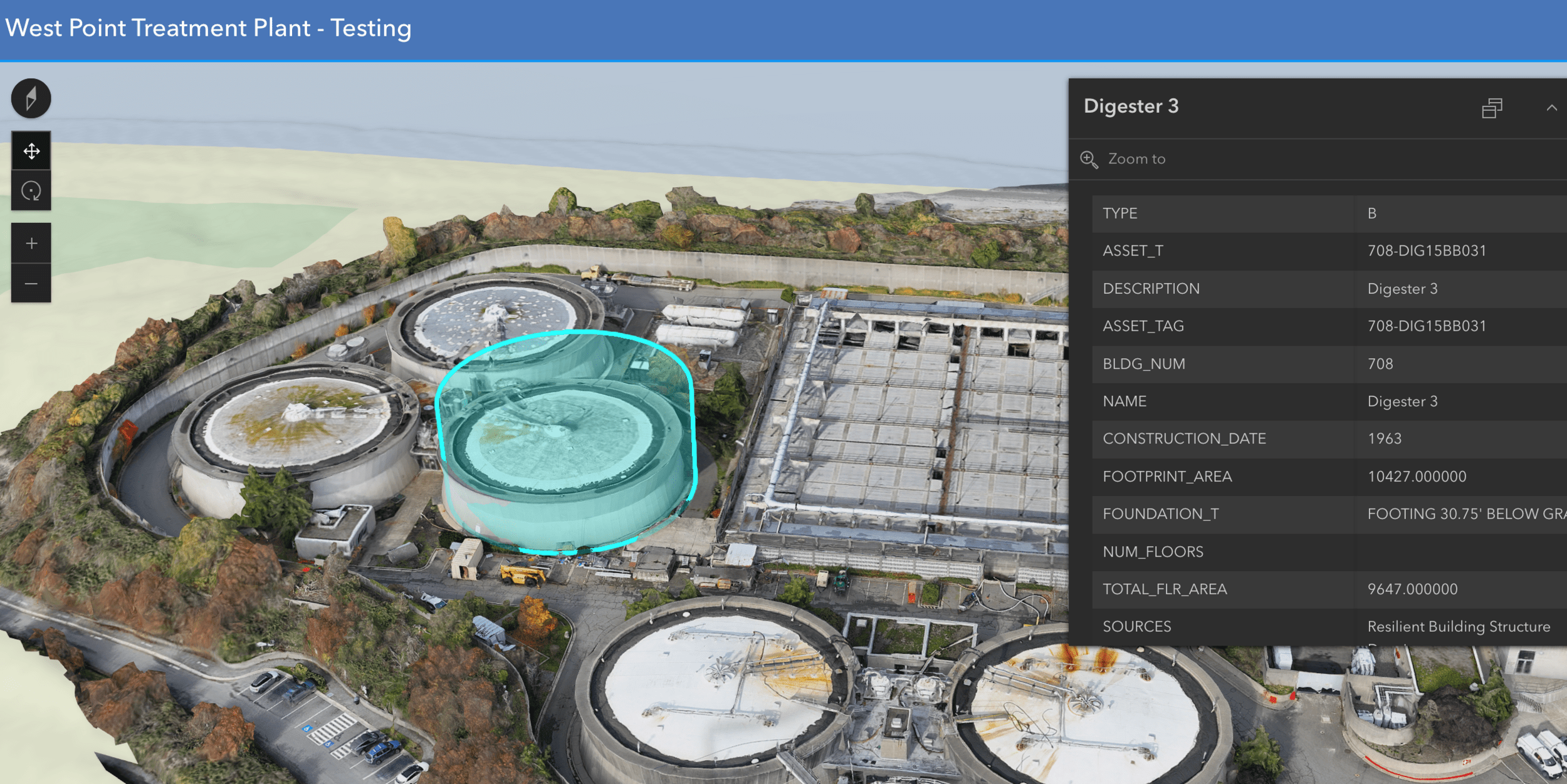
- Site Plan Data
- 3D Models
- Drone Collected Data
- .... many many more

WTD
GIS
DATA
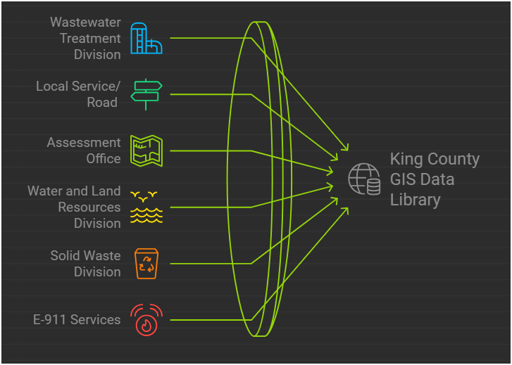
There are 17 county agencies support King County GIS Data Library System
WTD
Project Support
- Capital Construction Projects
- New Treatment Plants
- New Coneyance System
- Upgrade facilities
- many, many, more...
WTD GIS
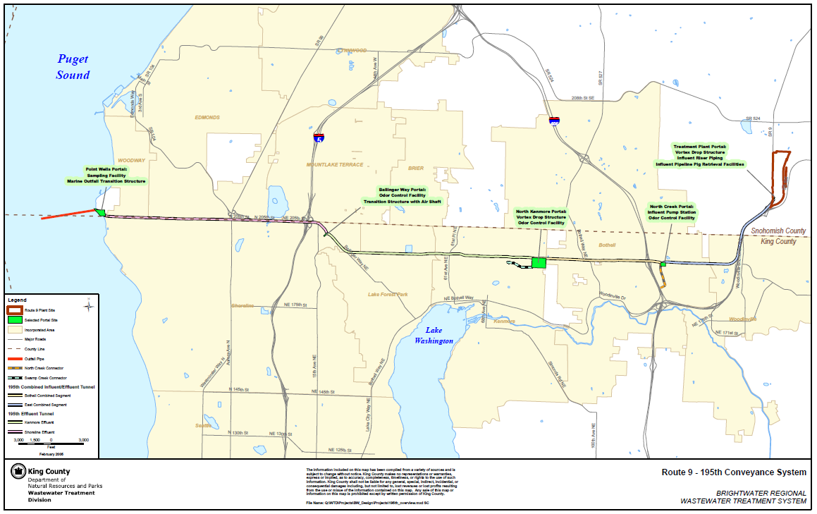
Feb 2005
Rt 9 - 195th (Brightwater) Conveyance System

Impacted Parcel Analysis

Lake Hills / NW Lake Sammamish


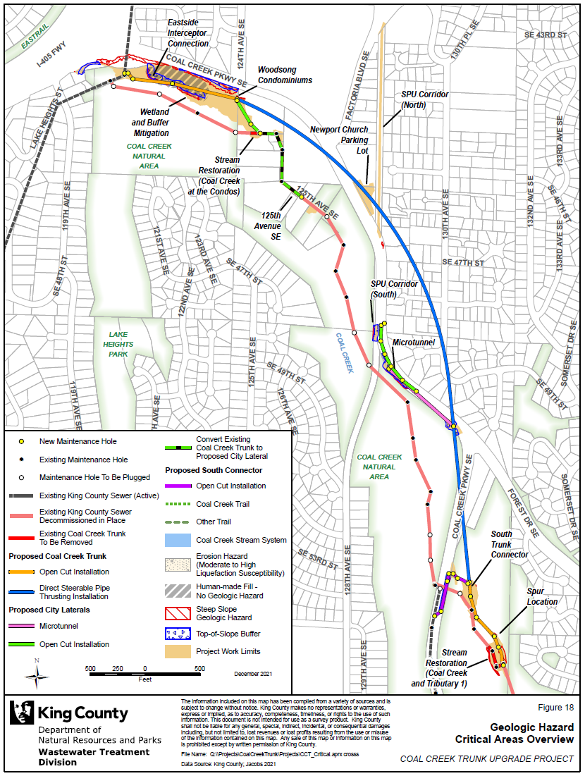
Coal Creek Trunk Upgrade


Georgetown Wet Weather Station


North Mercer Interceptor & Enatai Interceptor Upgrade

Multi-Discipline Data Integration
North Creek Interceptor Sewer Improvement Project

Program Support
- CSO (Combined Sewer Overflow) Control Program
- Modeling Group
- CIFM (Conveyance, Inspection, and Flow Monitoring) Group
- Asset Management Program
- Capacity Charge
- ....many other sections


Program Support
- CSO (Combined Sewer Overflow) Control Program
WTD GIS


KC & SPU
CSO Real-Time Status Viewer
RainWise
Basin Address Look-Up App
CSO Report
Program Support
- CSO (Combined Sewer Overflow) Control Program
- GSI (Green Storm Infrastructure) --> RainWise Program
WTD GIS


Program Support
- CSO (Combined Sewer Overflow) Control Program
- GSI (Green Storm Infrastructure) --> RainWise Program
WTD GIS


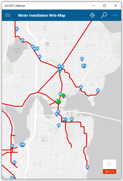
Program Support
- Modeling Group & CIFM Group
Meter Installation Tool

Program Support
- 3D Modeling Rendering

Program Support
- 3D Modeling Rendering
Program Support
- CIFM (Conveyance, Inspection, and Flow Monitoring) Group

ESJ Support


SVI for Chelan CSO Basin
Short Back Story

David Shean "Ice Man" Ph.D @ UW
CUGOS April 2014
"Google Guys"

It's just a toy...past examples of what used to be


It's just a toy...


It's just a toy...
It's just a toy...

2016


- Price /Performance
- Easy to use
- Quality data collection
- Adopting Rule by FAA

Why Now?
Cell Phone Technology + Lower $$
- Electronic Control System (ECS)
- Accelerometer & Gyroscope Chip
- GPS Chip
- Lithium Polymer (LiPo) Battery
- Motors


UAV - Unmanned Aerial Vehicle
FAA Definition: Unmanned Aircraft (UA) system that is operated by a pilot via ground control or on-board computer.


UAV Categories

Small - $
- Size: 1 - 2 meters ( 3 ft - 6.5 ft), < 55 lbs.
- Control: Radio control
Medium
- Size: Equivalent to a car, ~ 1000 lbs.
- Control: Visual Line Of Sight (VLOS) & Beyond LOS, RC & Satellite ~ $$$
Large
- Size: > 30,000 lbs.
- Control: Visual Line Of Sight (VLOS) & Beyond LOS, RC & Satellite ~ $$$$


Sensors Payload


Multi-spectral
Thermal Infrared

Lidar Camera

High resolution digital camera (100 MP)

Lidar Camera
Lidar Camera
Methane Gas Dector
RPAS as Platform
Multi-rotors
Fixed-wing & VTOL

- Shorter flight time (< 45 min)
- Cover smaller area
- Highly maneuverable
- Less expensive
- Access to confined spaces
- Long flight time (+ 40min)
- Covers very large area

(vertical take-off & land)


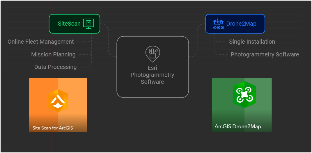
1. Aircraft + Sensor (Data Collection)
2. Data Processing & Analyzing (GIS)
3. Information Products
||
+

Information Products
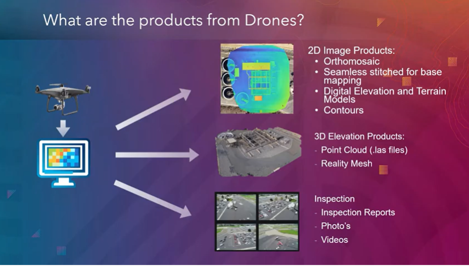
credit: Esri

Drone

GIS
Great Combo?
&
Great combo !
GIS & DRONE


Summary of KC Wastewater Treatment Division RPAS Program

People
+
Technology
+
Organization
=
RPAS Program
WTD GIS RPAS Program
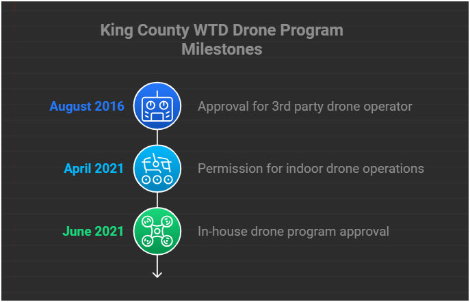
April 2025
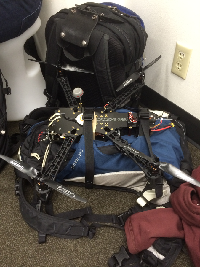
- Four FAA Part 107 Drone Certified Pilots - WTD GIS Specialists (Jim, Patrick, Joe, and Peter)
- Helping other departments to stand up their own RPAS programs


Joe
Outdoor
Indoor
DJI Mavic 2 Pro < $1,800

DJI Mavic 2 Pro Ent. Adv ~ $6,500
DJI FPV w/ Modification ~ $1,300


Mavic 3 Ent
~ $3,800
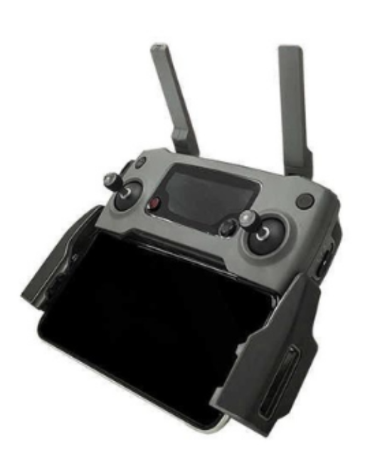
20 MP/ 56x zoom
20 MP
12 MP/ 32x zoom
+ Thermal


Matrice 4 Ent
~ $5,300/ $8,500
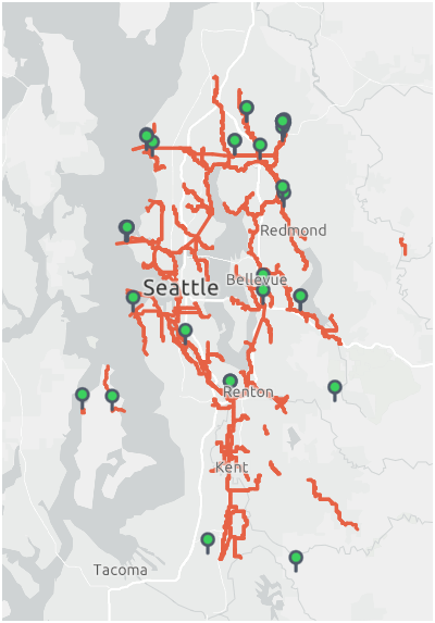
WTD RPAS Dashboard
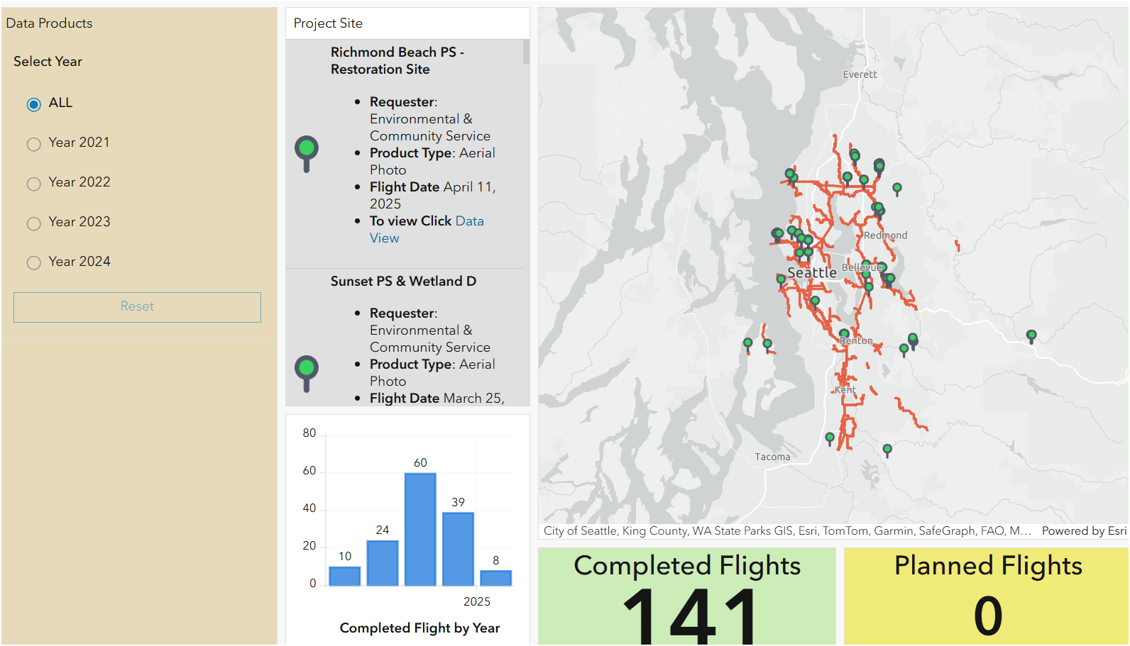


2021
June - Dec.
2023
Jan. - Nov.
Number of Flights
2022
Jan. - Dec.

+ 480 %
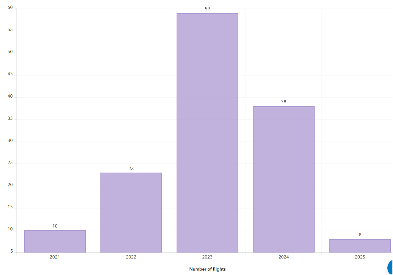

2024
Jan. - Nov.
Where are we now?

Where are we heading?


FAA Regulations - Where are we now?

Regulations
-
Fly under 400 feet above ground level
-
Not to fly < 5 nautical miles around airport
-
Aircraft < 55 lbs.
-
Fly during daytime
-
Fly visual line of sight ( VLOS)
-
No flight over non-participating people
FAA Part 107 Rule
Hobby/Recreation
-
Self register (over 13 yrs old)
-
Fly under 400 feet above ground level
-
Not to fly < 5 nautical miles around airport
-
Aircraft < 55 lbs.
-
Fly during daytime
-
Fly visual line of sight ( VLOS)
- Less than 250 grams (0.55 lbs) - No need to register with FAA
- More than 250 grams register with FAA $5.00
-
Be at least 16 yrs old
-
Pass the initial aeronautical knowledge exam
-
Online recurring training every 24 month
-
Understand recreational flying requirements
-
Take TRUST
-
Online recurring training every 24 month
Why Use Drones?
3 E's
-
Easy
-
Efficient
-
Effective
Why Use Drones?
Easy - Simple with little effort
Efficient - Results without waste
Effective - Producing Results
Why Use Drones?
1. Easy - Simple with little effort

Automatic
Repeatable
Flight Control App
- Automate Flight Planning - Fly Consistently for overlapping images
- Can fly manually but it's like mowing with scissors


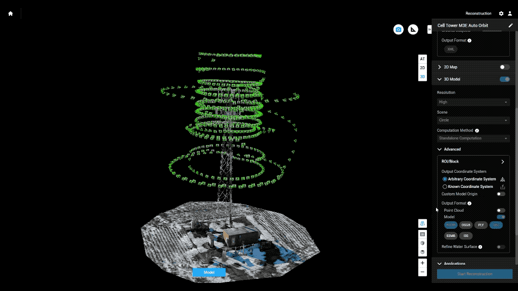
Example: Auto flight plan
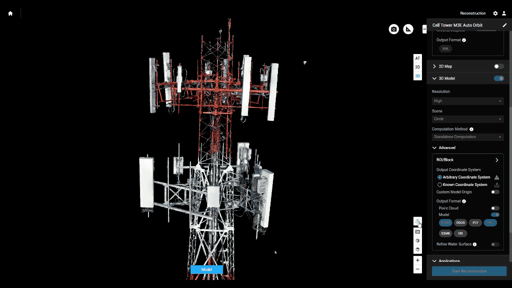
Result 3D Model
Why Use Drones?
2. Efficient - Results without waste
Safety of staffs
Save Time & $$

Why Use Drones?


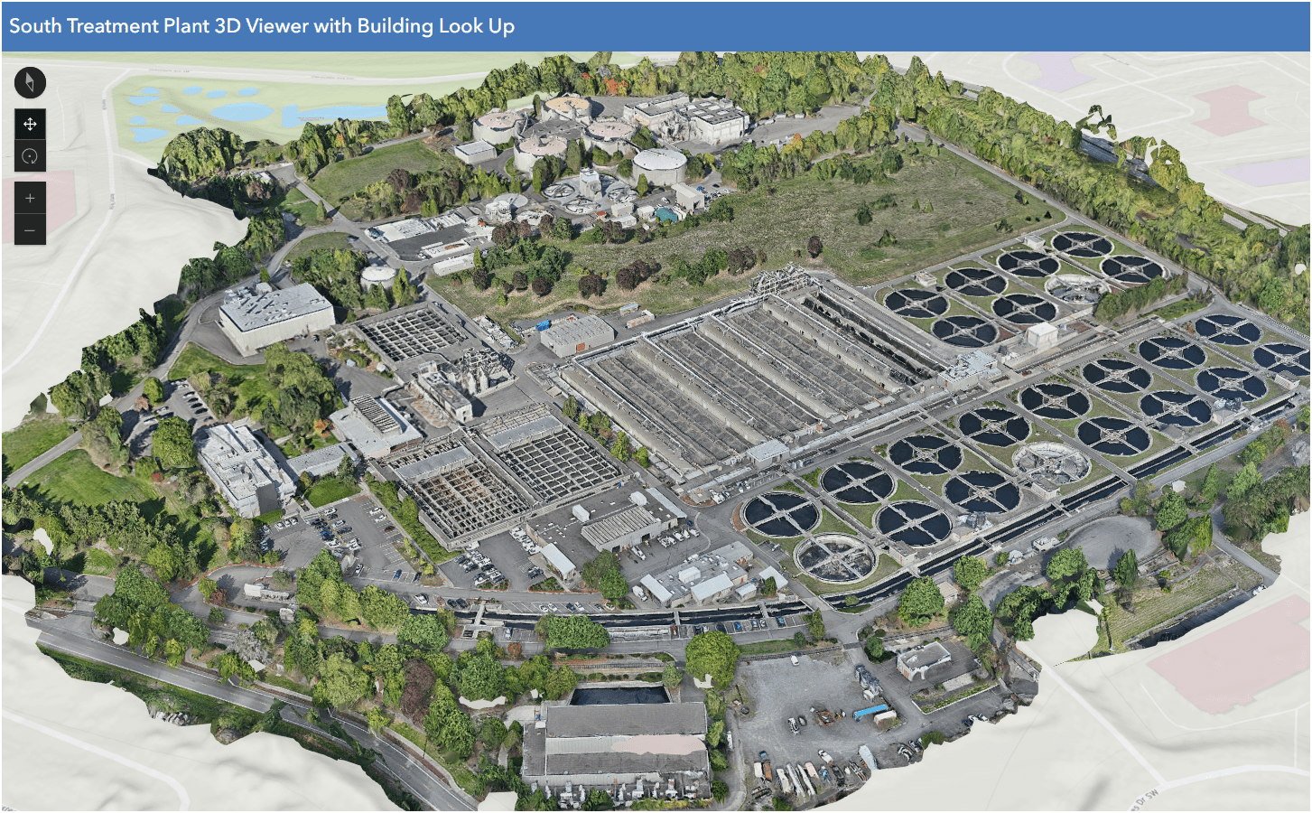
South Treatment Plant
Primary Division Channel
Increase Safety for Staff
Why Use Drones?
Increase Safety for Staff


Data Processing - Efficient

- Cloud Storage & Cloud Data Processing
- Flight Planning from Desktop - fly on Mobile (controller)
- Cloud storage/Cloud Processing
- Centralized System
- Project Deliverables
Why Use Drones?
3. Effective - Producing Results


- Environmental Monitoring
Examples - Effective
August 2022
March 2022


April 2023
- Update 2D aerial map
Examples - Effective

- 1172 Photos
- 0.57in/px
- Update 2D aerial map
Examples - Effective


0.57 in/px
Sept 2023
3.0 in/px
2021 KC Aerial
- Construction Site Monitoring
Examples - Effective

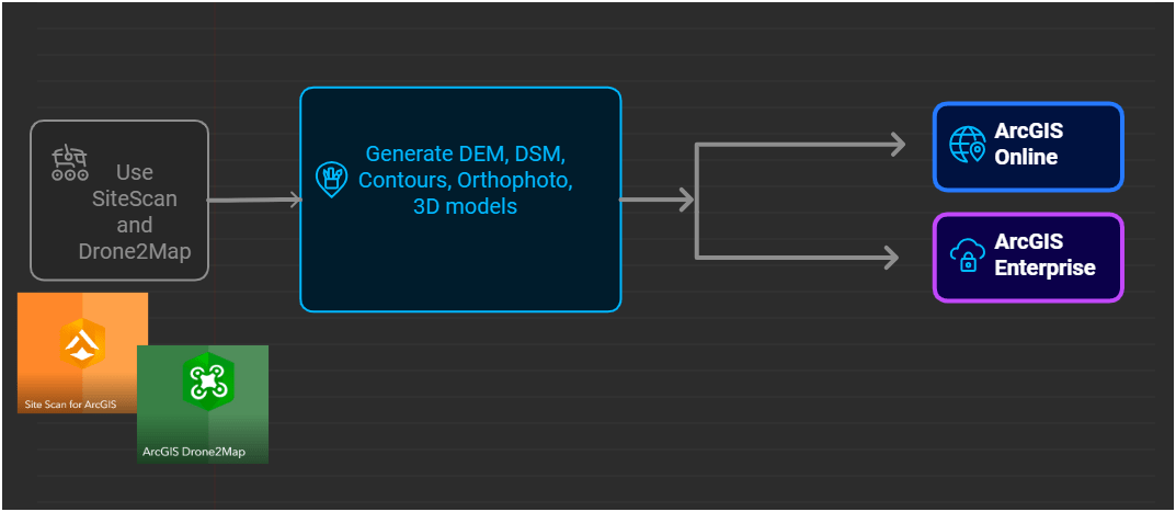
Just another Layer
GIS Integration


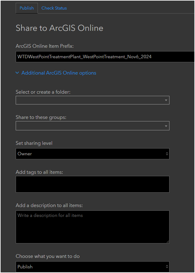
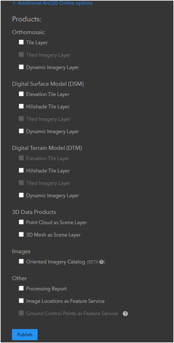
Esri Workflow
- Public
- No AGO Account
- Group Sharing
- Share with everyone
- Security


- Internal Only
- No AGO Account (KC)
- Group Sharing
- Selected Data to share
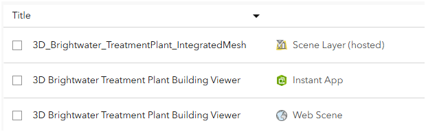
Hosted Feature Layer
Web Map
Web App
Scene Layer (hosted)
Web Scene (3D)
Instant App
Examples - Integrating with GIS
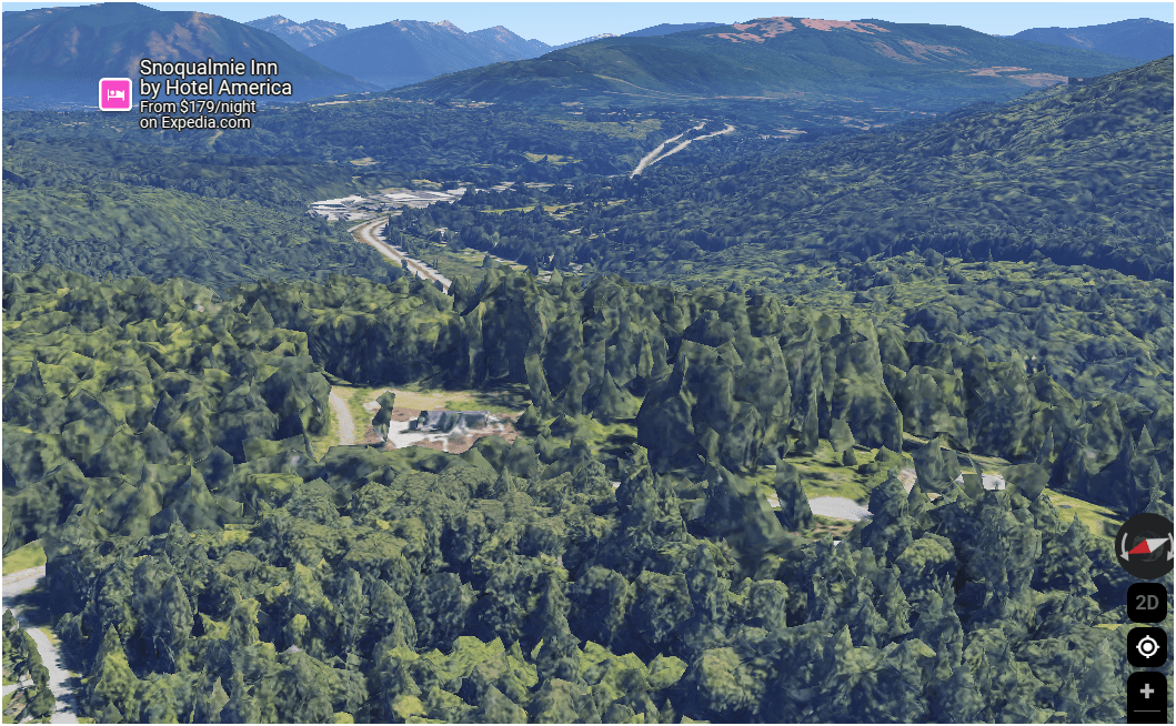
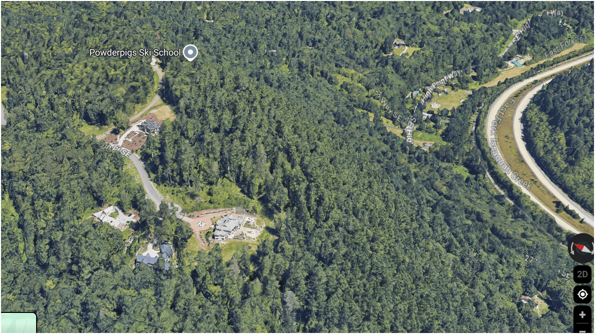
Helping KC Parks
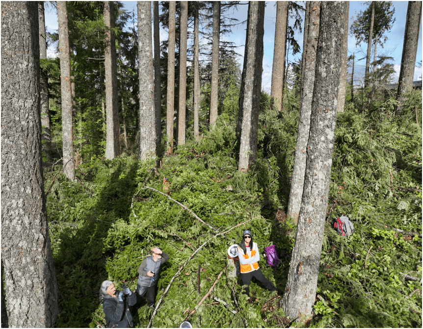
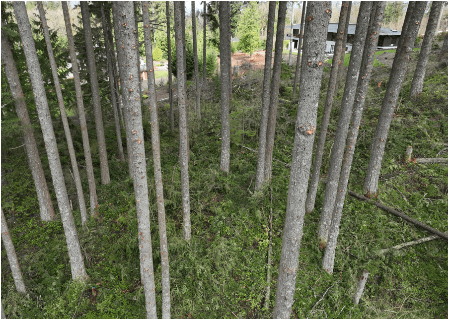
Proof Of Concept
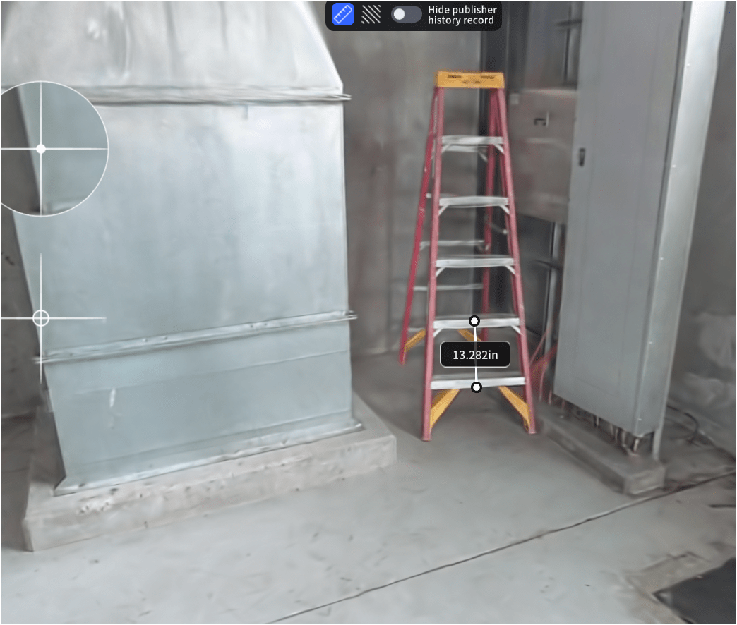
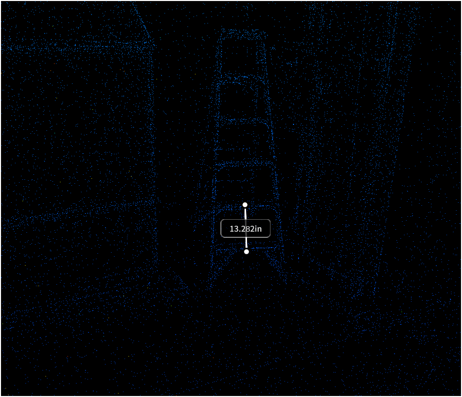
Lidar SLAM Handheld Unit
Video of Scan Path
Proof Of Concept
Lidar SLAM Handheld Unit
Examples

WHOA!
Proof Of Concept
Lidar SLAM Handheld Unit
Examples
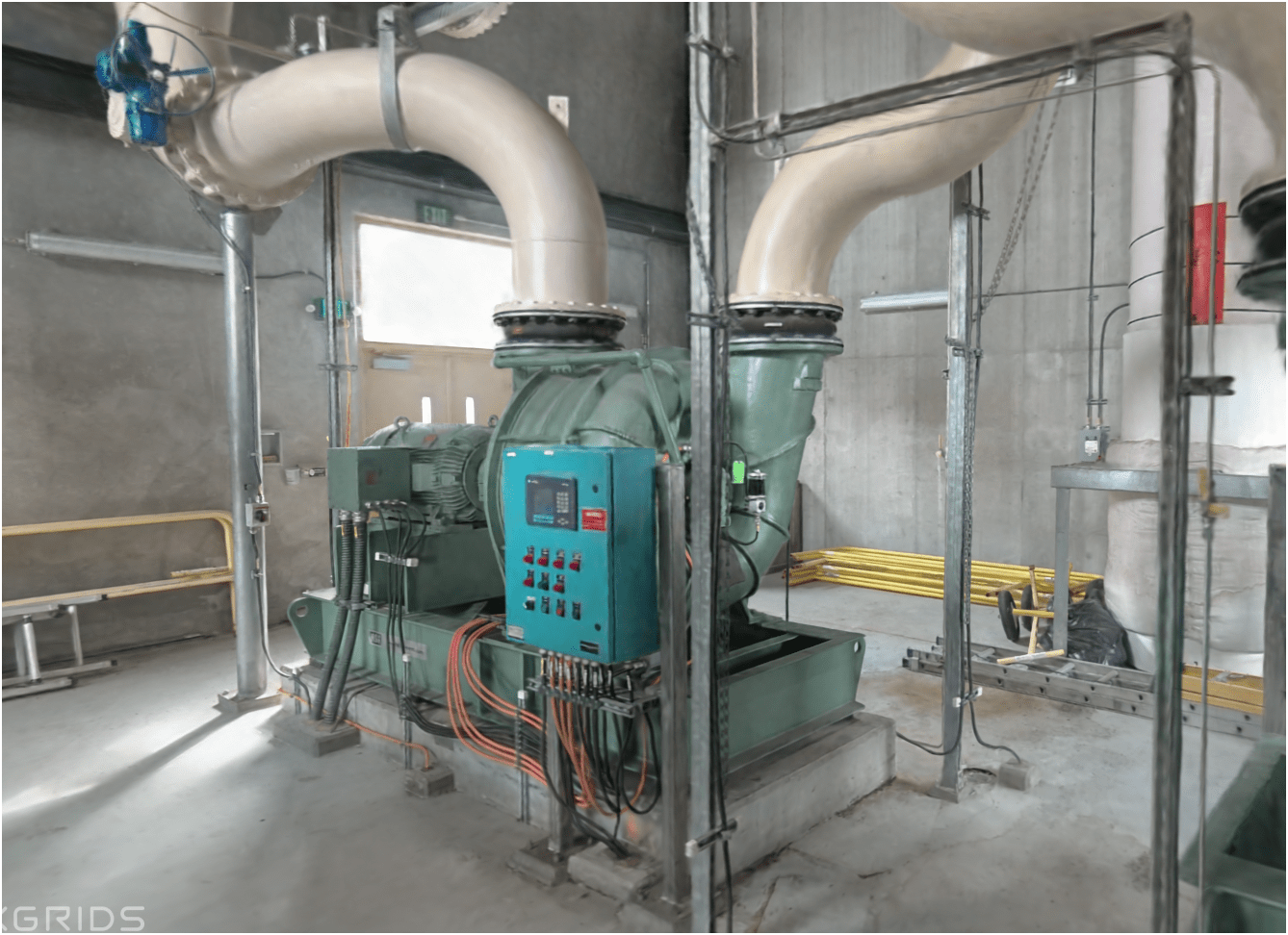
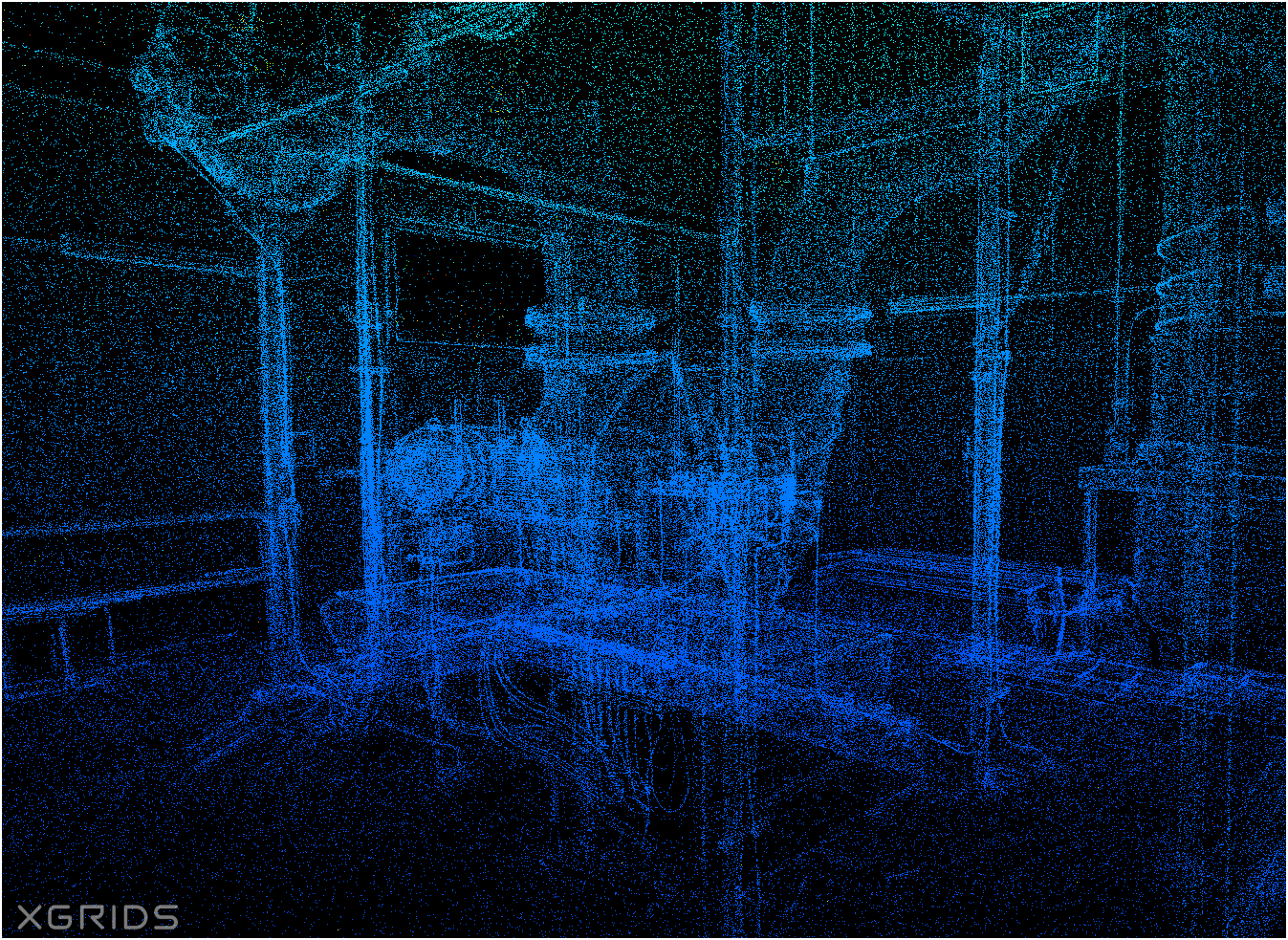
Proof Of Concept
Lidar SLAM Handheld Unit
Examples


Let's go find solution

Washington GIS Association Drone Special Interest Group


- Email Sign-up
- Resources
- Every 3rd Thursday
- ZOOM Meeting
- 165 Members
- Monthly Meeting - Every 3rd Thursday over Zoom
- Share resources online
- Help educate and introduce new users to the field of drone mapping and GIS
CUGOS
Cascadia
Users
of
Geospatial
Open
Source

peter.keum@kingcounty.gov