Remotely Piloted Aircraft System (RPAS)
What are they Good for?
April 8 , 2021
Peter Keum - KC WTD GIS Specialist, GISP
Just another tool in the toolbox


WSU Mt Vernon NWREC


CUGOS


Puget Sound QGIS
Short Back Story

CUGOS April 2014

RPAS - Remotely Piloted Aircraft System
FAA Definition: Unmanned Aircraft (UA) system that is operated by a pilot via ground control or on-board computer.


1. Background Information
Categories

Small - $
- Size: 1 - 2 meters ( 3 ft - 6.5 ft), < 55 lbs.
- Control: Radio control
Medium
- Size: Equivalent to a car, ~ 1000 lbs.
- Control: Visual Line Of Sight (VLOS) & Beyond LOS, RC & Satellite ~ $$$
Large
- Size: > 30,000 lbs.
- Control: Visual Line Of Sight (VLOS) & Beyond LOS, RC & Satellite ~ $$$$


RPAS as Platform

Multi-rotors
Fixed-wing & VTOL

- Shorter flight time (< 30 min)
- Cover smaller area
- Highly maneuverable
- Less expensive
- Access to confined spaces
- Long flight time (+ 40min)
- Covers large area
- Larger selection of sensors

(vertical take-off & land)
Multi-rotors

Sensors Payload

Multi-spectral
Thermal Infrared

Lidar Camera

High resolution digital camera (100 MP)

Lidar Camera
Lidar Camera
Methane Gas Dector
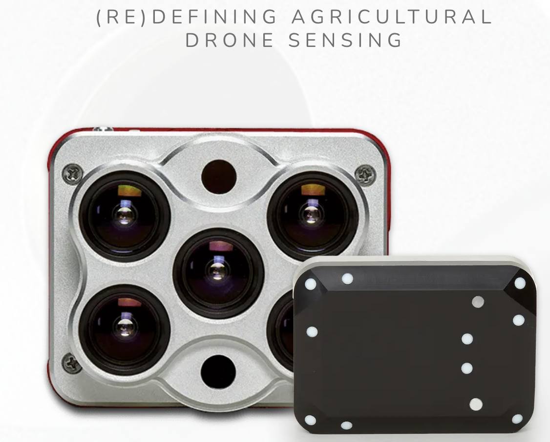
Sensors Payload
High resolution digital camera


1. Aircraft + Sensor (Data Collection)
2. Data Processing & Analyzing
(R, ML, Python, GIS)
3. Information Products
=
+


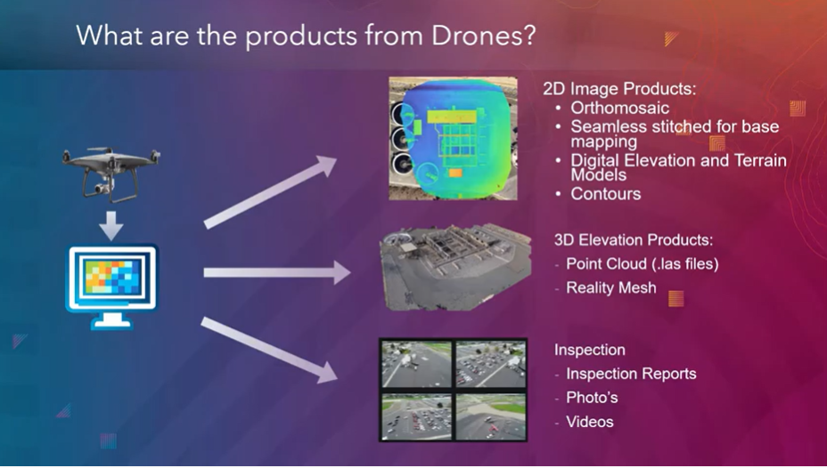
credit: Esri

Information Products


Example: Inspection
Improve Safety,
Save time, Improve efficiency


Two Spaces for Drone
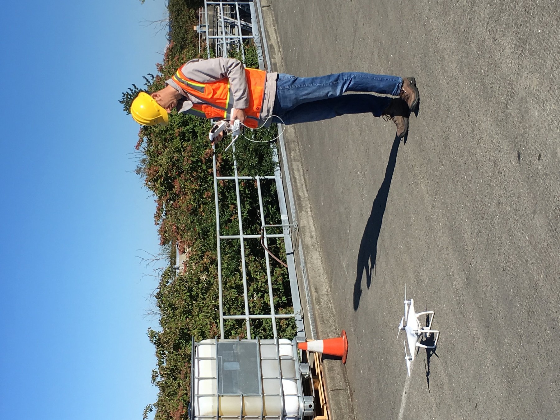


Outdoor
- GPS Signal
- Automated Planning and Flight
- Even, Diffuse lighting
- Open space
Indoor
- No GPS signal
- Limits on speed and motion
- Manual flight control
- Tight spaces
Outdoor
Indoor


DJI Air & Mavic 2 Pro < $1800
Aertos 120 $25,000 +
Eilos 2 $48,000 +
DJI Matrice 300 $12,000 +


Hazardous Condition


KC West Point TP - Digester
Precision Data Collection
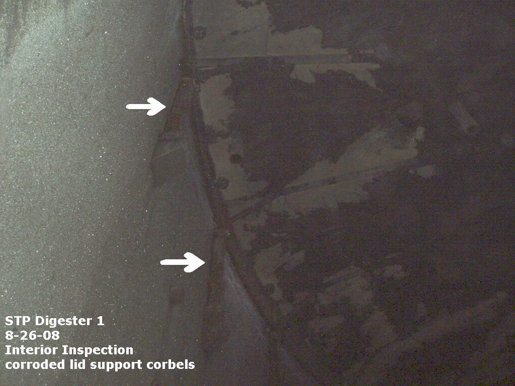


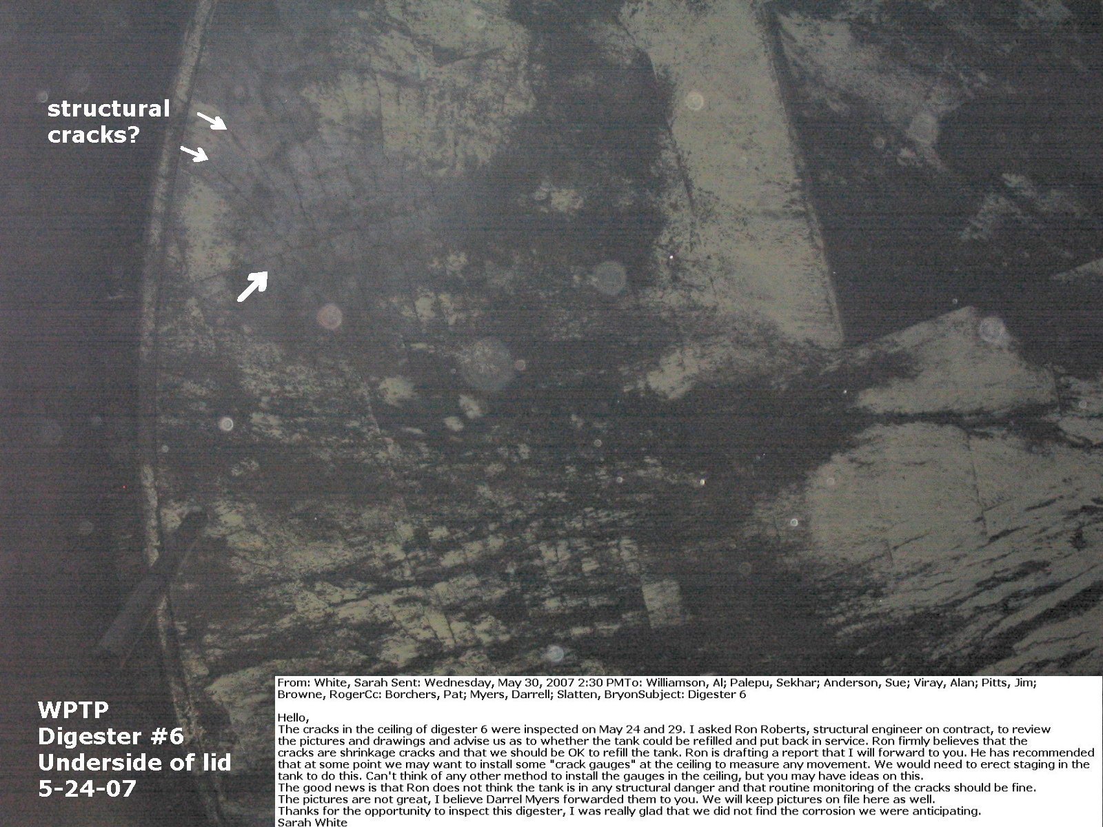
Why Use Drones?
-
Increase Safety for Staff
-
Avoid hazardous condition
-
Precision Data Collection
-
Repeatable & Recordable & Searchable
Standard Workflow

FAA Regulations - Where are we now?

2. Regulations
Commercial/Governmental
FAA Part 107 Rule, July 2016
-
Need FAA Remote Pilot Certification (Pilot license NOT needed)
-
171,744 - Remote pilot certified (2020)
-
441,709 - Commerical Drones Registered
-
Fly under 400 feet above ground level
-
Not to fly < 5 nautical miles around airport
-
Aircraft < 55 lbs.
-
Fly during daytime
-
Fly visual line of sight ( VLOS)
-
No flight over non-participating people
-
Many, Many more
FAA Part 107 Rule
Future Success (personal view)

3. Post Graduate
GPT
General Purpose Technology


GPT


1. Aircraft + Sensor (Data Collection)
2. Data Processing & Analyzing (GIS)
3. Information Products
=
+
GPT?
GPT?
GPT?
Information Products


+
=
YOU
Four C's
Critical
Thinking
Communication
Creativity
Collaboration


(Drone/GIS/ [Your work].....), What are they Good for?
Just another tool in the toolbox


Now Let's go use them!
peter.keum@kingcounty.gov