Use of Drones for King County Wastewater Treatment
August 30, 2025
Peter Keum, FAA Part 107/GISP
King County Wastewater Treatment
Drone Program Lead/ GIS Analyst
Learning Objectives
- King County Wastewater GIS/Drone Program
- Integration of Drone with GIS
- State of GIS


CUGOS


So Let's Dive In!

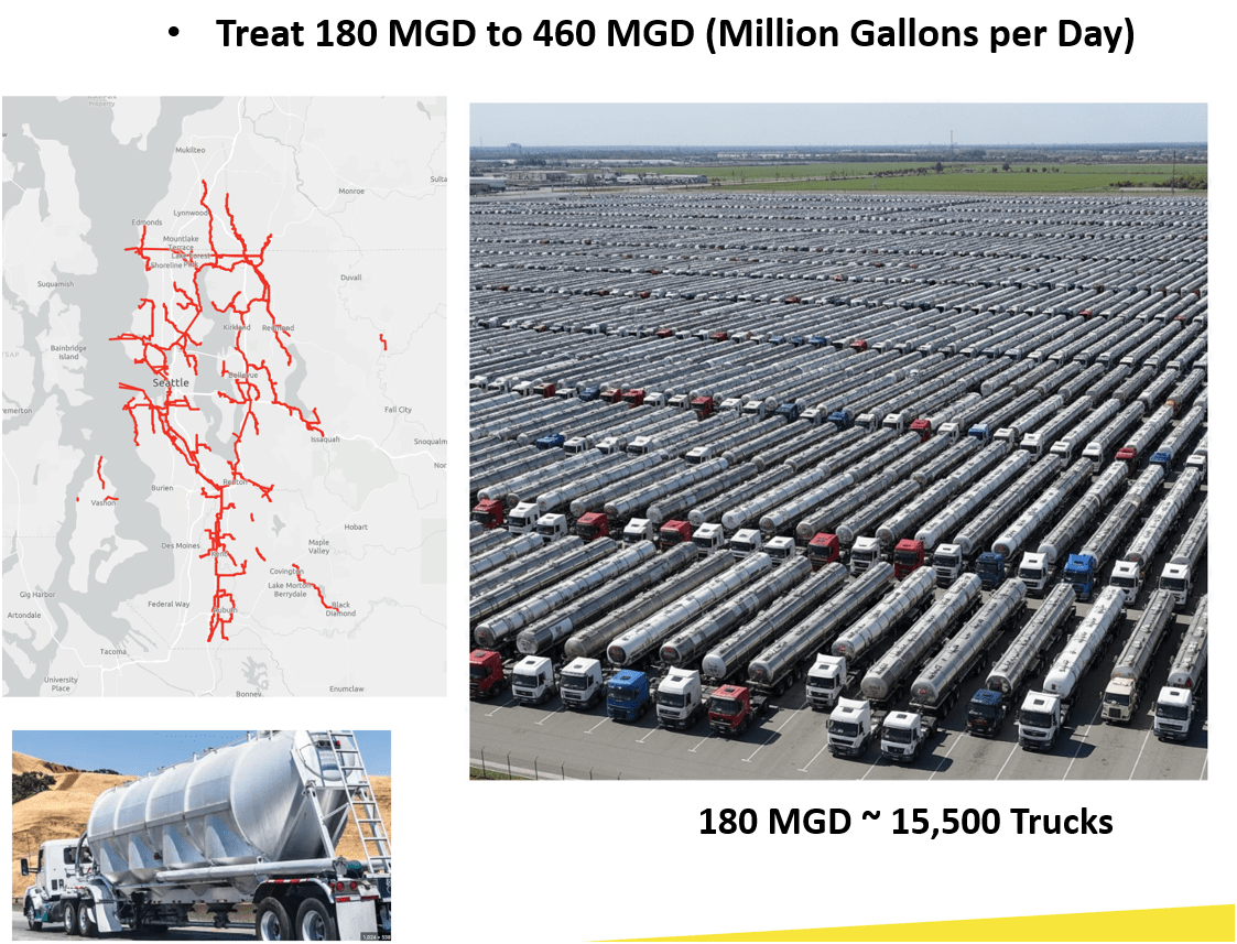
King County Wastewater Treatment by Numbers
-
2 million residents
-
34 Agencies
-
424 square miles
-
383 miles sewer pipeline (2.5 inch to 14 ft)
-
74 facilities (PS & RS)
-
3 Treatment Plants: 180 MGD ~ Max. 460 MGD

Seattle, WA --> Medford, OR
WTD GIS Team
- 7 GIS Specialists + 3 New in Oct.
Supervisor


WTD GIS
Maintain Sewer GIS Data
-
FIRS (Facility Information Retrieval System) Data
- Maintenance Hole
- Pipes
- Pump Stations
- Regulator Stations
- Treatment Plants
- Outfalls
- Flow Monitors
- CP Stations
- Connection Points
- Site Plan Data
- 3D Models
- Drone Collected Data
- .... many many more

WTD
GIS
DATA
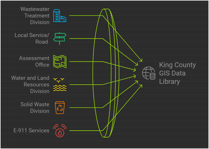
GIS Data:
The core of a GIS is its Database
BUT.....There are 17 county agencies support
King County GIS Data Library System
WTD
GIS Data:
The core of a GIS is its Database
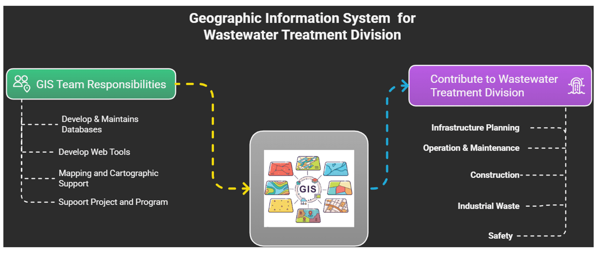
Program Support
- CSO (Combined Sewer Overflow) Control Program
- Modeling Group
- CIFM (Conveyance, Inspection, and Flow Monitoring) Group
- Asset Management Program
- Capacity Charge
- ....many other sections


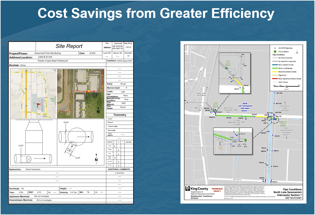
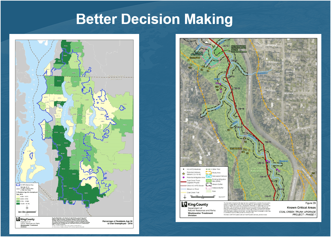
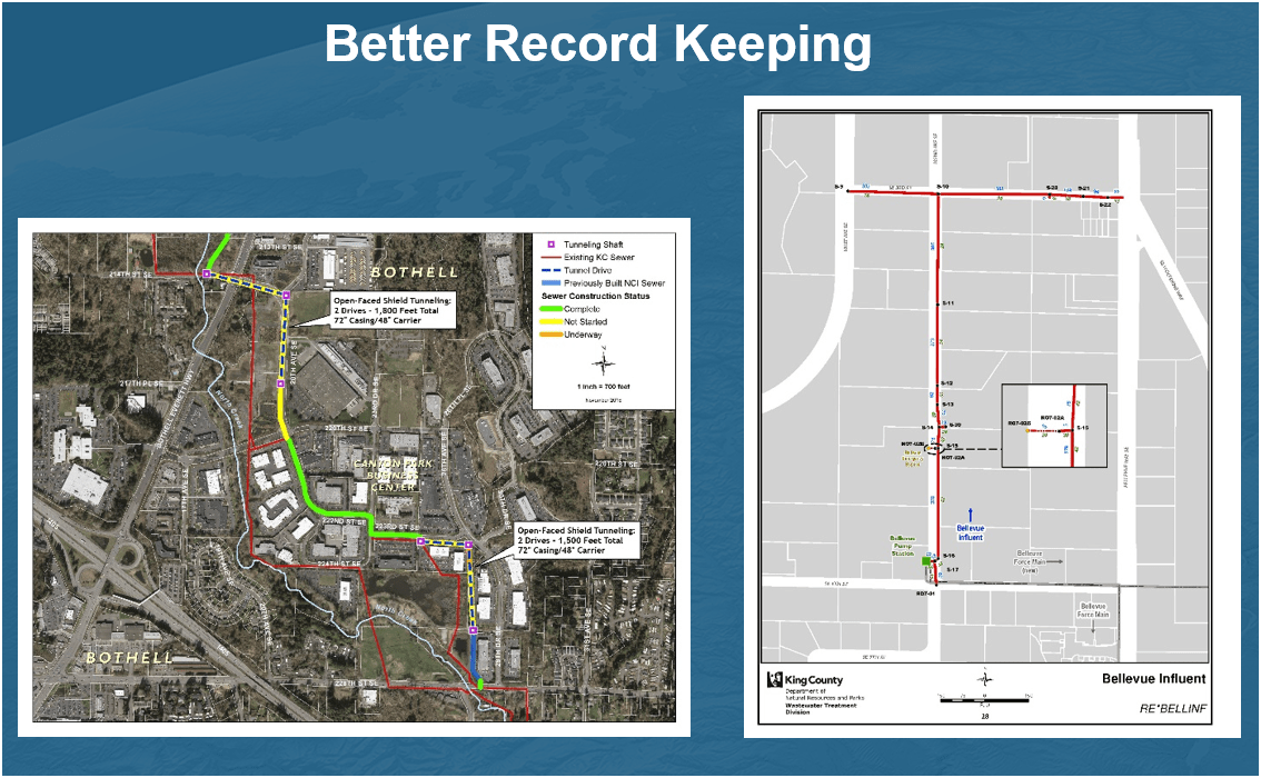
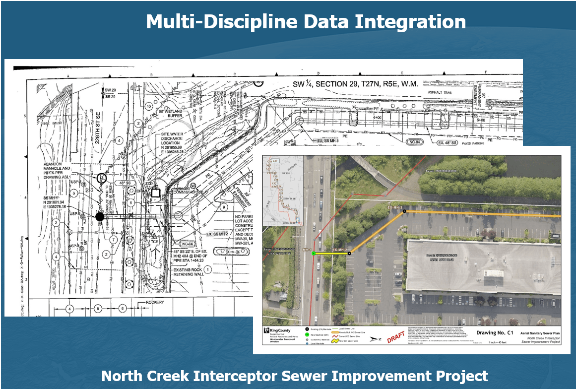
Projects & Programs Support
WTD GIS
Projects & Programs Support
WTD GIS
Projects & Programs Support
WTD GIS
Projects & Programs Support
WTD GIS
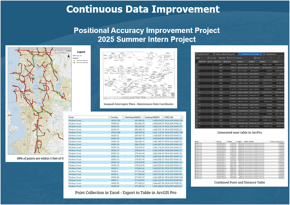
Projects & Programs Support
WTD GIS
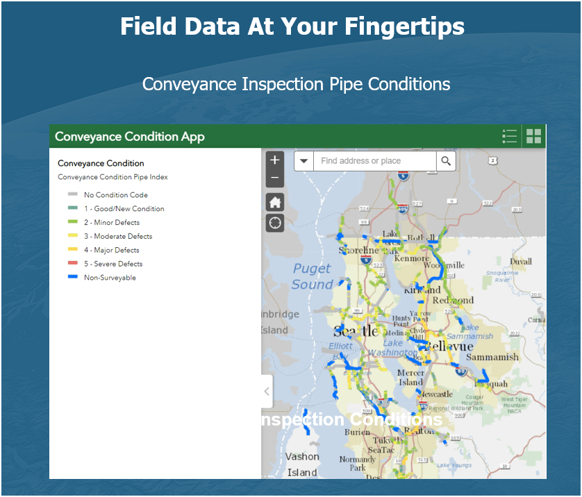
Projects & Programs Support
WTD GIS

Projects & Programs Support
WTD GIS
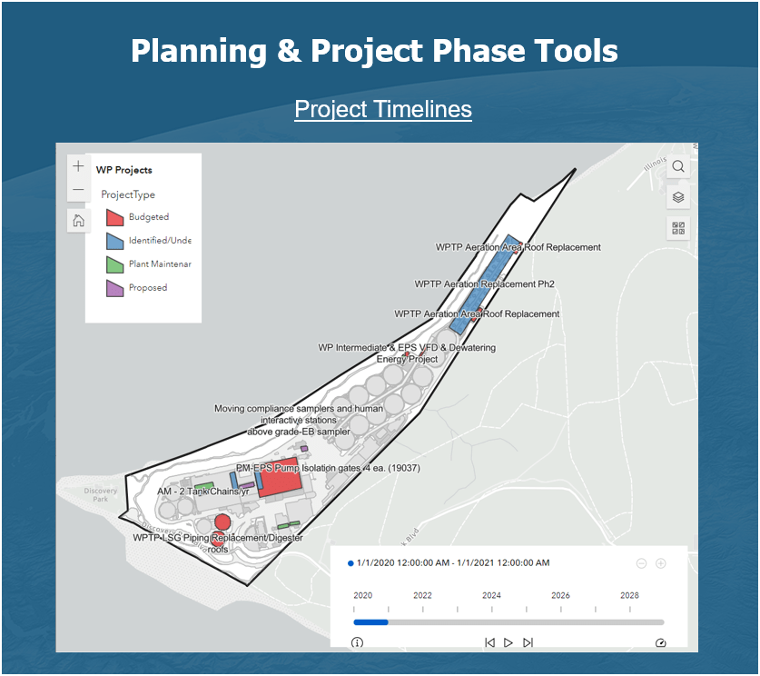
Projects & Programs Support
WTD GIS
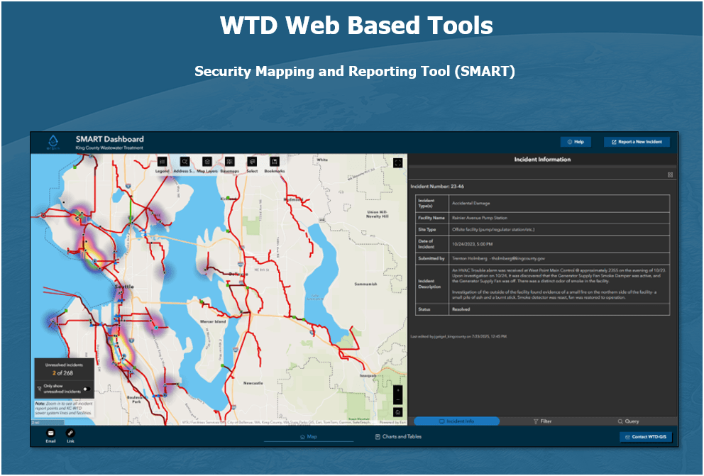
Projects & Programs Support
WTD GIS


1. Aircraft + Sensor (Data Collection)
2. Data Processing & Analyzing (GIS)
3. Information Products
||
+

Drone

GIS
Great Combo?
&
Great combo !
GIS & DRONE


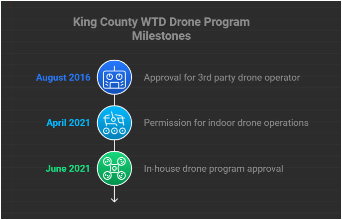
Summary of KC Wastewater Treatment Drone Program

People
+
Technology
+
Organization
=
RPAS Program
(drone)
WTD GIS RPAS Program
August 2025
- Four FAA Part 107 Drone Certified Pilots - WTD GIS Specialists (Jim, Patrick, Joe, and Peter)
- Helping other departments to stand up their own RPAS programs


Joe
DJI Mavic 2 Pro

Mavic 2 Ent. Adv.

Mavic 3 Ent (2x)

2021
2022
2023
Matrice 4 Ent.
2025
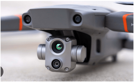
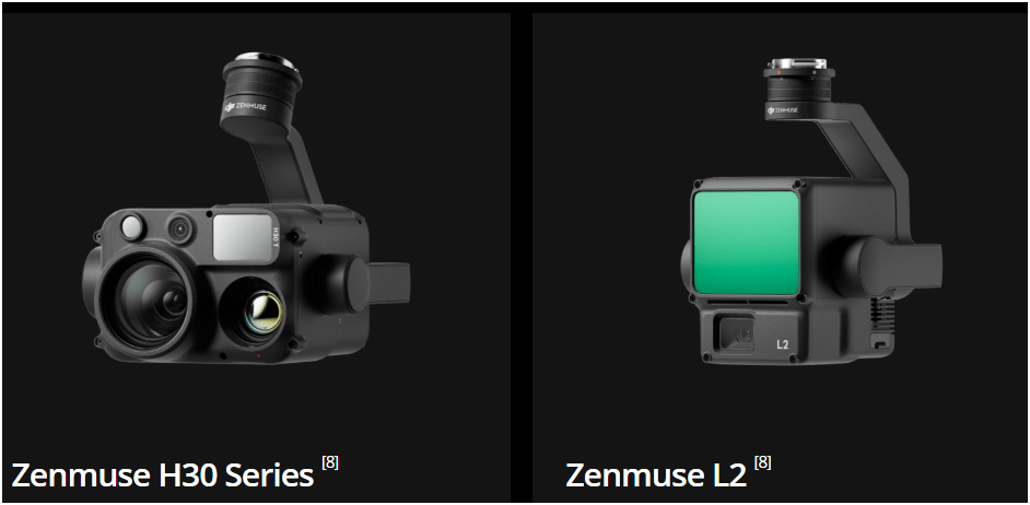
Current Hardware
DJI Mavic 2 Pro < $1,800 (Retired)

DJI Mavic 2 Pro Ent. Adv $6,500
DJI Avata $1,300
Mavic 3 Ent (2x)
$3,800
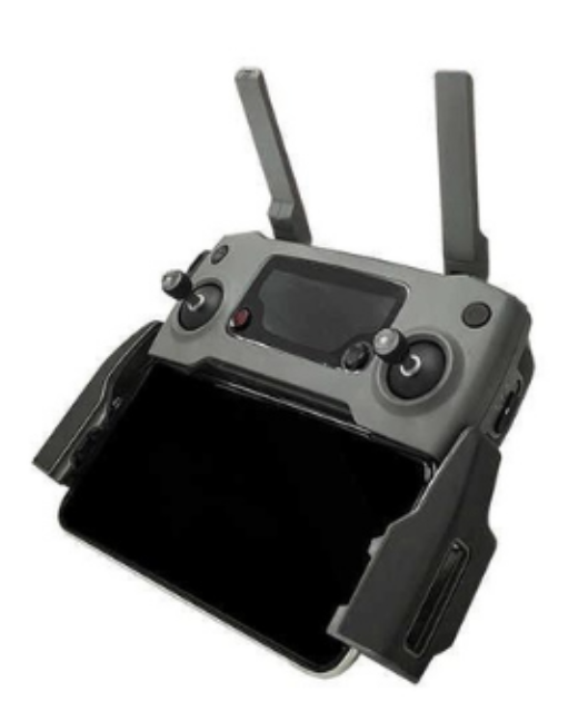
20 MP/ 56x zoom
20 MP
12 MP/ 32x zoom
+ Thermal

Matrice 4 Ent
~ $5,300/ $8,500
Text
Wish List Hardware
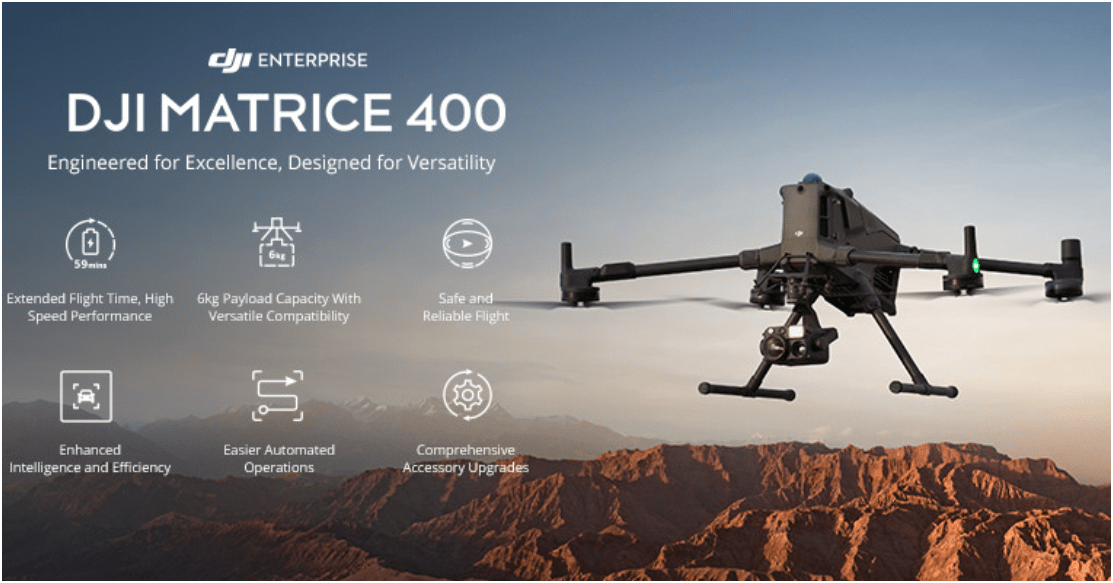
All Weather
$11,000
RGB Camera $3,500
Lidar Sensor
$ 12,500
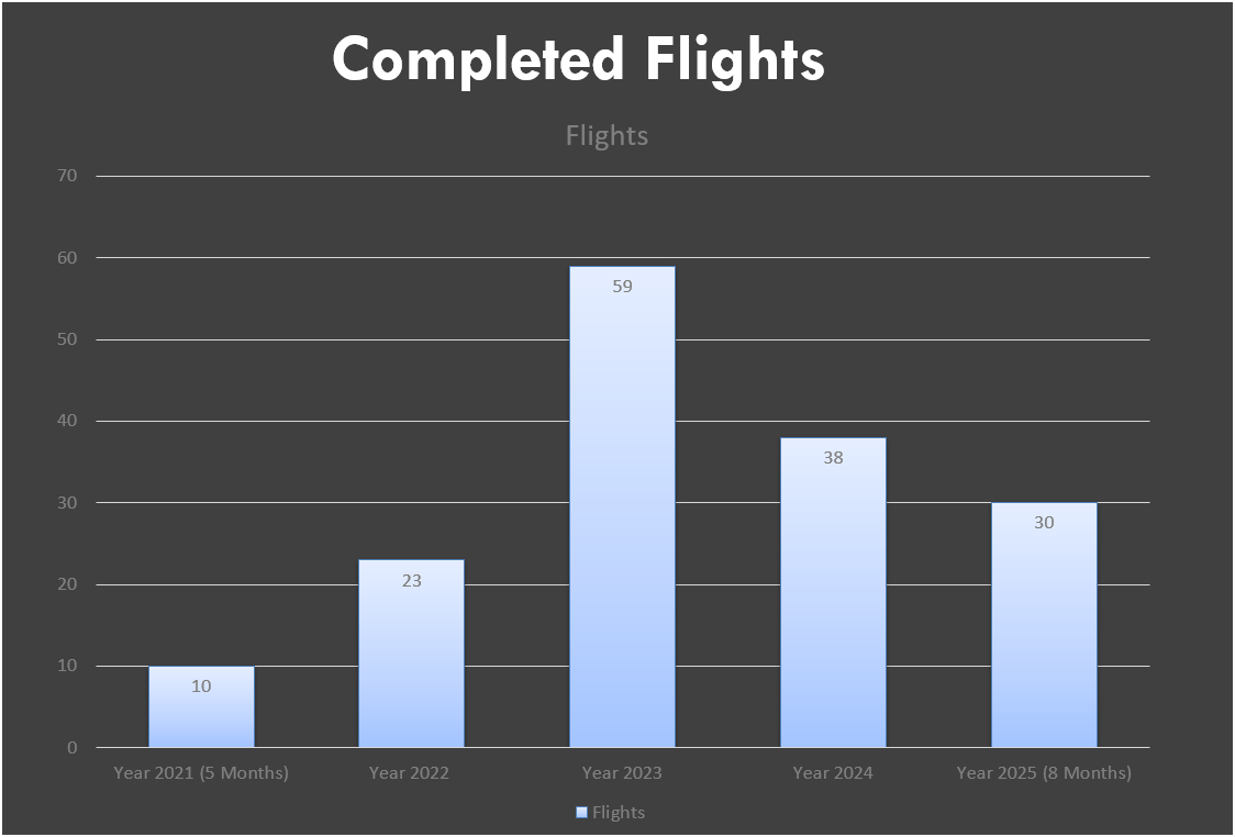
WTD RPAS Dashboard
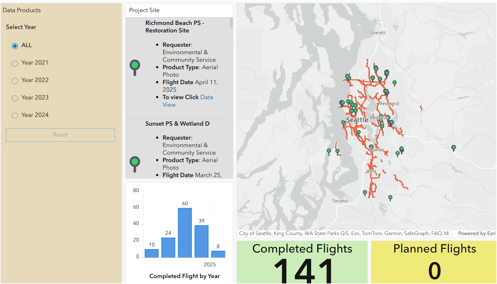


2021
June - Dec.
2023
Jan. - Nov.
Number of Flights
2022
Jan. - Dec.

+ 480 %
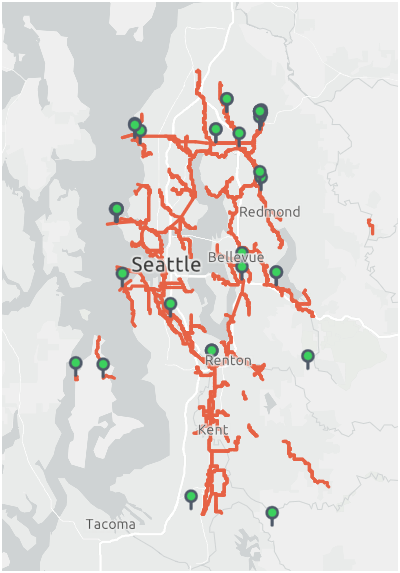

2024
Jan. - Nov.
Examples - Integrating with GIS
Examples - Integrating with GIS
Examples - Integrating with GIS
Helping KC Parks

Helping KC Parks
Why Use Drones?
3 E's
-
Easy
-
Efficient
-
Effective
Why Use Drones?
Easy - Simple with little effort
Efficient - Results without waste
Effective - Producing Results
Why Use Drones?
1. Easy - Simple with little effort

Automatic
Repeatable
Flight Control App
- Automate Flight Planning - Fly Consistently for overlapping images
- Can fly manually but it's like mowing with scissors


Why Use Drones?
2. Efficient - Results without waste
Safety of staffs
Save Time & $$

Why Use Drones?


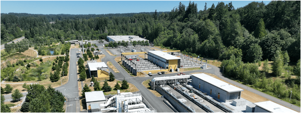
South Treatment Plant
Primary Division Channel
Increase Safety for Staff
Data Processing - Efficient

- Cloud Storage & Cloud Data Processing
- Flight Planning from Desktop - fly on Mobile (controller)
- Cloud storage/Cloud Processing
- Centralized System
- Project Deliverables
Why Use Drones?
3. Effective - Producing Results


- Environmental Monitoring
Examples - Effective
August 2022
March 2022


April 2023
- Update 2D aerial map
Examples - Effective

- 1172 Photos
- 0.57in/px
- Update 2D aerial map
Examples - Effective


0.57 in/px
Sept 2023
3.0 in/px
2021 KC Aerial
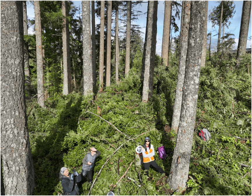
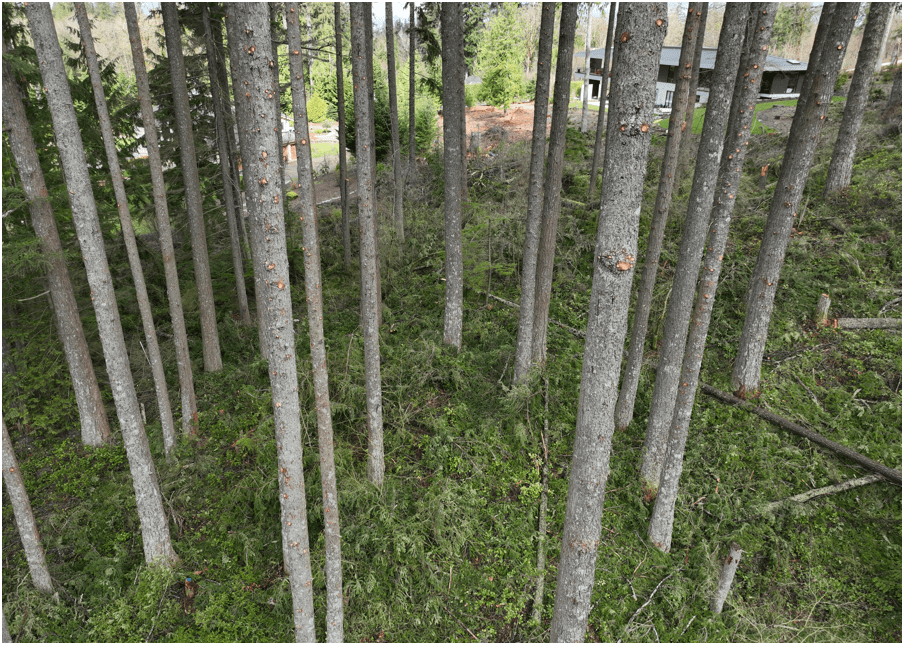
- Construction Site Monitoring
Examples - Effective
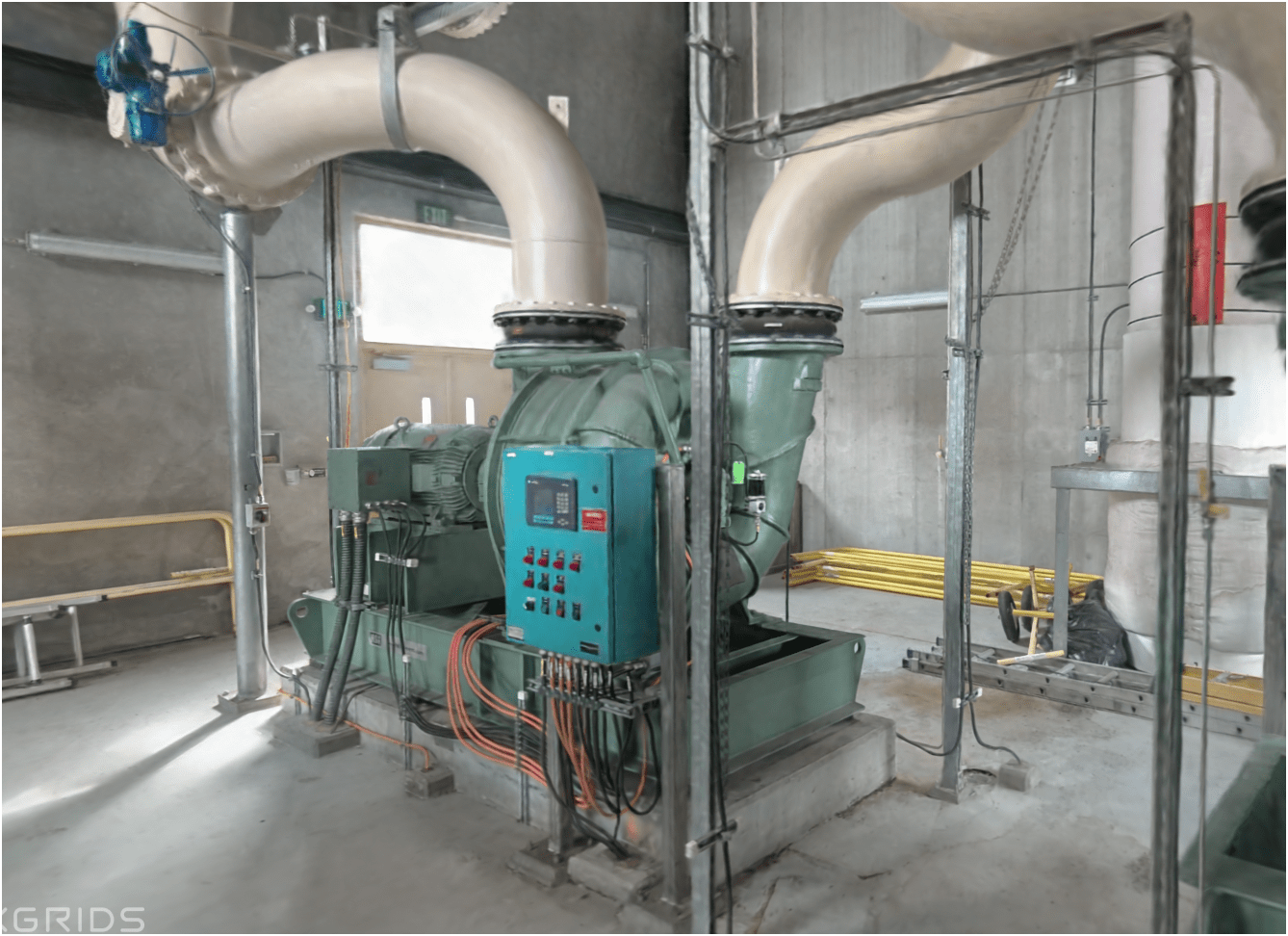
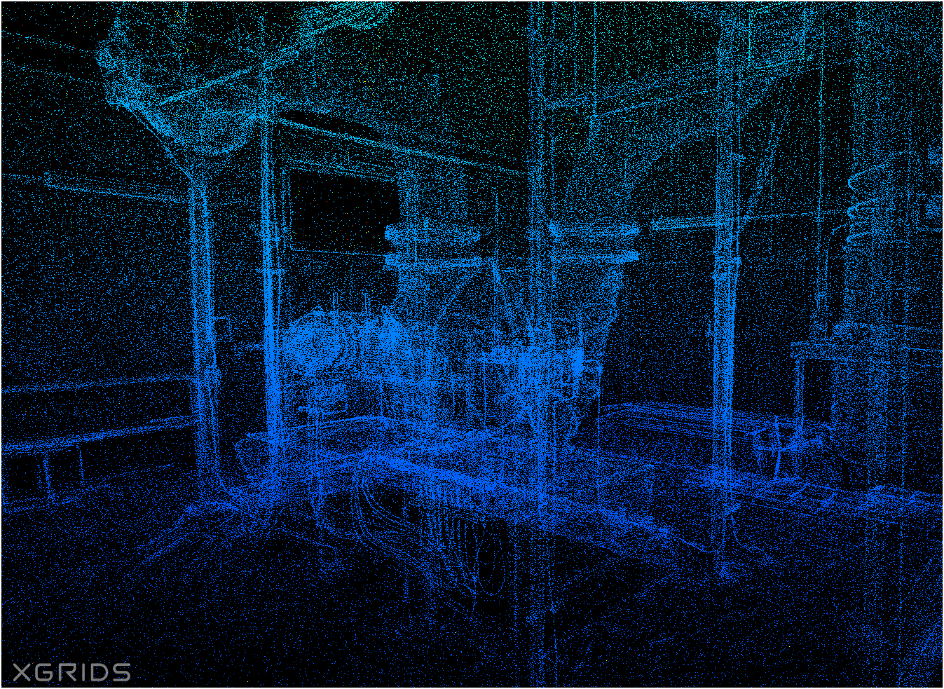
West Point Treatment Plant Raw Sewage Pump Building
Proof Of Concept (new)
Lidar SLAM Handheld Unit
Video of Scan Path
Proof Of Concept (new)
(Lidar data + Camera photo ) x Gaussian Splatting = below

WHOA!
Proof Of Concept
Lidar SLAM Handheld Unit
Examples
Proof Of Concept
Lidar SLAM Handheld Unit
Examples


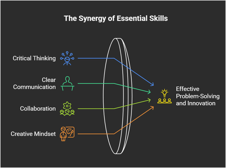
Future GIS & Success (personal view)

Post Graduate
GPT
General Purpose Technology NOT ChatGPT


Steam Engine
Electricity
GPT


"GPT always needs complements"
Urban Planning
Utilities/Engineering
You
Social Justice/Equity
Environmental
Science
GIS
GIS
GIS
GIS
You
You
You
Companies are thinking more creatively about how to combine location with outside content and internal business data to differentiate products


+
=
YOU


Doing is Learning, but...

Doing with mistakes?

It's still learning!
A
B
L

C
Tobin Bradley, Mecklenburg County, NC
Washington GIS Association Drone Special Interest Group


- Email Sign-up
- Resources
- Every 3rd Thursday
- ZOOM Meeting
- 165 Members
- Monthly Meeting - Every 3rd Thursday over Zoom
- Share resources online
- Help educate and introduce new users to the field of drone mapping and GIS
CUGOS
Cascadia
Users
of
Geospatial
Open
Source


Let's go find solution
