Earthsys 144: Fundamentals of GIScience
Projections and Coordinate Systems
where is your data? gis.stanford.edu
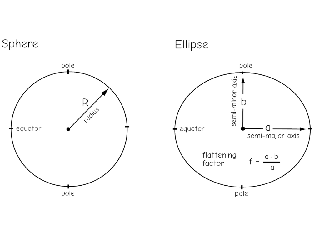
The Size & Shape
of the Earth
(Less complicated, but somehow more complicated, than you think)
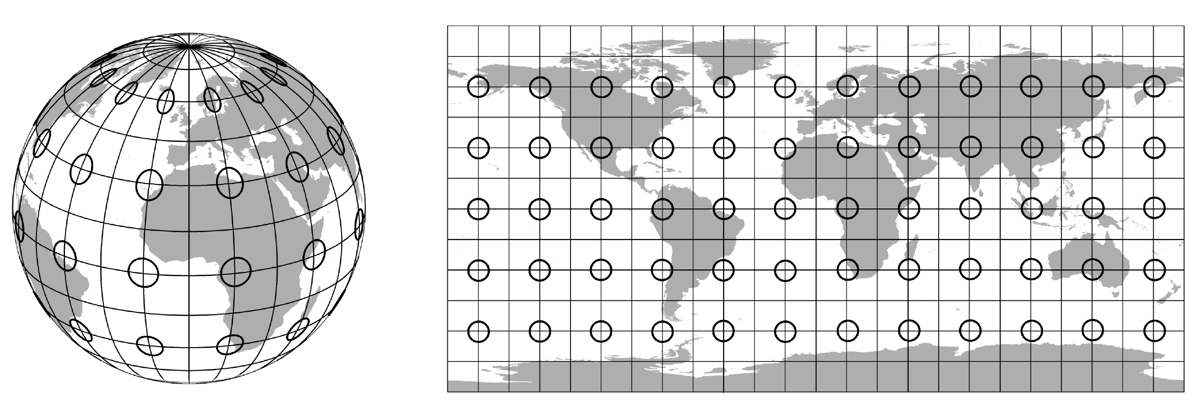
spherical vs ellipsoid?
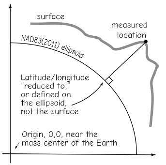
surface & ellipsoid coordinates
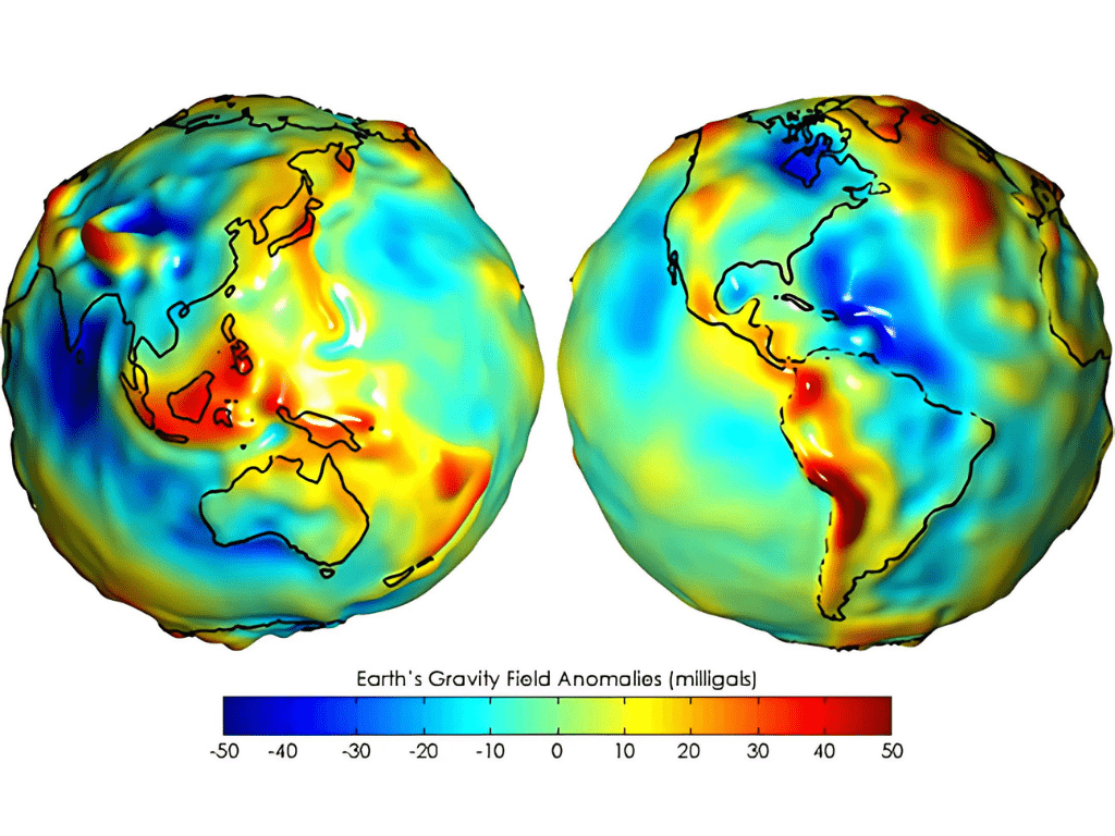
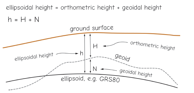
the geoid
But, really...
If Earth were scaled down to a standard billiard ball of 57.15 mm diameter, the difference between Mount Everest and the Mariana Trench would scale to about 0.09 mm
World Pool-Billiard Association (WPA) equipment specifications, a billiard ball must be uniform with a tolerance of +/- 0.127 mm

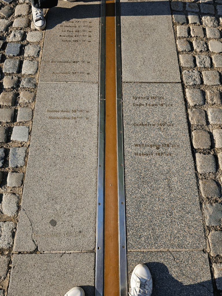
geographic coordinate systems
(Laying a "frame of reference" on the Earth)
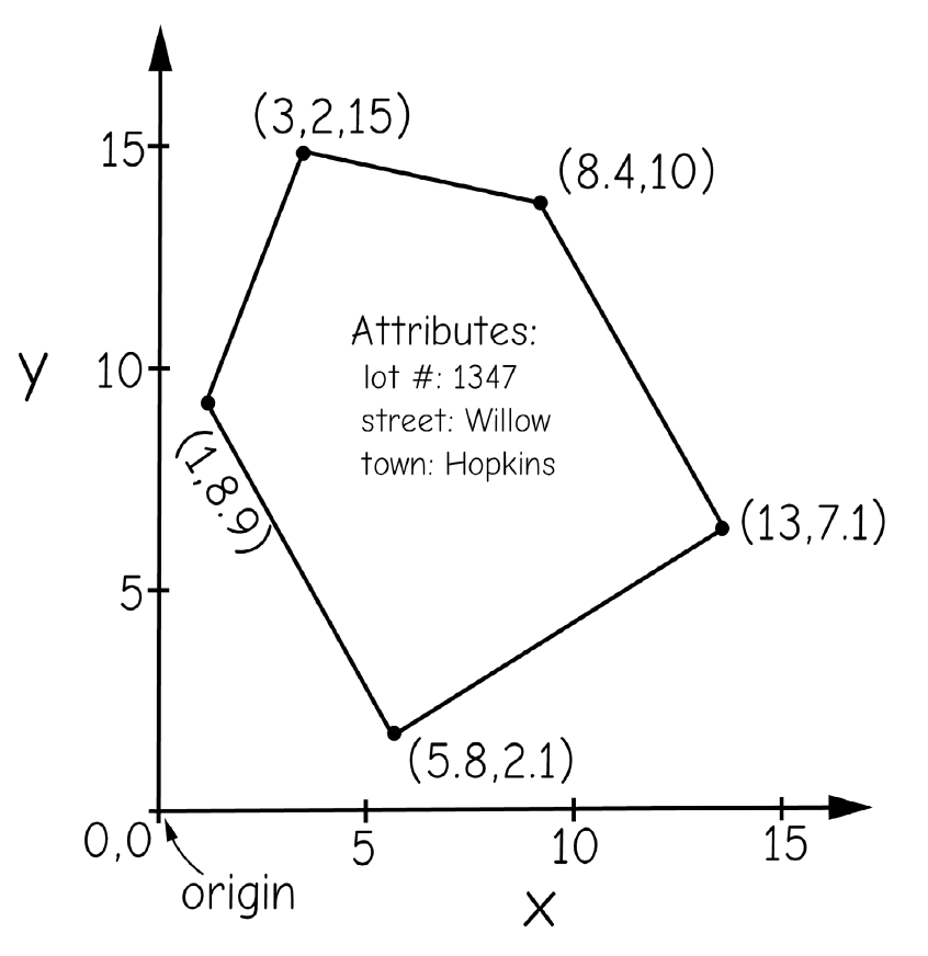
coordinates

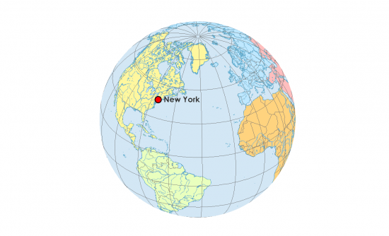
Geographic Coordinate Systems

longitude, con't
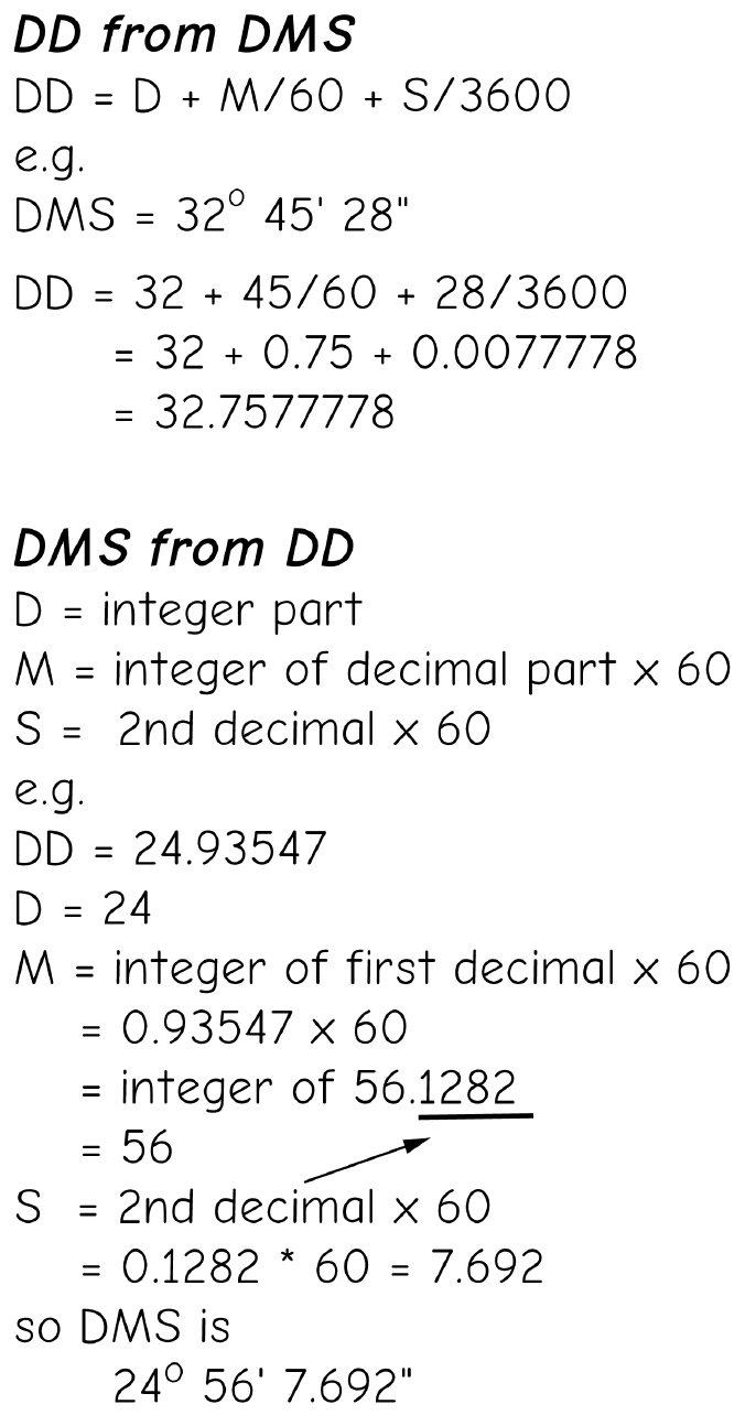
coordinate notation
Degrees Minutes Seconds (DMS)
📍 Latitude: 40° 42′ 51″ N
📍 Longitude: 74° 00′ 21″ W
Decimal Degrees (DD)
📍 Latitude: 40.714
📍 Longitude: -74.006
Precision
Precision
decimal
places degrees distance
------- ------- --------
0 1 111 km
1 0.1 11.1 km
2 0.01 1.11 km
3 0.001 111 m
4 0.0001 11.1 m
5 0.00001 1.11 m
6 0.000001 0.111 m
7 0.0000001 1.11 cm
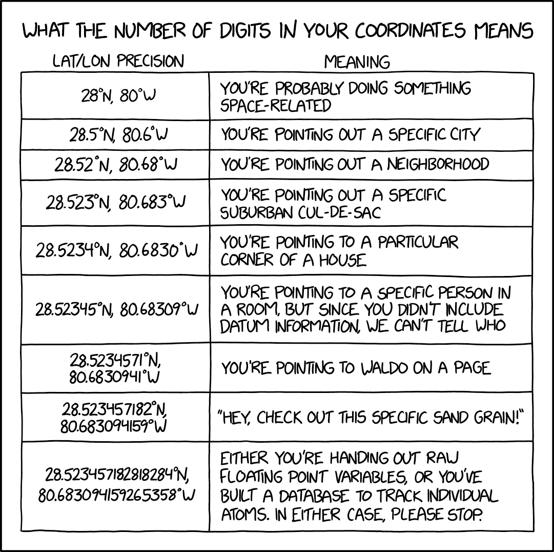
8 0.00000001 1.11 mmHow many locations can one place have?
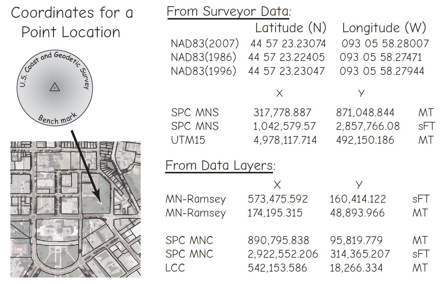
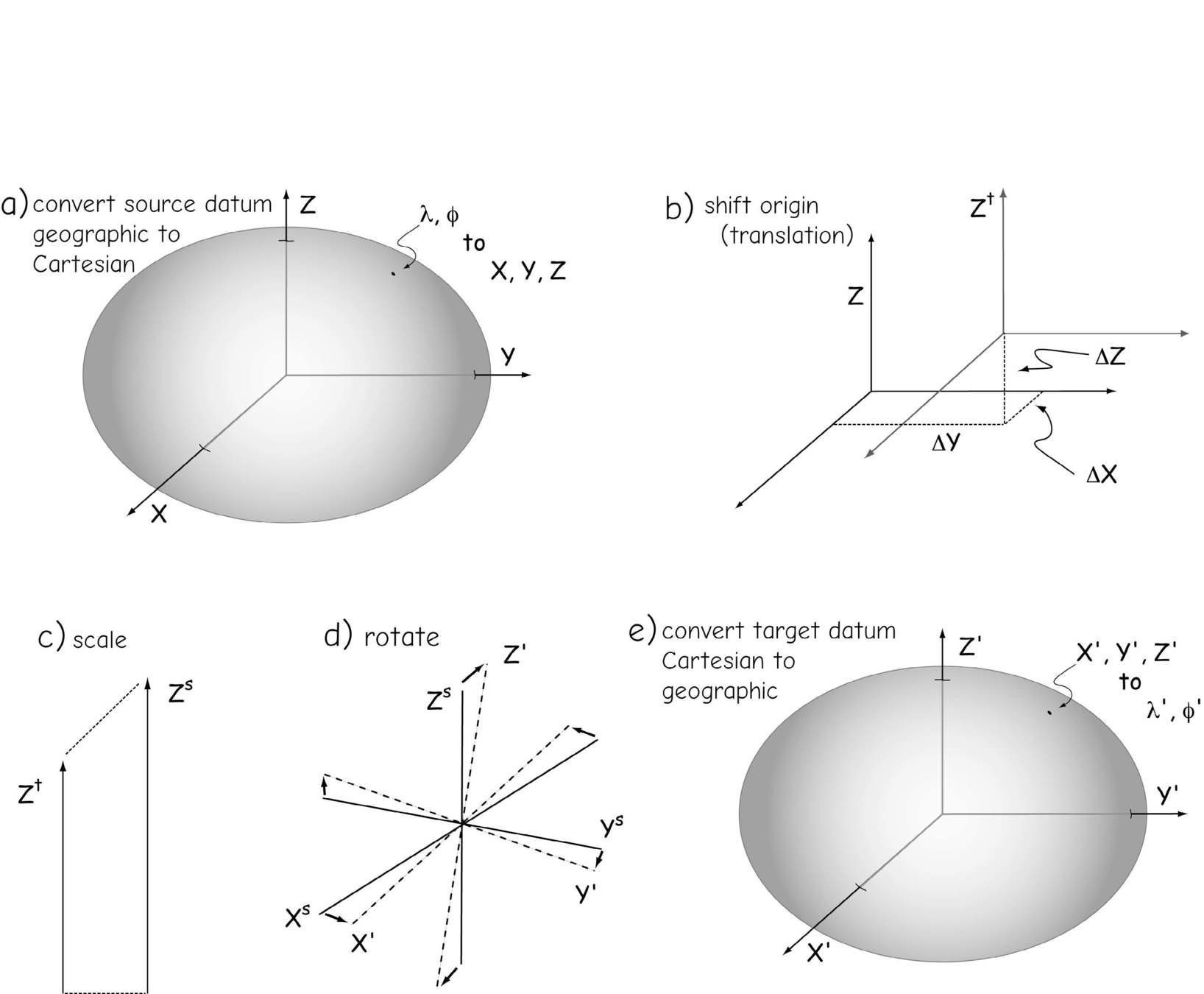
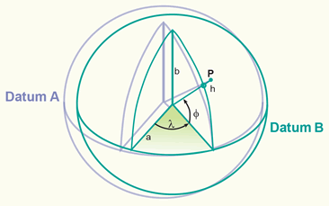
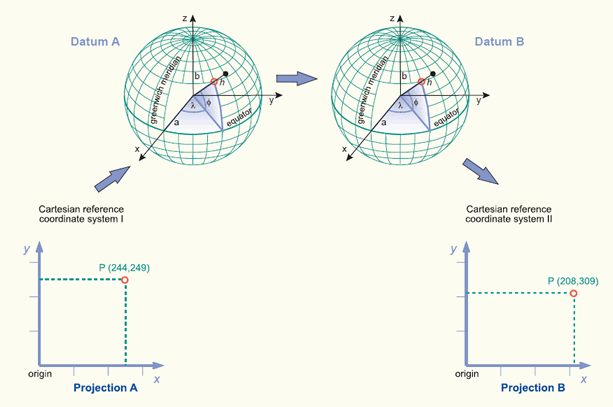
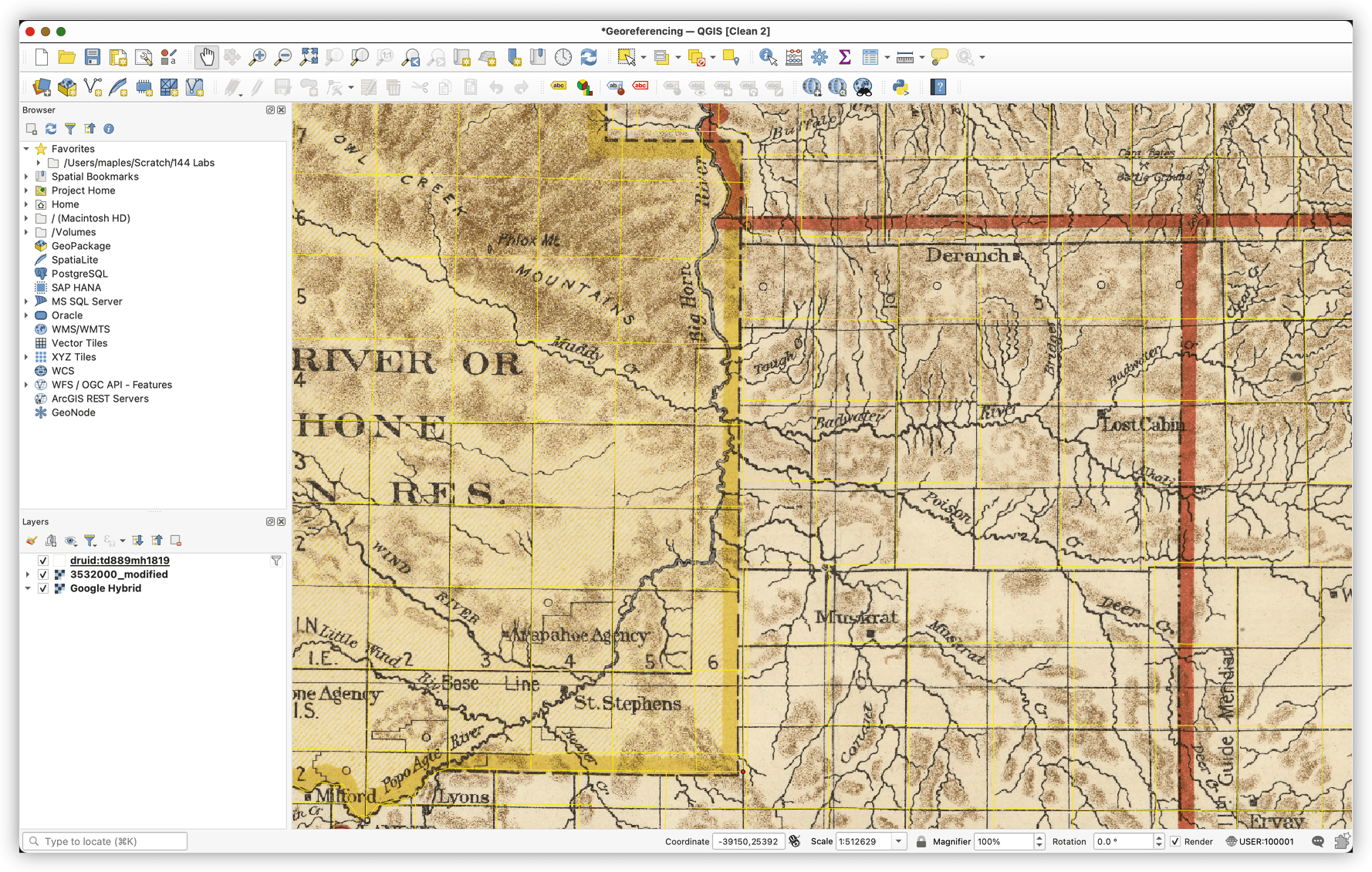
datums & (geographic) transformations
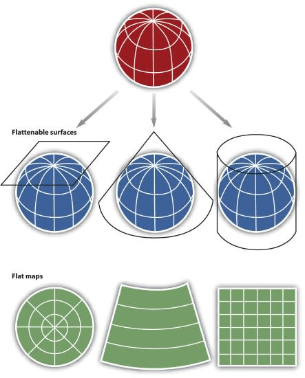
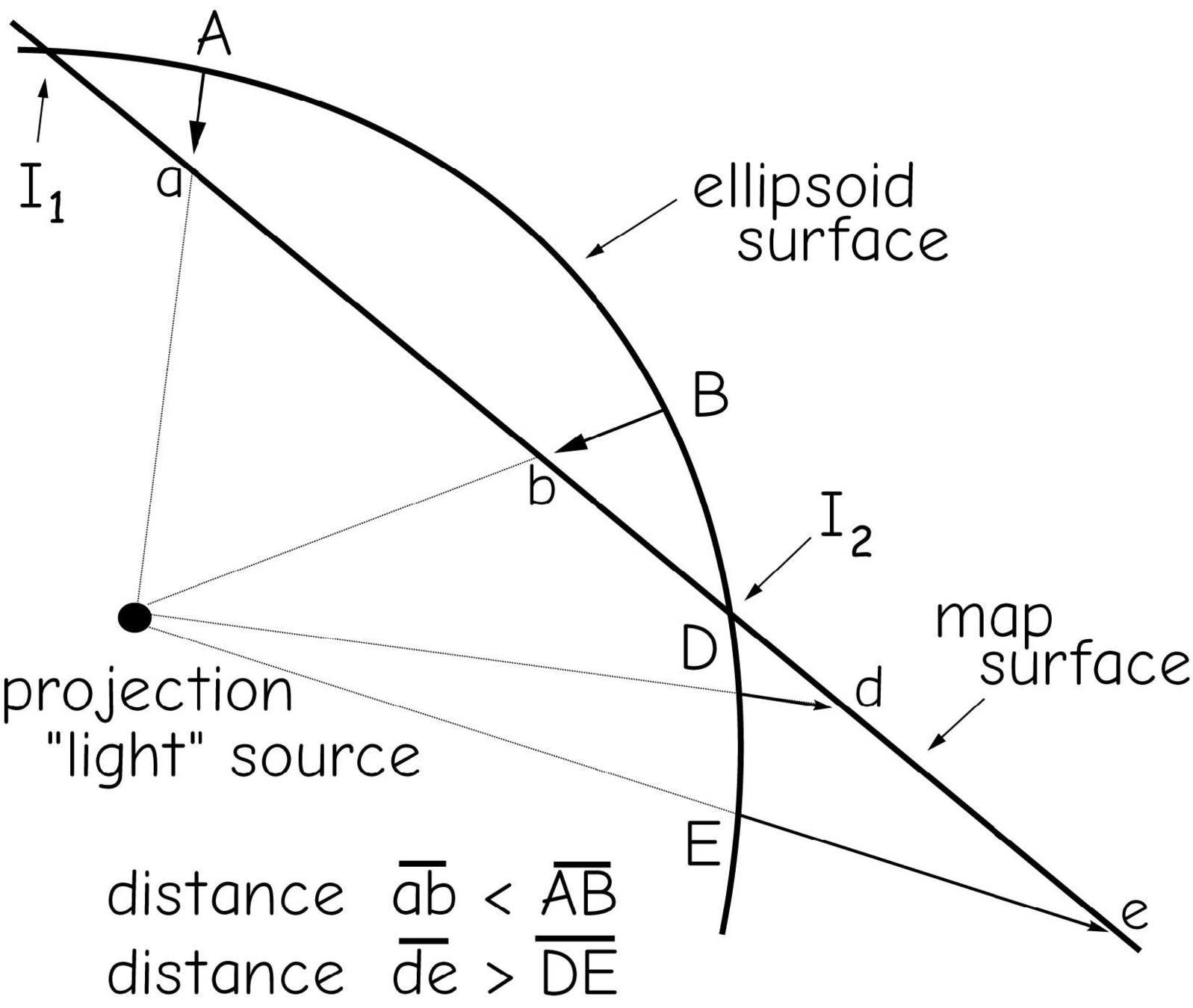
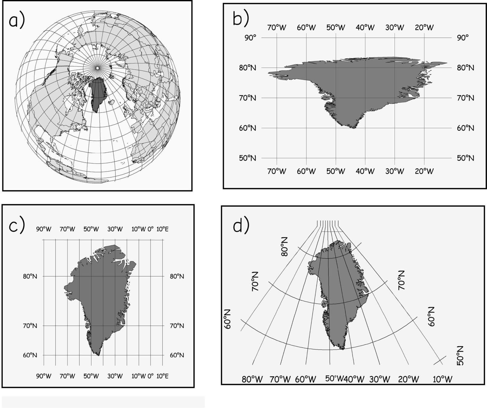
projected coordinate systems
(because the Earth isn't flat, but our desktops are.)

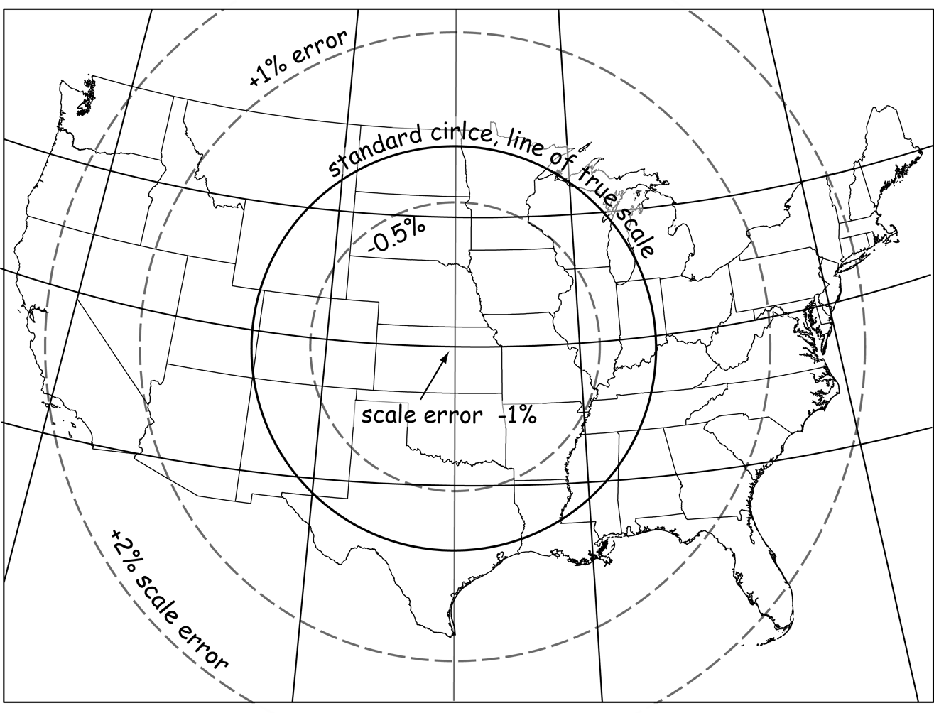
Projected Coordinate Systems
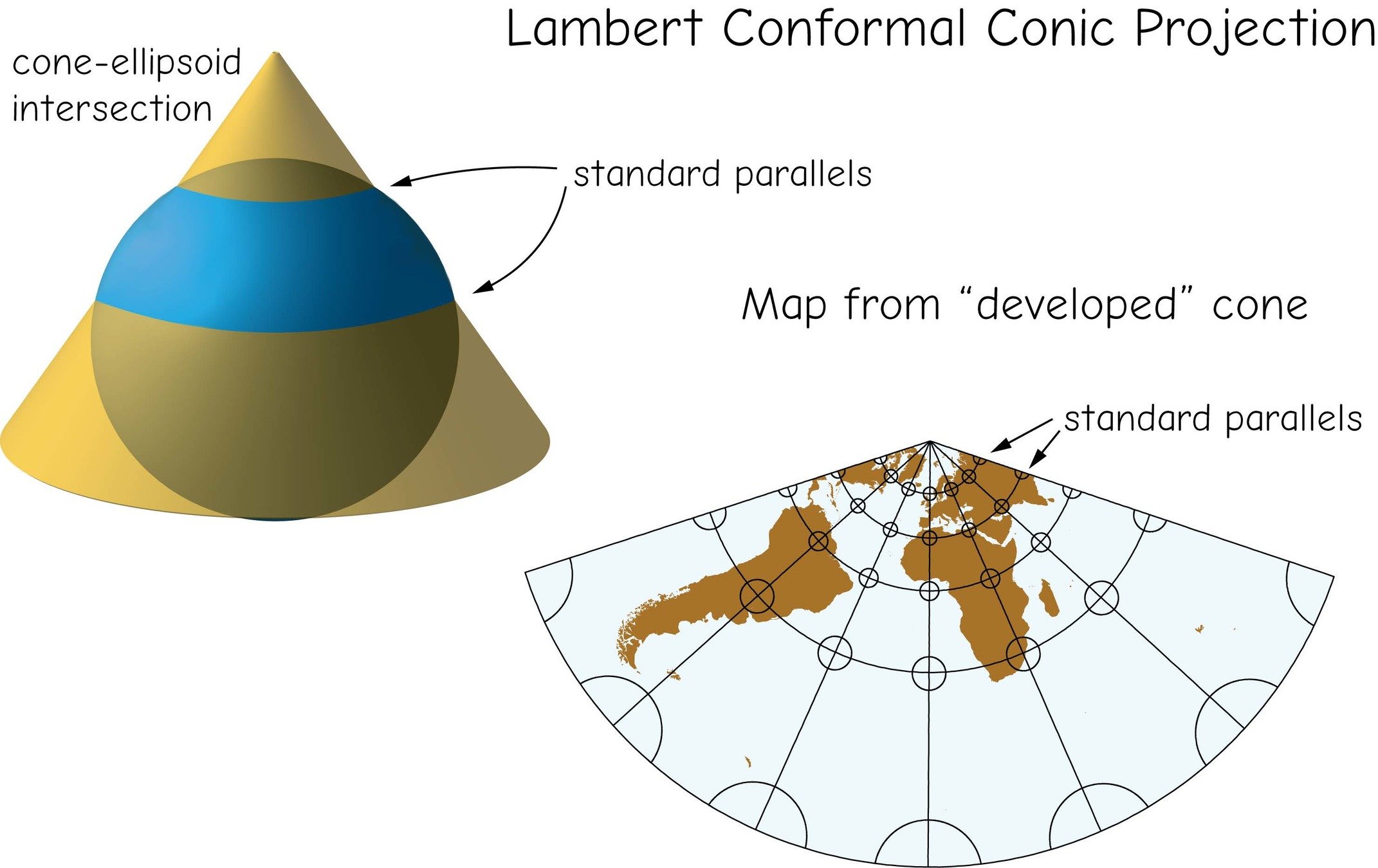
Lambert conformal conic
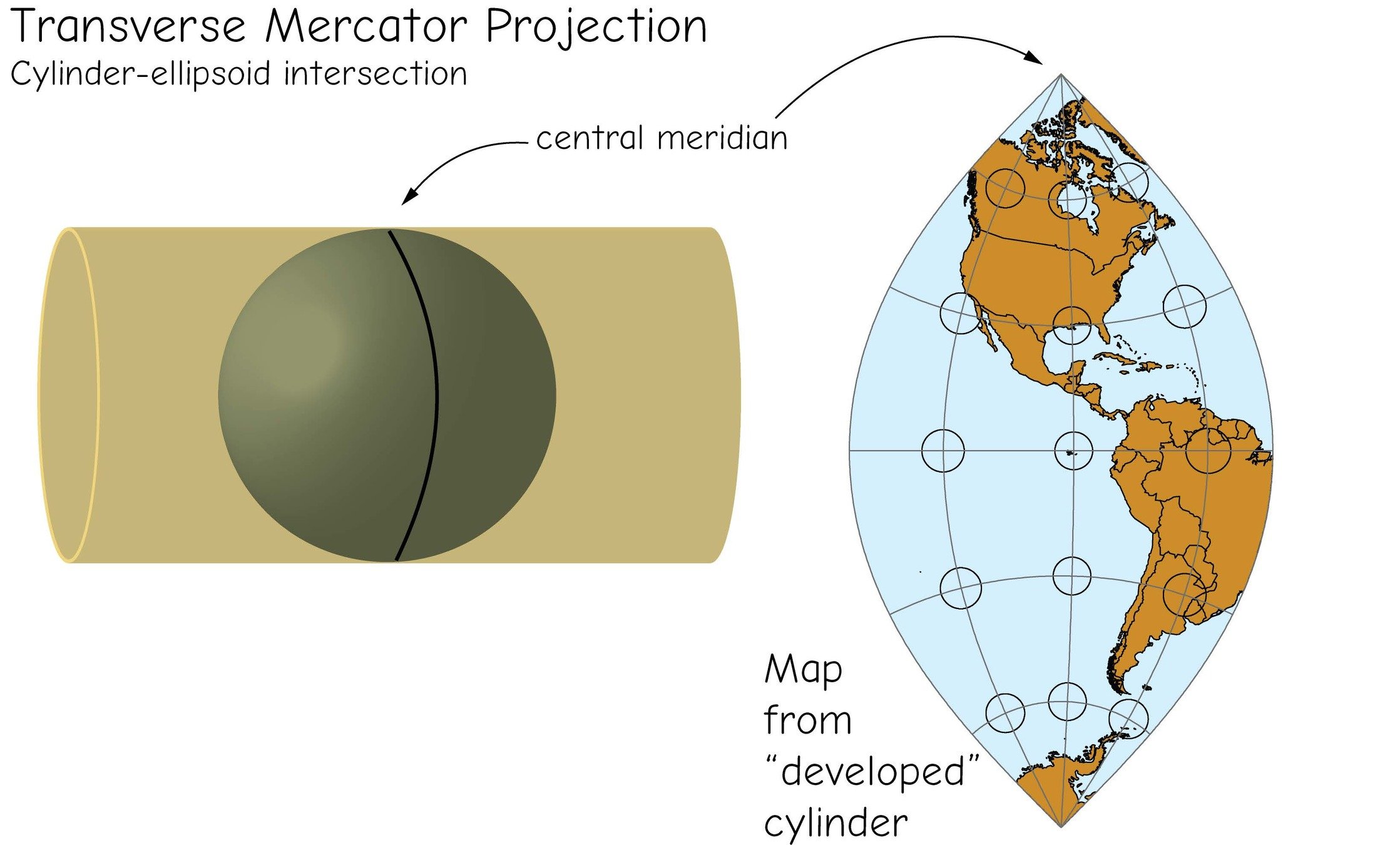
Transverse Mercator
projections & coordinate systems
projections & coordinate systems
projections & coordinate systems
projections & coordinate systems
projections & coordinate systems
state plane coordinate systems

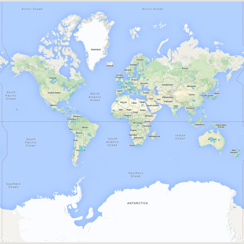
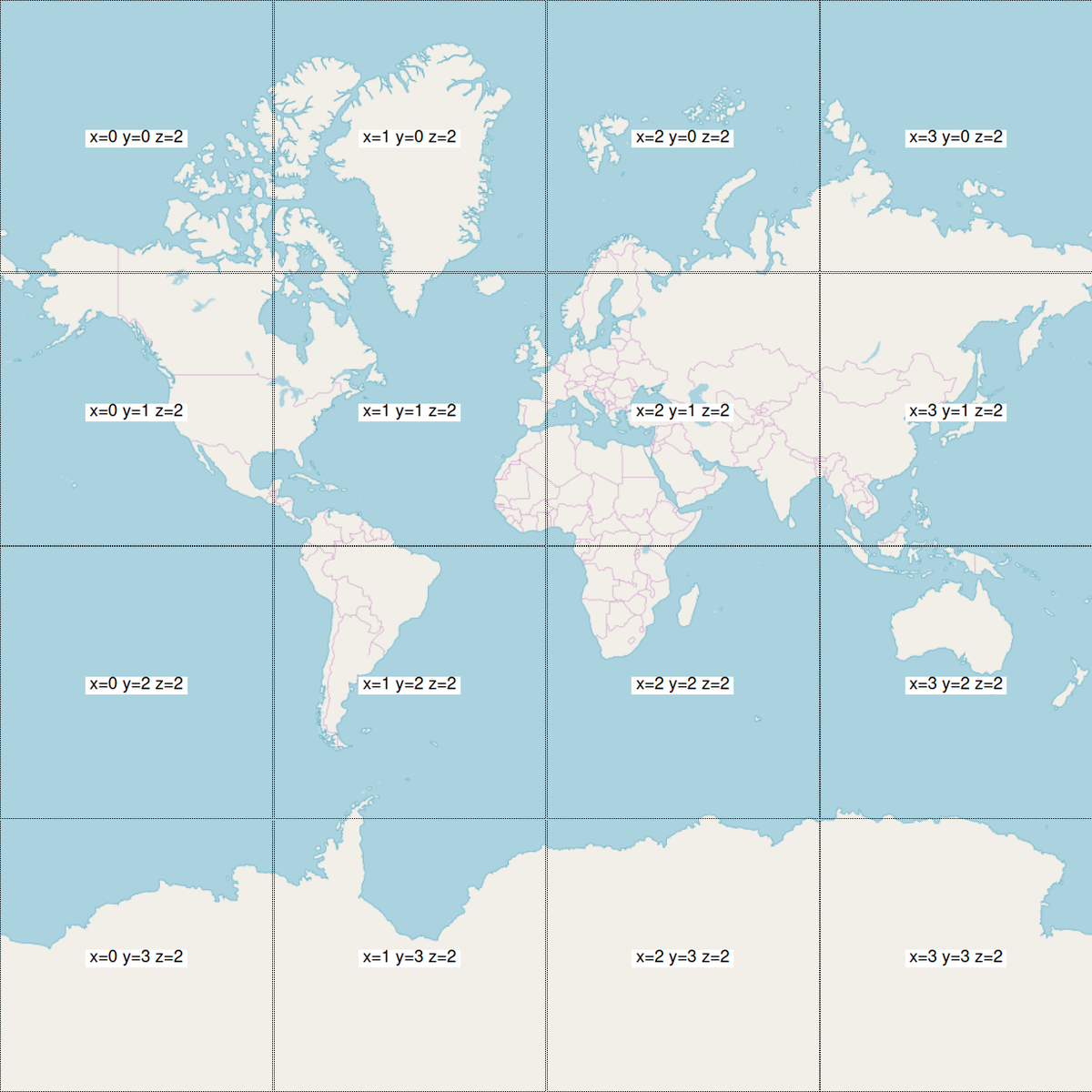
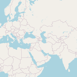
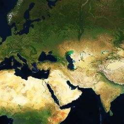
The "special" case of Web Mercator
(The "Map Projection" you are most familiar with!)


https://a.tile.openstreetmap.org/2/2/1.png
https://a.tiles.mapbox.com/v4/mapbox.satellite/2/2/1.jpg
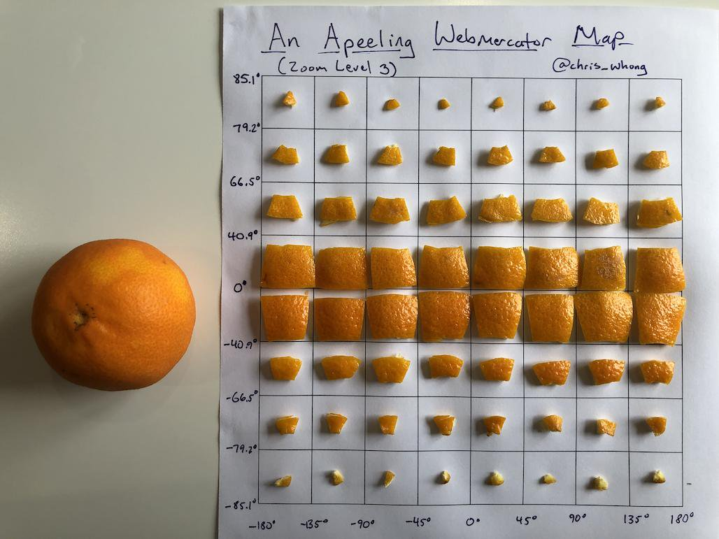
Credit: @chris_whong
Odds & Ends
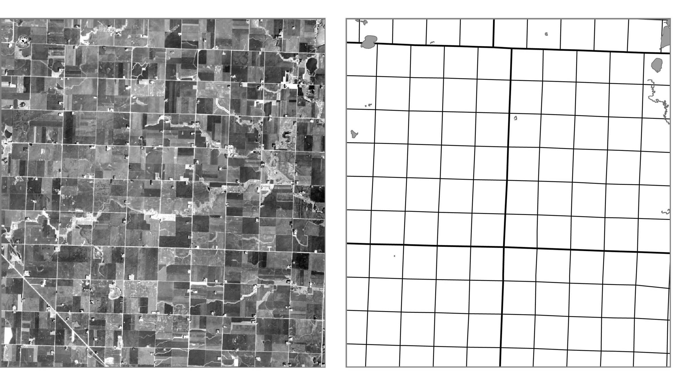
Public Land Survey System (PLSS)
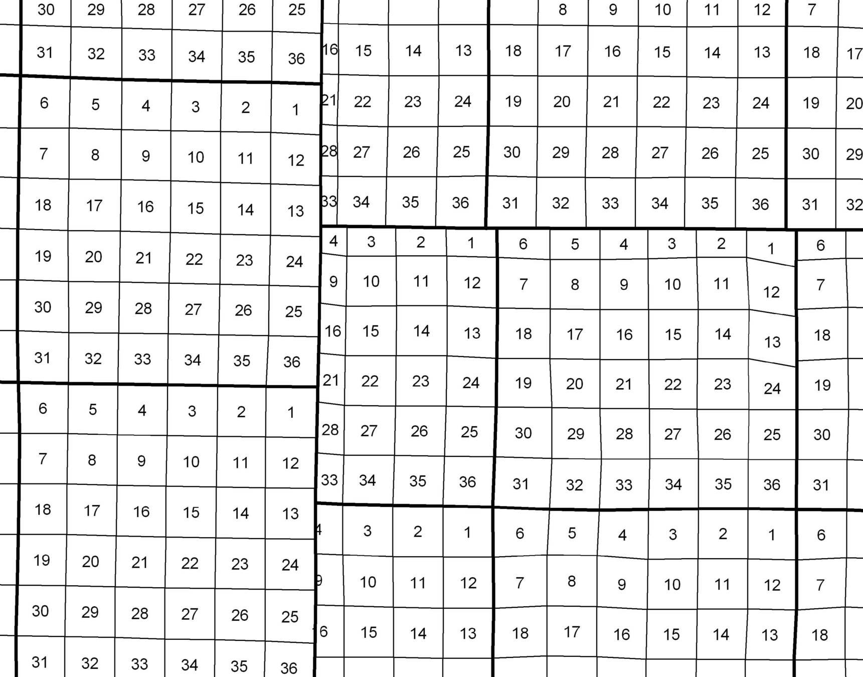
Public Land Survey System (PLSS)
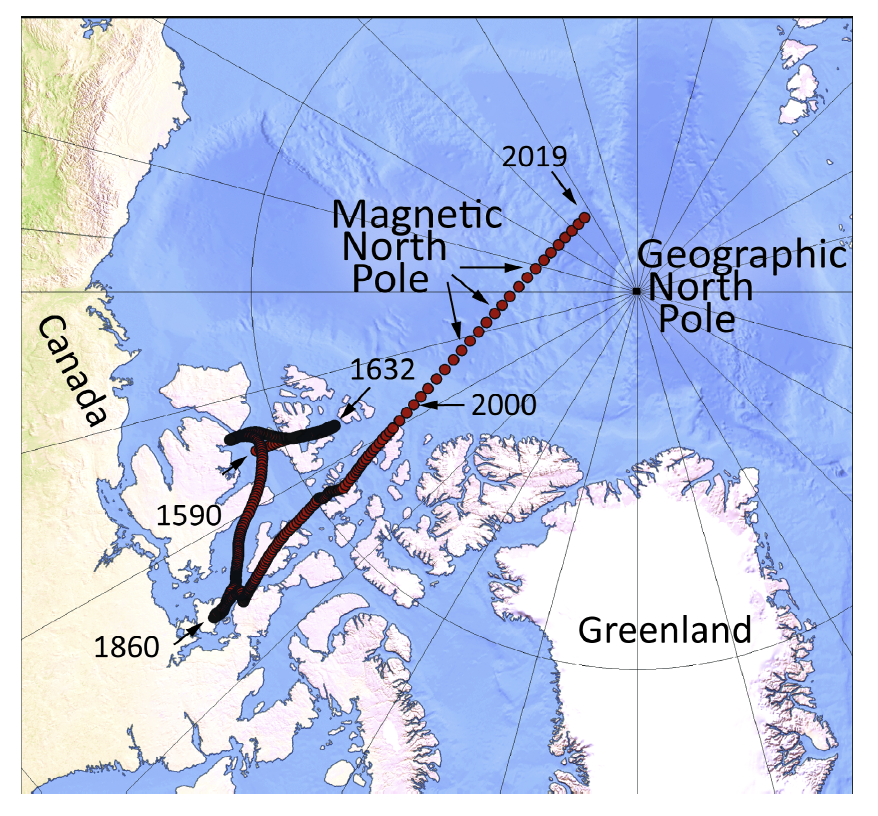
geographic vs magnetic north