Vector Data
Somewhere matters...
Search our spatial data collections at...
Satellite Imagery
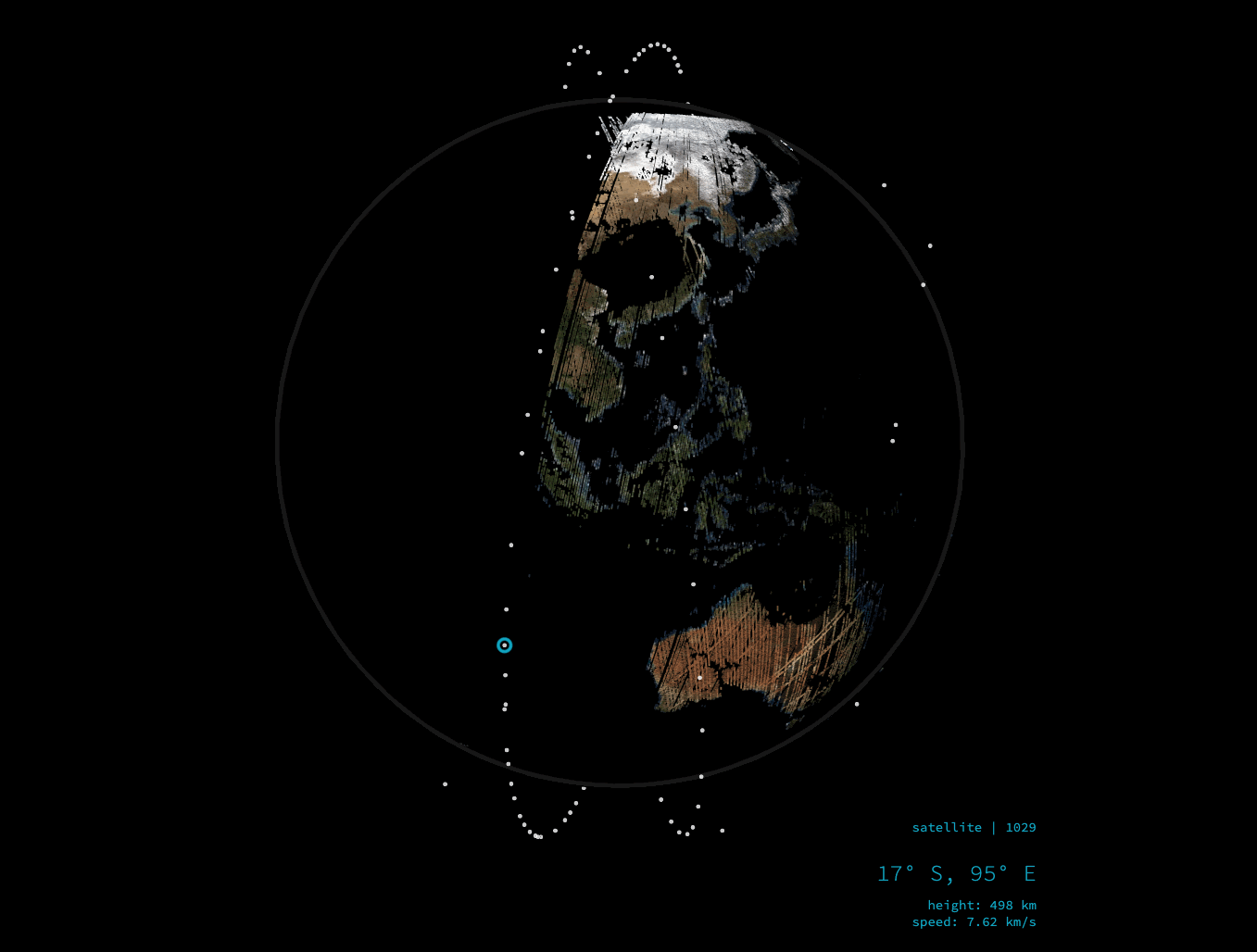
Everything is somewhere...
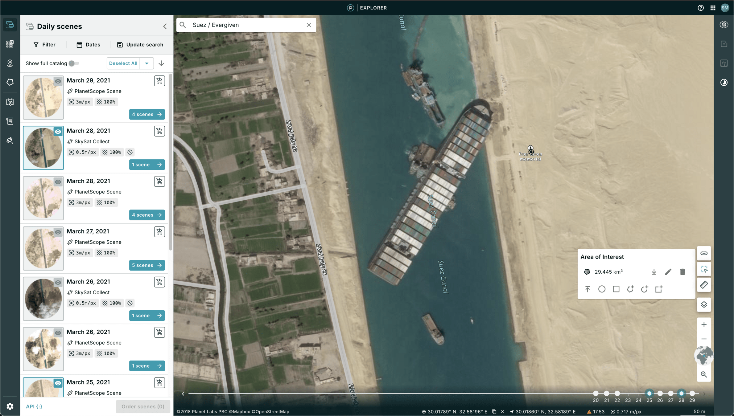
- Planetscope is a 3-meter resolution, multispectral image of the Earth, daily.
- Delivery:
- planet.com/explorer
- Orders API
- ArcGIS Pro & QGIS Integrations
- Google Earth Engine integration

This Slide Deck: https://slides.com/staceymaples/sgc_services_shortdeck
Fill out this form for access.
Planet 101 Slides: https://slides.com/staceymaples/planet-stanford-lovedataweek
Put your research on the map...

Google Earth Engine is more than 100 petabytes and over 700 datasets of Earth Observation Data, updated in near-realtime, colocated with planet-scale processing power and its FREE!
Access Public Domain Datasets like:
- 50+ years of Landsat
- Sentinel 1 & 2
- Digital Elevation Models
- NASA's MODIS-derived annual land cover maps
- ESA's GlobCover
- NOAA's Global Forecast System (GFS)
- and hundreds more!
Earth Engine 101: https://github.com/StanfordGeospatialCenter/Google-Earth-Engine_101
Put your research on the map...
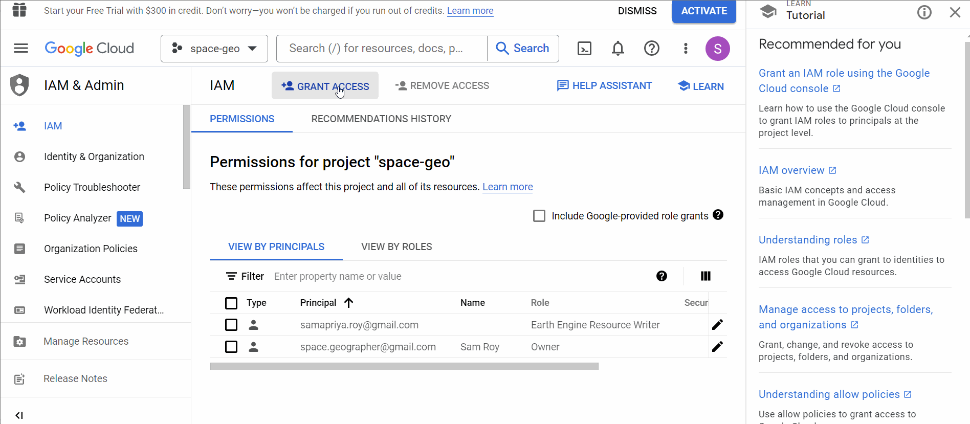
Google Earth Engine Python API Access (hack)
https://samapriyaroy.medium.com/google-cloud-projects-and-earth-engine-integration-in-universities-a-practical-guide-fb16d8dad14a
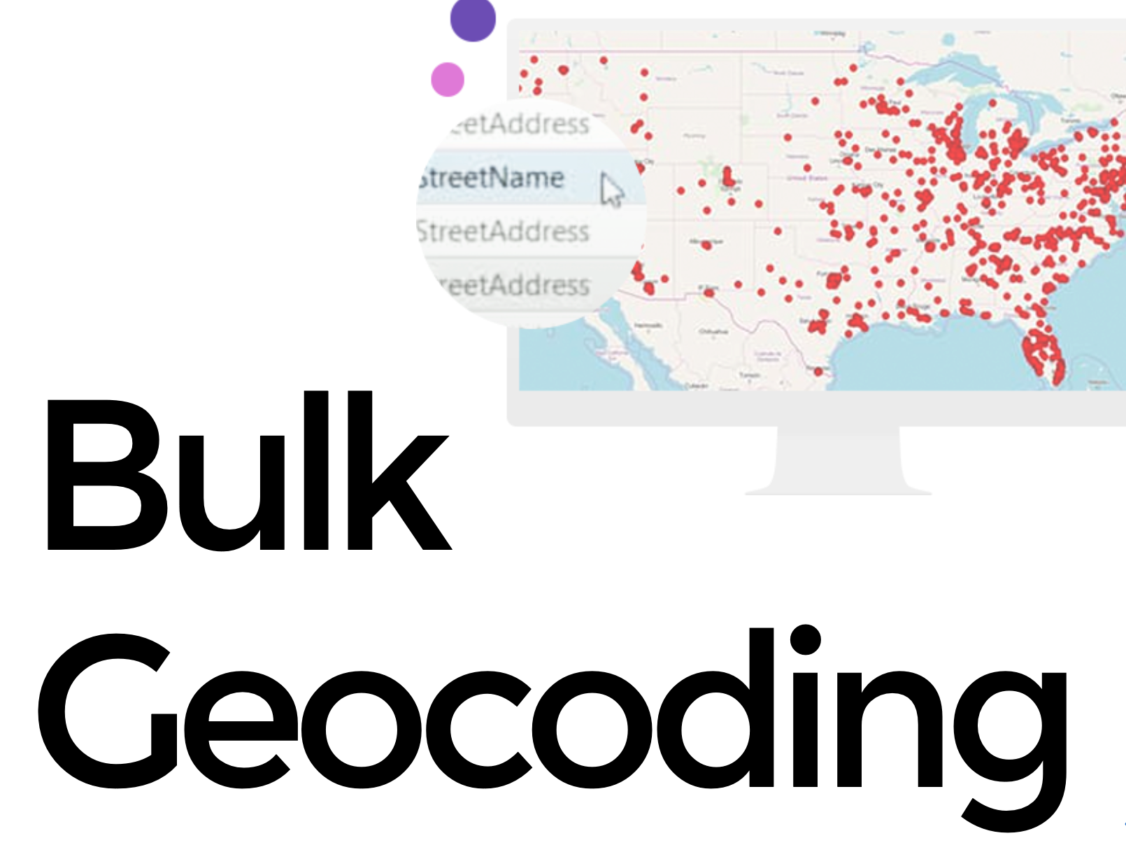
Geocoding
Somewhere matters...
Search our spatial data collections at...
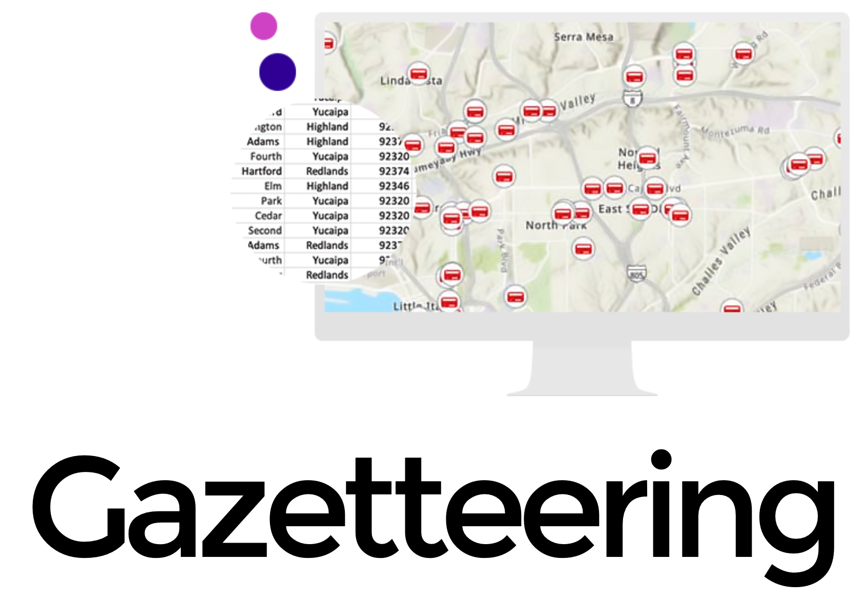
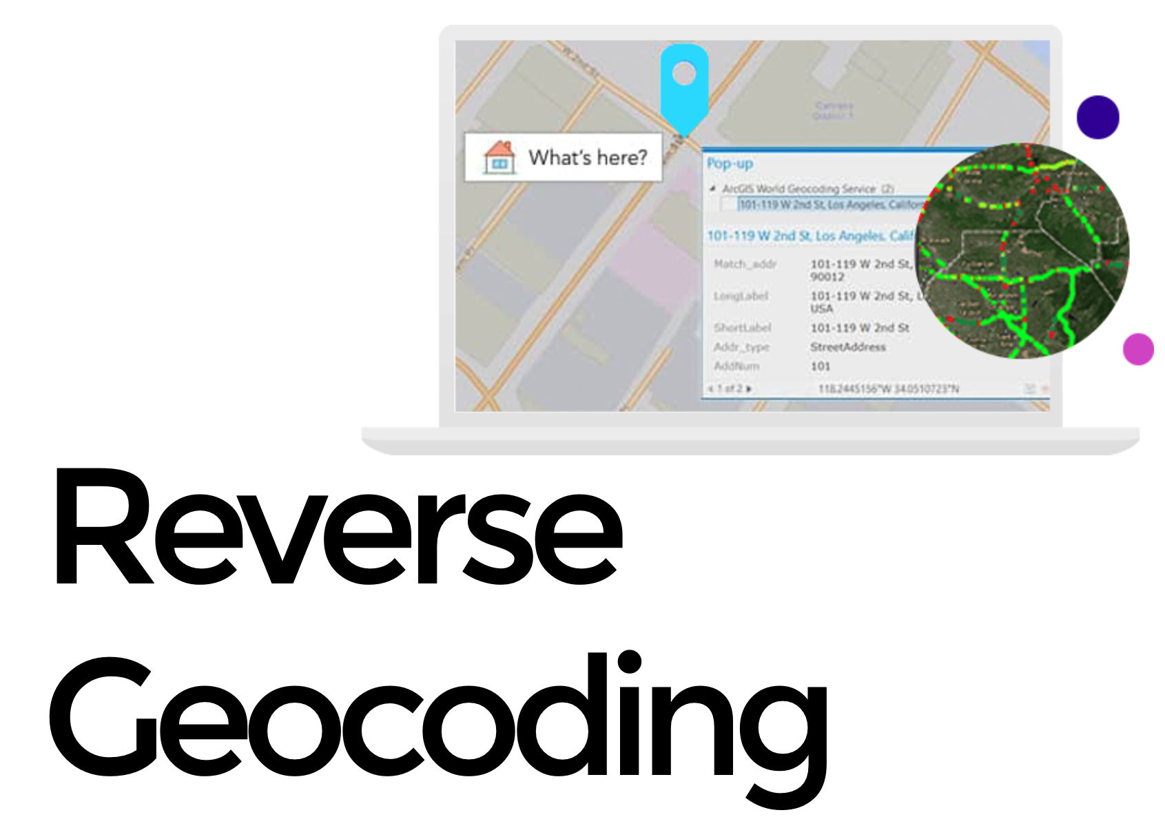
This Slide Deck: https://slides.com/staceymaples/sgc_services_shortdeck
Maritime Shipping

Somewhere matters...
This Slide Deck: https://slides.com/staceymaples/sgc_services_shortdeck
Vessels API
The Spire Vessels API is a REST API service that returns only the most recent information provided for each vessel, in JSON format.
It joins the position reports and static voyage reports which are transmitted in separate AIS messages into a single record. This saves the end user from having to join AIS messages and keep track of the MMSI identifiers linked to each IMO number.
Historical Positions API
The Historical Positions API allows the retrieval of all historical positions for a specific vessel; and either from the beginning of the archive, or within a specified time window. Data available from 2018.
Historical Positions API
The Historical Positions API allows the retrieval of all historical positions for a specific vessel; and either from the beginning of the archive, or within a specified time window. Data available from 2018.
Historical Backfile to 2018
Vessel Characteristics
Somewhere matters...
This Slide Deck: https://slides.com/staceymaples/sgc_services_shortdeck
Latest Vessels Dataset (LVI) Overview
The Latest Vessels Dataset (LVI) delivers up-to-date global vessel information, sourced from Satellite-AIS (S-AIS), Terrestrial-AIS, and Dynamic AIS systems. Ideal for maritime tracking, planning, and analytics, it provides detailed data for the last 7 days.
Key Data Categories
-
Vessel Identification:
- MMSI, IMO, Vessel Name, Callsign
- Vessel Type, Cargo Type, Flag, and Vessel Class
-
Positional Data:
- Timestamped positions (UTC), Longitude, Latitude (WGS84)
- Speed Over Ground (SOG), Course Over Ground (COG), Rate of Turn (ROT), Heading
- Navigation Status and Source
-
Static and Voyage Information:
- Dimensions (Length, Width, Draught)
- Destination and Estimated Time of Arrival (ETA)
Somewhere matters...
This Slide Deck: https://slides.com/staceymaples/sgc_services_shortdeck
Vessel Characteristics Data Overview
The Vessel Characteristics Data Dictionary provides a comprehensive framework for understanding vessel specifications, capabilities, and operational parameters. The data is categorized into fields that address various aspects of vessel performance, design, and history, making it invaluable for maritime operations, logistics, and analytics.
Key Data Categories
-
Vessel Capacity:
Includes metrics such as deadweight, gross/net tonnage, container capacity (TEU/FEU), lane meters, and passenger capacity. Also provides details on specific cargo capacities like refrigerated space and grain cubic capacity. -
Vessel Design:
Describes structural and functional attributes, such as coated tanks, self-unloading capabilities, and gear specifications, including lifting capacity. -
Vessel Dimensions:
Details physical dimensions, including draught, length, air draught, and beam, essential for port compatibility and cargo planning. -
Vessel History:
Tracks historical data, such as construction year, owner changes, and previous names, aiding in vessel tracking and lifecycle analysis. -
Vessel Propulsion:
Provides propulsion system specifications, including engine count, maximum output, and propeller configurations, critical for performance evaluation. -
Vessel Registration:
Includes classification society codes, ice class status, and certificate details, important for compliance and operational standards. -
Vessel Type and Trading Status:
Categorizes vessels by type, trading status (active, newbuilding, or retired), and specific subtypes for refined classification. -
Vessel Bunker (Fuel):
Lists fuel tank capacities and types, offering insights into fuel requirements, sailing range, and environmental compliance.
This detailed dataset supports decision-making across maritime industries, enabling efficient fleet management, route planning, and compliance monitoring.
Put your research on the map...
Questions about where spatial data fits in your research?
Join Stanford Geospatial Center Slack!

This Slide Deck: https://slides.com/staceymaples/sgc_services_shortdeck