Ann Gledson, Douglas Lowe, Manuele Reani, Caroline Jay, Dave Topping
The University of Manchester


Methods for dealing with sparse and incomplete environmental datasets
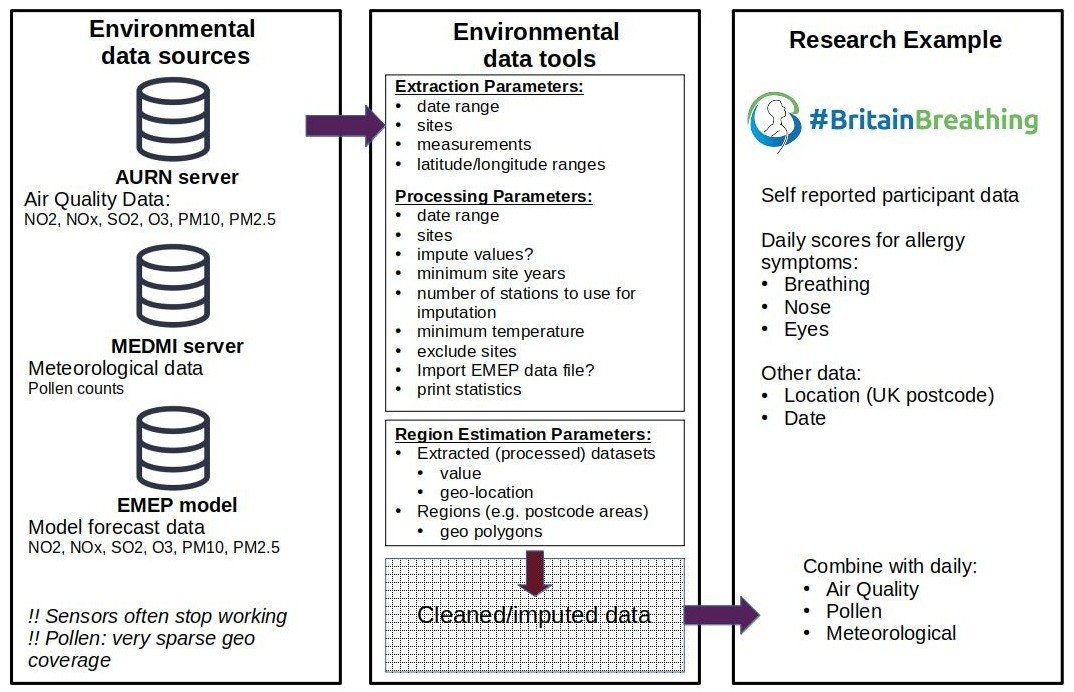
An open source tool-set for obtaining and working with environmental data sets


Filling the gaps


Part 1: Doug


Part 2: Ann


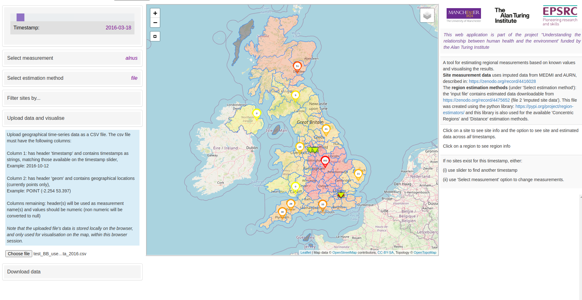
Part 2: Visualisation tool


Part 1: Doug


Cleaning and Imputation
- Remove duplicate/unphysical values
- Select sites by minimum temporal data coverage
- scikit-learn (python) used to impute missing data using hourly time series
-
Imputation method
- Bayesian Ridge
- Quantile Transformer preprocessing
- Final data: daily mean / maximum values (or simple daily count)


Part 2: Ann


Regional estimations


Concentric Regions method illustrated on fictional postcode regions
- Regions where sensors exist: take mean
- Regions with no sensors: take mean of surrounding regions
- Working outwards until sensors found


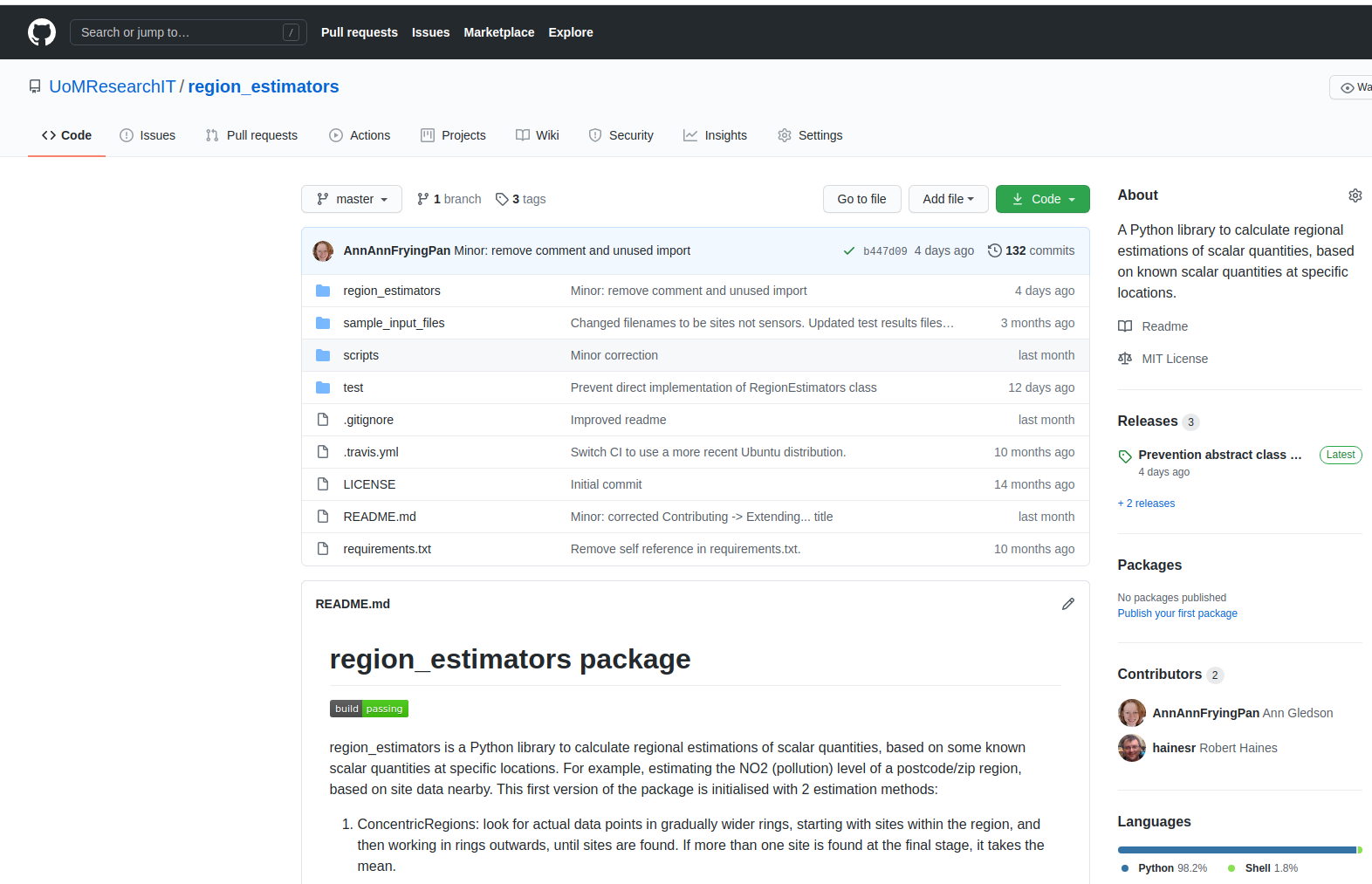
All code on Github (see links)


Regional estimations

Simple
Distance
Estimator
Concentric
Regions
Estimator
- Current implementations are only baselines
- Open source MIT license
- Use as-is or extend as above
- Improve estimation techniques
Other
Estimators...
RegionEstimator


Part 2: Visualisation tool


- Open source MIT license
- Usage:
- Use web-app as-is (our data)
- Contribute to and extend web-app code
- Clone the repository and load in your data
- Quick overview of data
- visual patterns
- estimation methods
- filtering
- download data
- time-series
- Compare with own data


Part 2: Minethegaps demo


Links
- 2016-2019 datasets:
- measurements (original and imputed)
- https://zenodo.org/record/4416028
- includes link to extraction and imputation tool set
- regional estimations (from original and imputed)
- https://zenodo.org/record/4475652
- includes link to region_estimators tool
- measurements (original and imputed)

