Robust Object Tracking:
A Path Planning Approach
Bryant Chandler
Problem
Flying a UAV for ground object (waldo) tracking requires a trained team
Solution
Automate the UAV flight to reduce team size and allow the user to focus on more strategic tasks

Waldo
Thesis Statement
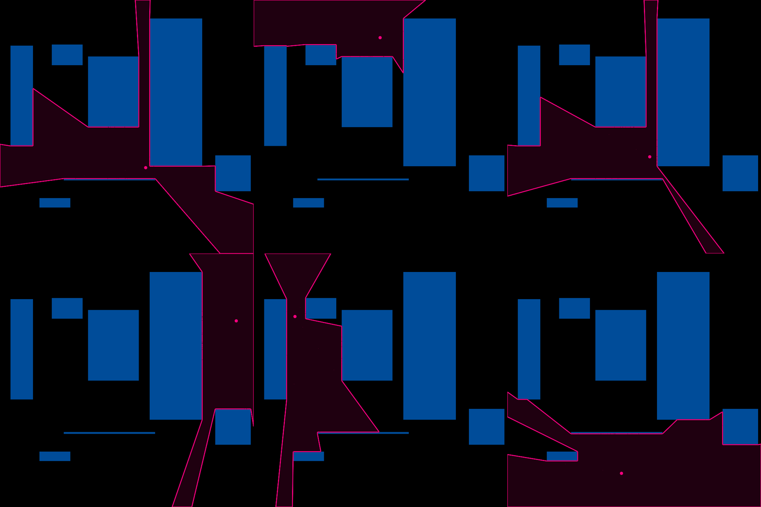
UAV path-planning can support vision-based object tracking by moving the UAV to a location that maximizes the visibility of important targets. This can be done by using sampling-based path-planning that has been optimized for rapid online replanning. A goal point can be chosen periodically by identifying, from a pre-defined discretization of the space, the cell that maximizes visibility of important targets. Furthermore, tree structures in RRT* and FMT* can be adapted to handle changes in cost and start/end points, in an anytime fashion without replanning from scratch.
Related Work - Discrete Planning
-
Advantages
- Reduces execution time by discretizing into grid
- Simple to implement
-
Disadvantages
- Discretization excludes good solutions
- Graph search is slow at high resolutions
- Variants
- Dijkstra - Finds optimal path from point to all others
- A* - Uses a heuristic to improve speed, only finds path to one endpoint
- D* - Adapts Dijkstra to handle unexpected obstacles
- D* Lite - Accomplished D* more efficiently using A*
Related Work - Sampling Planning
-
Advantages
- Finds solutions A* would get at high resolution
-
Disadvantages
- Slower than A* at low resolutions
- Variants
- RRT - Randomly samples points to form a tree
- PRM - Randomly samples points to form a graph
- RRT* - Adapts RRT to rewire tree when new(better) nodes are added
- CC-RRT* - Adapts RRT* to prune for new obstacles
- Informed RRT* - Improves RRT* convergence time
RRT - Rapidly Exploring Random Tree
- Randomly sample a point
- Find the nearest neighbor
- Create a new node, no longer than max segment from nearest neighbor in the direction of the sampled point
- Connect to nearest neighbor as parent

RRT* (* for optimal)
- A point is sampled and all nodes in a neighborhood are found
- The neighbor that would provide the lowest cost is selected and becomes parent of sampled point
- All other neighbors are checked to see if they would reduce cost by rewiring to the new node as their parent


RRT* Replanning Limitation
- Robot starts at red headed to purple
- At green it realizes that it really wants to go to blue
- The only way to get there is to replan (expensive)

FMT* - Fast Marching Tree


Online RRT* and FMT*
- Requirements
- Allow both start and end points to move
- Sample indefinitely without becoming intractible
- Solution
- Run RRT* or FMT* to saturate configuration space
- A fixed threshold based on area
- Continue sampling and rewiring without adding new nodes
- Run RRT* or FMT* to saturate configuration space
Online Rewiring
Sample a point (highlighted in pink) and find all nodes in its neighborhood
Find the node in the neighborhood that has the lowest cost (blue)
Rewire all neighbors to the best node if it would improve their cost


Move Start Point
A tree with the start node as a square


A new start node (blue square) is made parent of the original and its neighbors are found
Neighbors are rewired to the new start node
Impact on # of Nodes
- Moving the start point acts like a memory leak
- Eventually becomes a significant problem

Online Pruning
Prune a leaf node in the vicinity of the new root after moving start


Cost Function

Endpoint Selection
-
Discretize into bins
-
Each waldo gives a weighted vote to the bins from which it is visible
-
Fullest bin wins


Endpoint Selection - Prediction


center
constant velocity
directed random walk
Execution Efficiency


The performance of OFMT* and ORRT* is comparable to A* on a visibility graph
Online Pruning Efficiency


The best pruning radius was 0.7 units
Cost Function

Unseen area doesn't appear to constructively contribute to scores
Prediction

The directed random walk seems to be detrimental
Time-Varying Cost
ORRT*
OFMT*


Both algorithms do quite well, but OFMT* appears to be more efficient at adjusting the tree
Summary
| Claims from thesis | Evidence from work |
|---|---|
| Goal point maximizes visibility of important targets | Subjective analysis shows that the goal points are placed appropriately |
| RRT* and FMT* can be adapted to handle changes in cost in anytime fashion | RRT* and FMT* were within 30% of truth path costs when sampled in a world with time-varying cost |
| RRT* and FMT* can be adapted to handle changes in start/end point in anytime fashion | RRT* and FMT* rivaled the replanning efficiency of A* (visibility graph) with start point moving and rapidly changing endpoint |
Conclusions
- Successfully followed Waldos
- Developed path planning algorithms that extend RRT* and FMT* by:
- Affording rapid replanning with a moving start
- Affording path adjustment to account for time-varying cost
Future Work
- General
- Apply to real tracking data from Recursive-RANSAC, and other multi-target tracking algorithms
- Endpoint Selection
- Explore more prediction methods - user input
- Explore outcomes in cluttered environments with more interesting object shapes
- ORRT* and OFMT*
- Expand to 3D
- Explore application of time-varying cost to other problems
Acknowledgement
This work has been funded by the Center for Unmanned Aircraft Systems (C-UAS), a National Science Foundation-sponsored industry/university cooperative research center (I/UCRC) under NSF Award No. IIP-1161036 along with significant contributions from C-UAS industry members.