Structure of the
shear-line polar low
south of Svalbard
Denis Sergeev, Ian Renfrew, Thomas Spengler


This presentation is available online:
Objectives
- To investigate the structure of the shear-line polar low (PL)
- To validate the model against airborne and satellite observations
Motivation
- One of a dozen of PLs observed with instrumented aircraft
- Very few shear-line cases in PL studies
- Archetype of many mesoscale vortices forming in cold-air outbreaks near Svalbard
Polar low evolution
Synoptic overview
Mesoscale structures
Outline
Data & methods
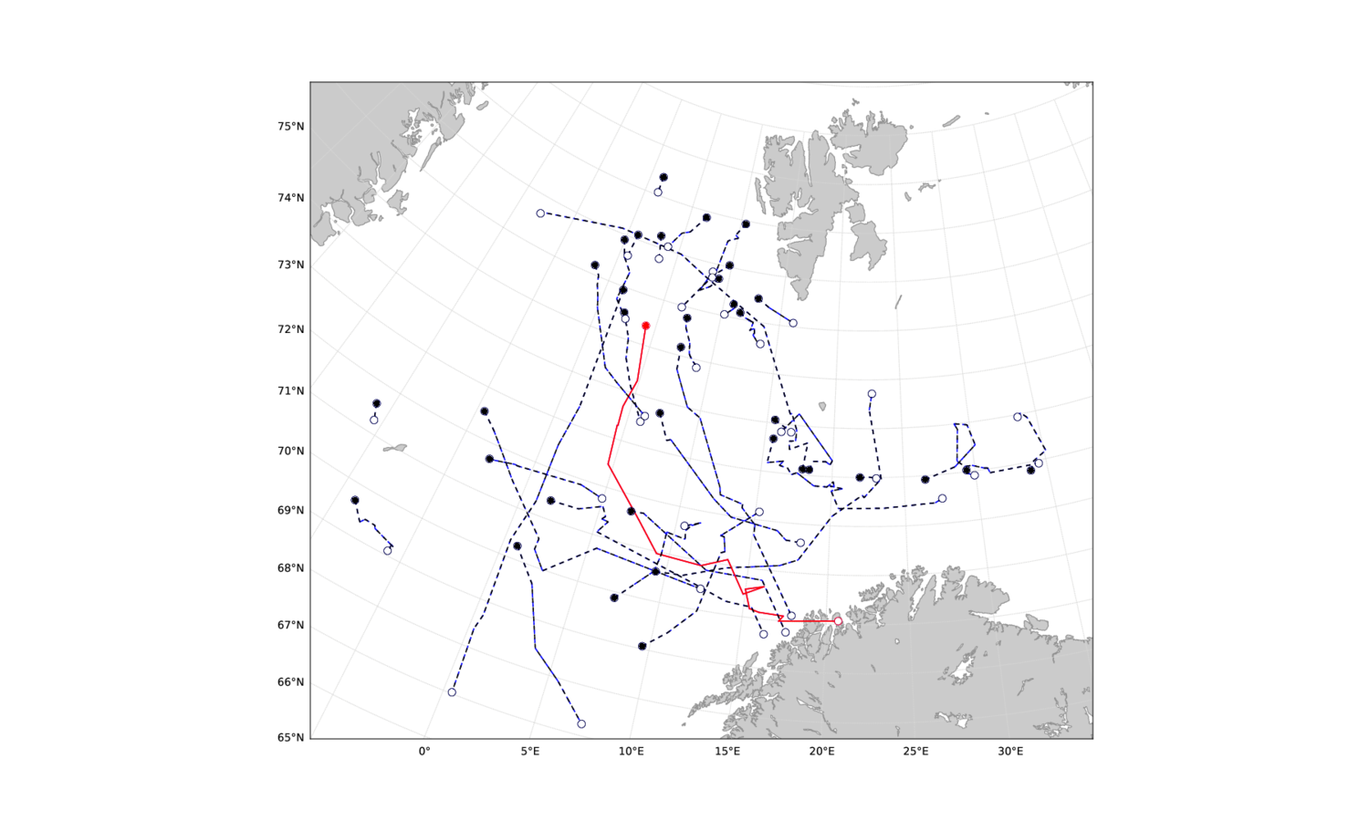
ACCACIA field campaign
March-April 2013
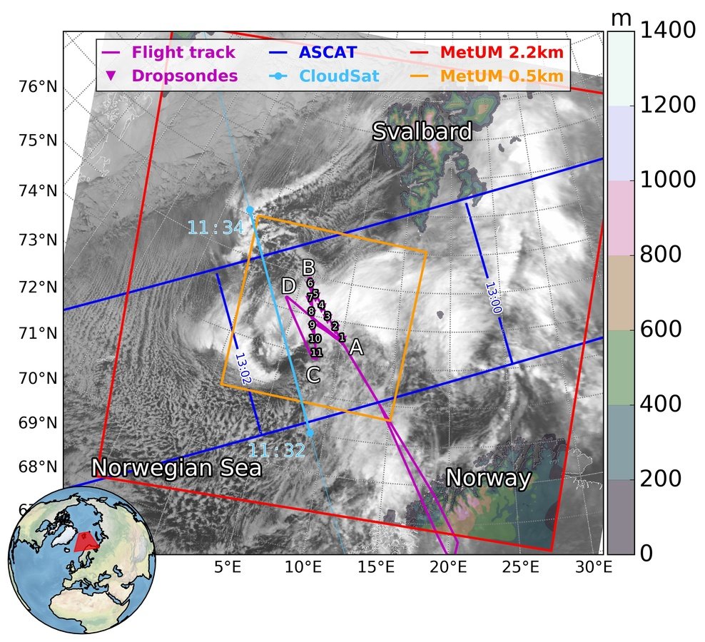

-
In-situ measurements
-
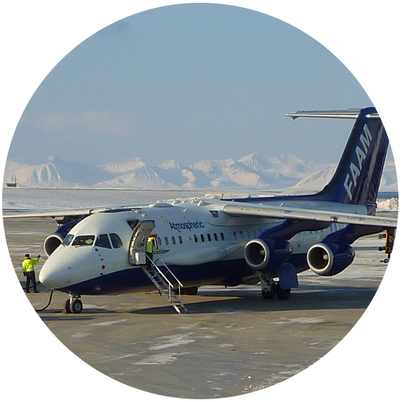
Standard equipment of FAAM aircraft
-
11 dropsondes
- Cloud probes (CDP, 2D-S, Nevzorov)
-
-
Satellite data
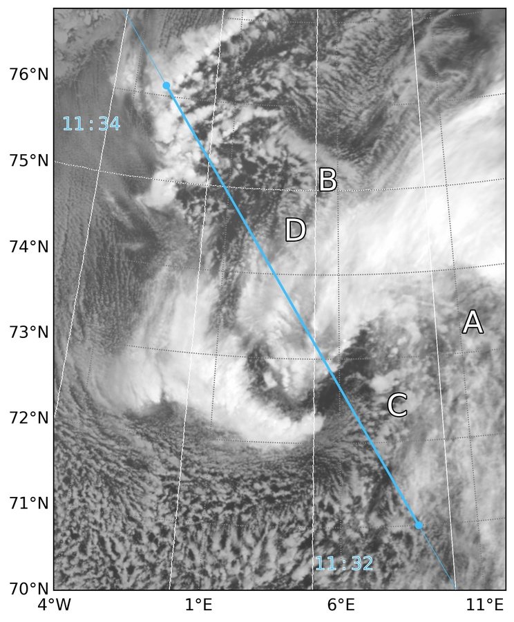
Cloud cover: AVHRR
Cloud composition: CloudSat
Surface wind: ASCAT
Observations
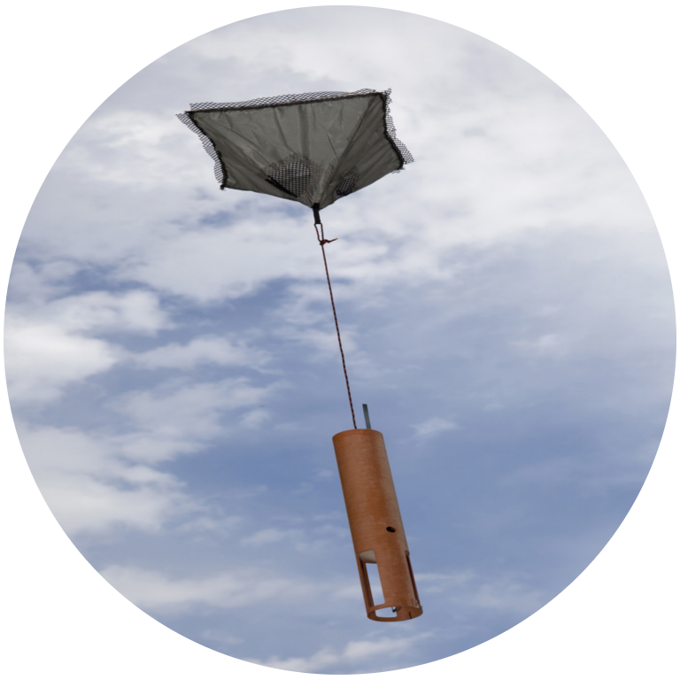
FAAM aircraft
Photo by Rhiannon Davies
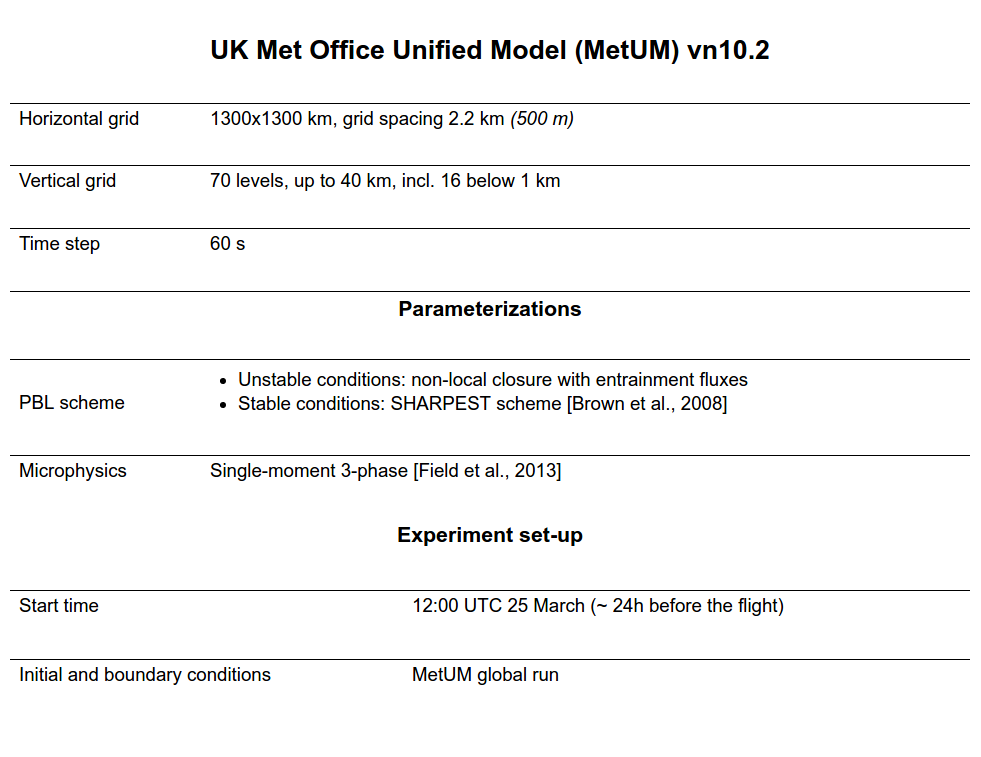
| UK Met Office Unified Model (MetUM) vn10.2 | |
|---|---|
| Horizontal grid | 1300x1300 km, grid spacing 2.2 km (500 m) |
| Vertical grid | 70 levels, up to 40 km, incl. 16 below 1 km |
| Time step | 60 s |
| Parameterizations | |
| PBL scheme |
|
| Microphysics | Single-moment 3-phase [Field et al., 2013] |
| Experiment set-up | |
|---|---|
| Start time | 12:00 UTC 25 March (~ 24h before the flight) |
| Initial and boundary conditions | MetUM global run |
The big picture
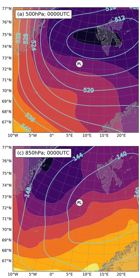
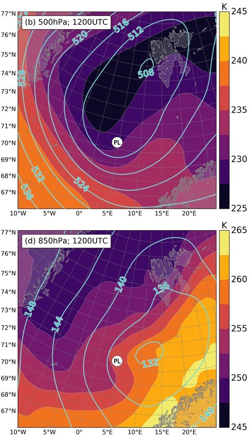
Synoptic
overview
- Stationary large-scale depression
- “Merry-go-round”
- Intense cold-air outbreak in W part
- Reverse-shear conditions in the lower troposphere
-
Upper-level PV anomaly >4 PVU
-
SST-T500 ≈ 50 K
-
MCAO index > 7
- Sharpening baroclinic zone
PL precursors
500 hPa
850 hPa
Polar low life cycle
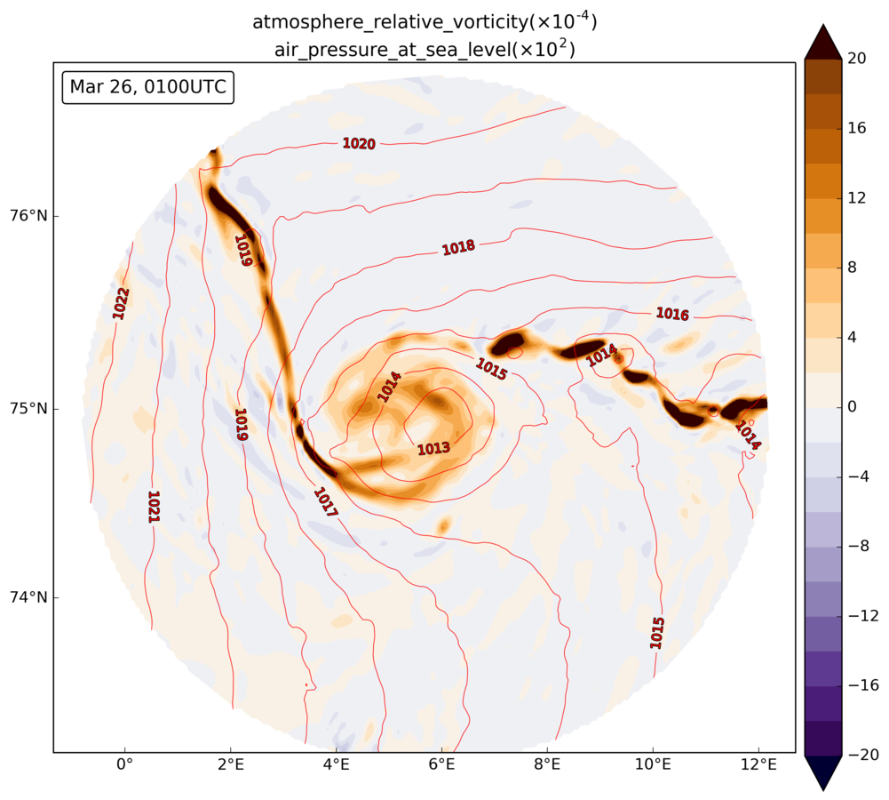
Initial stage
- Convergence of two branches of CAO
- High positive relative vorticity filament in the lee of Svalbard
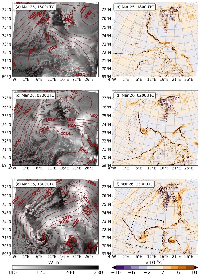
Decaying stage
The PL travels SE around the synoptic low
The core disintegrates into smaller disturbances
Remnants of the vortex get absorbed by a new stronger cyclone
Mature stage
- Instability waves merge into the dominant mesocyclone - the PL of interest
6 h
14 h
25 h
Surface wind patterns
- PL diameter is 100-150 km
- Wind speed - up to 25 m/s
- Stronger winds - at crests of the shear-line waves
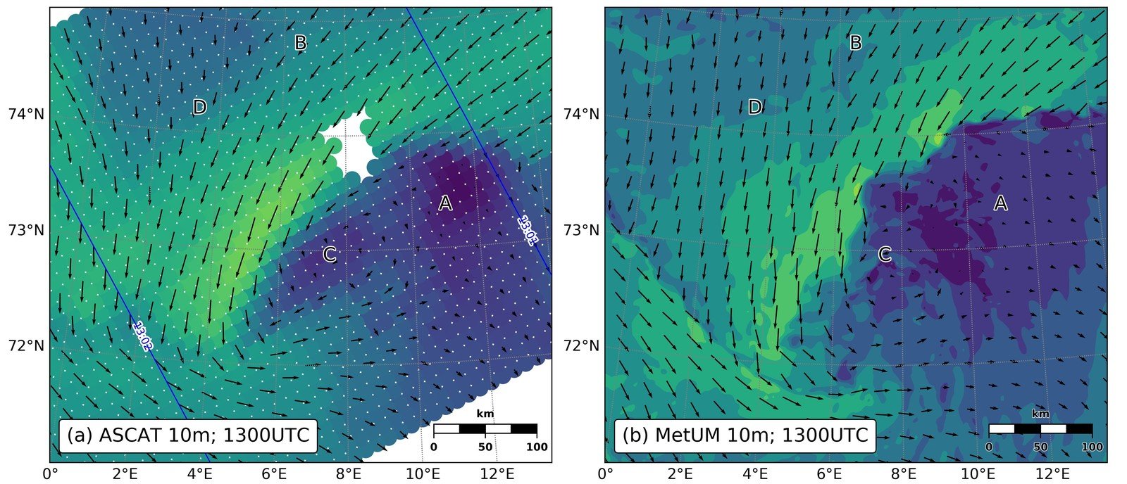

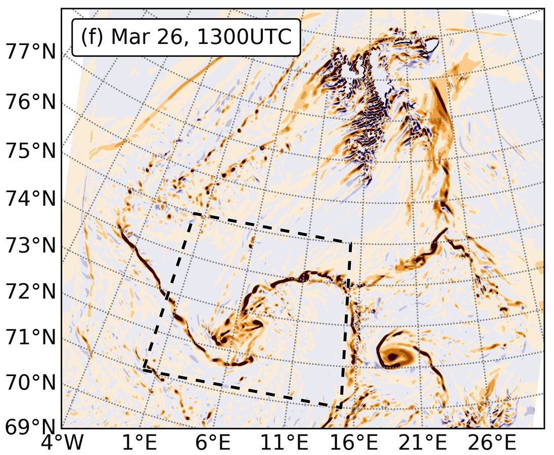
ASCAT
Model output
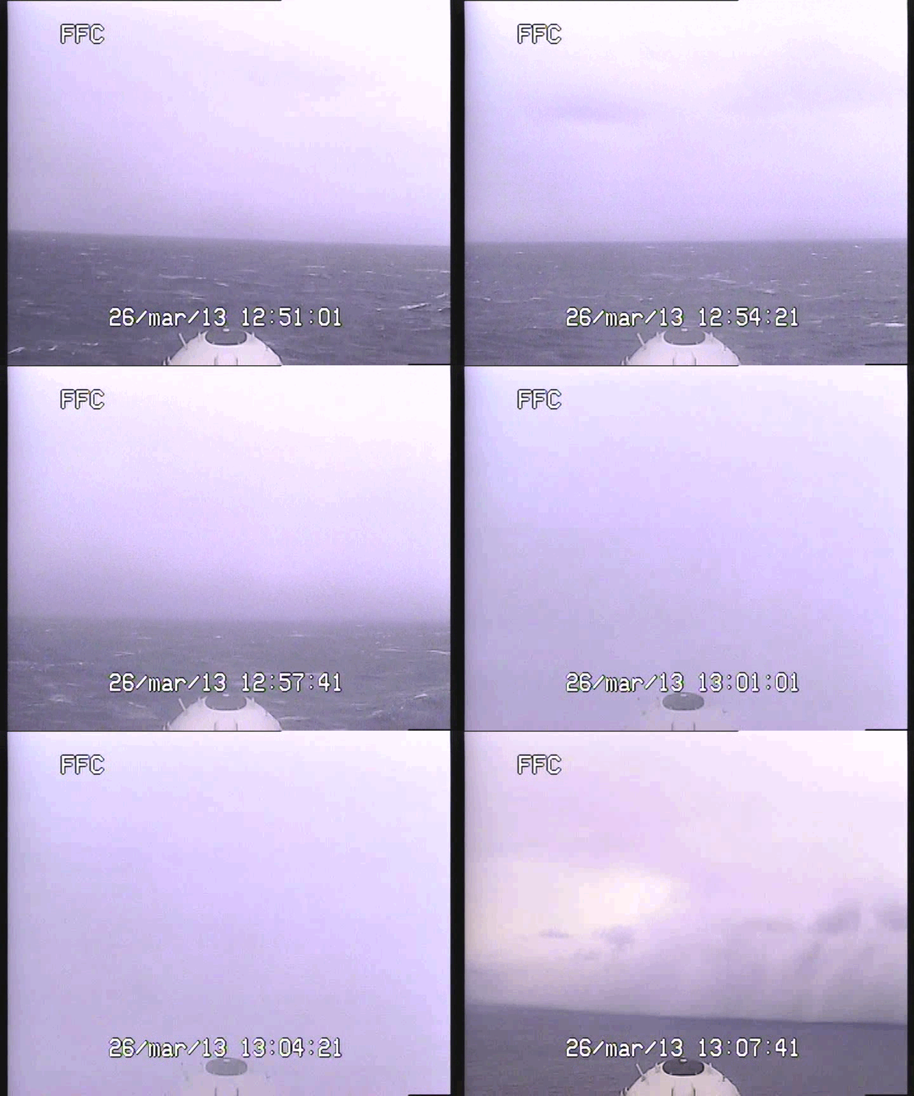
Flying through the shear line
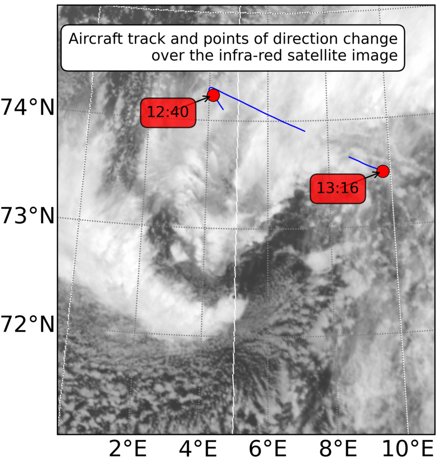
Vertical structure
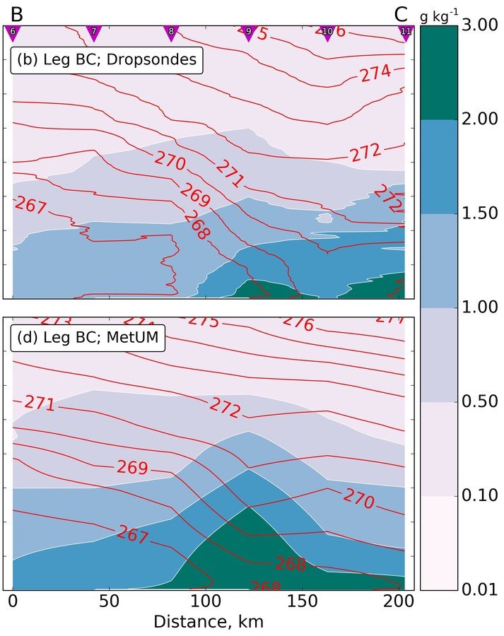
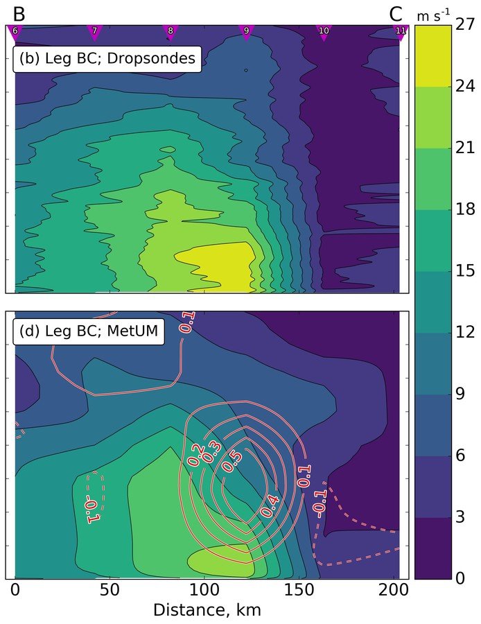
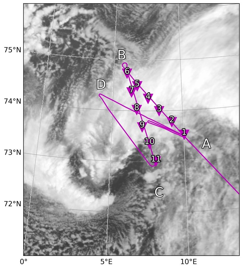


Mesoscale structure
of the shear line and polar low
Close-up of the surface layer
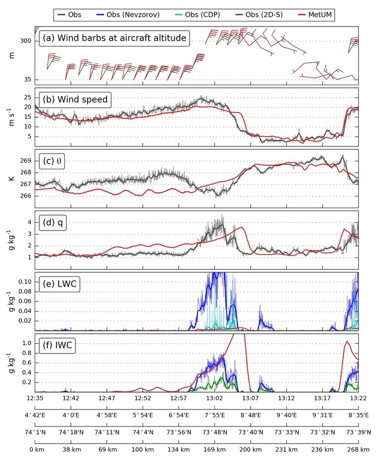
- Sharp gradient in wind velocity
- Peaks in total humidity and cloud particles
Model performance
- Excellent match in wind gradients
- Temperature front is slightly steeper than observed
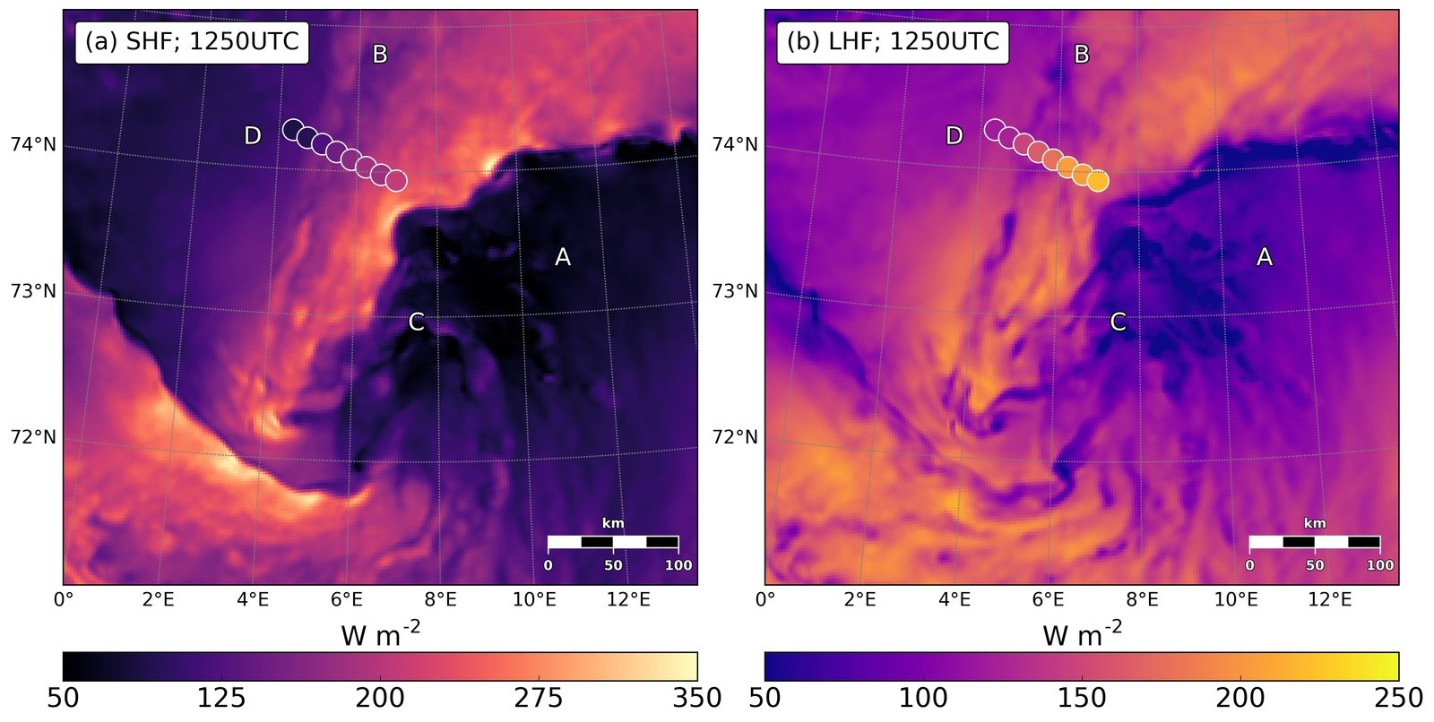
Surface heat fluxes
-
Surface heat fluxes repeat the wind speed pattern
-
Total heat transfer reaches 500 W m-2
-
Sensible heat flux is about twice larger than latent heat flux
-
SHF overestimated, LHF - underestimated
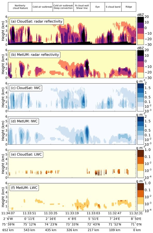
Cloud structure
derived by CloudSat radar

Credit: www.turbosquid.com
Summary
-
Synoptic conditions: merry-go-round pattern, CAO behind a low
-
PL genesis: wrap-up of a vorticity filament fuelled by shear-instability waves
-
Mesoscale features:
-
Well-defined shear line (~25 m/s over 50 km) and convective cloud wall
-
The eye-like centre with well-mixed mostly dry boundary layer
-
Clouds are mostly mixed-phase
-
-
MetUM performance:
-
Wind gradients captured perfectly
-
Near-surface atmosphere is not sufficiently mixed (error of ~3 K)
-
SHF overestimated, LHF underestimated (20-30 W m-2)
-
Too many ice crystals, too few liquid droplets
-
Overall, the model does a great job, which lays ground to future exploration of the dynamics of this shear-line PL
Current work:
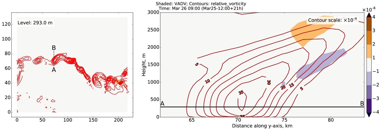
dynamical diagnostics
Vorticity budget

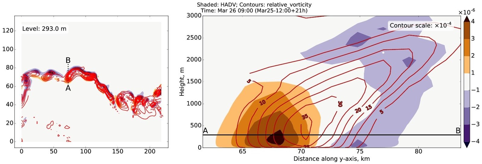
Horizontal advection
Vertical advection
Vorticity budget

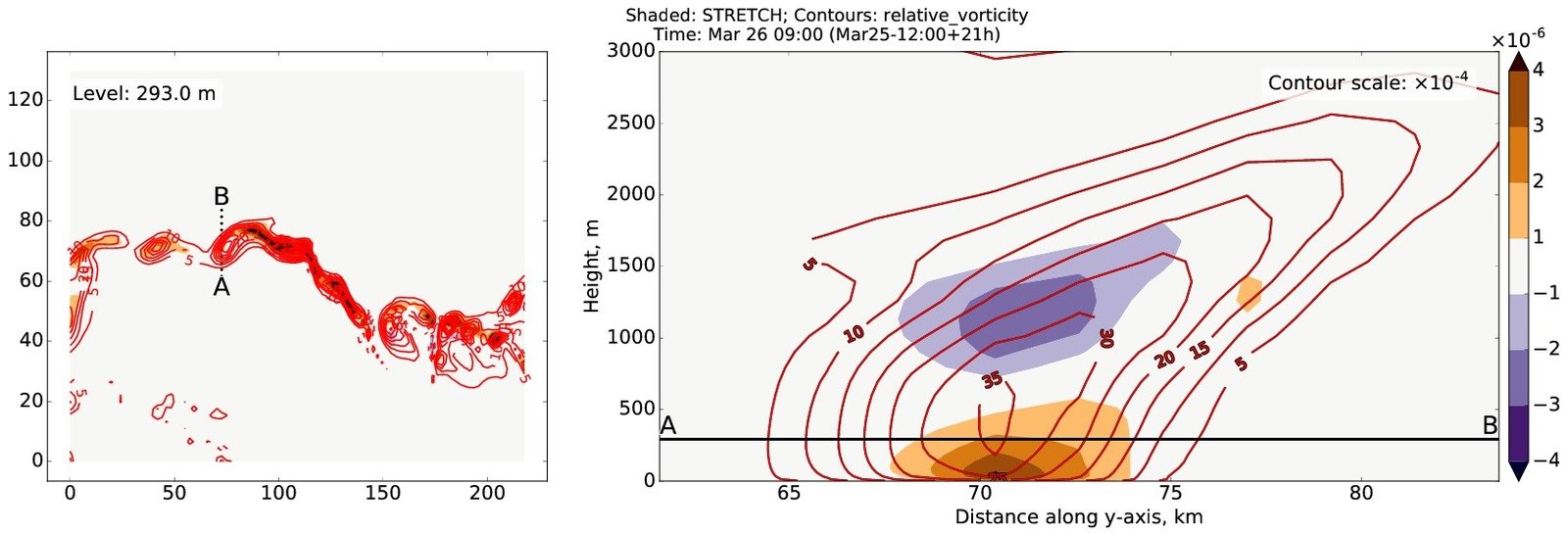
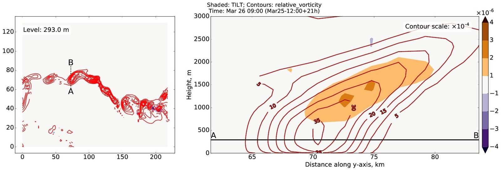
Stretching term
Tilting term

Title Text
