


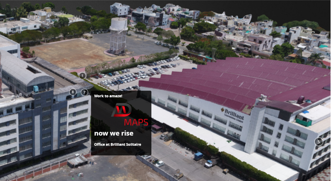
DronaMaps recreates the world around us in centimeter level 3D, both indoors and outdoors.

Artillery


Utkarsh Singh
Founder & CEO
Johns Hopkins University
Ronak Khandelwal
VIT Vellore & Ex-Deloitte
President
Raghav Palriwala
Sajil K R
Vatan Patel
Ayushi Mishra
Johns Hopkins University
IIM Indore
IIT Bombay
IIM Indore & Ex- VF Corp
Chief Strategy Officer
GIS Research Engineer
Operations
Product & Marketing

Technology
We use proprietary 3D pipelines based on Poisson Surface Reconstruction invented at Johns Hopkins.
- Visualization: SfM + MVS
- Analysis: 3D DEM, TIN Network
- Data compression
- WebGL and WebVR
- UAV platform agnostic
- Blockchain & Multispectral capable
Pain Points
There is a gap between physical infrastructure as it exists and the data we have about it. Governments and industries are plagued by disorganised data and not having a common platform for communication that connects the analytical information with the actual land visually.
Our technology does vertical integration of
discrete stakeholders in the value chain by providing a central digital platform to act as a backbone for planning, communication and resource optimization.
recreates, preserves, & manages
Computer Graphics
centimeter level accuracy
CAD
3D Map
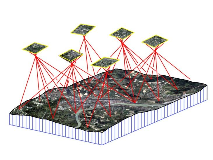

Collect
Process
Deliver
3D Pipelines
SFM
MVS
DEM
TIN
Multispectral
Blockchain
WebGL
Olly
Scale
-
Annotations
-
360 Indoor walk through
-
360 Outdoor drive through
-
3D Model flythrough
-
Aerial 4k videos
-
Time-lapse
-
Graphics & Animation
-
Orthomosaics
-
Elevation: 3D DEM, Contour Maps, DSM
-
Normalized Difference Vegetation Index (NDVI)
-
Overlays
-
Parametric Data Extraction
-
Boundary and Services’ Network overlays
-
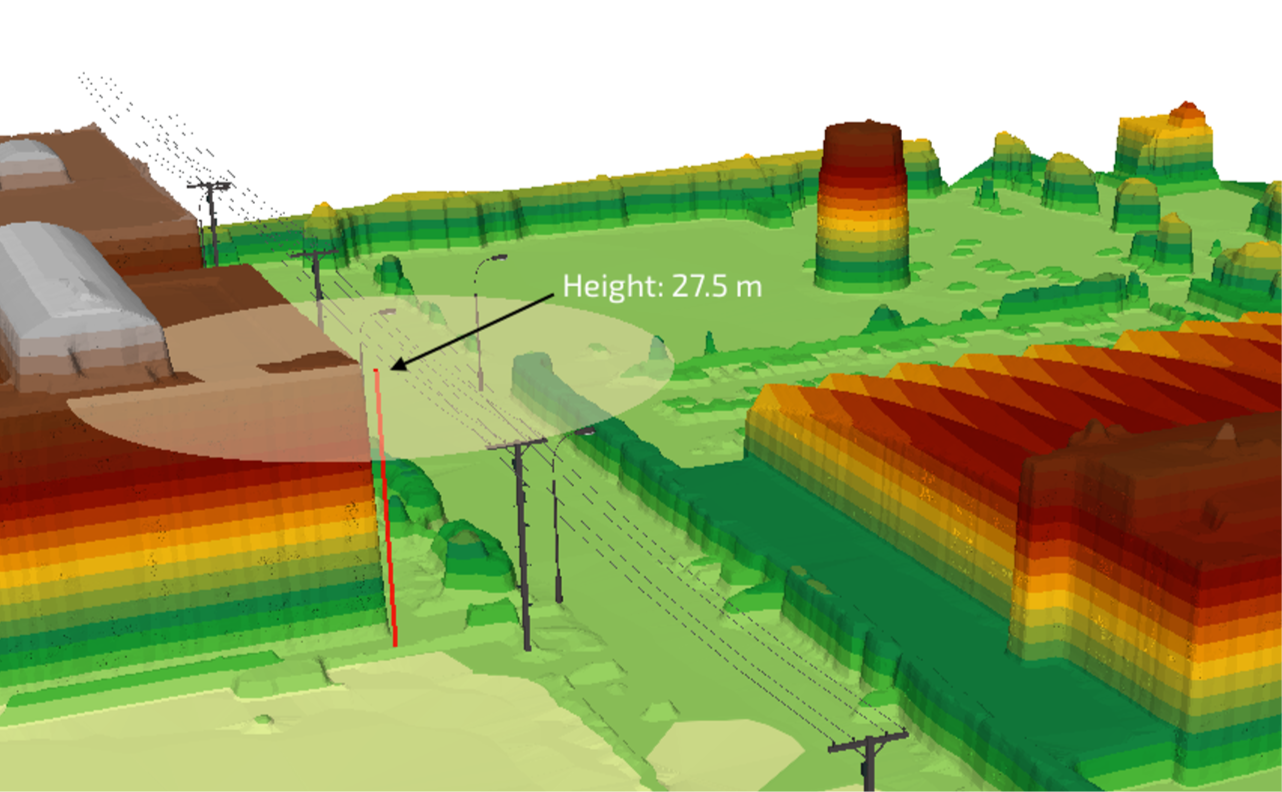
Line of Sight Analysis
Industrial Infrastructure (oil, coal, solar, telecom)
Public Infrastructure (education, health, water, sanitation, highway, electricity, railway, tourism, airways)
Security Planning
Evacuation Planning
Disaster Management
Smart City & Smart Village - Rural & Urban Planning
Housing & Offices, Engineering & Construction
Experience and Markets
DronaMaps has successfully recreated:
- The City of Ayodhya
- The City of Maheshwar
- SEZ Industrial Areas of MP
- String of 9 villages in Eastern UP
- Individual Real-Estate Properties
Our Target Markets:
- State Space Application Centers
- Real-Estate Markets
- Educational Institutions
Business Model
1 mn sqkm
$2000
$2 bn
market share
avg extraction per sqkm of map service
revenue by 2023
currently bootstrapped based on a
Service Model
eventually transition to a
SaaS model
Co-opetition
- Their niche in:
- UAV Manufacturing
- Survey
- DronaMaps compliments them:
- 3D Maps
- IoT Integration
- 3-phase integration
- Before (Plan & Prepare)
- During (Build & Manage)
- After (Optimize & Market)
WE DO SKY
SKYLARK DRONES

Opportunities

DronaMaps aims to identify the right use-cases where we can expand operations in association with:
AirBus Aerial && FarmStar
More collaborations proposed with various companies at AirBus BizLab focusing on BlockChain, IoT, VR/AR and Satellite Imagery Services.
StreetFactory, ShoonyaVR, Qualitas
Artillery