Canadian Census Workshop
CITY 7410
Today we will cover:
- Census geography
- How to access census data, both current and historic
- Using Beyond 20/20 software
Census Geography
- Census Division (23 in MB)
- Census Subdivision
- Dissemination area
Largest area
Smallest area
- Census Metropolitan area
- Census Tract
Stats Canada Homepage:
statcan.gc.ca
Census subdivisions can be:
- reserves
- rural municipalities
- towns
- villages
- etc
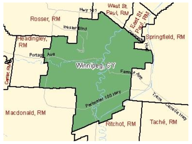
The City of Winnipeg is a census subdivision
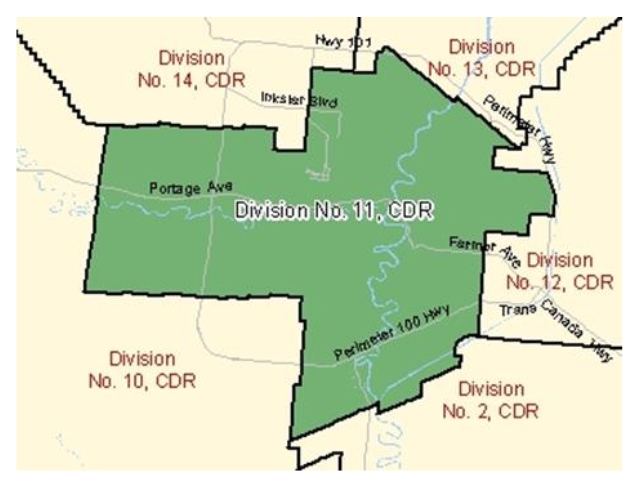
Winnipeg and Headingley together make up Census Division #11

The area surrounding Winnipeg is included in the Winnipeg Census Metropolitan Area
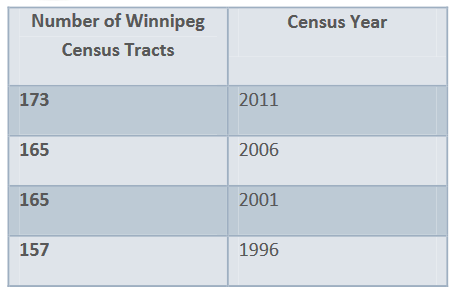
Census Metropolitan Areas are divided into Census Tracts.
Census tracts are a level of census geography commonly used when researching large cities.
Census tract geography changes over time due to population thresholds.
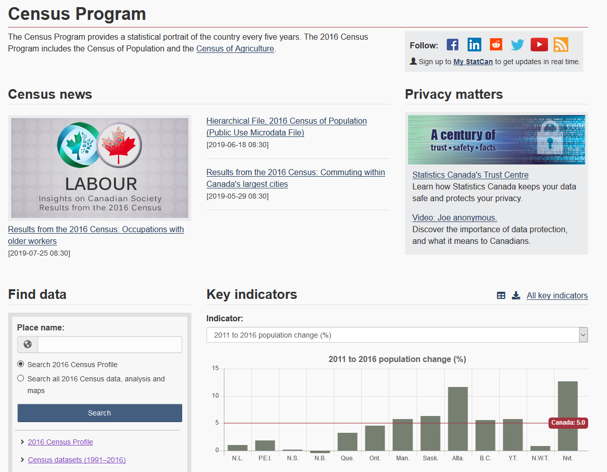
Accessing Census Data
- Stats Can website: statcan.gc.ca
- Census in top menu
- Further down that page:
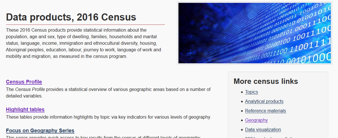
Data Products
A variety of data products & visualizations are available. Most of the easy-to-use options provide data for large levels of geography - country-wide, province- or territory-wide, city-wide.
-
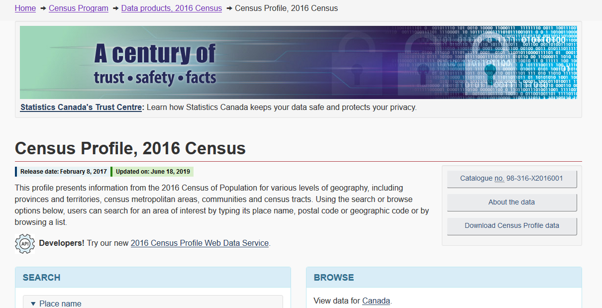
Census Profiles: provide data describing a single variable
- useful for quick fact checking
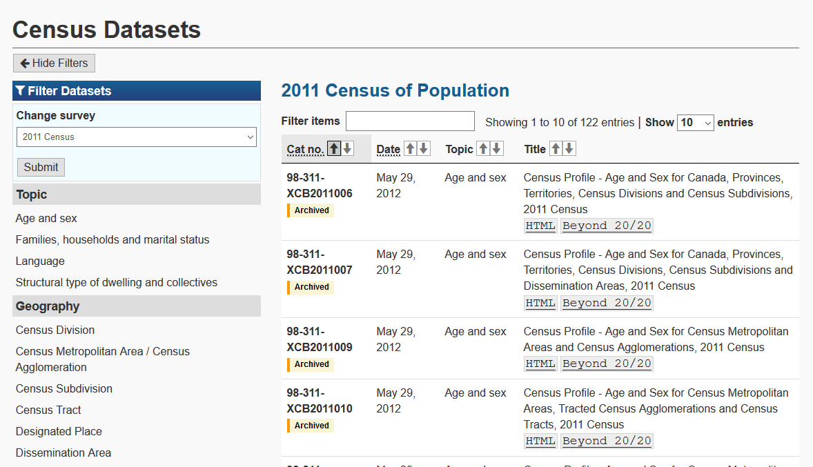
To access census tract data:
- Data Products page:
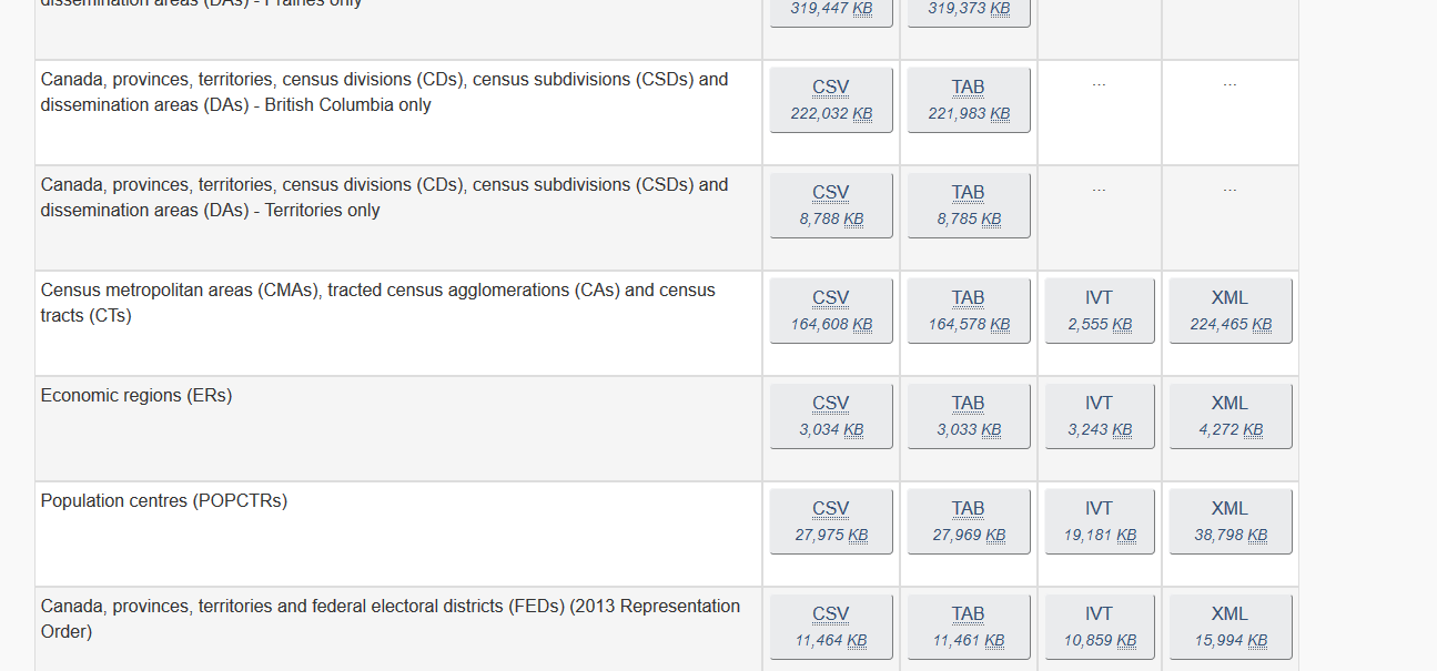
IVT = multidimensional table file
for use with Beyond 20/20 software
Getting Started with
- Download B20/20 (Windows only)
- Quick Start Guide
- Full User Guide
Beyond 20/20
Key terms:
- dimension: an attribute of table data, such as sex, geography, time, etc. Tables can have up to 10 dimensions.
- item: an element of a dimension. E.g. Female is an item of the sex dimension.
- label: a title or display heading of an item. An item may have multiple labels: e.g. census tract #, geographic ID #...
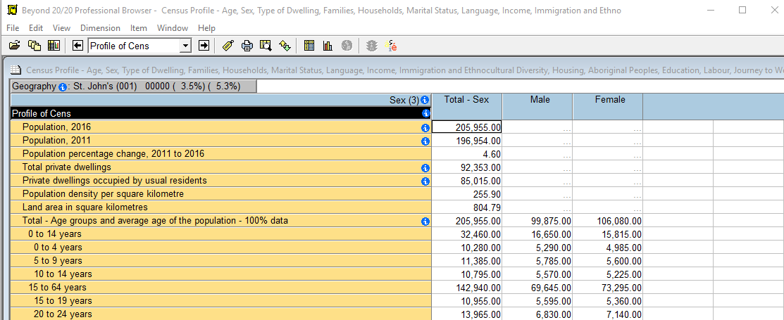
Dimensions:
- Census profile (population & more)
- Sex
- Geography - not active in image below
Click & drag dimension names to view values in the table
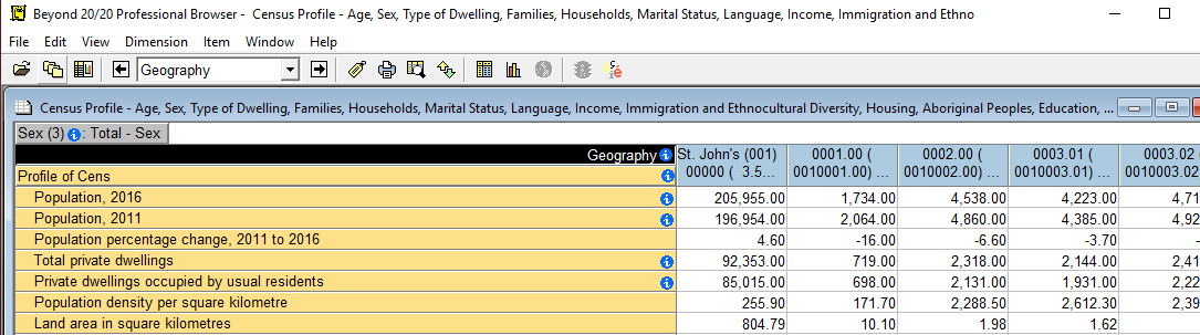
Geography is now the active dimension (name highlighted in black, name visible in drop-down menu)
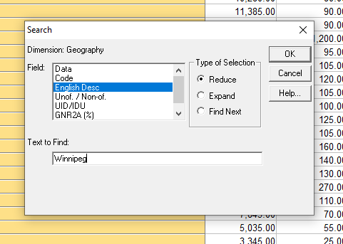
The Search tool can be used to skip to the geography of your choice
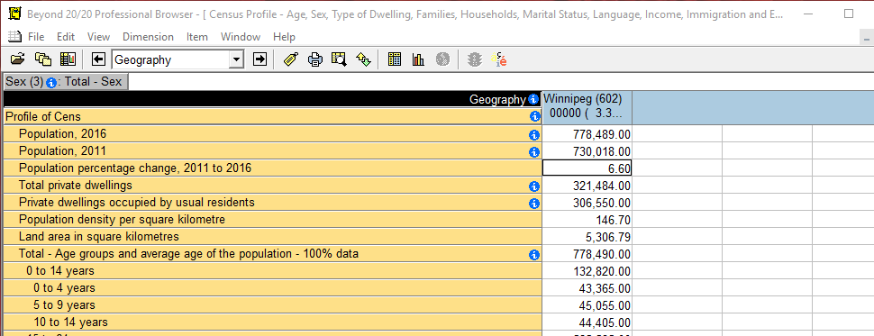
The first column of Winnipeg (602) data is a summary total of all of Winnipeg's census tracts
Right-click column label > Show All
to see neighbouring rows
A few more B2020 tips:
- Selecting columns or rows:
- Click & drag to select nearby adjacent items
- CTRL + click for non-adjacent items
- To select a large range, click first item, SHIFT + click last item
- In top menu, Item > Show to see only selected items
- File > Save As - export as an Excel worksheet, CSV, etc
Finding a specific census tract #:
Finding Historical Census Data
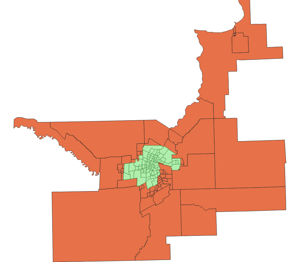
Census tracts were trialed in 1941; boundaries changed for 1951 onwards
-
Canadian Census Analyser - via UM Libraries Databases A-Z list
- Census tract data back to 1961
- 1951 & 1941 census tract data available only in PDF format, via our Statistics Subject Guide
- Scroll about halfway - Census Publications Digitized - Winnipeg Census Tracts
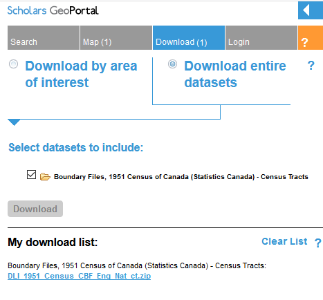
Even more historical census tract data
Mapping with Spatial Files
2001 - 2016 shapefiles available via StatsCan website
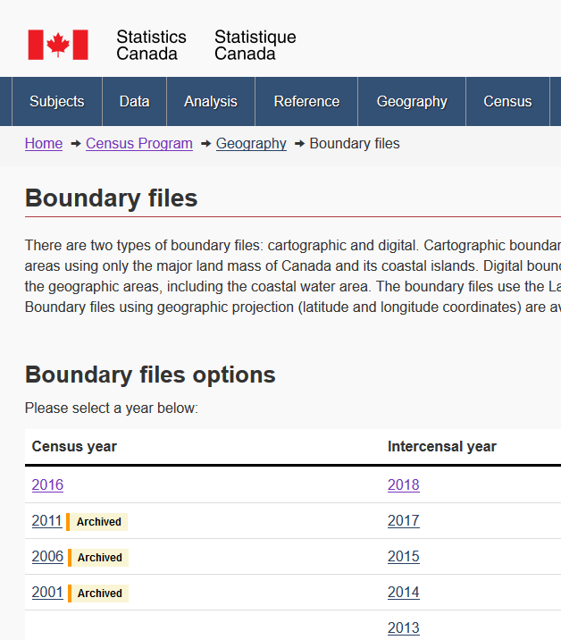
Older boundary files
- Browse > Census and administrative boundaries (95)
- Search for "tract" to find census tract files going back to 1951
More on working with census data in B2020:
Working with Census 2011 Data [PDF] - still relevant for 2016 data
- Getting more data dimensions at census tract level (e.g. family structure - common-law couple families, lone-parent families, male-parent families...)
More on finding historical census data:
Census of Canada Report Locator (1851-1996), by Gary Strike