QGIS FULL MOTION VIDEO (FMV)
Fran Raga
franka1986@gmail.com
QGIS FOR THE MILITARY ENVIRONMENT
INTRODUCTION
CONCEPTS
AGENDA
CONCLUSIONS
MULTIPLEXOR
IMPORTANT COMPONENTS
DEMO
PRESENTATION
GOALS
who I am?

Engineer in Geodesy and Cartography
Francisco Raga
Full-Stack GIS Developer


QGIS FULL MOTION VIDEO
What is it?
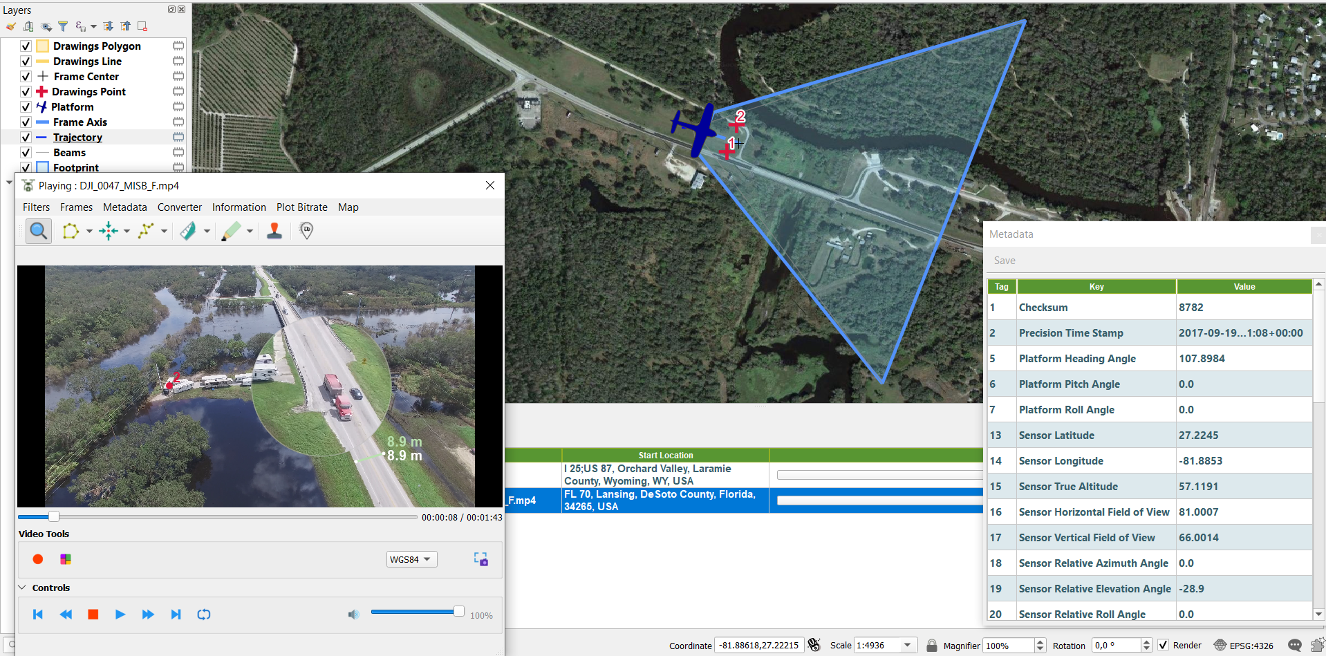
Plugin for QGIS 3 which allows to analyze, visualize and process videos inside the QGIS environment. QGIS FMV accepts multiple video formats such as mp4, ts, avi, etc. It is also able to extract video frames, to capture the current frame, to plot bitrate and to observe the video metadata with aerial images and more. It also offers the possibility to create reports with video metadata.
Motivation
This development arises after observing that there was no free solution for the metadata extraction and video analysis in real time. All solutions are APIs or private tools such as Esri, for this reason, I decided to develop this open source project and, this way, offer this open source alternative to the QGIS community.
QGIS FULL MOTION VIDEO
Where does FMV data come from?
•Unmanned Aerial Vehicles (UAV’s; UAS’s, RPV’s, drones)
•Fixed Wing and Helicopter
•Orbital sensors (overhead sensors)
•Vehicle mounted cameras
•Hand-held mobile devices and cameras
•Stationary (persistent surveillance)
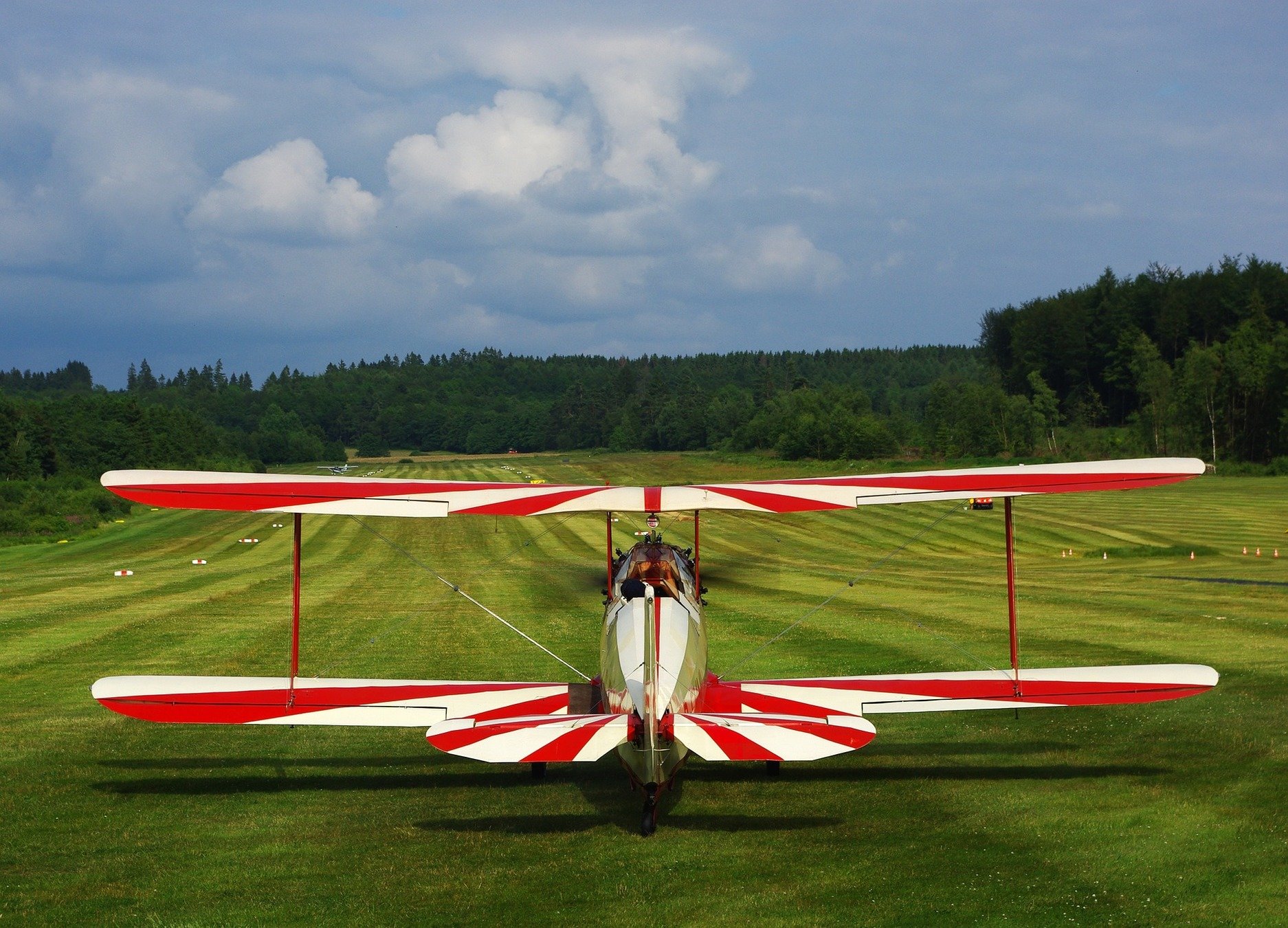

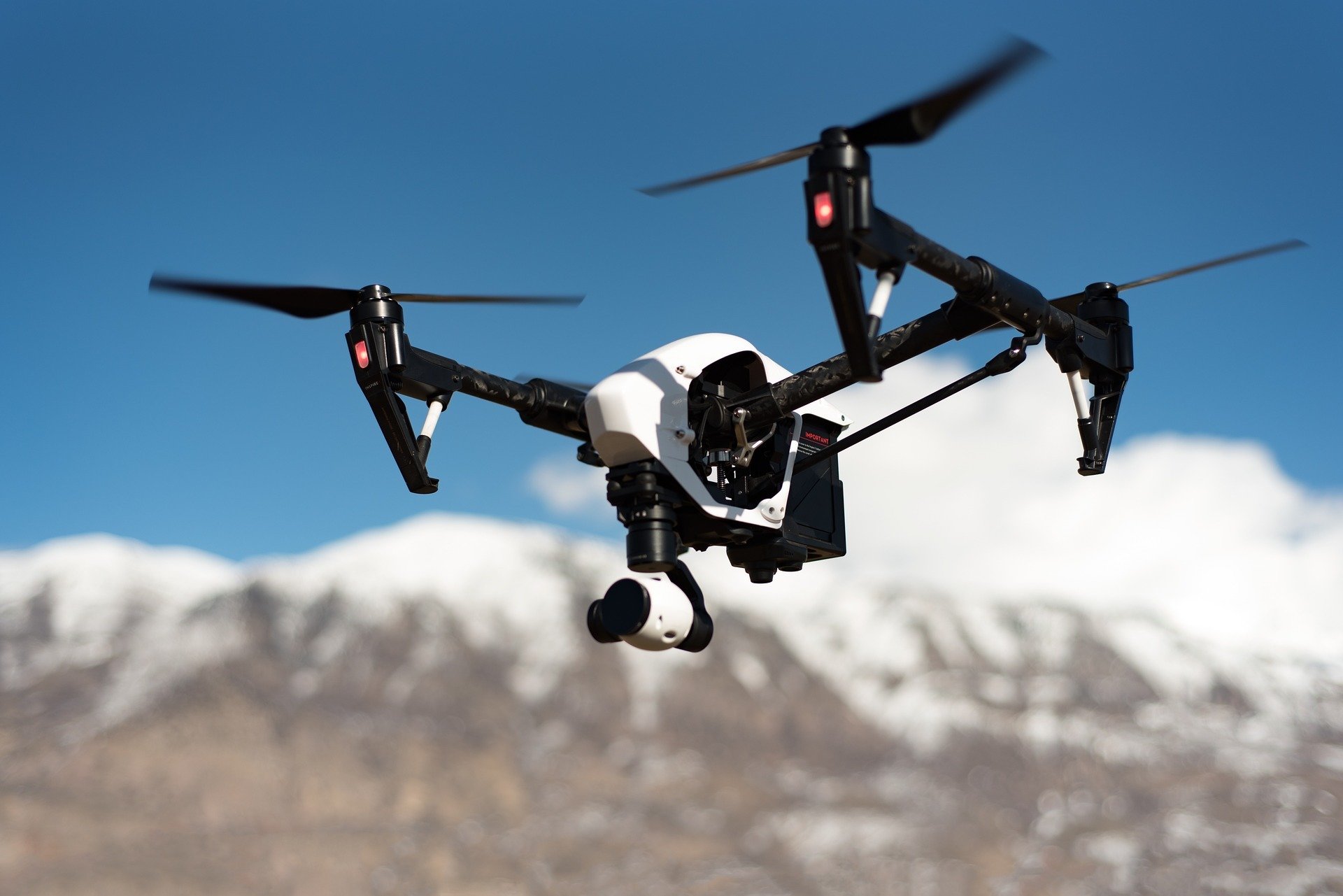
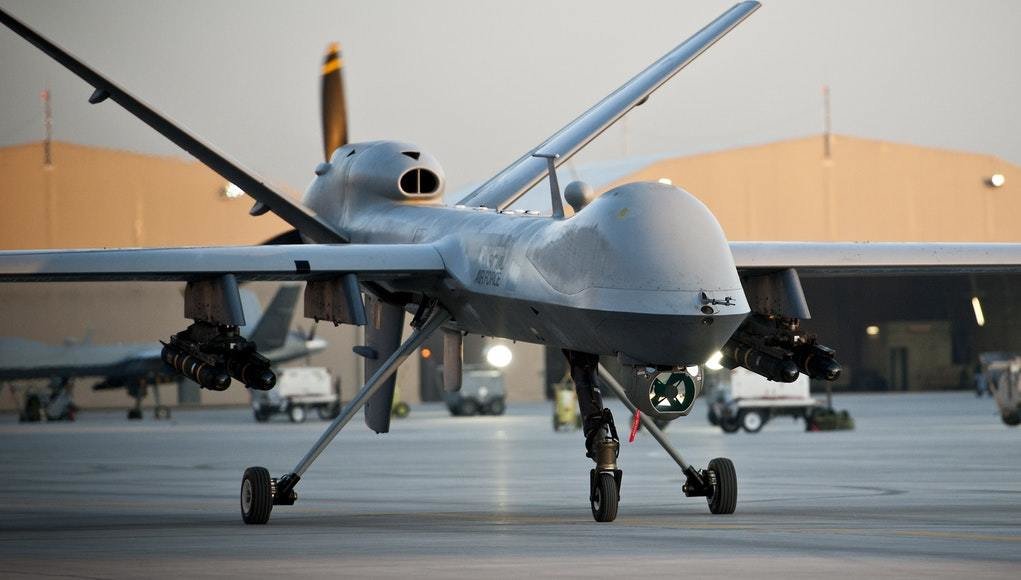
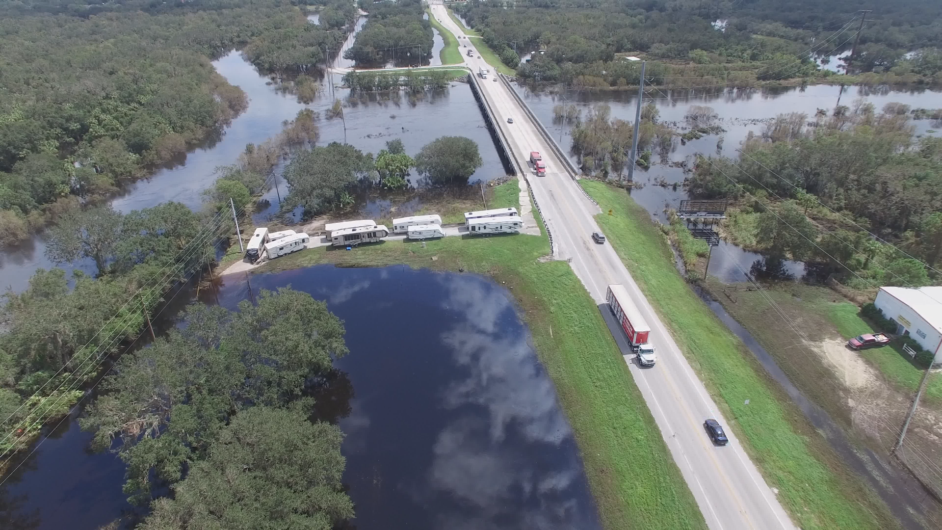
Image Credit: The Connected Shop
Who is it for?
- ISR Defense (Intelligence, Surveillance, and Reconnaissance)
- Army
- Emergencies
- Humanitarian Crises
- Border control patrols
- Anyone who needs to analyze flights
VIDEO
WHAT IS THE PLUGIN FOR QGIS 3 "QGIS FMV"?
Video Metadata (MISB)
QGIS ENVIRONMENT

SUMMARY OF FUNCTIONALITIES
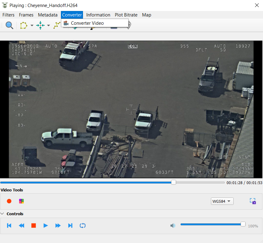
- Convert videos to other format
- Extract metadata from video file
- Show Platform,trajectory and beams position in a QGIS
- Possibility of extracting parts of the video
- Capture of the current frame
- Extraction of all frames of the video
- Extract lon/lat cursor coordinates
- Apply sobel filters, edge detection
- And more ...
WorkFlows
Find, Analyze and Share video information
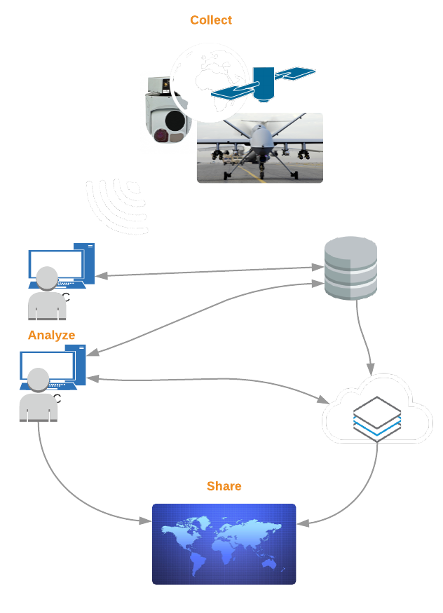
COMPONENTS
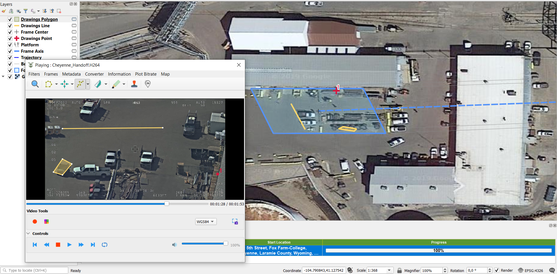
- Video Player
- Video processors
- Metadata parser
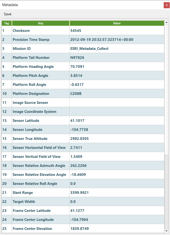
What is MISB-Data.
Why is it Important?
http://www.gwg.nga.mil/misb/faq.html#section1.1
The Motion Imagery Standards Board (MISB) was established in accordance with DoD Directive 5105.60 "to formulate, review, and recommend standards for Motion Imagery, associated Metadata, Audio, and other related systems" for the Department of Defense (DoD), Intelligence Community (IC), and National System for Geospatial-Intelligence (NSG). The MISB exists under the Geospatial Intelligence Standards Working Group (GWG) which is operated by the GEOINT Standards Center of Excellence division at NGA.
The MISB meets three times a year (typically February, June and October) in the Washington D.C. metropolitan area. The MISB is comprised of working groups that address different functional areas regarding Motion Imagery.
MULTIPLEXING VIDEO
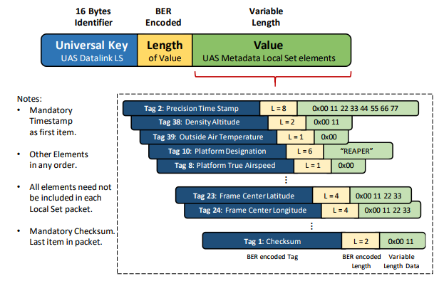
The metadata is collected from Uav following a standard "UAS Datalink Local Set", ST0601.11"
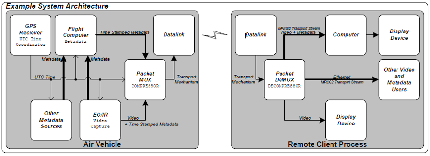
Get MISB Data Parser
MULTIPLEXING VIDEO
Minimum requirements to create the Footprint
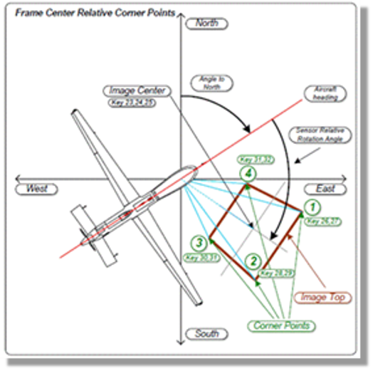
Position Group
SensorLatitude,
SensorLongitude
SensorAltitude
PlatformHeading
Target Group
Frame Center Latitude
Frame Center Longitude
Target Width
Field of View Group
HorizontalFOV
VerticalFOV
Gimbal Group
SensorRelativeAzimuth
Range Group
Slant Range
- Platform Heading Angle
- Sensor Latitude
- Sensor Longitude
- Sensor True Altitude
- Sensor Horizontal Field of View
- Sensor Vertical Field of View
- Sensor Relative Azimuth Angle
- Slant Range
- Frame Center Latitude
- Frame Center Longitude
- Target Width
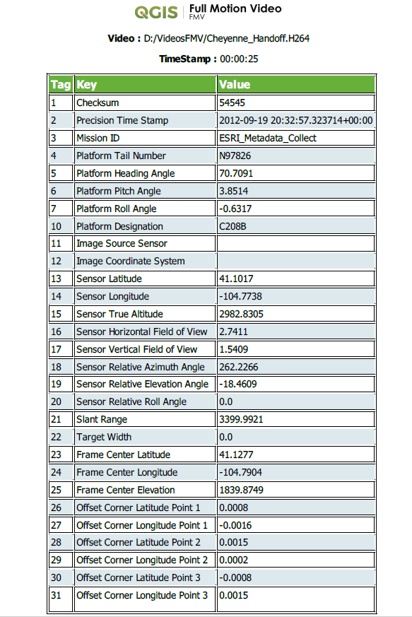
Missing Corners and Offsets
With Offsets
4 Offsets (Lat/Lon)
Frame Center Latitude
Frame Center Longitude
Summary
DEMO
GOALS
- Translators
- Code Contributors
- Information Contributor
-
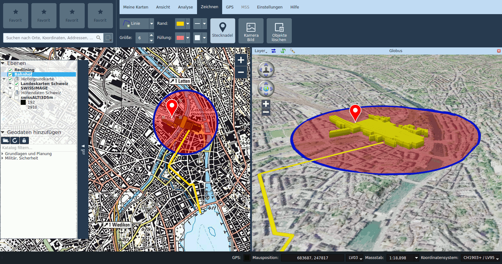
Core integration in KADAS Albireo (basic GIS Software for the Swiss Army needs, based on QGIS)
FUTURE
- Continue with the development
- Follow search partners
- Find financing
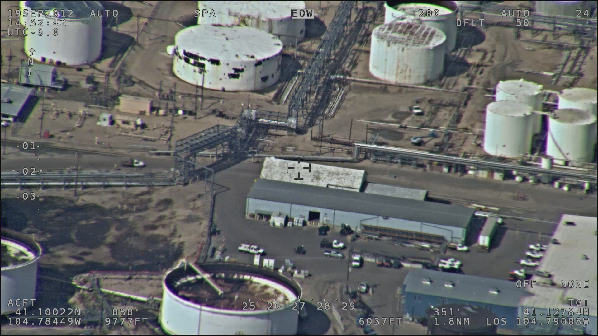
VIDEO FRAME
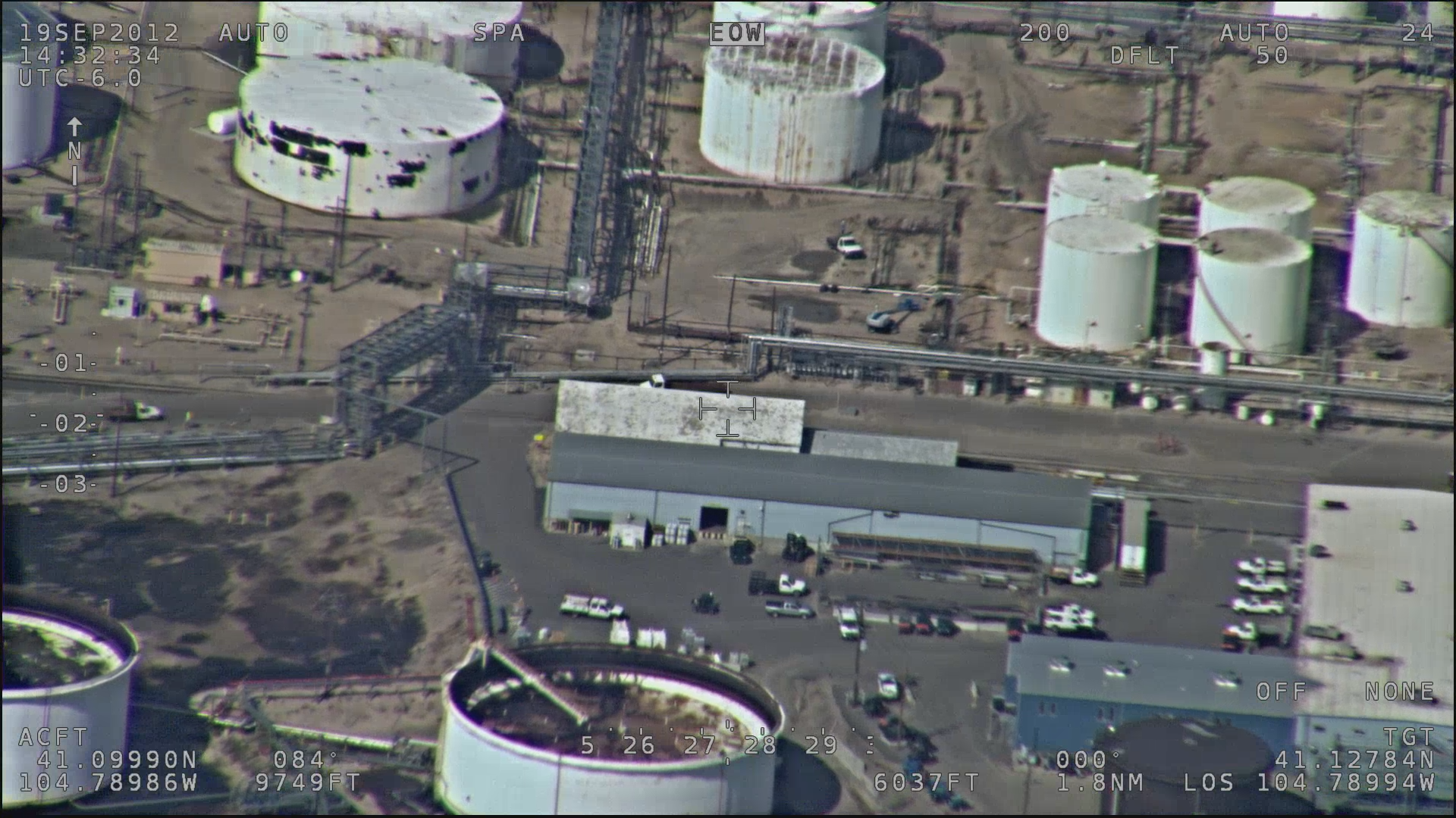
MAGINIFYING GLASS
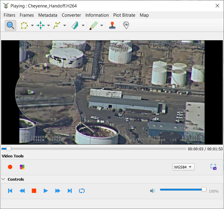
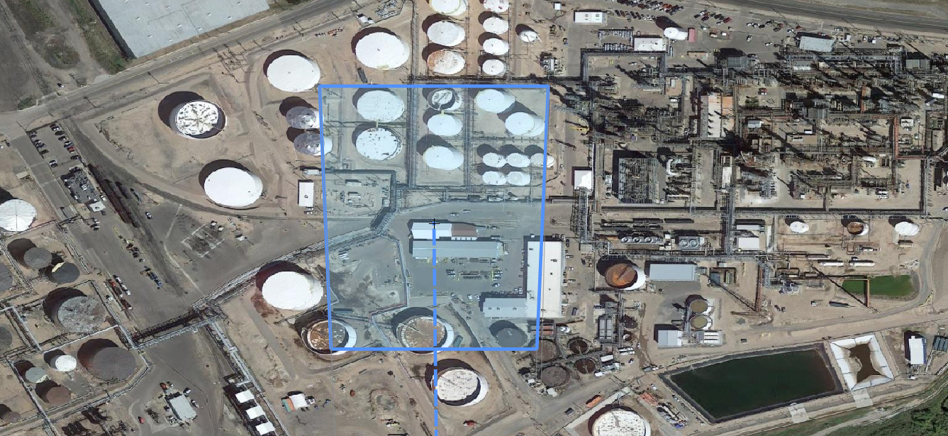
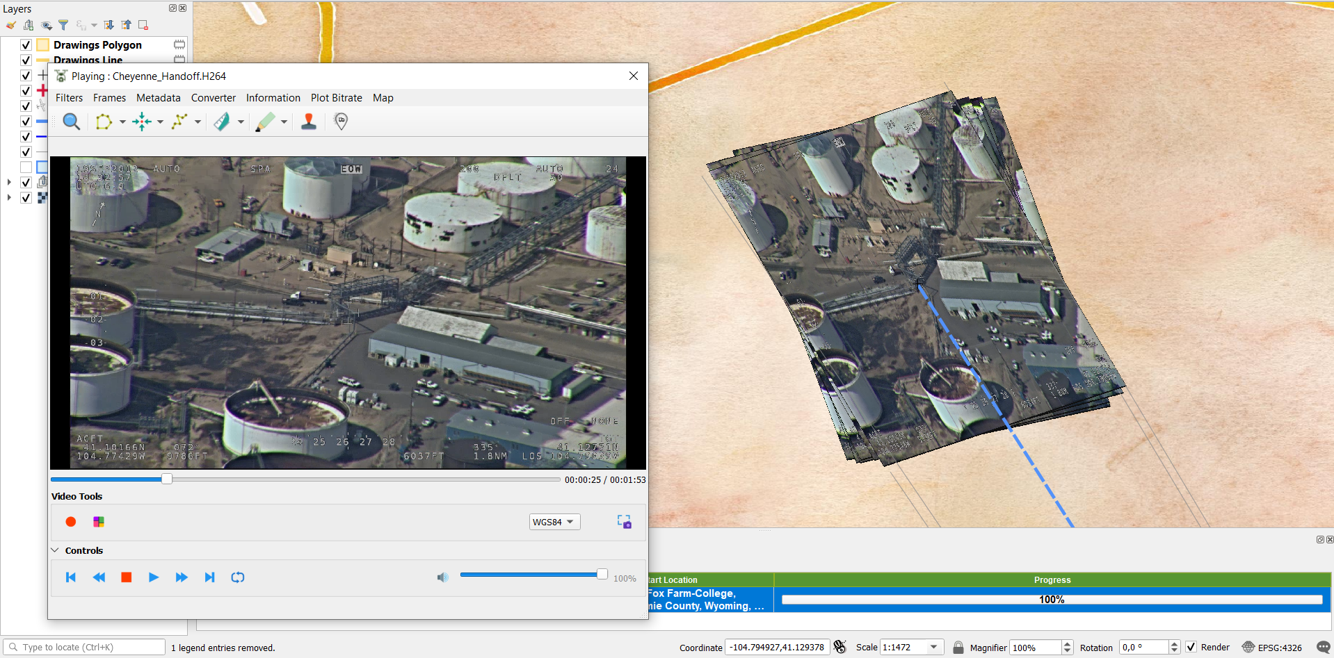
VIDEO FOOTPRINT
VIDEO FRAME CONTEXT
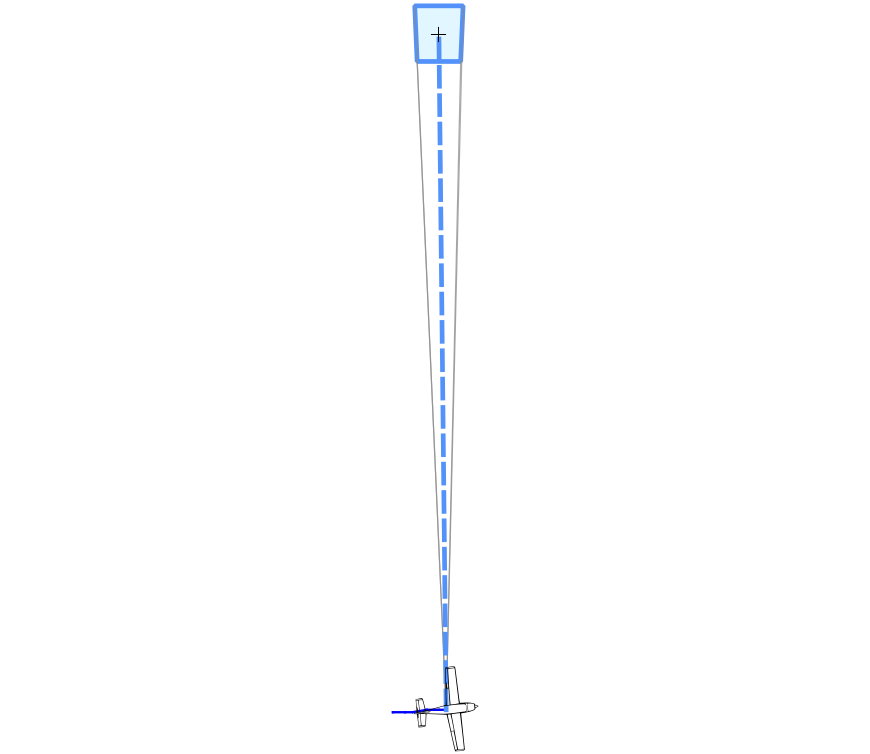
- Platform
- Platform Orientation
- Beams
- Footprint
- Trajectory
- Frame Center
DRAWING ON VIDEO
- Points
- Lines
- Polygons
- Stamp
- Censure Zones
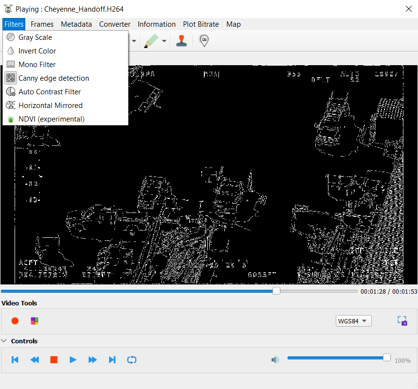
VIDEO FILTERS
- Color Inversion
- Gray Scale
- AutoContrast
- Edge detection
- NDVI ...
RECORD VIDEO AND CONVERSOR
GEOREFERENCING PHOTOGRAMS TO THE FLIGHT
Extracting telemetry in
Real Time

Contributions are welcome!
"Emplear software libre es más divertido si participamos en él !! "
https://github.com/All4Gis/QGISFMV
@fran_raga
QGIS FULL MOTION VIDEO (FMV)
Fran Raga
franka1986@gmail.com