Raúl Jiménez Ortega
@hhkaos - raul.jimenez@esri.es


Who am I?
What are we going to talk about?
- Basemaps
- Geocoders
- Routes
- Traffic data
- Influence areas
- Spatial search
- Points of Interest (POIs)
- GeoPopularity
- GeoEnrichment
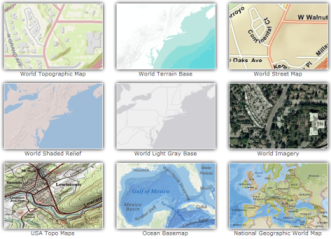


Basemaps
Sample of services offering different basemaps
a.k.a. map types
| Coverage | Cartography | |
|---|---|---|
| Google Maps | World | Own |
| ArcGIS Online | World | Own |
| Bing Maps | World | Own |
| Here | World | Own |
| OSM | World | Own |
| Mapbox | World | OSM |
| Stamen | World | OSM |
| CartoDB | World | OSM |
| Junta Andalucía | Local | Own |
| Grafcan | Local | Own |

10/45
Things you may ask yourself:
- How much it cost?
- Does it have visualisation limits?
- Which are the legal restrictions?
- Does it have enough zoom levels?
- How often they update?
- Does this design fit with my data? (context matters)
- Can I customize?
- Are labels good enough?
- Is it done with official data?
Geocoders
Geocoding / reverse geocoding / candidates

Address
Lat, Lng
20/45
Geocoders comparison
Routes


Edsger W. Dijkstra
May 1930 – 6 August 2002
Rotterdam, Netherlands
28/45
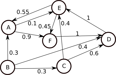
Solving routes
Traffic
32/45
33/45
Spatial search
34/45
Using a geometry engine (ArcGIS Online Geometry Service API)
Points Of Interest (POIs)

43/45
OpenStreetMap POIs (Pubs)
GeoPopularity
44/45
GeoEnrichment: Demographic & lifestyle data
ArcGIS Developer account needed: http://developers.arcgis.com/sign-up
45/45
Nice APIs!, but... anything else for me?
Join us at: meetup.com/Geo-Developers!

slides.com/hhkaos/40-geo-apis

github.com/esri-es/demos
You liked it? If so... tweet it!

@hhkaos
Github issues
Questions

THANKS


