Mapping the future with OpenStreetMap
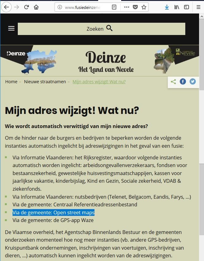
getting ready for future addresses for the municipality fusions
15 become 7
And they like unique addresses
Solution?
Let's map it even firster!
Plan of attack
Do all of the hard work now,
the flick the switch on December 31st


Data model for streets
- name = Current Name
- proposed:name= Future Name
- fixme:name = WikiProject_Belgium/Municipality_Fusions
Now
Future
- name = Future Name
- old_name= Current Name
So what about addresses themselves?
[out:xml][timeout:25];
{{geocodeArea:Deinze}}->.searchArea;
(
way["addr:street"="Kouterstraat"](area.searchArea);
);
out meta;
>;
out meta qt;
Show 'em on a mapp

You want to find the way in the future?

www.OpenStreetMap.be
@osm_be
community@osm.be
Meetup.com/OpenStreetMap-Belgium
Links
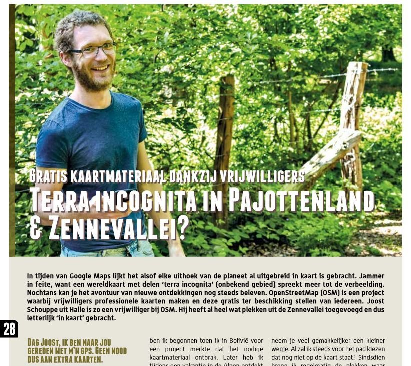
https://www.pajot-zenne.be/sites/default/files/documenten/Pajot%20Zenne%20magazine%20zomer%202018.pdf
http://www.fusiedeinzenevele.be/adreswijziging
https://riot.im/app/#/room/#osmbe:matrix.org/
https://github.com/osmbe/community_planning/issues/2
https://www.mapcontrib.xyz/t/2d975c-Geplande_adreswijzigingen_gemeentefusies
https://help.openstreetmap.org/questions/66446/overpass-query-addresses-near-a-street-with-the-same-name-and-a-special-tag
https://tools.geofabrik.de/mc/#17/50.8659/4.3492&num=3&mt0=mapnik&mt1=google-map&mt2=here-map