Crowdsourcing Urban Accessibility: How to attract large user base and obtain precise data
| Bc. et Bc. Michaela Riganová


- 2 -
| route-planning for blind pedestrians
Naviterier
- 3 -
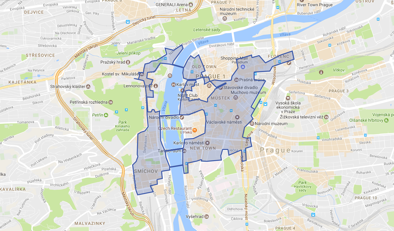
covered area in Prague
How to gather this huge amount of data which the Naviterier needs to work with?
- 4 -
Geo-crowdsourcing
minimal investments
big volume of hard-to-obtain data
in a short time
quick update

| Letting ordinary people (crowd)
provide spatial data (outsource).
data of poor quality
amateur equipment and tools
abusing the system with wrong data
an absence of motivation
- 5 -
How to accommodate the expert language to be well understood by non-experts?
How non-expert collected geodata will differ from data collected by professionals?
What methods will non-experts use for measurements?
- 6 -
Is the crowd capable to identify real obstacles and properties needed for safe navigation of handicapped people?
Key findings
| design recommendations
- 7 -
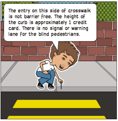
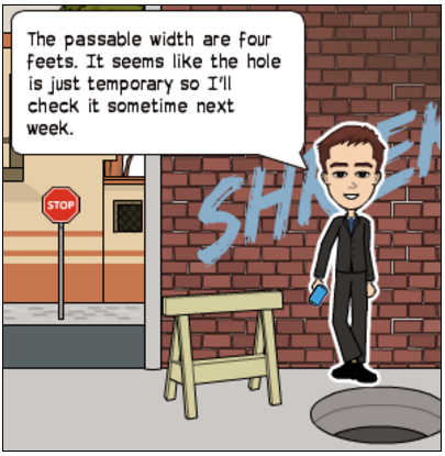
- proper guidance
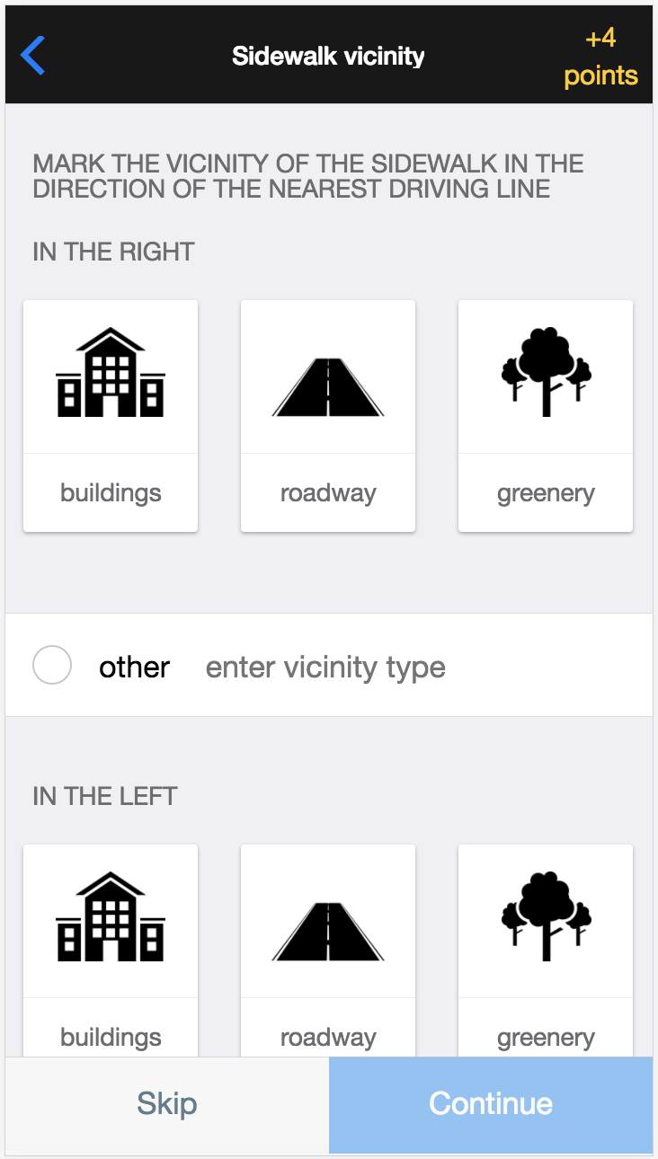
- objective information (width, height, depth, slope, material etc.)
- pictograms in combination with easy-to-understand language
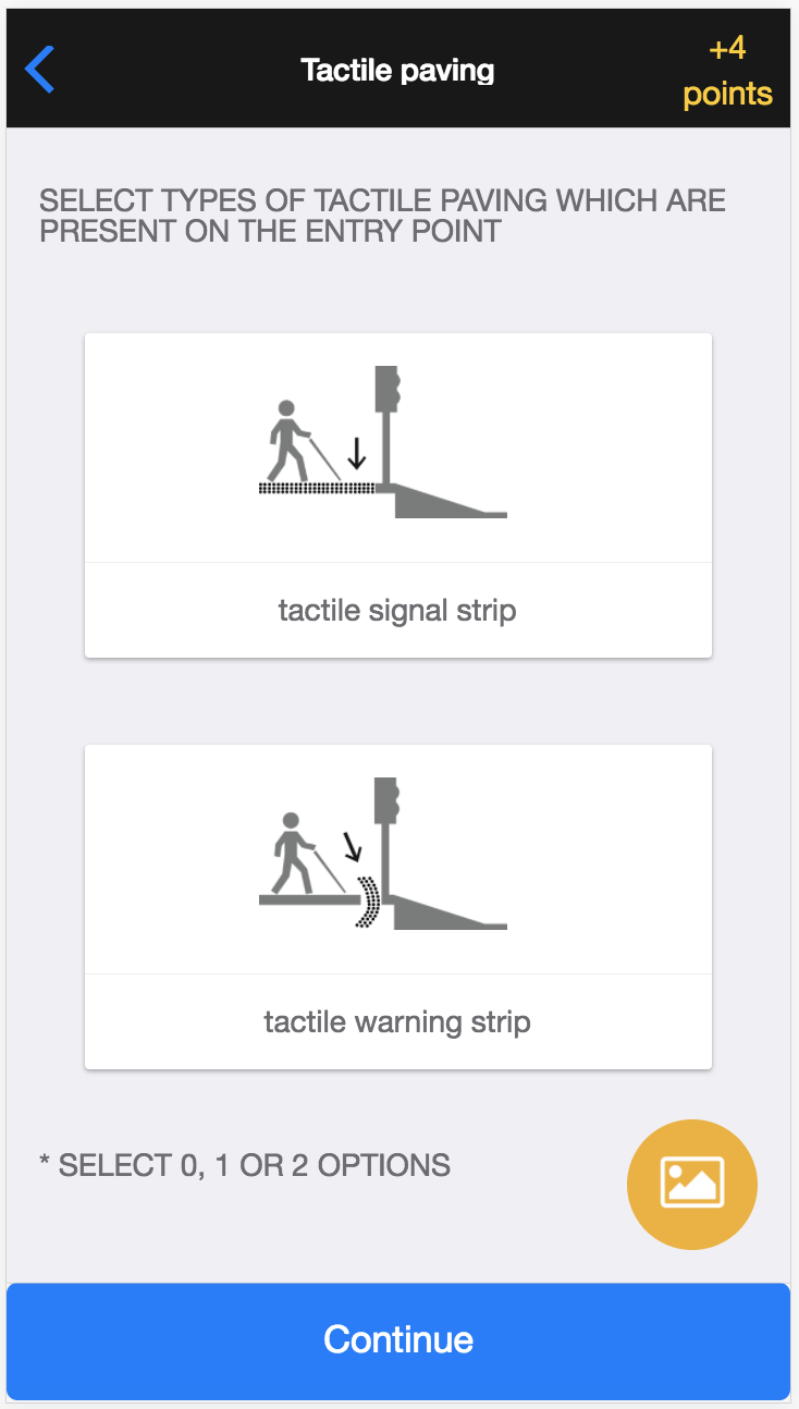
- suitable measuring techniques: stepping, feets, credit cards
Non-expert contributors are not familiar with special needs of each end-user group, they should not subjectively evaluate the accessibility or safety of the requested pedestrian segments and landmarks.
Design
| use cases
- 8 -
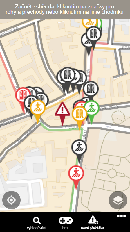
collecting attributes of landmarks and segments
marking new obstacles
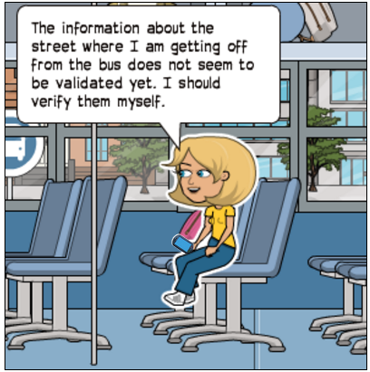
validation of collected data
Design
| How to efficiently visualize pedestrian segments and landmarks on a map?
- 9 -
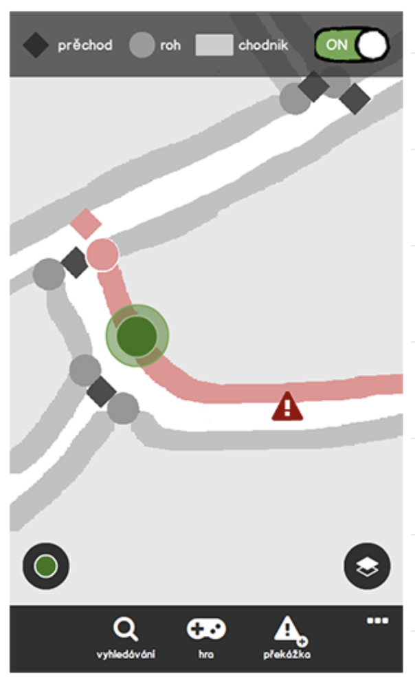
mockup
low-fidelity prototype
high-fidelity prototype
no data collected
not validated attributes
partially validated attributes
validated attributes
Design
| How to make sure that all the data will be properly described?
- 10 -
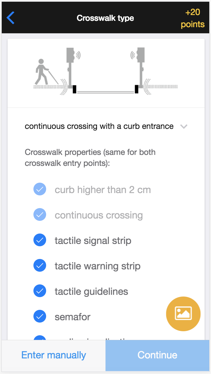
predefined pedestrian crossing types
skippable subtasks
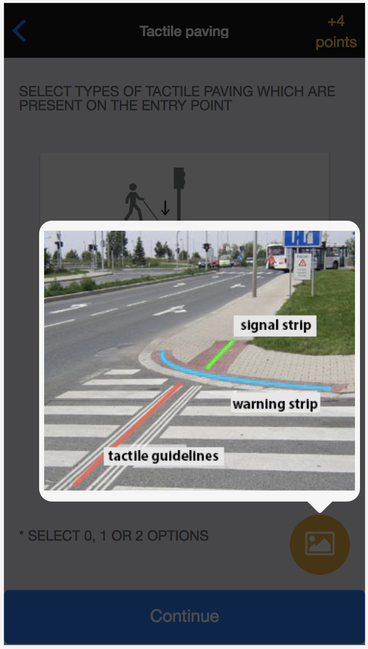
instructional images
pictograms with easy-to -understand language
How to motivate people to engage in geo-crowdsourcing?
monetary payments
amusement
useful information
altruism
- 11 -
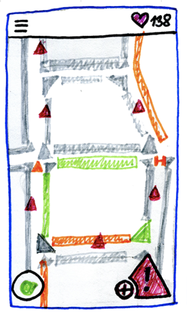
Gamification
| game elements
- 12 -
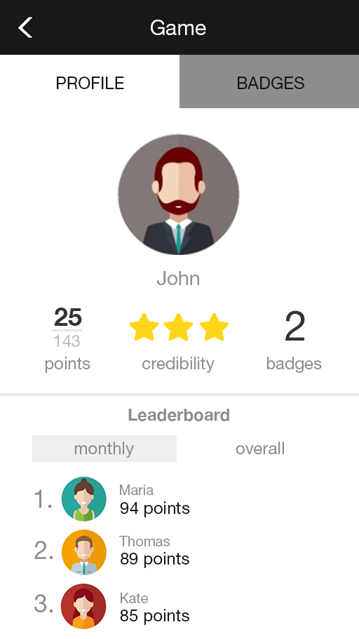
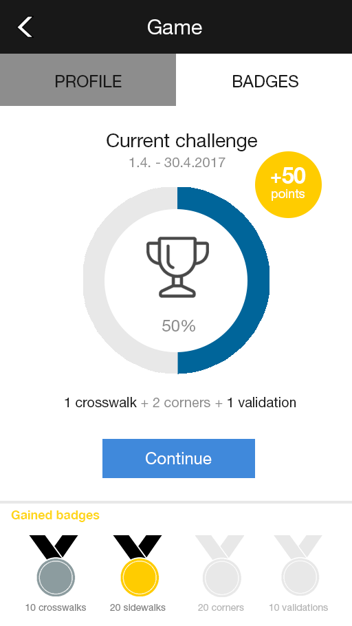
monthly & overall leaderboards
gained points for accomplished tasks
user's status
personalization
badges
monthly challenges
Conclusion and future work
- 13 -
- extension of the gamified layer on material prices
- evaluation of the quality of collected data
- review of the impact of the gamified layer
Application demo
- 14 -
bit.ly/HTWcrowd
task: Accomplish the month challenge!
Please, leave us feedback.