Crowdsourcing as a possible solution to inaccurate navigation systems for handicapped people
| Bc. Michaela Riganová

There is a significant need for navigation system, which would provide handicapped people with information about the presence of existing landmarks, obstacles and other features of pedestrian communication.

How to collect these data efficiently?
How to make sure that all the data will be properly described?
Geo-crowdsourcing | Letting ordinary people (crowd) provide spatial data (outsource).
A big volume of hard-to-obtain data which we can gathered in short time with minimal investment.

Possible problems of crowdsourcing | Alan Armstrong, 2014
1. Non-expert contributors cannot produce the same quality of data as legitimate professionals.
2. Non-expert contributors use amateur equipment and tools, so their results cannot be as precise as those of professionals.
3. Every contributor has a different motivation for participating in crowdsourcing. Some of the contributors might intentionally abuse the system with wrong data.
Armstrong, Alan. "Does the Wisdom of Crowds have a place in the realm of GIS?.", 2014.
How to encourage people to get involved
into crowdsourcing?
Incentives
- monetary payments
- altruism
- amusement
- useful information
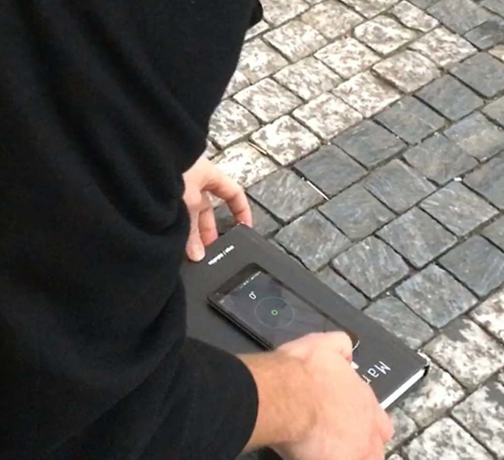
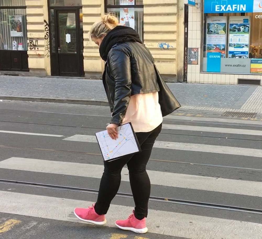
Experiment
Participants
- 11 young and middle-aged persons
- experienced in the use of smartphones
- divided into 3 focus groups
- no special technology or measuring tools
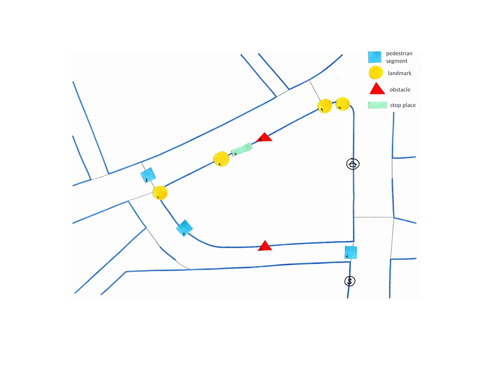
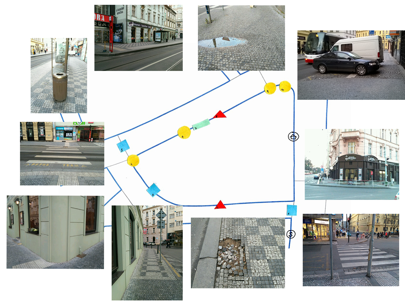
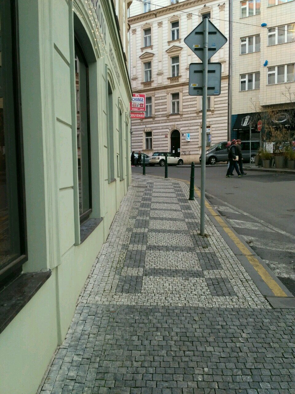
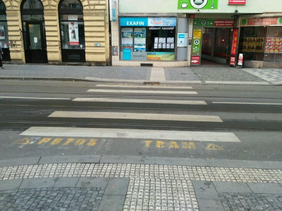
Location
- quiet area in the city center of Prague
- approximately 200 meters long
- consists of 4 segments, 3 landmarks, 2 obstacles and 1 stop place
Experiment outcomes
Recognition
- participants struggled to identify all the necessary features for navigation of handicapped users
- they couldn’t identify what objects on the street are the real obstacles for handicapped users and witch properties are exactly needed for safe navigation
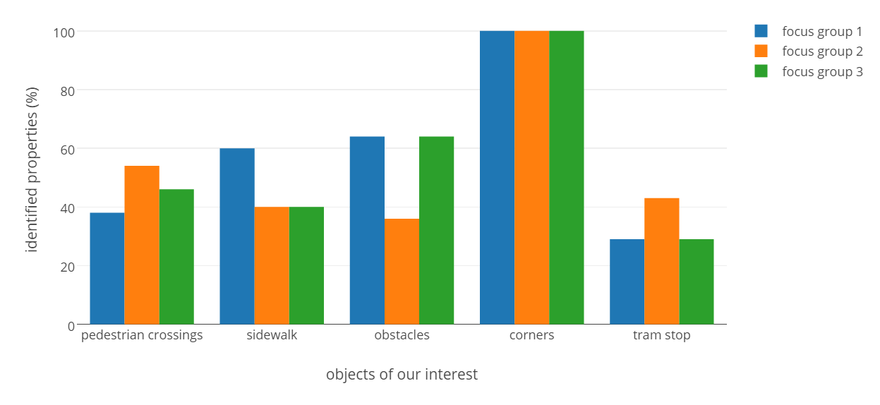
The percentage of identified properties of required objects without an assistance of the moderator:
Experiment outcomes
Terminology
- participants had no problem with naming pedestrian segments and landmarks
- participants struggled to correctly name some of the properties of pavement segments and landmarks: shapes of corners, different kinds of slope, tactile paving surfaces
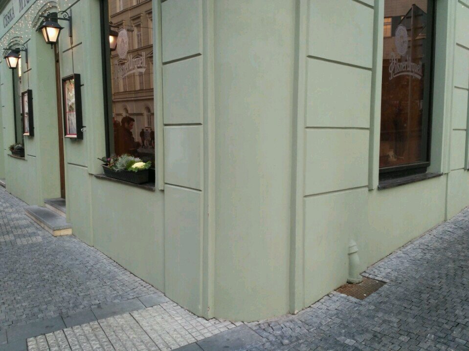
"round" "rounded" "roundish"
"direct" & "side"
↔
longitudinal & cross
tactile paving surfaces
Experiment outcomes
Measuring
- used techniques: stepping, feet, credit cards and squared paper
- participants struggled to measure exact slope of pavement segments
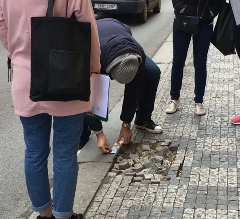
feet
mobile app
credit cards
Experiment outcomes
Deviations in measurements
- values measured by participants only slightly differ from the actual values
- measurement methods chosen by participants quite accurate
average
deviations
group 3
group 2
group 1
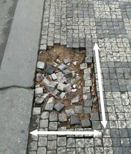
w: 4 m l: 7,5 m h: < 2 cm
w: 4,5 m l: 7,2 m h: 1,5 cm
w: 4 m l: 7 m h: < 2 cm
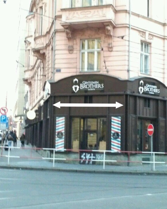
l: 6 m
l: 6 m
l: 6 m
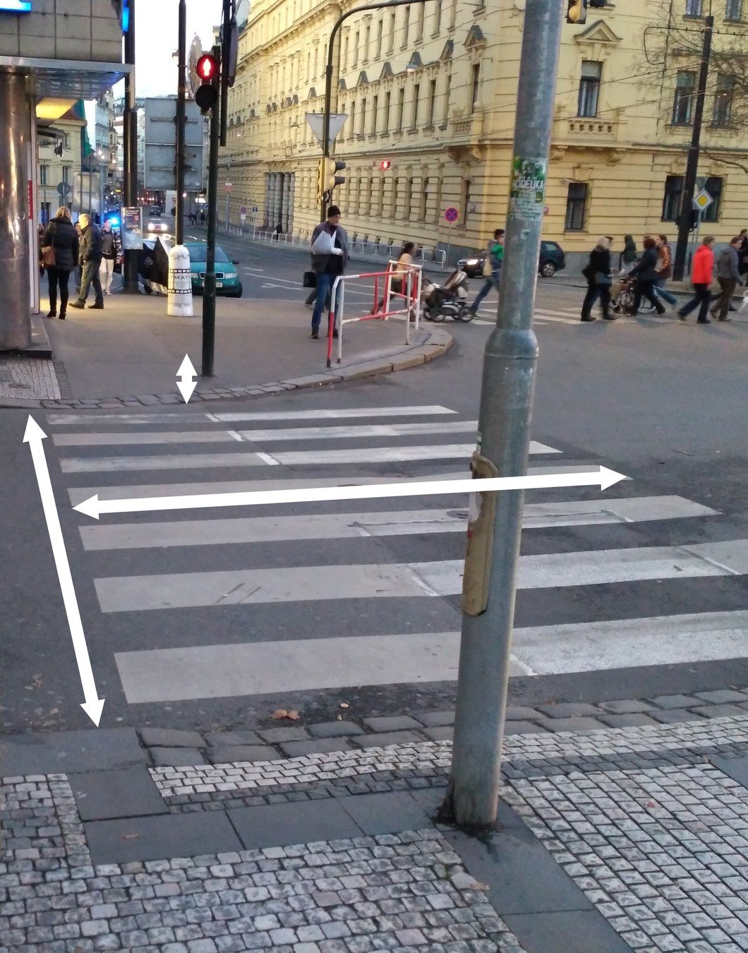
w: 47,3 cm l: 73,1 cm
w: 48 cm l: 70 cm
w: 50 cm l: 70 cm
w: ∆ 1,56 cm l: ∆ 1,03 cm
w: ∆ 16,66 cm l: ∆ 46 cm h: ∆ 0,16 cm
l: ∆ 40 cm
Motivation for geo-crowdsourcing
some participants do not feel motivated at all - the whole topic seems rather distant for them
those who have relative or a friend with a disability confirmed that their motivation is much higher
↔
- element of gamification
- gathered data useful also for non-handicapped people: traffic noise, atractivness of routes
Design recommendations
1. The application should provide contributors with proper guidance and instructional pictures.
2. Contributors should provide only objective information about the requested pedestrian segments and landmarks, such as width, height, depth, slope, material etc.
3. We need to raise public awareness about lives and certain needs of people with disabilities, so that contributors do not feel distant from this issue.
4. To attract more users, we should consider gamification of the application.
5. The application should also collect subjective data on the attractiveness of routes.
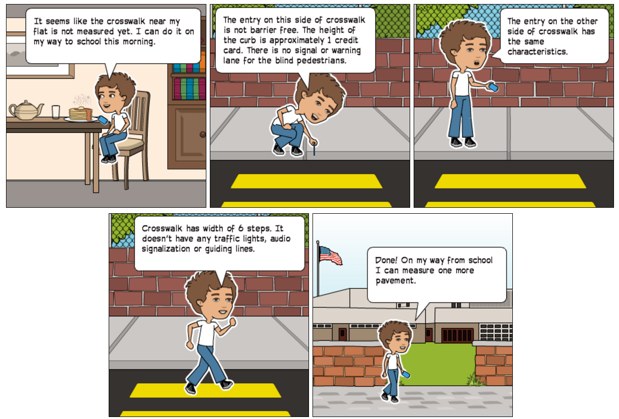
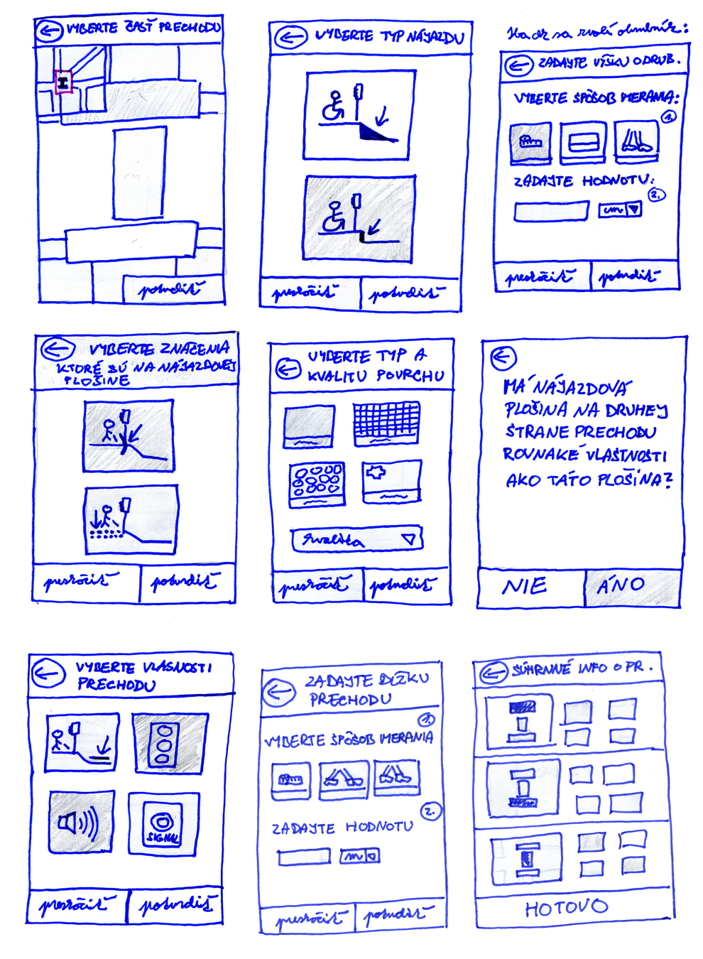
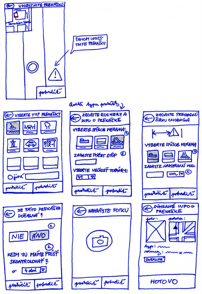
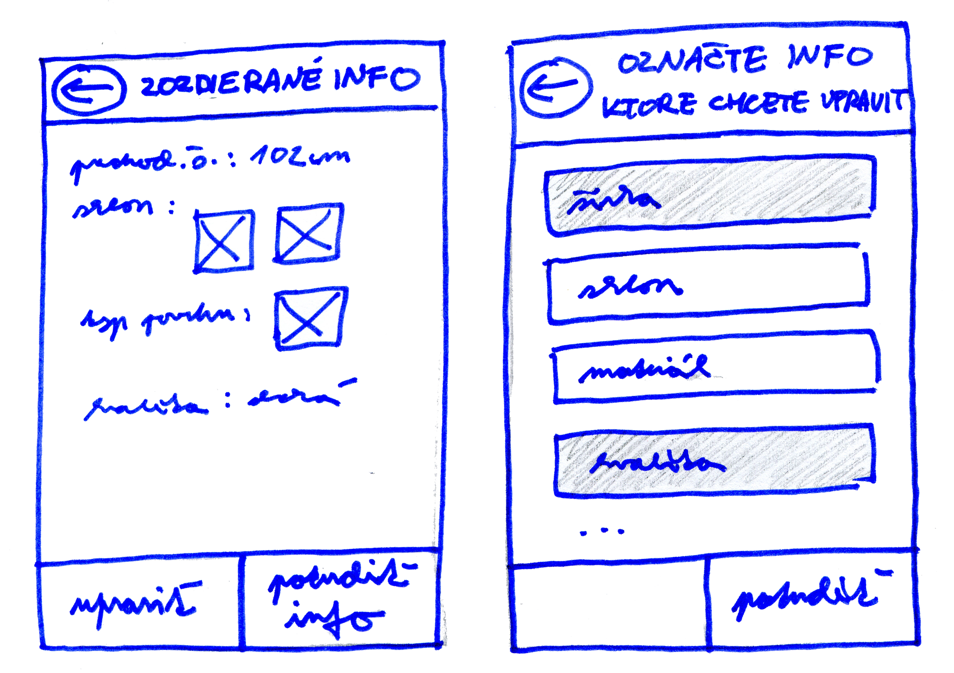
1. Use-case: Collection of new data on undocumented objects
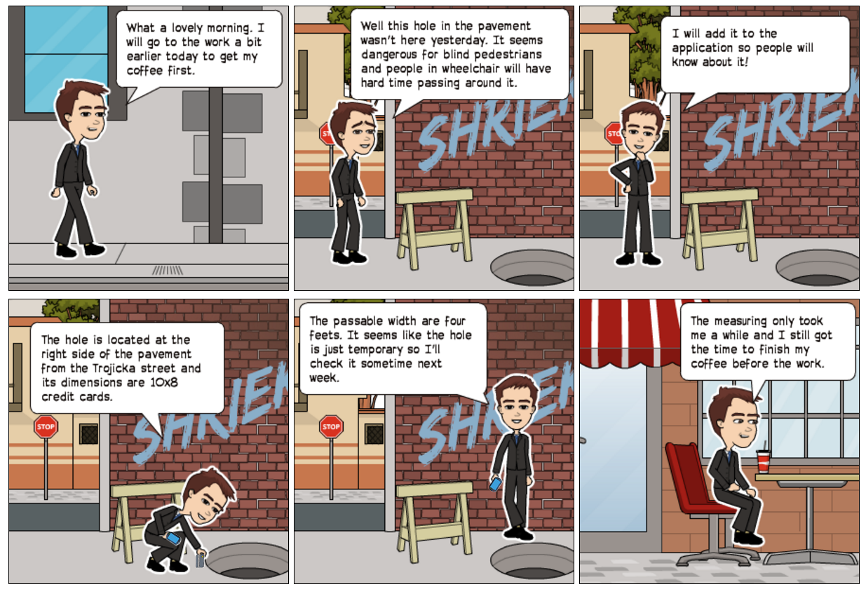
2. Use-case: Marking of new obstacles
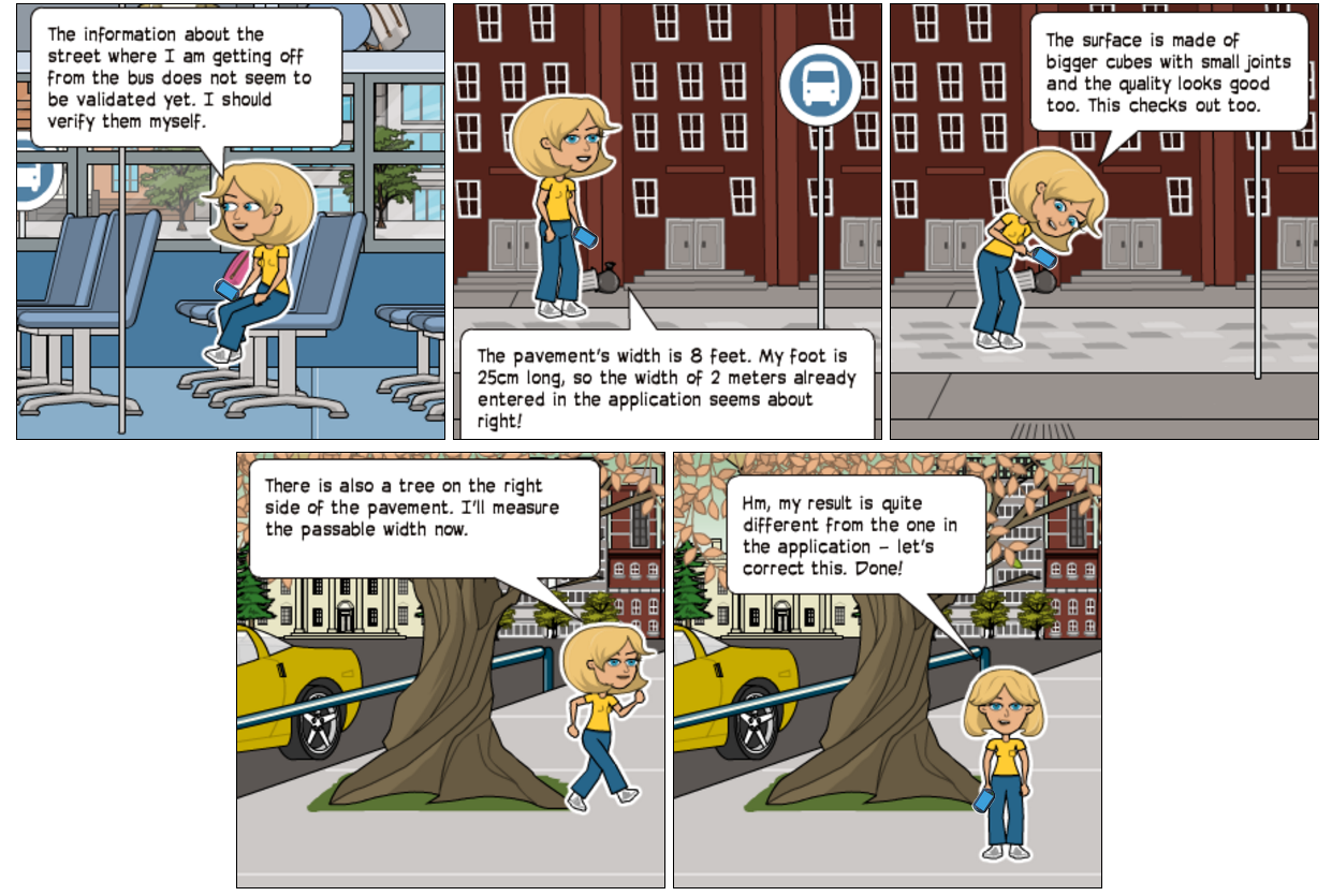
3. Use-case: Validation of collected data
Paper mockups - initial screen
Paper mockups - Collection of new data on a crosswalk
Paper mockups - Marking of a new obstacle
Paper mockups - Data validation
Design probe results
1. The users were discouraged from using application on daily basis due to the large number of steps and complicated measuring of individual tasks.
Solution proposal: We should provide the user with choice of two modes - basic and advanced mode.
2. The users would welcome a presence of illustrative photos of surface types or types of guidelines for visually impaired people as an addition to the used pictograms.
Solution proposal: When solving the task for the first time we should educate the users by providing them with photos of properties which should be collected.
3. The users have no incentive to use the application however they liked the idea of gamification. They would prefer a conquest game where teams or individuals can compete against each other.
Solution proposal: The gamification of the application where users would be motivated by the domination over the city or by winning valuable prizes.