5 Reasons to Love
LeafletJS!
1.Rapid Workflow Integration
Reasons
- I was doing lots of experimentation/research when opportunity met circumstances
- led to field testing of the api... under duress
How?
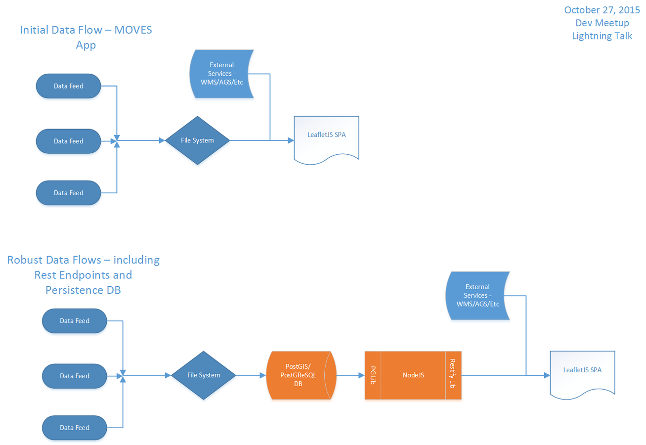
- used lots of flat file geojson for operational layers
- scraped data from repositories with python
- used a dump off directory and scheduled tasks to move data to active viewers' directories
Good?
- very good indeed
- provided us with an automated workflow for updates 24-7 (more on this in my second lightning talk)
2.Integration with ESRI Leaflet Plugin
Particulars
- ESRI basemaps - gotta love these, very versatile and useful for mapping applications
- Custom Raster Layers - harnessing the power of your own knowledge of the purpose of the map and cartographic skills, you can create your own base maps or tile layers.
Examples?
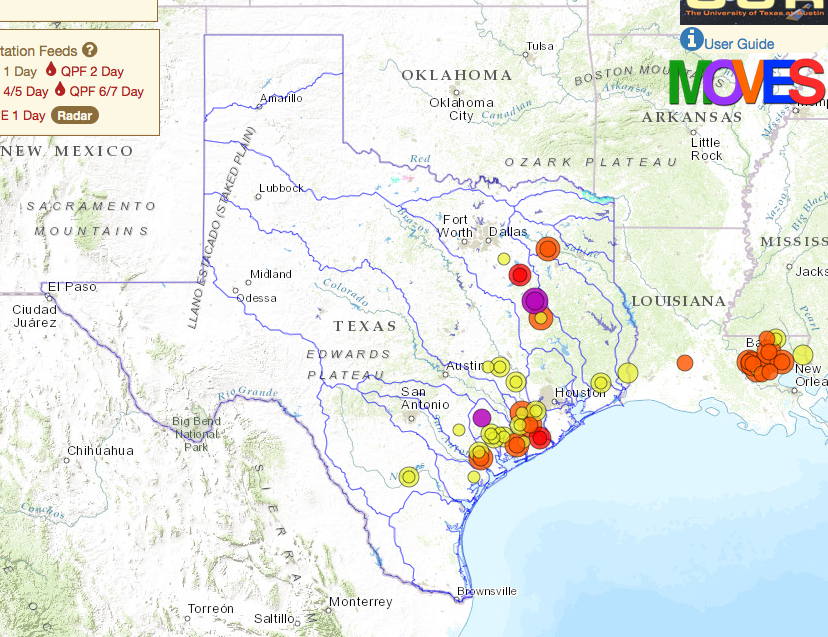
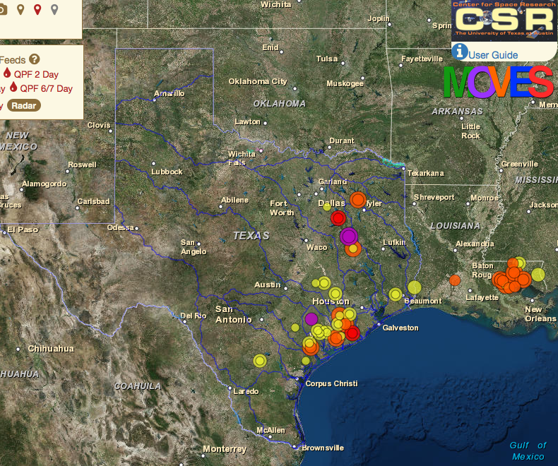
Custom Layers
3. Consuming Raw geoJSON as Layers
Full Disclosure - I 'cheated'
PostGreSQL/PostGIS
- I enabled PostGIS extension for PostGres for the spatial data type
- why? Works great with python and gdal (goodall) - remember the data flow?
- doesn't sound like cheating...
- it isn't - the cheating part is next
NodeJS
- I used nodejs and some of its ecosystem libraries to pull the data out and make rest endpoints out of the query response from the spatial data.
- the endpoints emitted geojson - this is what I pulled into Leaflet
Show Me!
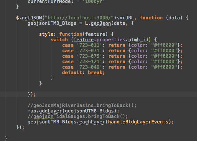
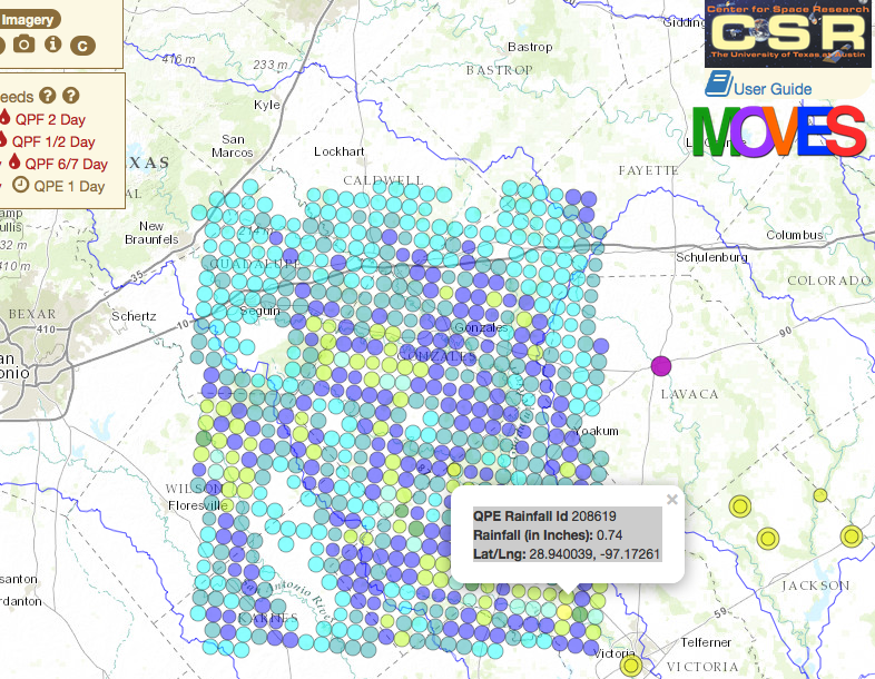
Gives you this -
4.Easy integration with ArcGIS Server Rest API
Remember how much I liked the ESRI api for Basemaps? :-)
Well, not so much for the dynamic/feature layers >(
Why?
- ESRI's feature layers/dynamic layers do not play nice with others.
- the stacking order becomes confused in the api
- removing and re-adding the layers sometimes throws errors
Caveat!
- If you are using ONLY ESRI layers with your Leaflet app - then you are good to go
- If you are trying to tie in disparate sources is when this will become more of a problem
Solution?
- ESRI ArcGIS Server Rest API to the rescue
- The Rest API emits JSON... remember the earlier code?
- with a little bit of code-fu you can parse the json and pull the REST endpoints in as json layers to your app
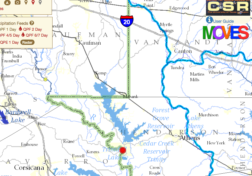
- Demo of that in the next talk but here is a little taste to keep you interested -
5. An Unobtrusive API
Leaflet is the path of least resistance
How
- built to integrate into existing patterns for app development with other javascript libraries
- I am able to integrate it with
- NodeJS
- JQuery
- A long list of plugins from both of the above
- ArcGIS Server
- Bootstrap
Proof?
How quickly I was able to take my research and experimentation to a production-ish level application in response to the floods in May and June.
Thank You!