Road Completion Project
Towards a complete and validated OSM street network for Belgium
Ben Abelshausen & Joost Schouppe
OpenStreetMap Belgium
Map
The
World!
'State of the Map' in Belgium
- Excellent basemap.
- Excellent state of transport-related data
- Good quality road network.
- Good quality transit data.
- Reasonable landuse.
- Basic address coverage
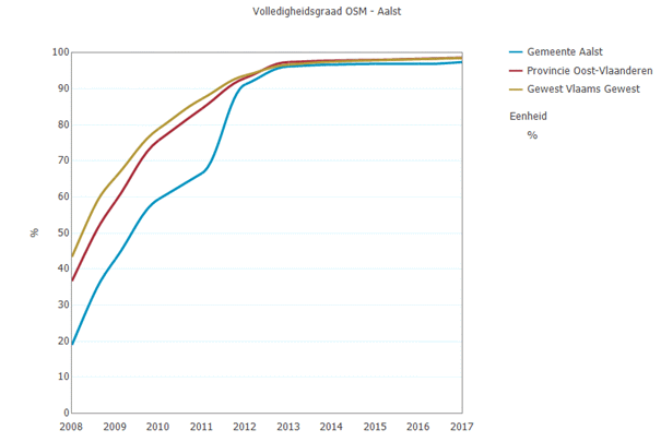
How far along are we?
How do we know?
What if things change?
Road Completion

Road Completion
Not about copying
data!
Road Completion
Not about changing the way we map!
Road Completion
- Change detection, spot changes faster
- Completeness & quality assurances.
Road Completion Project
- Compare OSM <-> Other data
- Mapping!
- Feedback

Loop 1
Loop 2
Step1 : Comparison


Step2 : Mapping

Step3 : Feedback
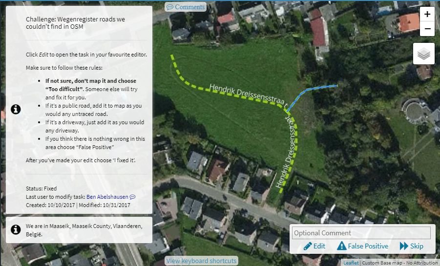
Comparison


wegenregister
OSM
OSM (buffers)
comparison
diff
Comparison
(v 0.1)
Comparison
(v 0.1)
Mapping

Mapping
Mid-term goals
- Verify OSM road network.
- Generate quality metrics for OSM roads in Belgium
- Publish false positives
Do this is in the open, use open-source tools and open-data so everyone can run their own!
Who's the best?
What's the best way to work together?
A validated Road Registry is easier to listen to
From Flanders to the world
Not just powered by tech
Powered by love
Tools for governments
-
Message feed about missing roads in government data in your commune
-
Validate Wegenregister with OpenStreetMap
- Quality metrics of Wegenregister
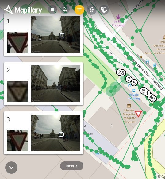
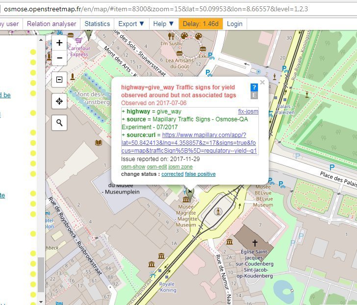
Validate traffic signs
And use open street view platforms together
Why?
Trust!
Imagine
- A costless (or very cheap) datasource.
- Quality checked and verified.
- Almost always up-to-date.
- Still community-driven!
Who can compete with this?

(almost) nobody
Commercially available data?

We
are
winning!
Join us!
Try it yourself at http://roads.osm.be/
Use our data and talk to the
community@osm.be
A framework made for working together
De Lijn
- Mapping & validation of bus routes.
- Mapping & validation of bus stops.
GRB
- Mapping & validation of buildings/roads/addresses.
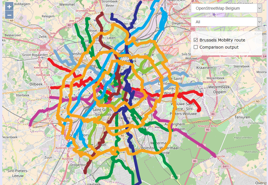
Cyclenetworks & tourism data
- Mapping & validation of cyclenetworks.
- Routing applications for this data.
Cyclenetworks & tourism data

An Open Summer of Code project
Machine learned traffic signs for OSM

About us
We are:
Ben Abelshausen
Board member of OpenStreetMap Belgium/Open Knowledge Belgium
Routing and mobility expert:
Joost Schouppe
Board member of OpenStreetMap
Former GIS at Stad Antwerpen
Geospatial Analist at Provincies in Cijfers