Bus stop collector
The ridiculously simple mobile app
for bus stop mapping in OpenStreetMap

project code name

by @overflorian
21 oct 2016 - OpenStreetMap France
We are in 2016 and bus stops in OpenStreetMap are still WRONG.
Let's fix that.

Current status
- Bus stops quality in OSM is very heterogeneous: from very bad to excellent (e.g. Managua, Nicaragua)
- Transportation Open Data often sucks
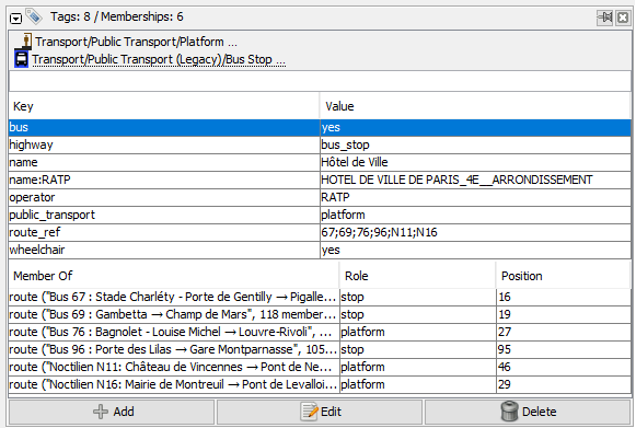
- Current editing tools are desktop and/or difficult to use


Why we need an app
- Accurate knowledge is on site. It really is!
- People have time to map while taking the bus
- We need to growth our community. The only way to achieve that is to provide simple tools

The app we need
- OpenStreetMap contribution on the fly
- Ridiculously simple: my mother must love it
- Open Source code
- Multilingual by design

Minimum viable product
Beta version
- Android app:
- Transport map as a main screen
- Create / move / delete bus stops
- Edit basic bus stops details: name, direction, bus line(s)
- Select a bus line for an overview

App version 1
It is the beta version with some more features:
- Contribute with your OSM account
- Offline edit possible
- Worldwide coverage
- Edit bus line road sections
- Tutorial to guide beginners
- QA tool : highlight possibly missing bus stops

Possible future evolutions
- Edit extra bus stops details: shelter, bench, wheelchair accessibility...
- Bus operators and network management
- Create / delete a bus line and edit its details: terminus, name, color...
- Manage stop position on the road
- Photo and GPS trace collection
- ...
- App available on other plateforms: iOS, web...

Overall goal
A game changing tool for transportation's crowdsourcing, created by the community for the community with a simple goal:
100% of Paris's region bus stops up-to-date in OpenStreetMap in 18 months

Help the project
This project is just a simple draft for now, October 2016, and I'd love to hear your feedback before going further.


I am Florian Lainez, a digital marketing officer that worked in a transportation company. I am also an active member of the french OSM community.

Extra resources
- A simple bus stop editor https://www.cartes.xyz/t/04e491-Arrets_de_bus__Florian#
- Technical description of a bus stop in OSM https://wiki.openstreetmap.org/wiki/FR:Tag:highway%3Dbus_stop
- A bus stop viewer for OSM http://overpass-api.de/public_transport.html
- A transport line editor http://makinacorpus.github.io/osm-transport-editor
- OSM bus mapping project in Managua, Nicaragua http://support.mapanica.net
- Digital Matatus http://www.digitalmatatus.com/about.html
