Gerrymandering and
congressional redistricting
what are congressional districts?
Representatives and direct Taxes shall be apportioned among the several States which may be included within this Union, according to their respective Numbers...
– U.S. Constitution, Article I § 2
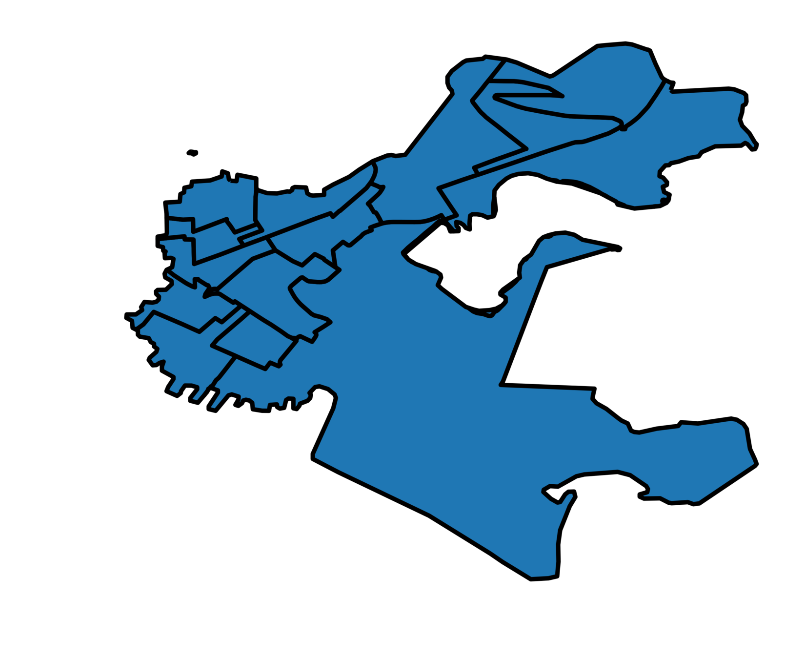
PENNSYLVANIA 113TH CONGRESS
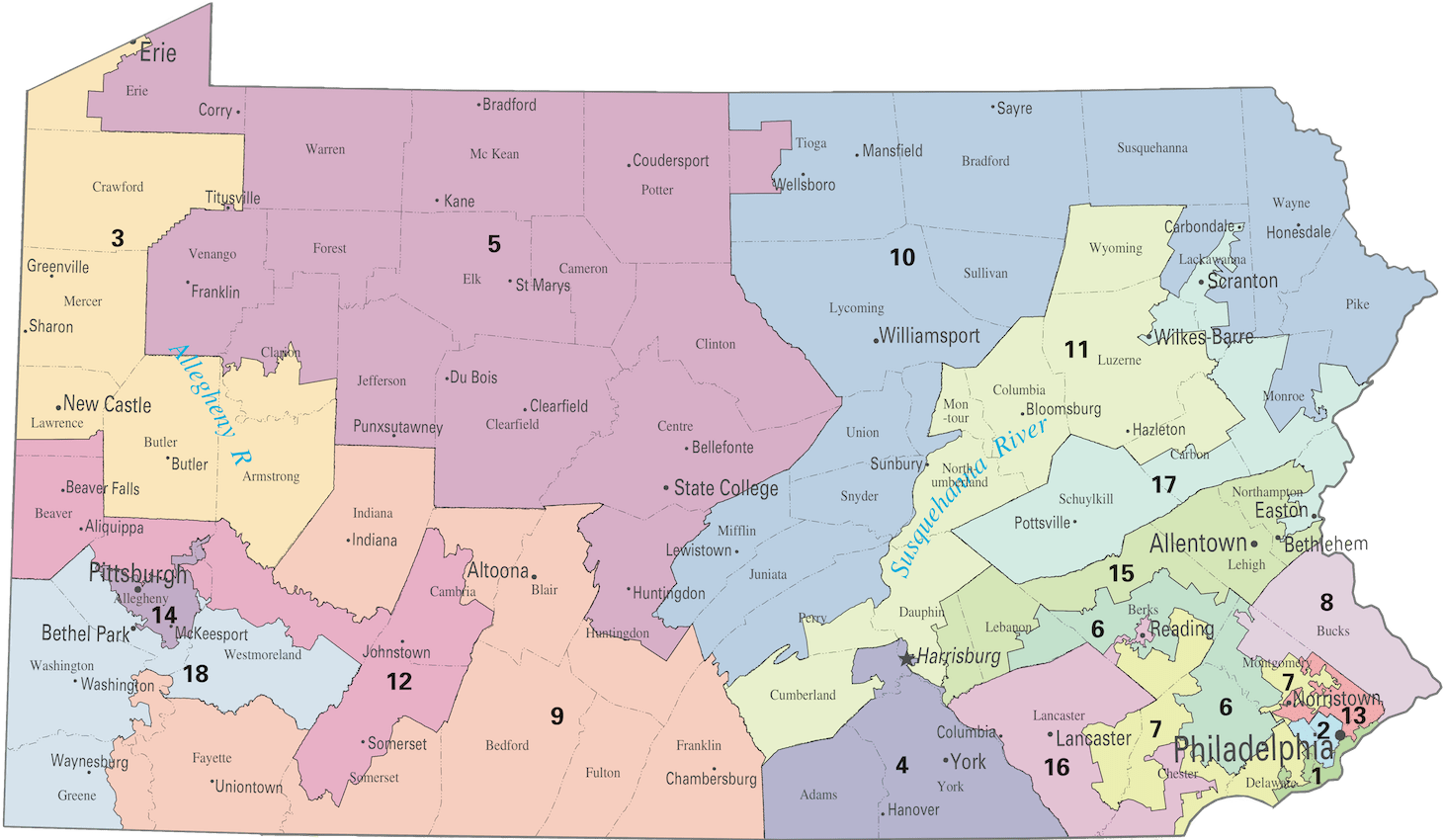
let's draw a districting plan.
constraint: Contiguity
Generally, all the precincts in a congressional district must touch each other.
(Exception: islands and the like)
constraint: equal population ("One person, One Vote')
The constitutional requirement in Art. I, § 2, that Representatives be chosen "by the People of the several States" means that, as nearly as is practicable, one person's vote in a congressional election is to be worth as much as another's.
– Wesberry v. Sanders (1964)
Text: Justia
constraint: Municipal boundaries
| State |
|---|
| County |
| City/Town |
| Precinct/Ward/VTD |
ATOMIC subunits
Voting districts (VTDs)
Wards
Precincts
(essentially synonymous)
See Wikipedia for more.
ATOMIC subunits
Data from MGGG, Data.gov, and Census.gov.
| State | Population | Subunits | Average subunit population |
|---|---|---|---|
| Utah | 2,764,056 | 2,123 | 1,301 |
| Wisconsin | 5,686,986 | 6,634 | 857 |
| Massachusetts | 6,728,170 | 2,151 | 3,128 |
| Pennsylvania | 12,684,929 | 8,921 | 1,422 |
| California | 37,254,523 | 17,582 | 2,119 |
There are typically ~1,500 people per subunit.
constraint: Compactness
...[Assembly districts are] to be bounded by county, precinct, town or ward lines, to consist of contiguous territory and be in as compact form as practicable.
– Wisconsin Constitution, Article IV § 4
Source: Wisconsin.gov
constraint: Compactness*
Adapted from King et al. 2018

more compact
less compact
constraint: Voting rights act
In some cases, a districting plan must contain one or more minority opportunity districts.
Source: Public Mapping Project
seems hard but doable.
what's all the fuss about?
Graphic courtesy MassMoments
gridlandia
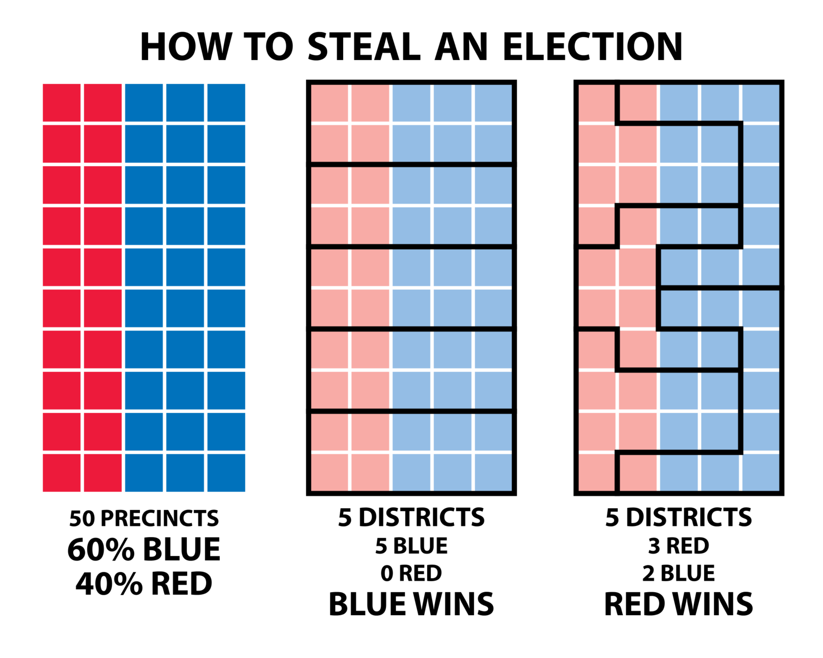
Graphic courtesy FairVote
Packing

Graphic courtesy FairVote
90% blue
100% blue
Cracking

Graphic courtesy FairVote
All districts 60% blue
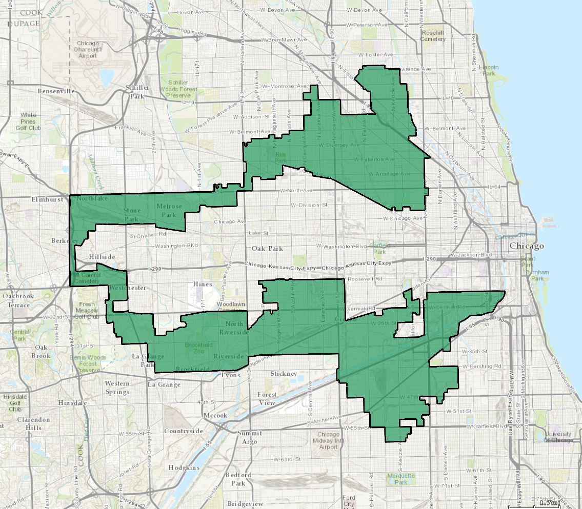
Graphic courtesy Wikipedia/NationalMap.gov
Racial gerrymandering
what's fair?
spoiler: nobody quite knows.
proportionality
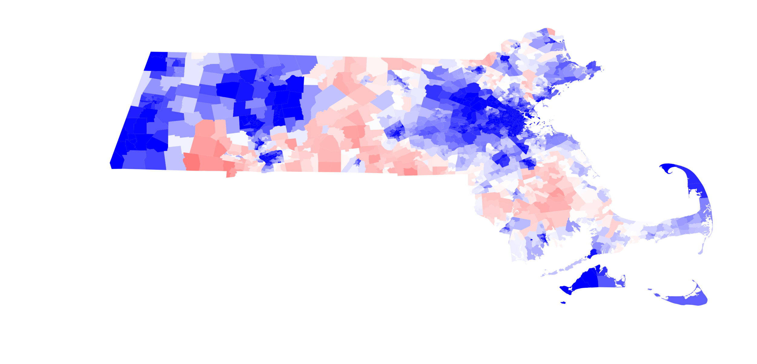
proportionality?
Republican candidates often receive between 30 and 40 percent of the two-way vote share in statewide elections in Massachusetts…For several of the elections studied here, there are more ways of building a valid districting plan than there are particles in the galaxy, and every one of them will produce a 9-0 Democratic delegation.
–"Locating the representational baseline" (Duchin et al. 2018)
The efficiency gap ("wasted votes')
| Party 1 | Party 2 | |
|---|---|---|
| District 1 | 55 | 45 |
| District 2 | 75 | 25 |
| District 3 | 35 | 65 |
| District 4 | 20 | 80 |
The efficiency gap ("wasted votes')
| Party A (Total) |
Party B (Total) |
Party A (Wasted) | Party B (Wasted) | |
|---|---|---|---|---|
| District 1 | 55 | 45 | 5 | 45 |
| District 2 | 75 | 25 | 25 | 25 |
| District 3 | 35 | 65 | 35 | 15 |
| District 4 | 20 | 80 | 20 | 30 |
| Total | 195 | 205 | 85 | 115 |
See Ballotpedia
Problems
Contextually dependent
Somewhat arbitrary
Normative
The courts on the efficiency gap
...sociological gobbledygook.
–John Roberts, Chief Justice of the United States
outlier detection
Inspired by MGGG (2018)
Partisanship

Combinatorics!
Problem: partition a set of subunits (smaller voting districts) into N congressional districts.
Stirling numbers of the second kind
Given a set with n elements, find the number of ways the set can be partitioned into k non-empty subsets.
See Wikipedia for more.
Stirling numbers of the second kind
Let's partition our 50-subunit grid into five districts.
See Wikipedia for more.
Stirling numbers of the second kind
Let's partition Massachusetts (2,151 precincts) into nine districts.
See Wikipedia for more.
(Of course, the overwhelming majority of these districting plans are invalid due to constraints. But still.)
we need to sample.
framing the problem
framing the problem: partitioning a graph

sampling districting plans
Data from MGGG, Data.gov, and Census.gov.
Problem: uniformly sample from the space of all possible valid districting plans.
Markov chain monte carlo
If we make a succession of random changes to a districting plan, we'll eventually have a large distribution of possible plans.
(We can impose constraints on these changes to ensure that all the plans in the distribution are valid.)
reinforcement learning
A.k.A. learning to do
My work: learning to gerrymander

my work: learning to gerrymander

my work: Data pipelines
MD:
  sources:
    vtd_map: https://dataverse.harvard.edu/api/access/datafiles/2288574
    demographics: https://www2.census.gov/.../md2010.pl.zip
    county_names: https://www2.census.gov/.../st24_md_cou.txt
    openelections:
      2008: https://raw.githubusercontent.com/.../20081104__md__general__precinct__raw.csv
      2010: https://raw.githubusercontent.com/.../20101102__md__general__precinct__raw.csv
      2012: https://raw.githubusercontent.com/.../20121106__md__general__precinct__raw.csv
      2014: https://raw.githubusercontent.com/.../20141104__md__general__precinct__raw.csv
    md_gov:
      2012: https://elections.maryland.gov/.../All_By_Precinct_2012_General.csv
      2016: https://elections.maryland.gov/.../All_By_Precinct_2016_General.csv
my work: elbridge
from random import random
from geopandas import read_file
from elbridge import Plan
from elbridge.strategies import stochastic_pop_coords

ma = read_file('MA_precincts_02_10/MA_precincts_02_10.shp')

plan = Plan(gdf=ma,
            n_districts=9,
            pop_col='POP2000',
            county_col='COUNTYFP10',
            city_col='City/Town')

while not plan.done:
    stochastic_pop_coords(plan, random() * 0.2, random() * 6.28)
what i'm (probably) working on this summer
Personal
Finishing up Elbridge
More reinforcement learning work
VRDI
Data, data, data!
GerryChain