Basics of GIS
Earth Sciences & Map Library Workshop Series
Phil White
Earth Sciences & Environment Librarian
Earth Sciences & Map Library Workshop Series
Workshop Agenda:
-
What are we doing here?
-
What is GIS & what can I do with it?
-
Data, Analysis, Viz, points between
-
-
Hands on time
-
Wrap up
GIS Basics
Earth Sciences & Map Library Workshop Series
GIS Basics
Download Workshop Data!
libguides.colorado.edu/GIS
Earth Sciences & Map Library Workshop Series
What is GIS?
GIS Basics
GIS is a tool for storing, organizing, manipulating, analyzing, and visualizing data.
Earth Sciences & Map Library Workshop Series
GIS Basics
Not just any data...
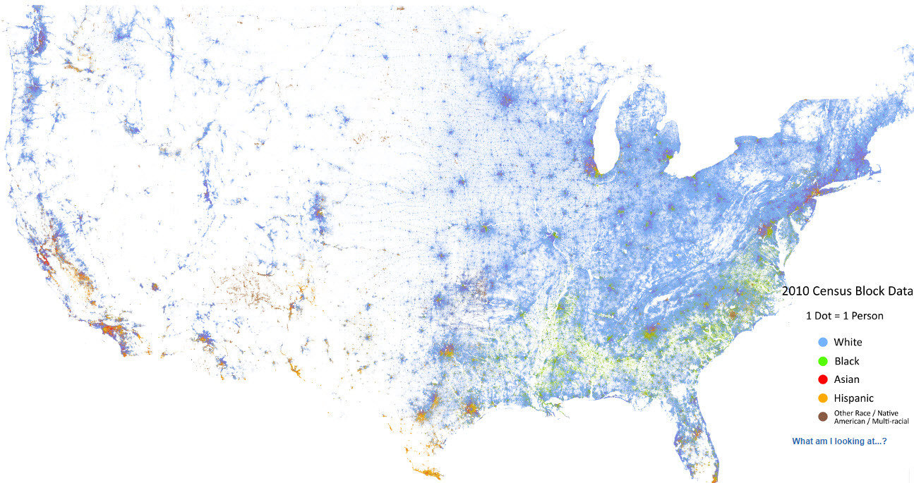
Spatial Data!
Earth Sciences & Map Library Workshop Series
GIS Basics
5 Things:
Points
Lines
Polygons
Cells
Associated Attributes
Earth Sciences & Map Library Workshop Series
GIS Basics
Cells (AKA Raster Data)
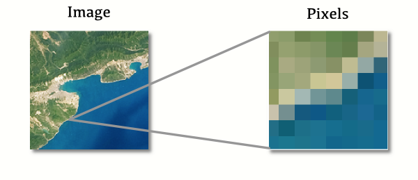
Earth Sciences & Map Library Workshop Series
GIS Basics

More than just cells...
Attributes!
DEM
(Digital Elevation Model)
White Cell = 2402.89 m
Black Cell = 1735.06 m
Earth Sciences & Map Library Workshop Series
GIS Basics
Raster Formats
- Usually geoTIFF
- Also ArcGRID, jpeg2000
Earth Sciences & Map Library Workshop Series
GIS Basics
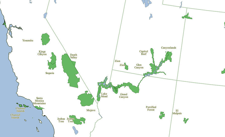
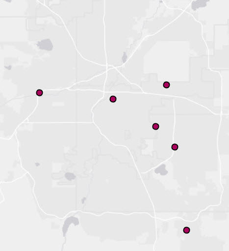
Points, Lines, Polygons (AKA Vector Data)
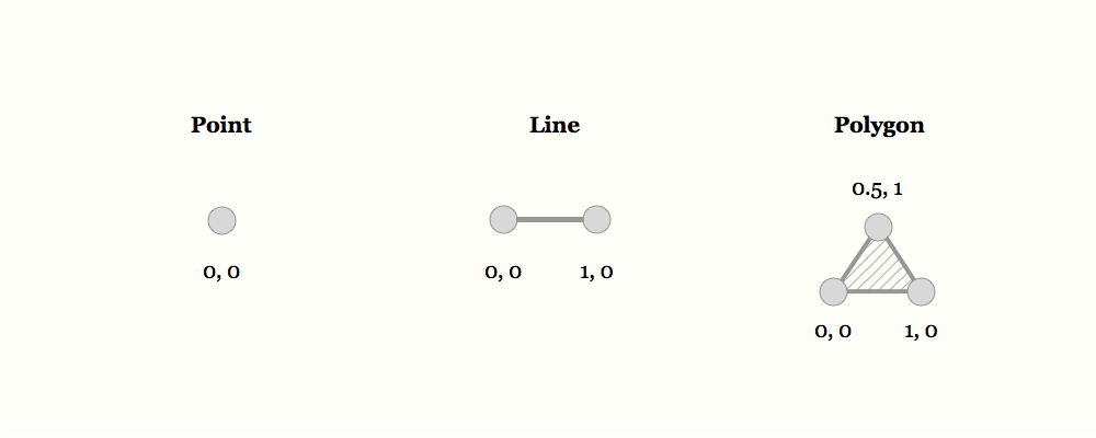
Earth Sciences & Map Library Workshop Series
GIS Basics
Earth Sciences & Map Library Workshop Series
GIS Basics
Earth Sciences & Map Library Workshop Series
GIS Basics
Earth Sciences & Map Library Workshop Series
GIS Basics
Attributes
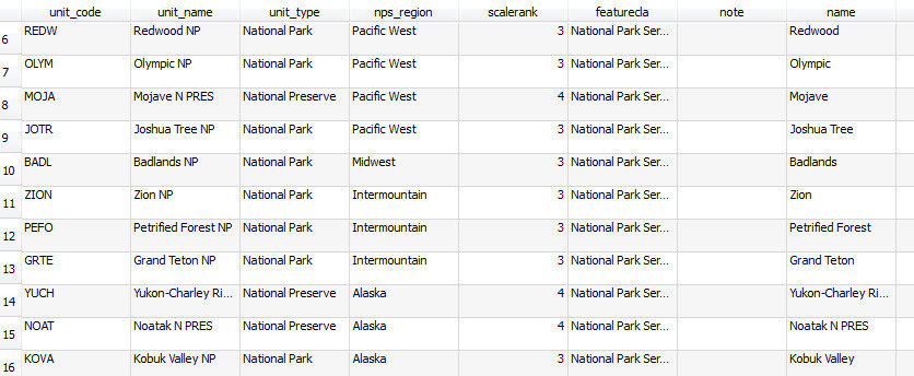
Earth Sciences & Map Library Workshop Series
GIS Basics
Vector Formats:
- Usually shapefile (.shp)
Also:
- Geodatabase (.gdb)
- kml/kmz
- Spatialite (SQL)
- GeoJson
Earth Sciences & Map Library Workshop Series
GIS Basics
When adding data to a GIS, we often refer to them as "layers."
Earth Sciences & Map Library Workshop Series
GIS Basics
Putting stuff on a map is more complicated than it seems.
Earth Sciences & Map Library Workshop Series
GIS Basics
Earth Sciences & Map Library Workshop Series
GIS Basics
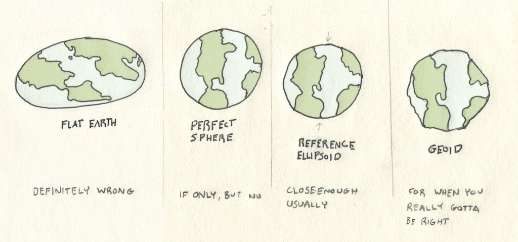
Because Earth's shape is irregular and changing, assigning locations is imperfect.
We use imaginary reference systems to approximate.
We tend to call this a "datum."
Earth Sciences & Map Library Workshop Series
GIS Basics
Earth Sciences & Map Library Workshop Series
GIS Basics
Common Datums: NAD83, WGS84
In GIS, we often use the term
"datum,"
"coordinate reference system,"
and
"geographic coordinate system" interchangeably
Latitude
Longitude
X
Y
Earth Sciences & Map Library Workshop Series
GIS Basics
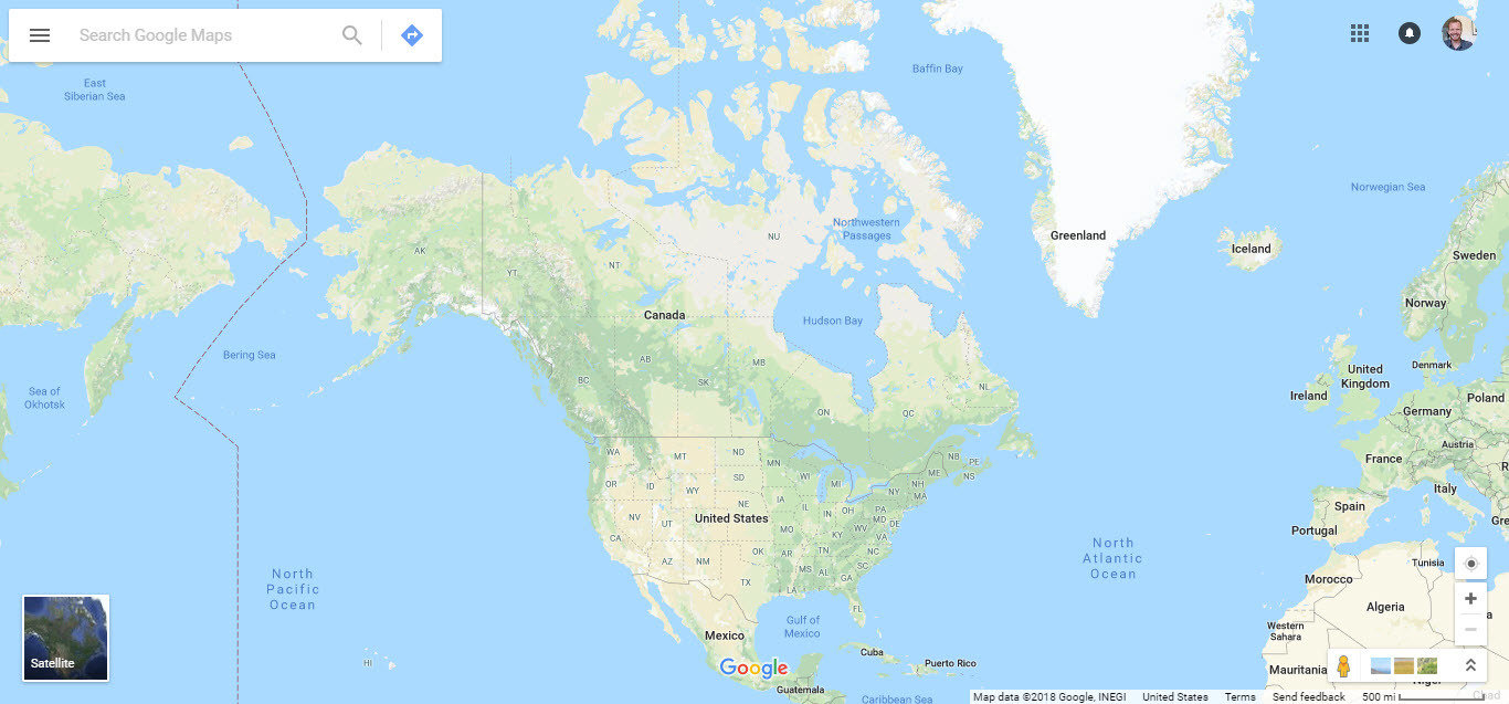
GIS data usually has a coordinate system built right into it.
GIS software will take that information and place your data at the right spot automatically...
...usually.
Earth Sciences & Map Library Workshop Series
GIS Basics
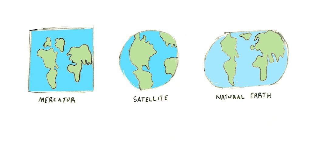
Projections
Earth Sciences & Map Library Workshop Series
GIS Basics
Distortion...
...is inherent to map projections.
Shape, Area, Distance, & Direction
Earth Sciences & Map Library Workshop Series
GIS Basics
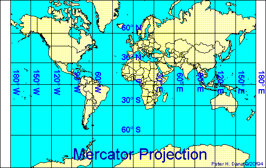
Mercator
Good for direction
Bad for Shape
(Hello Greenland!)
Earth Sciences & Map Library Workshop Series
GIS Basics
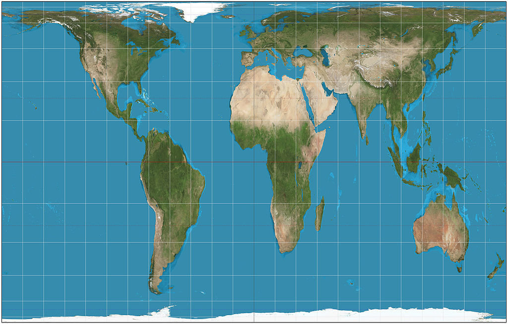
Gall-Peters
Earth Sciences & Map Library Workshop Series
GIS Basics
Scale
Large Scale
Small Scale
1:75,000,000
1:25,000
Earth Sciences & Map Library Workshop Series
GIS Basics
Enough blathering!
How do I use GIS?
Earth Sciences & Map Library Workshop Series
GIS Basics
Take some data....
...do some stuff to it...
...communicate new info.
Earth Sciences & Map Library Workshop Series
GIS Basics
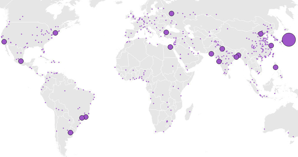
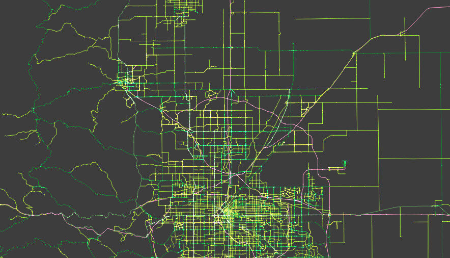
Stuff we do:
Symbolize
Aggregate
Interpolate
Overlay
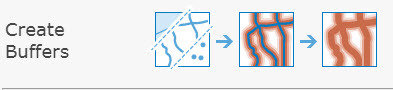
Measure
Earth Sciences & Map Library Workshop Series
GIS Basics
Geocode
Georeference
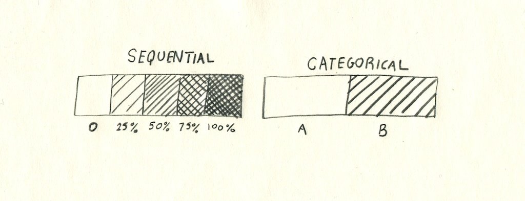
Symbolization
Earth Sciences & Map Library Workshop Series
GIS Basics
Earth Sciences & Map Library Workshop Series
GIS Basics
Earth Sciences & Map Library Workshop Series
GIS Basics
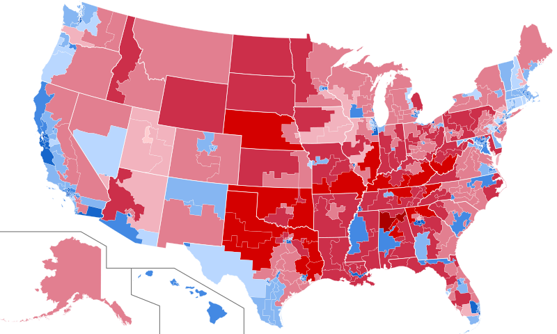
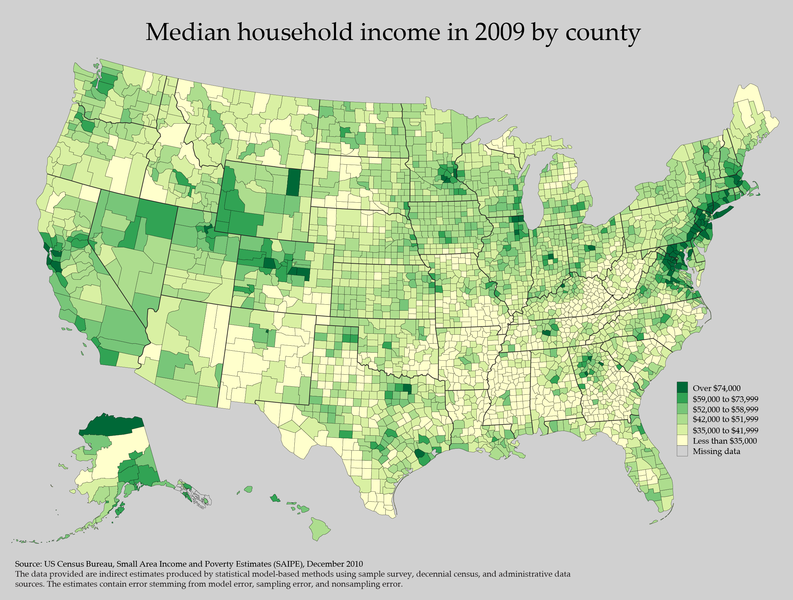
Those are called "Choropleth Maps."
Earth Sciences & Map Library Workshop Series
GIS Basics
Earth Sciences & Map Library Workshop Series
GIS Basics
Overlay
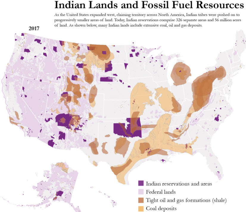
Jordan Wirfs-Brock
Earth Sciences & Map Library Workshop Series
GIS Basics
Overlay
Earth Sciences & Map Library Workshop Series
GIS Basics
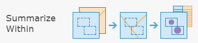
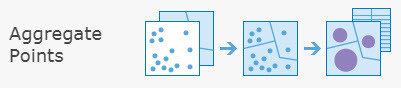
Aggregate
Earth Sciences & Map Library Workshop Series
GIS Basics
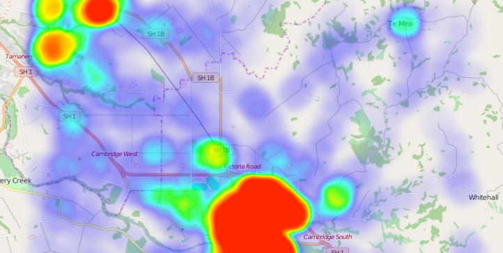
Interpolate
Earth Sciences & Map Library Workshop Series
GIS Basics
Measuring
Earth Sciences & Map Library Workshop Series
GIS Basics
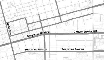
Georeference
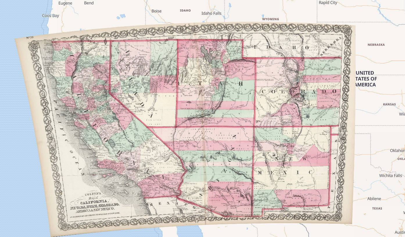
Earth Sciences & Map Library Workshop Series
GIS Basics
Geocoding
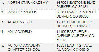
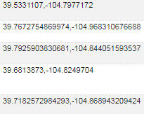
Earth Sciences & Map Library Workshop Series
GIS Basics
Now, seriously! Enough blathering!
Earth Sciences & Map Library Workshop Series
Intro to ArcMap
Resources available to you:
-
libguides.colorado.edu/GIS
-
ArcGIS Online
-
Esri software via CU site license
-
Esri Training Catalog
-
More workshops
-
Esri student licenses
-
Coursework in Geography, Geological Sciences
Earth Sciences & Map Library Workshop Series
GIS Basics