OpenLayers

Angular Basel Meetup
April 11, 2018
Agenda
- Geographical Information Systems (GIS) in general
- Open Layers: Introduction and basic concepts
- Practical example
- OpenLayers and Angular (discussion)
About me
- Full Stack Developer (Symfony, Drupal) @ IWF Web Solutions
- New to Angular
- Background in Forestry (hence some GIS knowledge)
GIS
Geographical Information Systems
GIS <---> Map
Database <---> Report
Projections
- WGS84: EPSG:4326
-
Google Earth, OSM: Geographic coordinate system with the wgs84 datum. (EPSG: 4326)
-
Google Maps, OSM tiles, WMS: projected coordinate system that is based on the wgs84 datum. (EPSG 3857)
- Projections map a point in the map coordinate system to the real world position
- Trickier than it sounds, but can be expressed mathematically by the datum (a set of parameters)
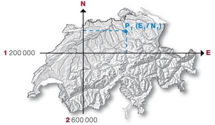
Swiss Coordinate system
- Unit meters
- can never confuse East/North (shifted)
- LV03 (CH1903)
- LV95 (CH1903+)
- new standard
- added 2Mio to Y, 1Mio to X coordinate
- + a slight correction of projection
Layers
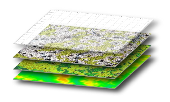
- A (composable) part of a map containing features
- topic-oriented
- corresponds to a table containing elements of a given entity
Webservices (OGC)
- WMS
- WMTS
- WFS
Raster Data
- each pixel has value(s)
- corresponds to a search index
- multi-resolution formats exist
Vector Data
- point
- polyline / linestring
- polygon
- usually linked to attribute data
Spatial Queries
- Distance(geometry, geometry) : number
- Equals(geometry, geometry) : boolean
- Disjoint(geometry, geometry) : boolean
- Intersects(geometry, geometry) : boolean
- Touches(geometry, geometry) : boolean
- Crosses(geometry, geometry) : boolean
- Overlaps(geometry, geometry) : boolean
- Contains(geometry, geometry) : boolean
- Length(geometry) : number
- Area(geometry) : number
- Centroid(geometry) : geometry
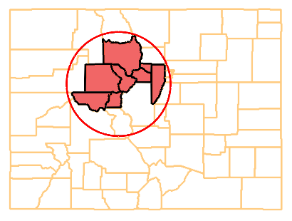
- spatial queries are computationally expensive
- use libraries such as GDAL or database extensions
GIS Databases and formats
- distiction between geodata and attribute data
- Web: usually GeoJSON
- traditional:
- ESRI Shapefile
- ESRI Geodatabase
- ... lots of proprietary legacy
GIS Programs
- Desktop/Workstation software (for analysis)
- ESRI ArcGIS
- QGIS (open source)
- Server
- ESRI products
- MapServer (open source)
- GeoServer (open source)
GIS Ecosystem
"Base Maps"
API vendors
(google, mapbox, etc)
topic raster data
topic vector data
interactive maps/applications
apps, platforms,
resellers
analysts, engineering consultants
consumers
value added
government
spatial analysis
static (topical) maps
transactional data (e.g. logistics)
WMS, WMTS
REST
WFS
attribute data from RDBMS
Desktop GIS Client
Browser Client
value added
Public Swiss Maps
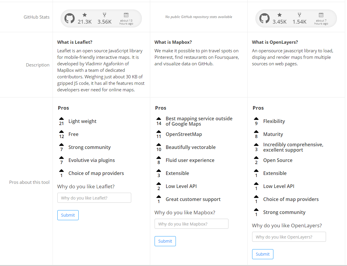
Open Layers: Competitors
Basic Concepts in Open Layers
- Map
- View
- Source
- Layer
Open Layers
<canvas>
View
Map
[Layer]


[Source]
Map
- The top level object where all other functionality is registered. Bound to a DOM element
View
- A "window" over all layers
- Controls Zoom, Extent, Center
- Maps Pixel coordinates to projected Map coordinates
Layer
- Contains a surface (raster) or features (vector) and knows how (and where) to draw them
Source
- Datasource
- "Store"
- reactive, triggers rendering when mutated
Practical Examples / Experiences
Demo Time
Form Widget
- Project at IWF Web solutions
- unfortunately not yet presentation ready
- enhanced usability:
- choosing from a (large) set of predefined points
- sync between select2 dropdown and a map chooser

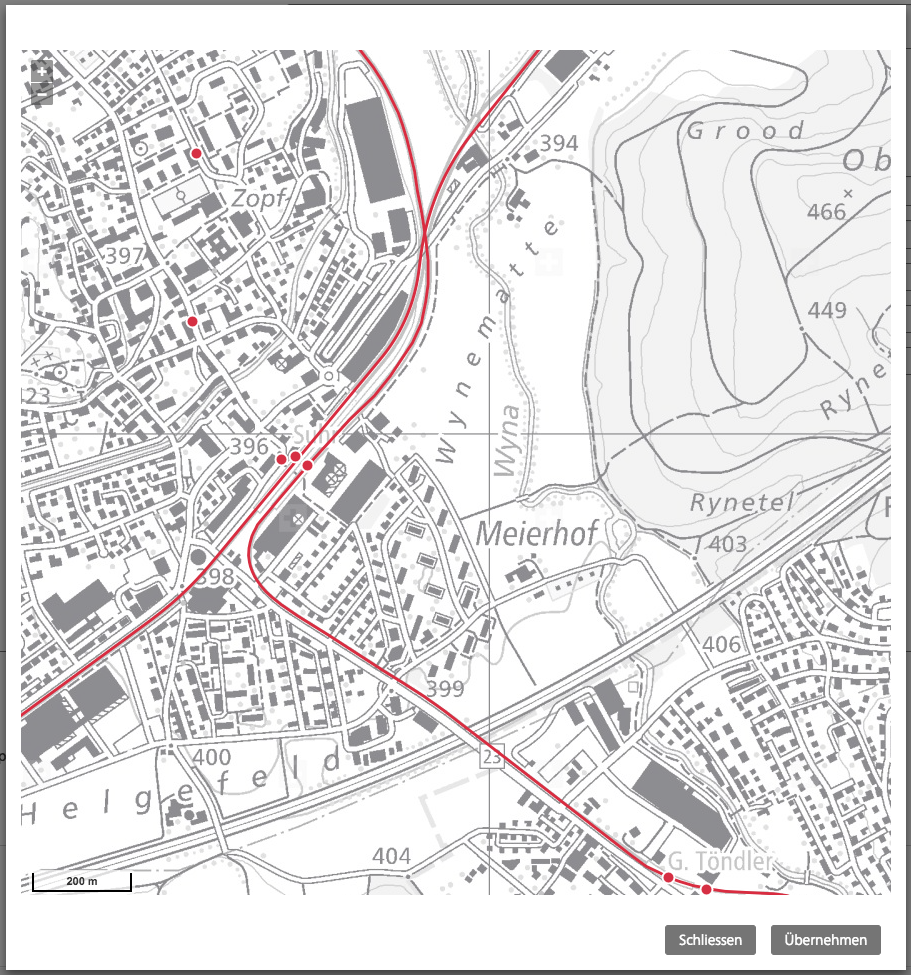
"Selection Layer" pattern
- The feature itself is immutable, no manipulation of geodata or attribute data
- State (e.g. Hover, Selection) is represented by the containing layer
- e.g. to select a point, we move it to another layer (or more specifically, the attached store)
Images as you know them
- WMTS / WMS tile data are just normal images from a browser / webserver perspective. You can watch the requests on the network inspector.
- Formats behave as you would expect them to: JPEG is smaller in Filesize, PNG allows for Transparency
OpenLayers and Angular
OL's own (reactive) stores
OL has its own (performant) reactive architecture. Trying to modify this might be hard, it is better treat it as a completely independent node
Typescript "boilerplate"
- when did working with JSON get so cumbersome?
Libraries
- No "ultimate package" you need to be aware of
- lots of angular 1 stuff
- Cool example app:
- https://github.com/mpoelstra/Angular-OpenLayers-NL