From Pixels to Points
Digitizing Spatial Data
where is your data? gis.stanford.edu
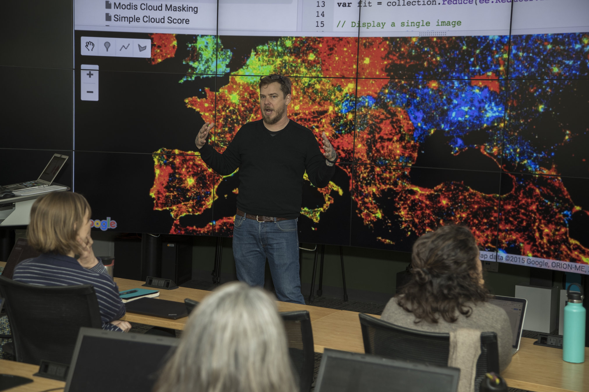
about me

gis.stanford.edu
Modeling the World


Data Models

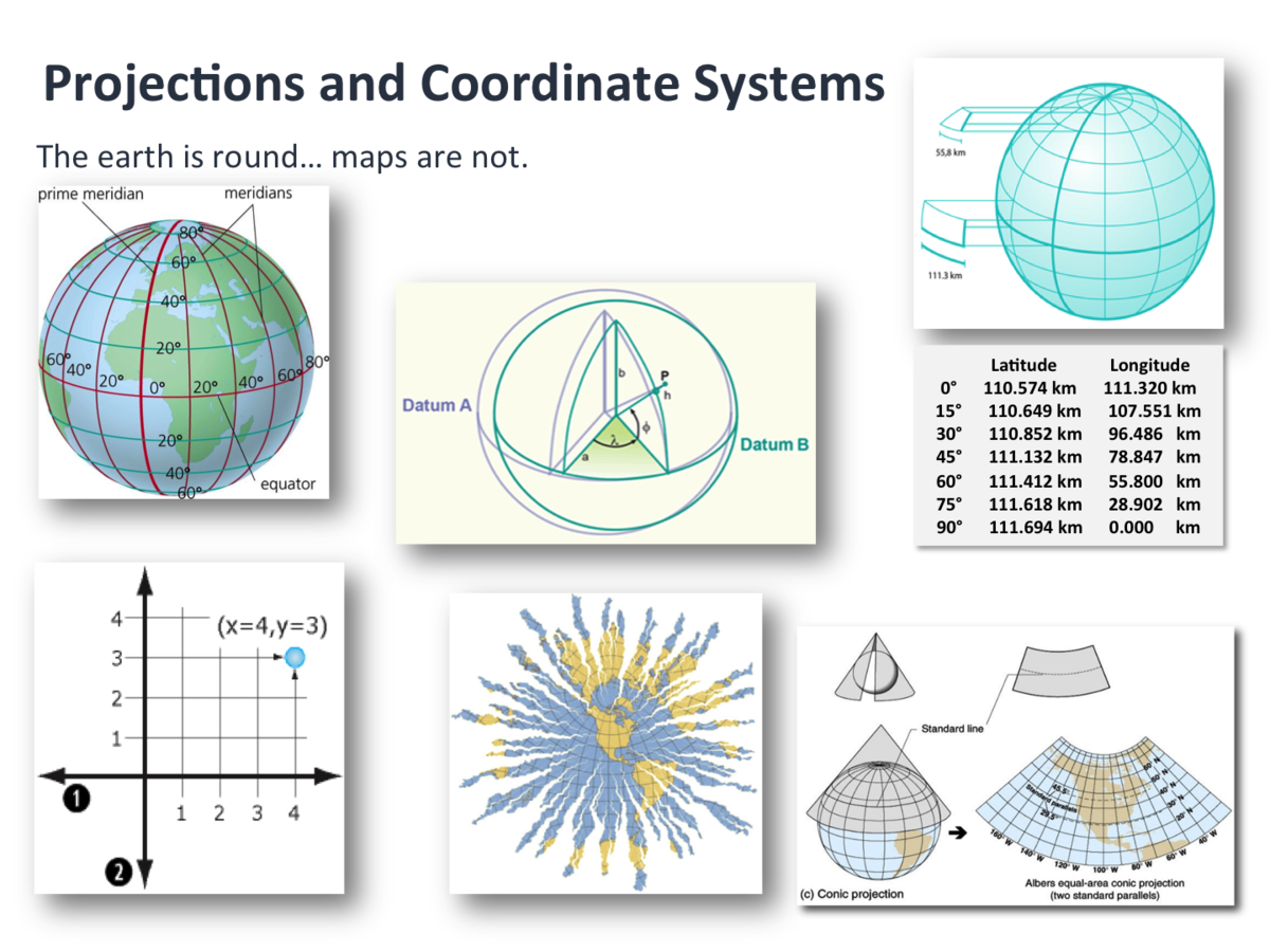
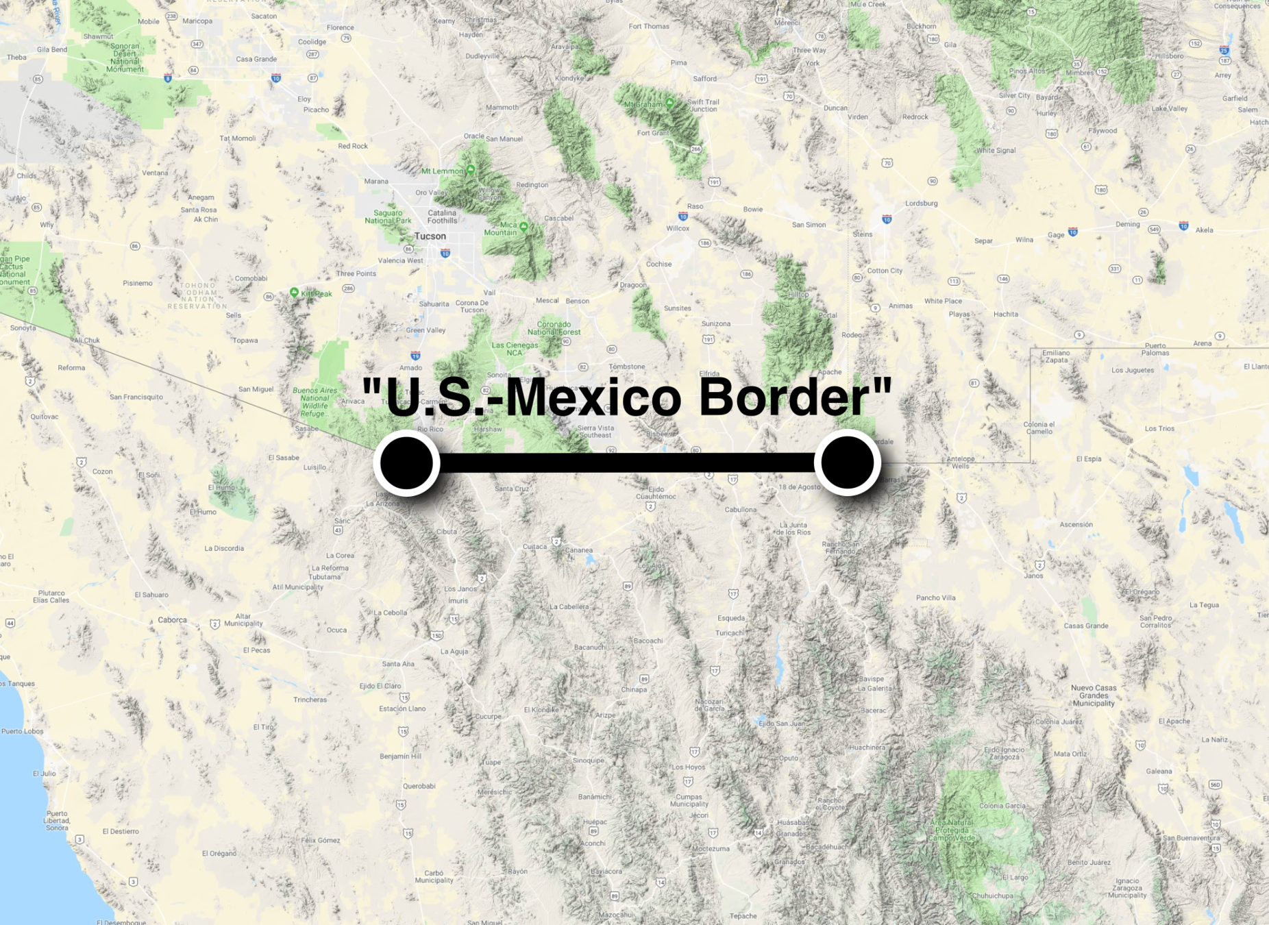
Everything is somewhere, but how do we say where?
Coordinate Systems
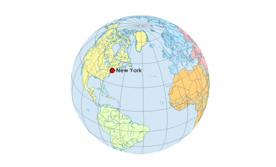
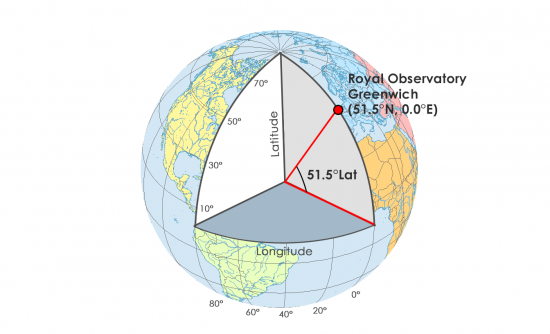
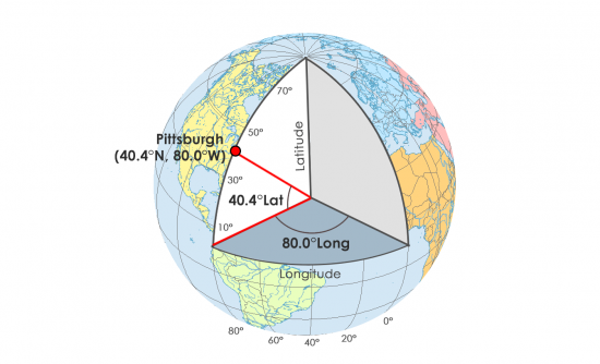
Geographic Coordinates

Projections
Think of them as translations from 3d to 2d

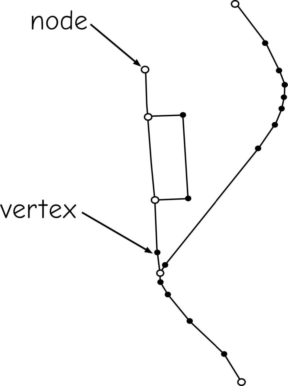
Vector Data


Vector Formats
Shapefiles*
*(a shapefile isn't really a file)
- *.shp
- *.shx
- *.dbf
- *.prj
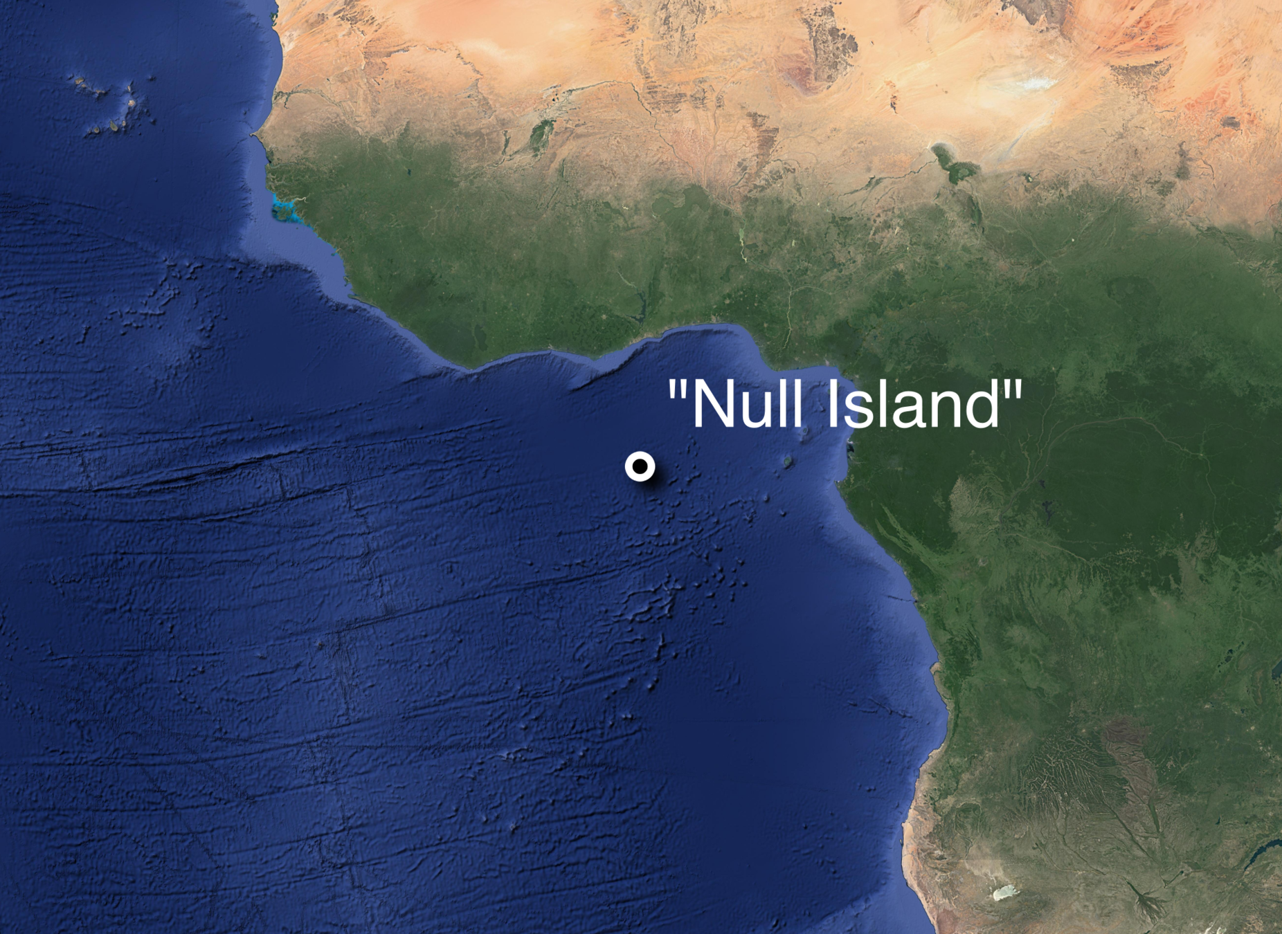
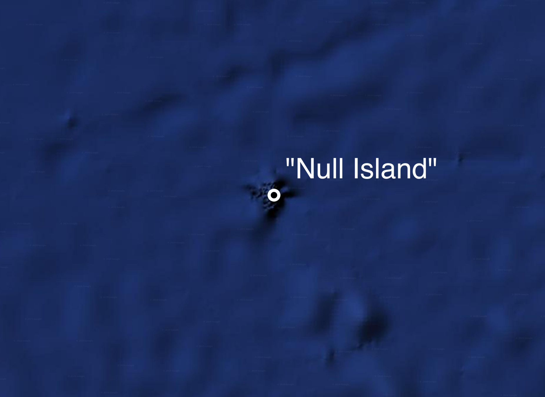
GeoJSON
{
  "type": "FeatureCollection",
  "features": [
    {
      "type": "Feature",
      "properties": {
        "Label": "\"Null Island\""
      },
      "geometry": {
        "type": "Point",
        "coordinates": [
          0,
          0
        ]
      }
},Hardcopy Sources
https://slides.com/staceymaples/digitizingbootcamp
"Heads-down" Digitization
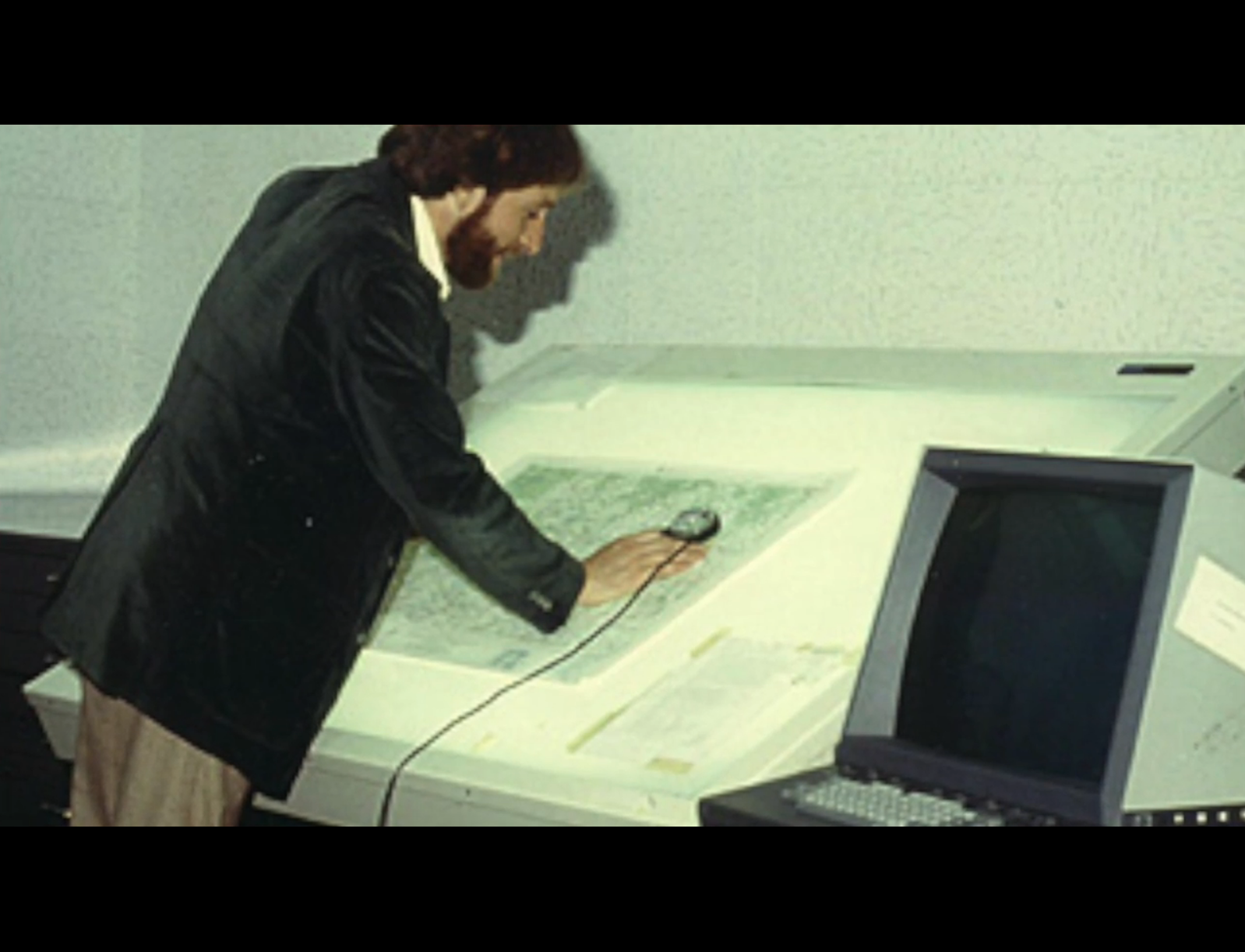
On-Screen/Head's Down Digitization
"Heads-up" Digitization

Digitization
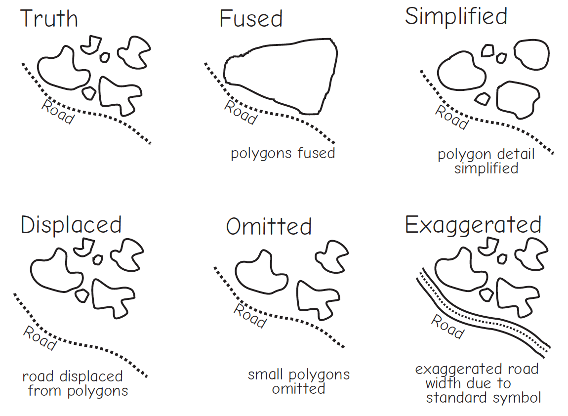
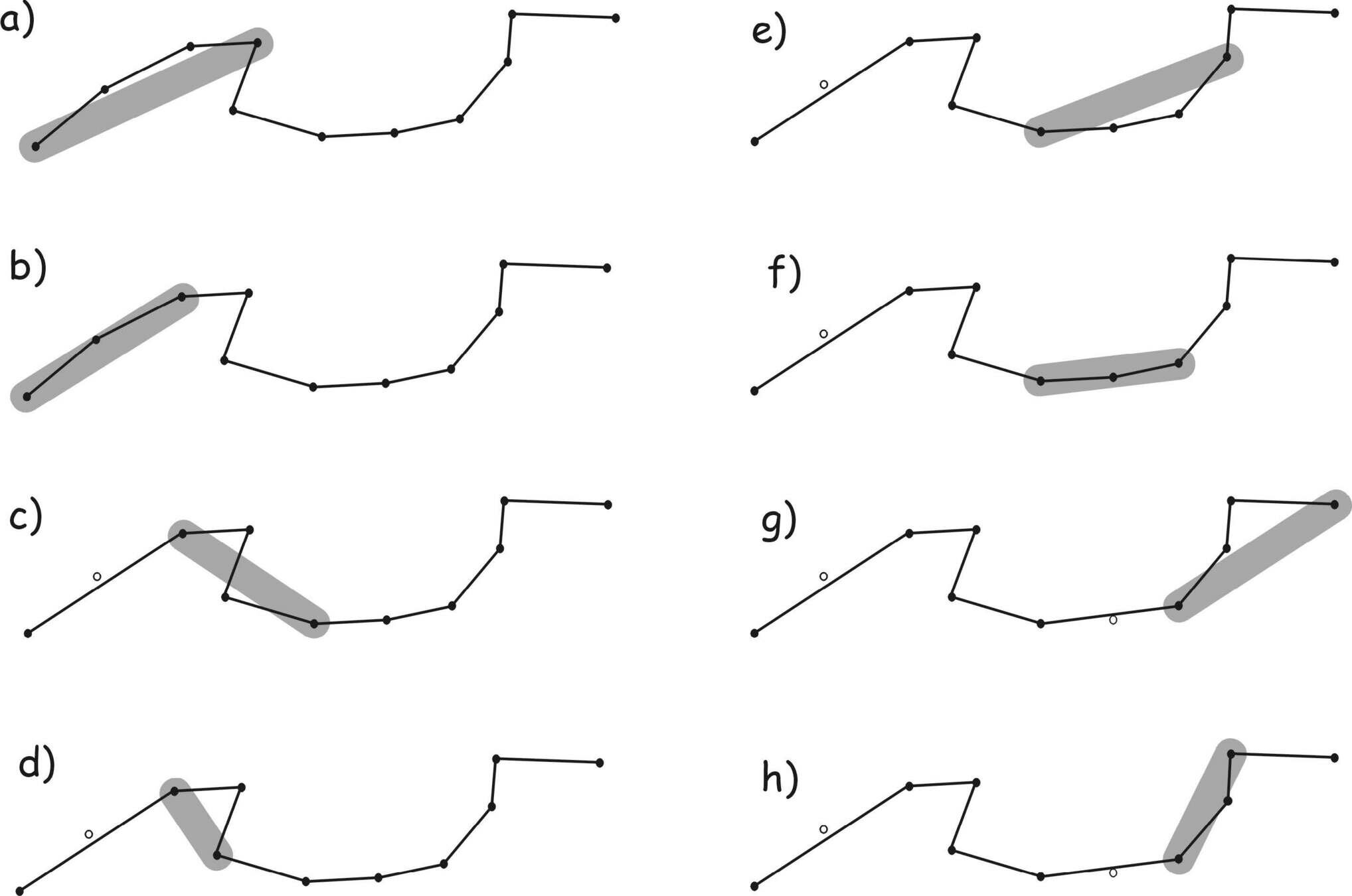
Feature Generalization
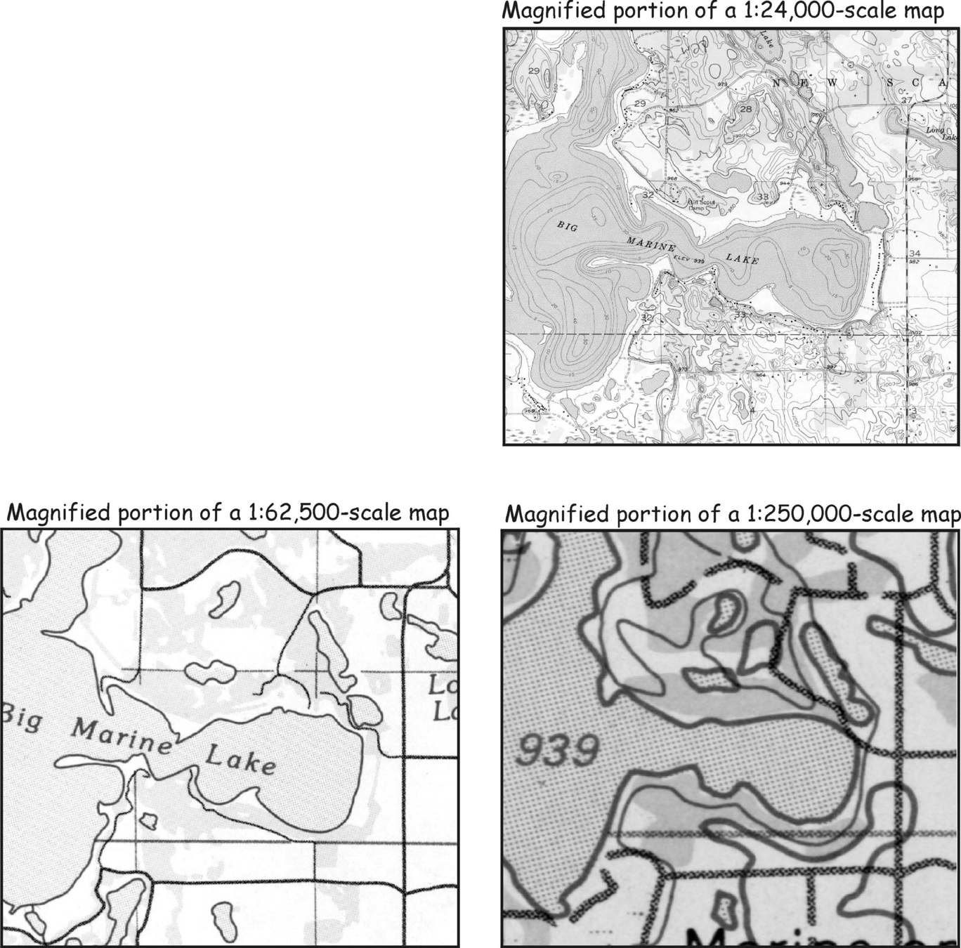
How long is the coast of Britain?


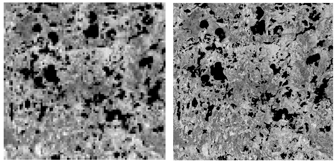
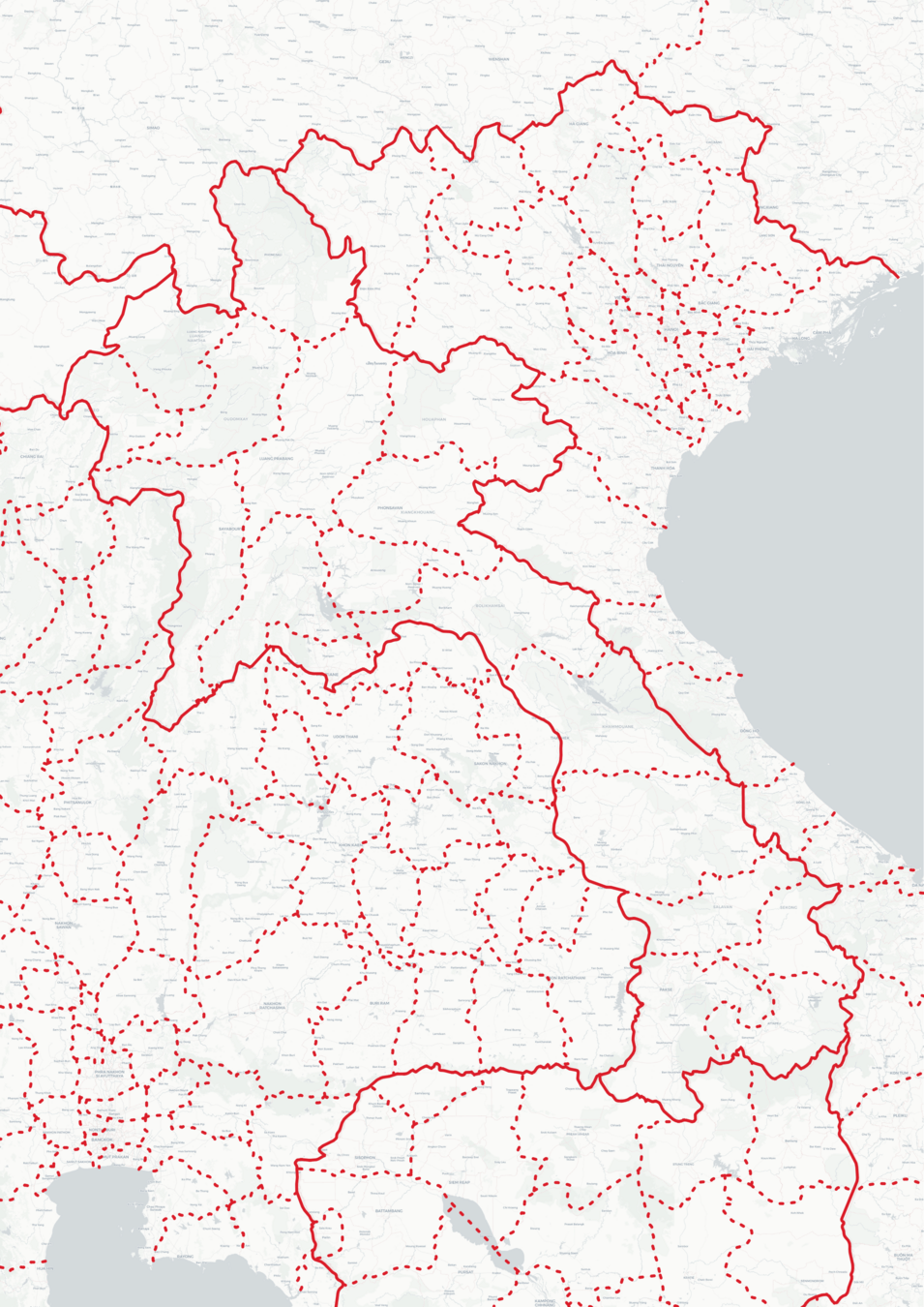
Errors
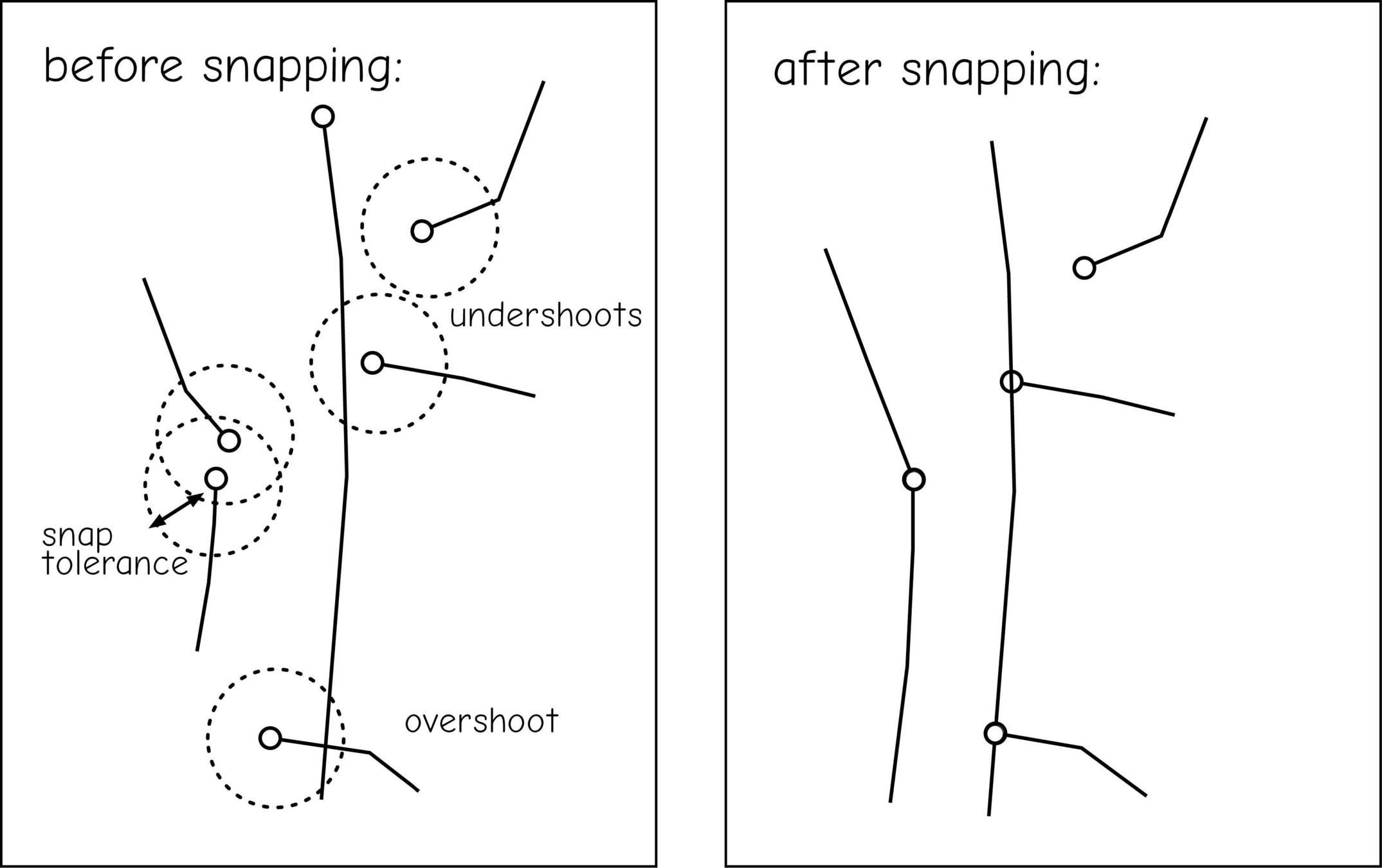
Undershoots & Overshoots
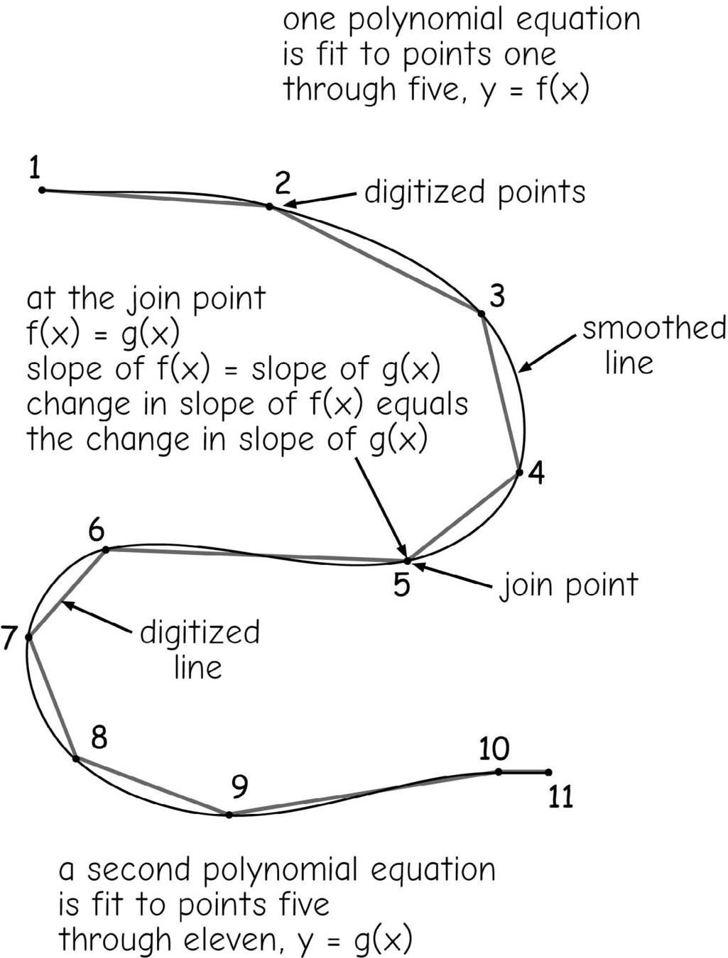
Reshaping
(smoothing & thinning)
Error Across Layers
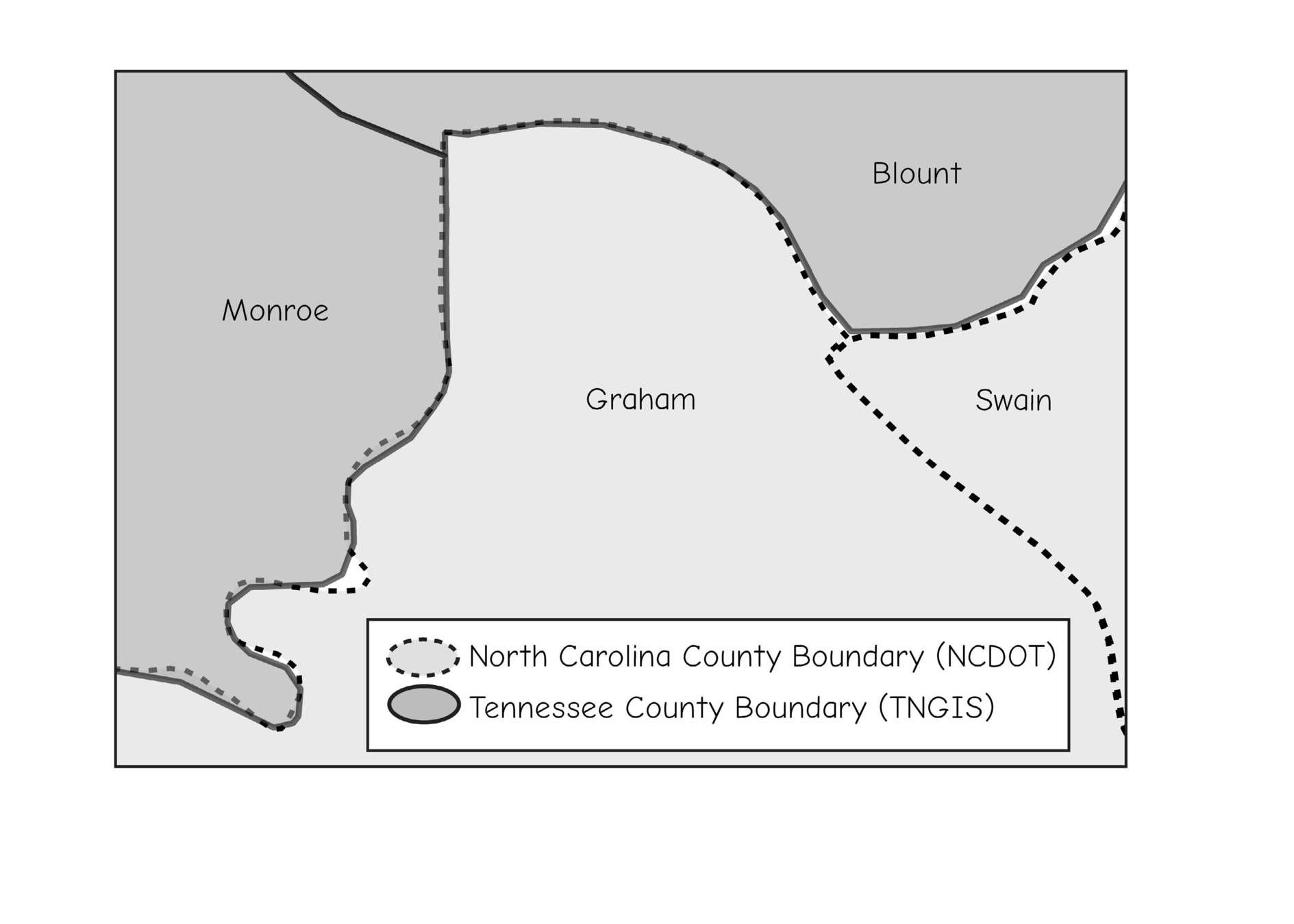
Error Across Layers
OK, now... how webmaps work

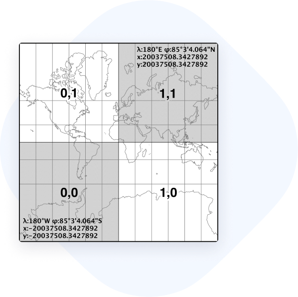
web mercator

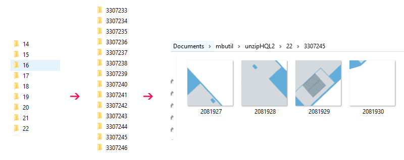
https://allmaps.xyz/images/45bbc7ea6e45e5c9/{z}/{x}/{y}.png
https://allmaps.xyz/images/45bbc7ea6e45e5c9/{z}/{x}/{y}.png
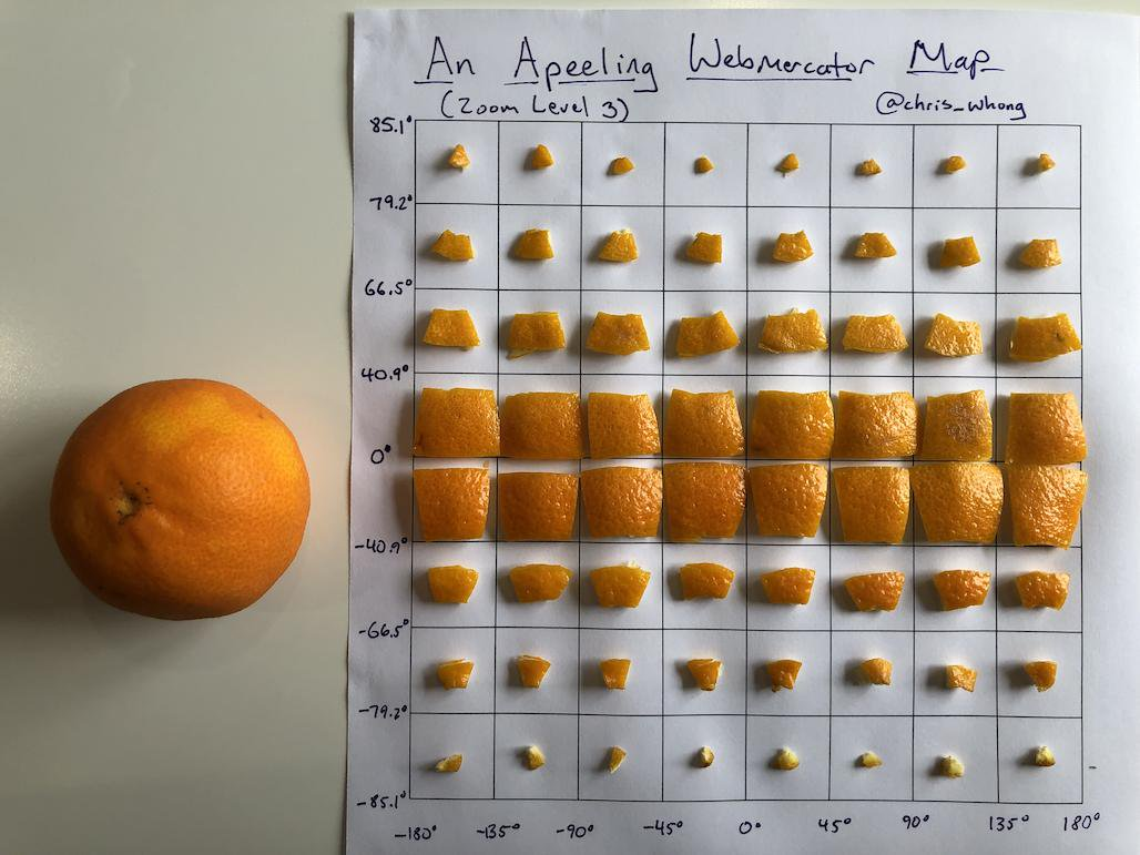
Credit: @chris_whong