Earthsys 144: Fundamentals of GIScience
GNSS/GPS and Data Collection
where is your data? gis.stanford.edu
What is GNSS/GPS?


The military satellite navigation system called the Global Positioning System (GPS)/NAVSTAR, developed in the 1970s under the direction of Bradford W. Parkinson, Stanford professor of aeronautics and astronautics, and an U.S. Air Force colonel at the time.

NAVSTAR "GPS"
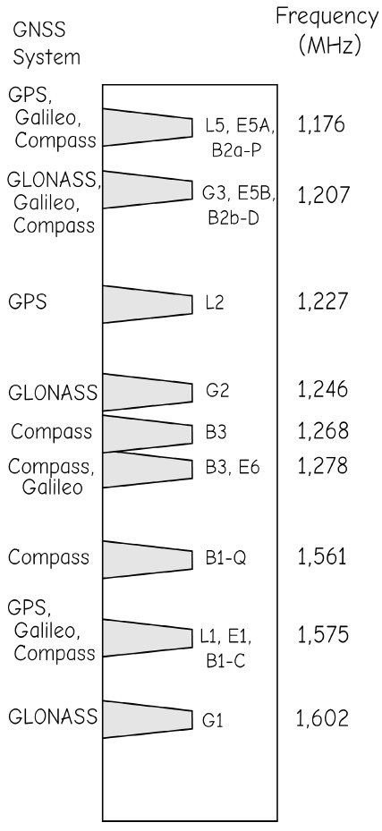
GLONASS
Beidou
Galileo
Quasi-Zenith Satellite System (QZSS)
Indian Regional Navigation Satellite System (IRNSS)
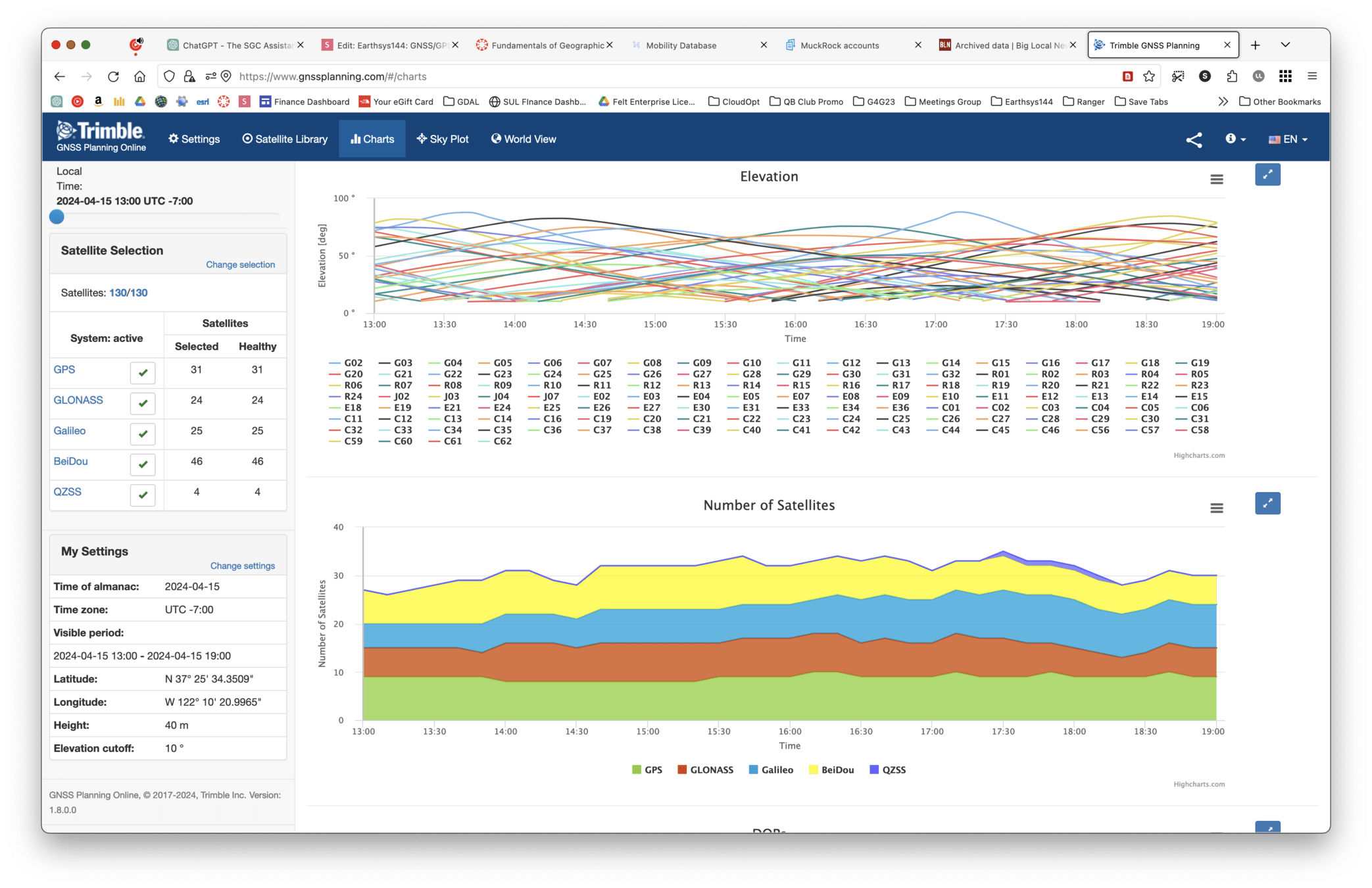
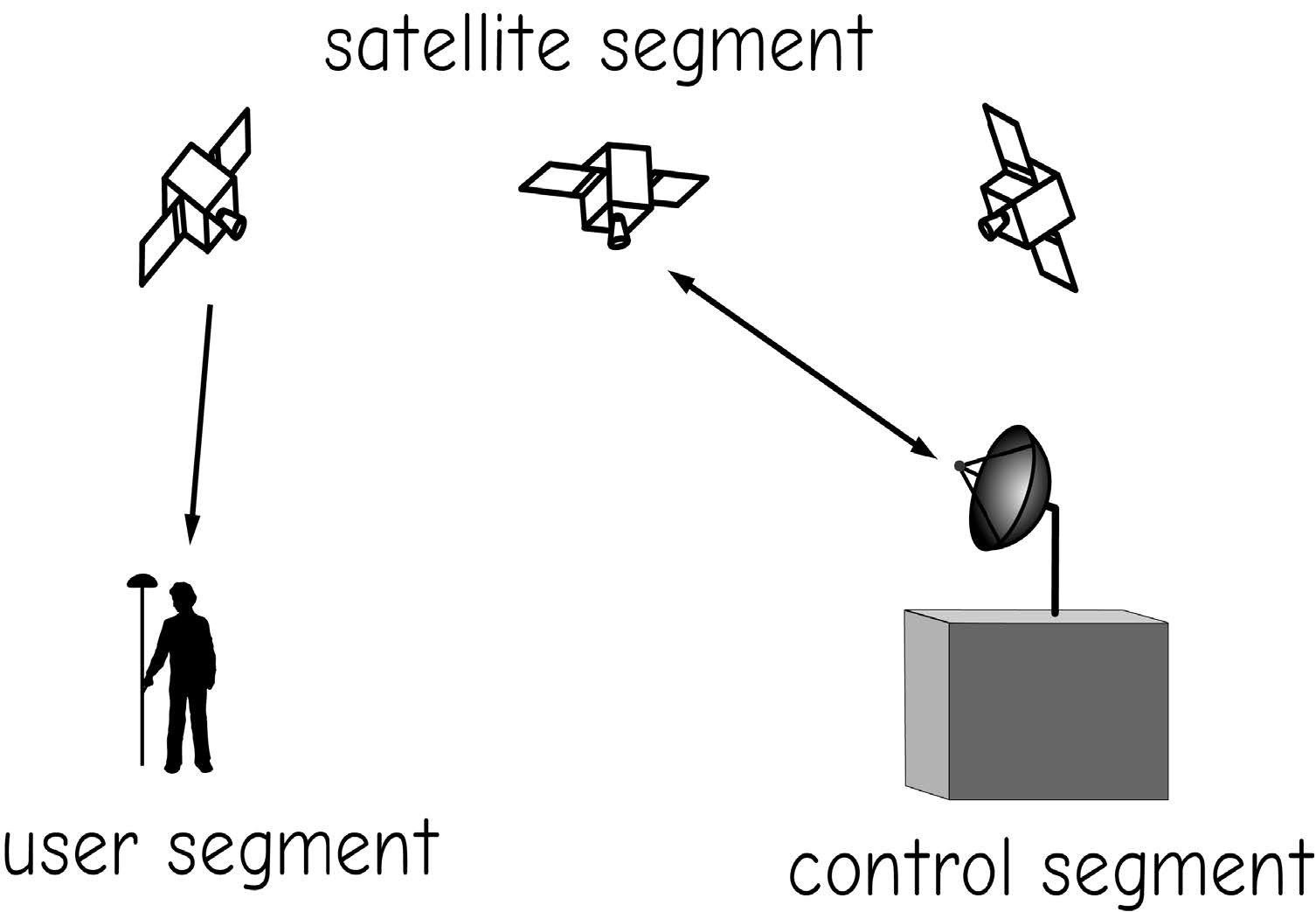
The Global Navigation Satellite System (GNSS) has 3 main components
- Receiver (User)
- Satellite Constellation
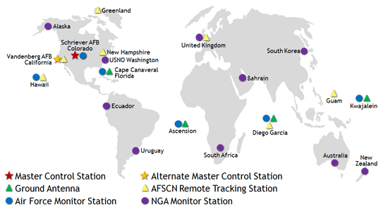
- Ground Stations (Control)

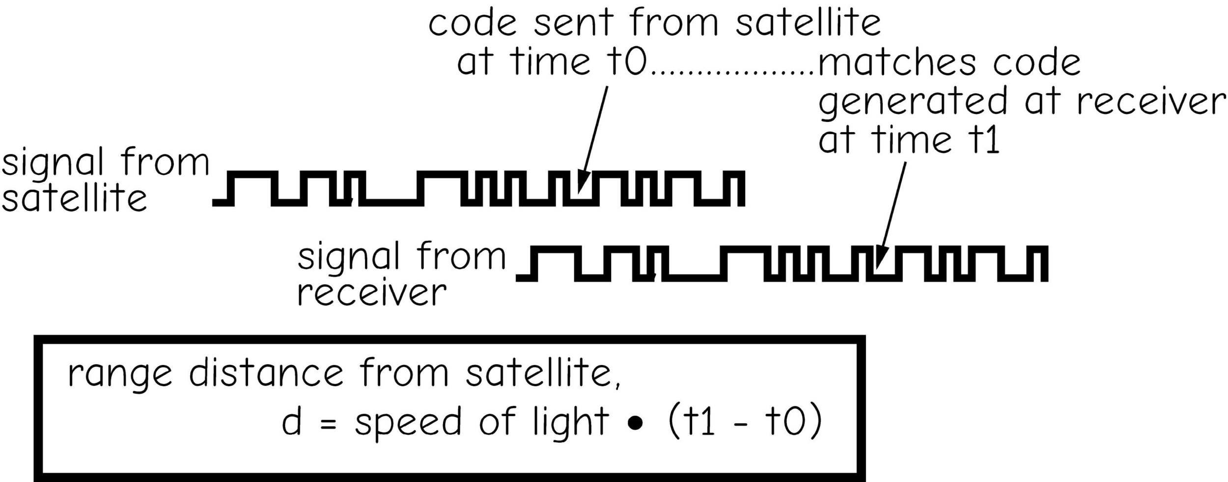
GNSS is based upon time converted into distance
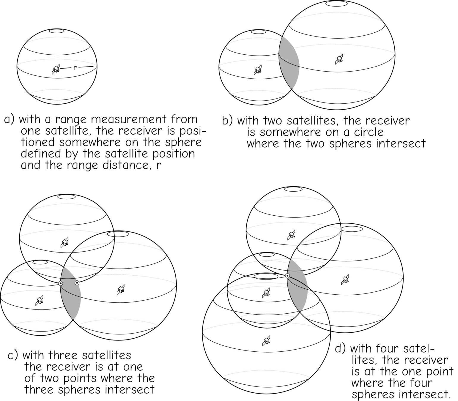
Trilateration
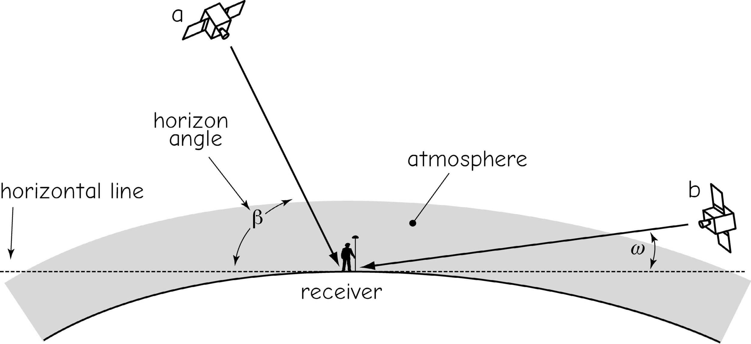
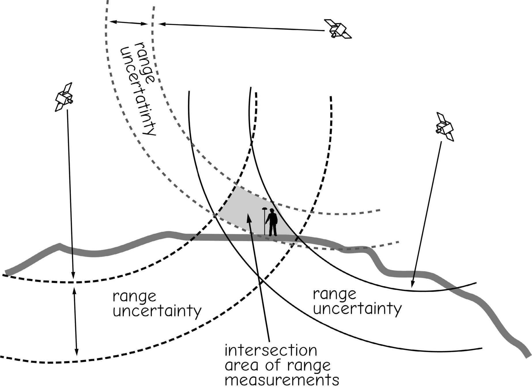
Sources of Error
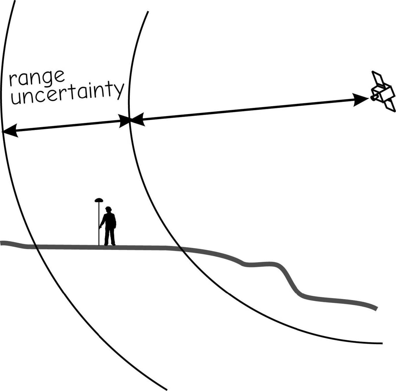
signal delays/range uncertainty
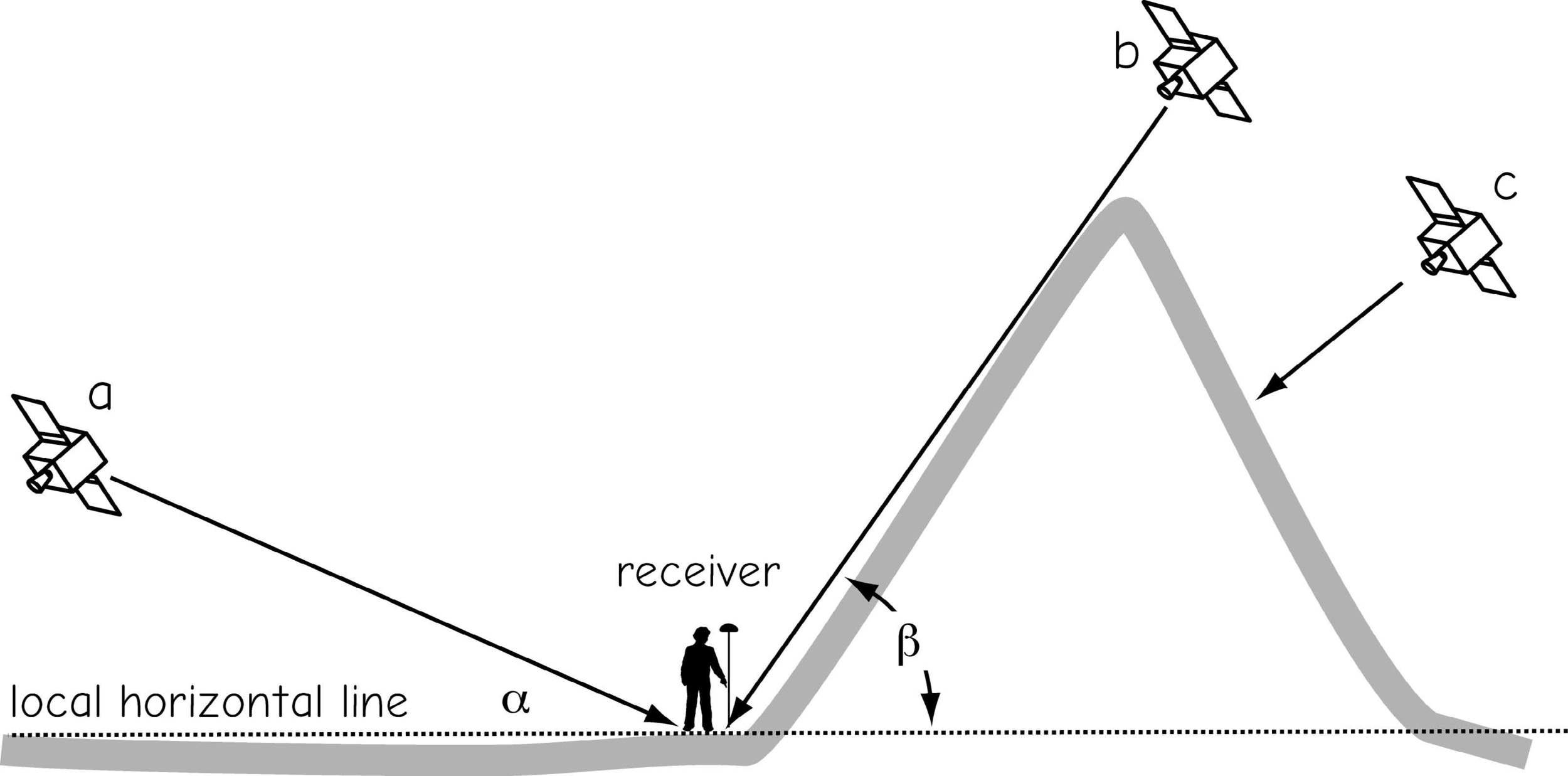
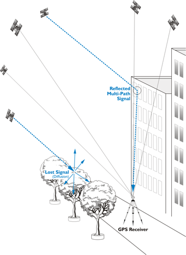
Multipathing
constellation geometry
constellation geometry
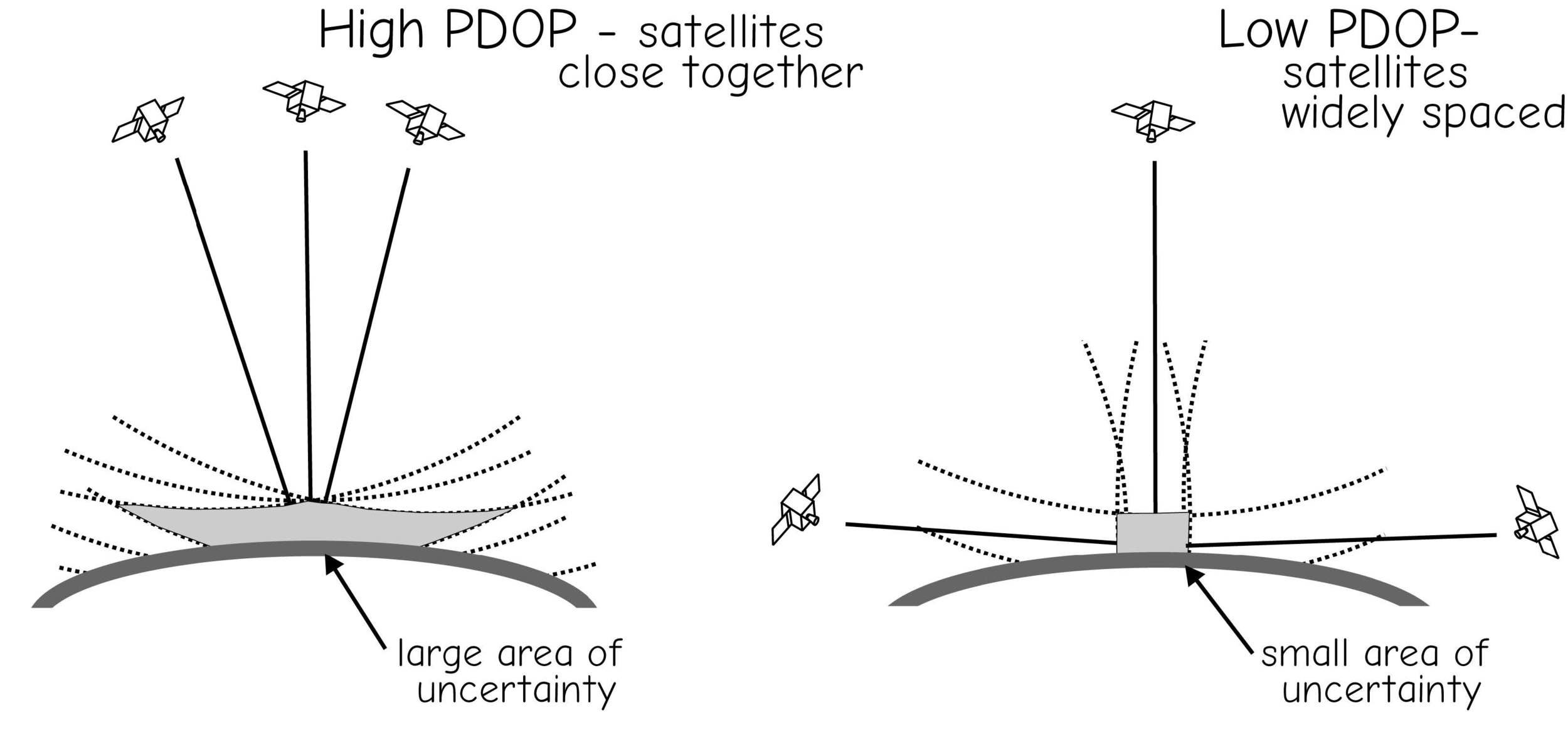
Dilution of Precision
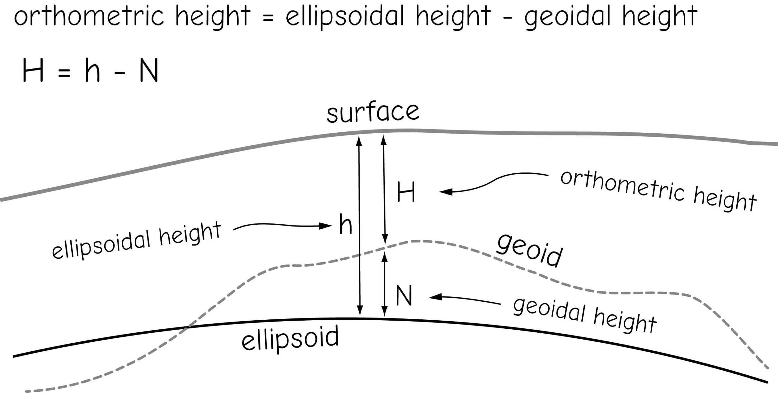
GNSS Height Measurement
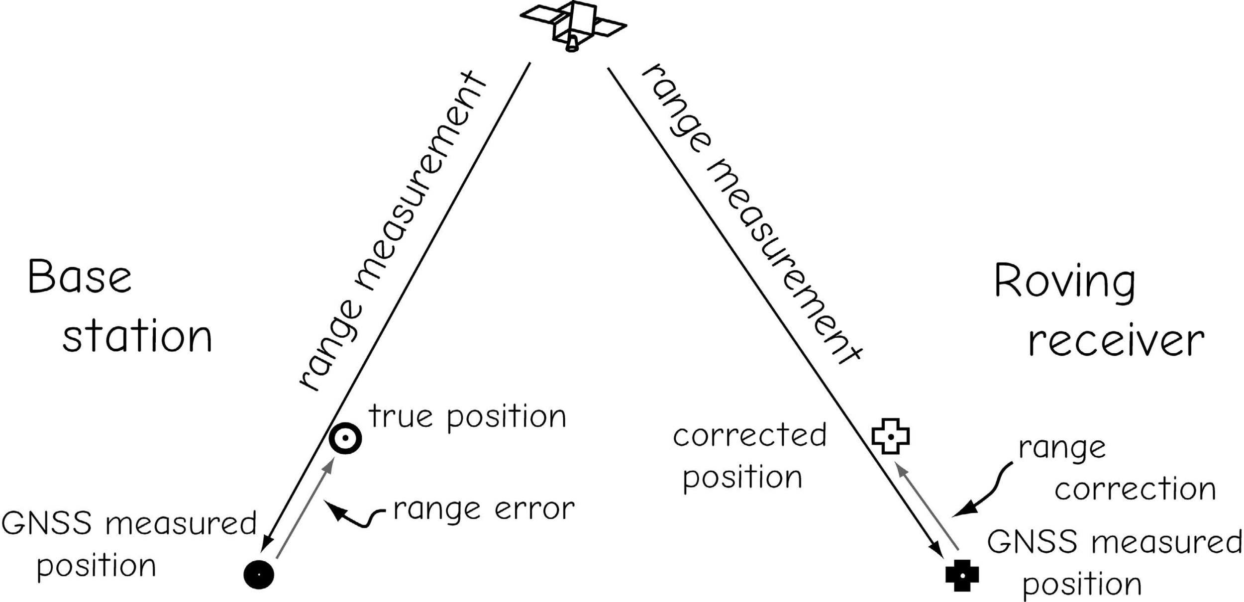
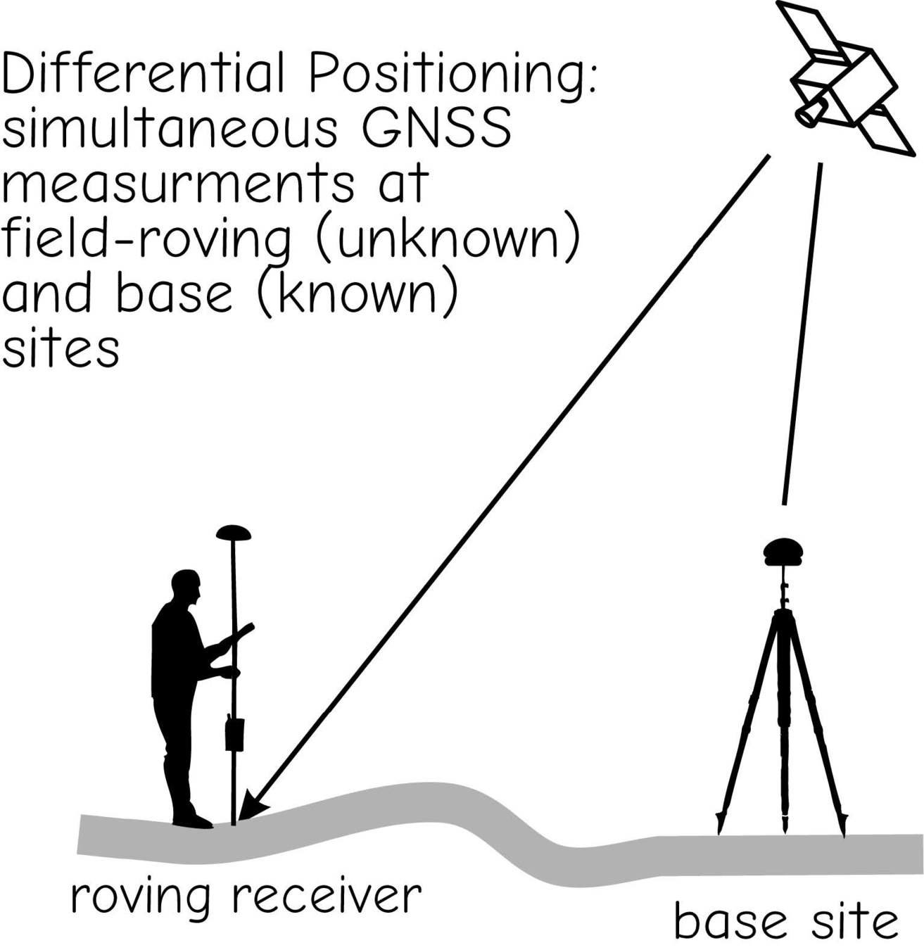
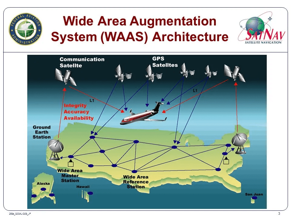
Real-time Differential Correction & RTK
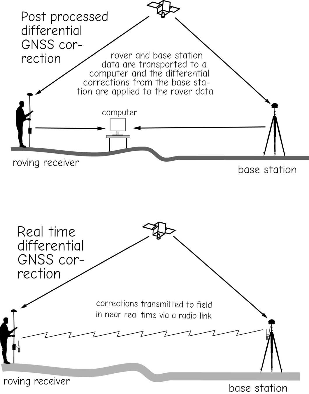
Post-Processing
vs
Real-Time Kinematic (RTK)
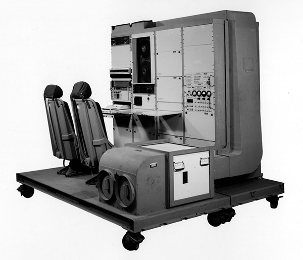
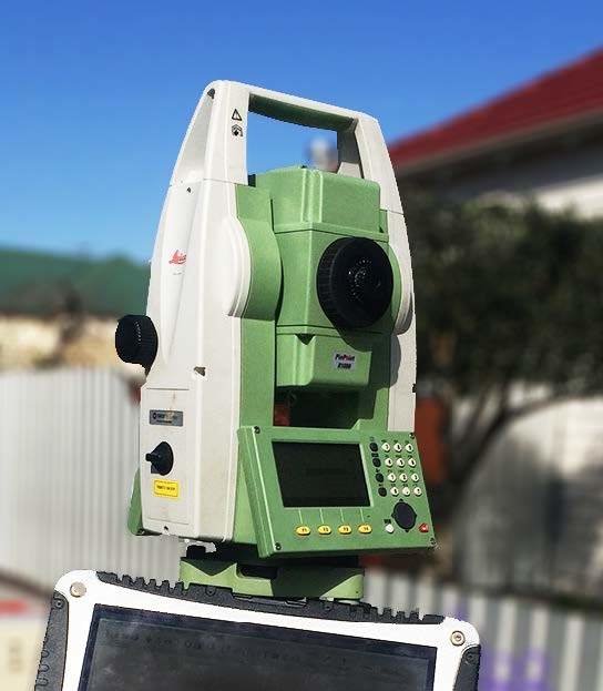
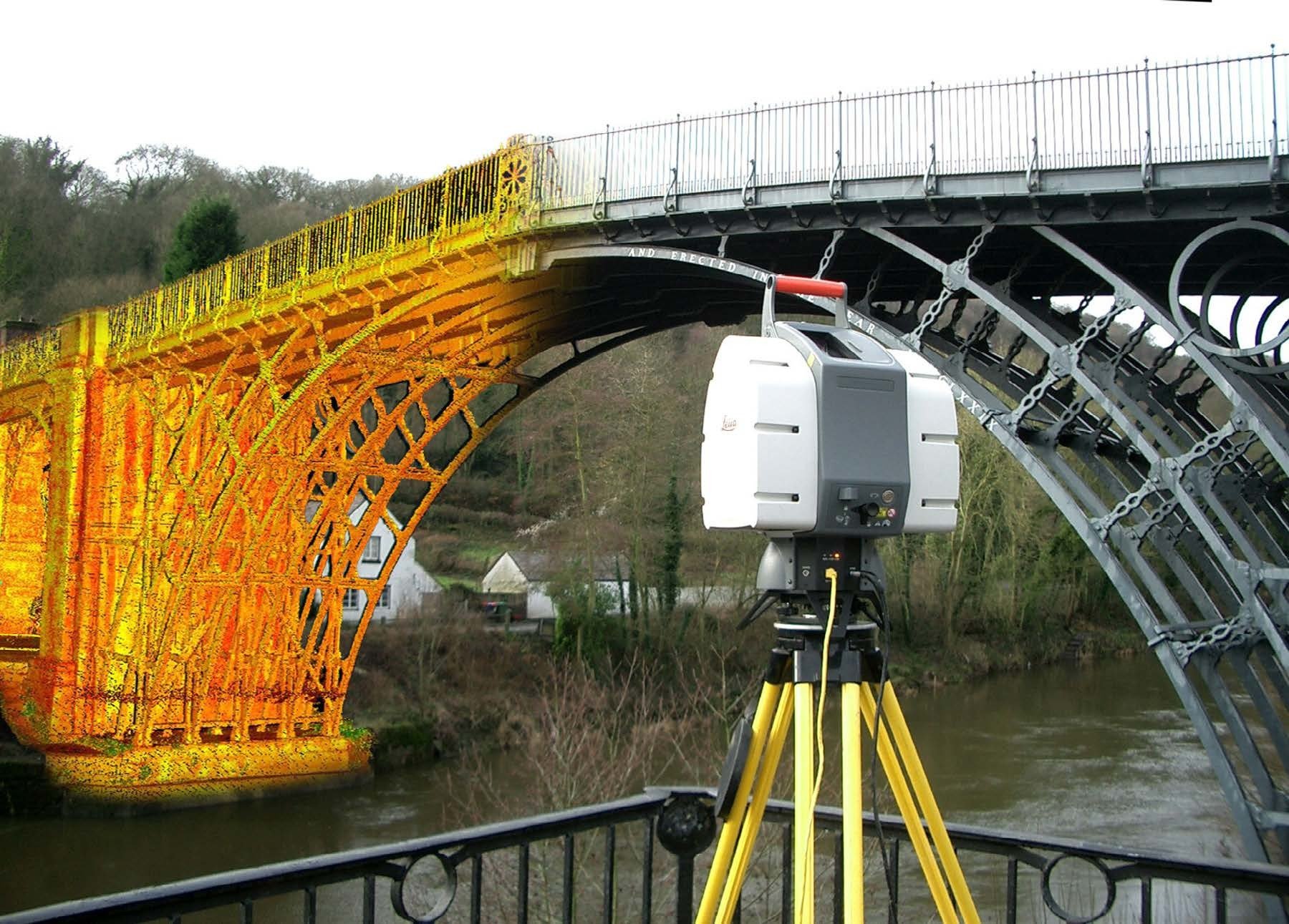
Optical (Total Station) Survey
Laser Theodolite
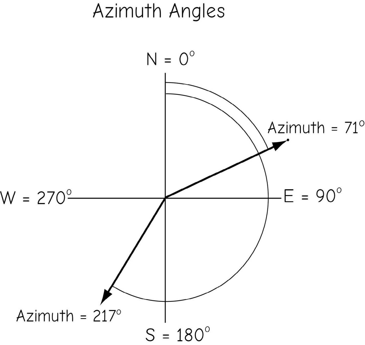

Azimuth vs Bearing
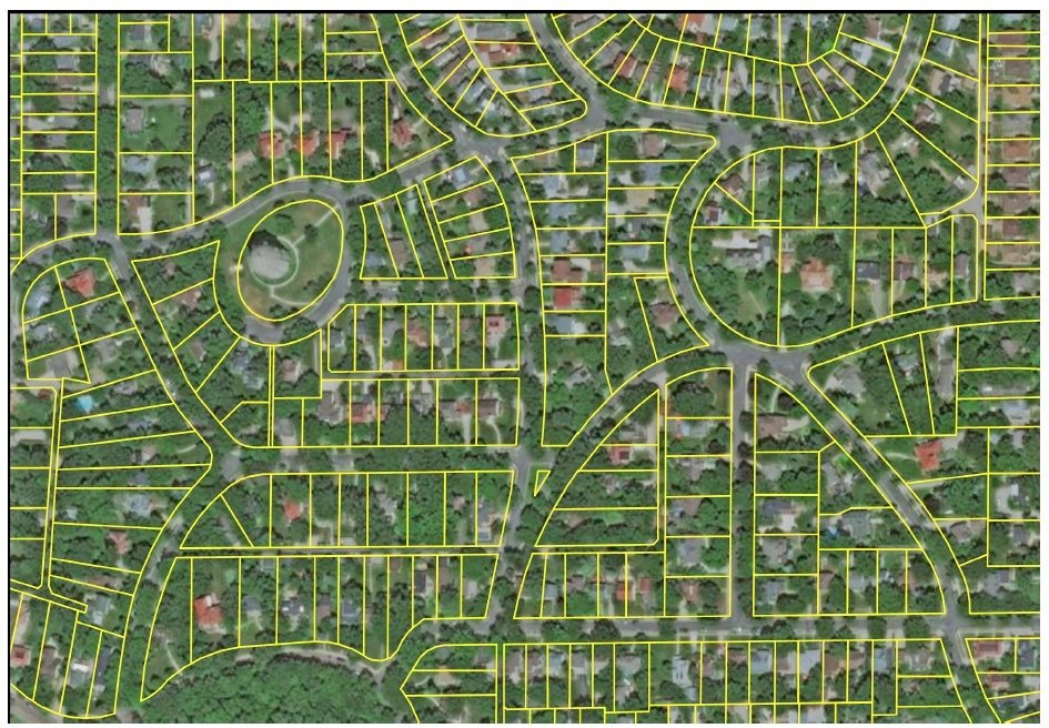
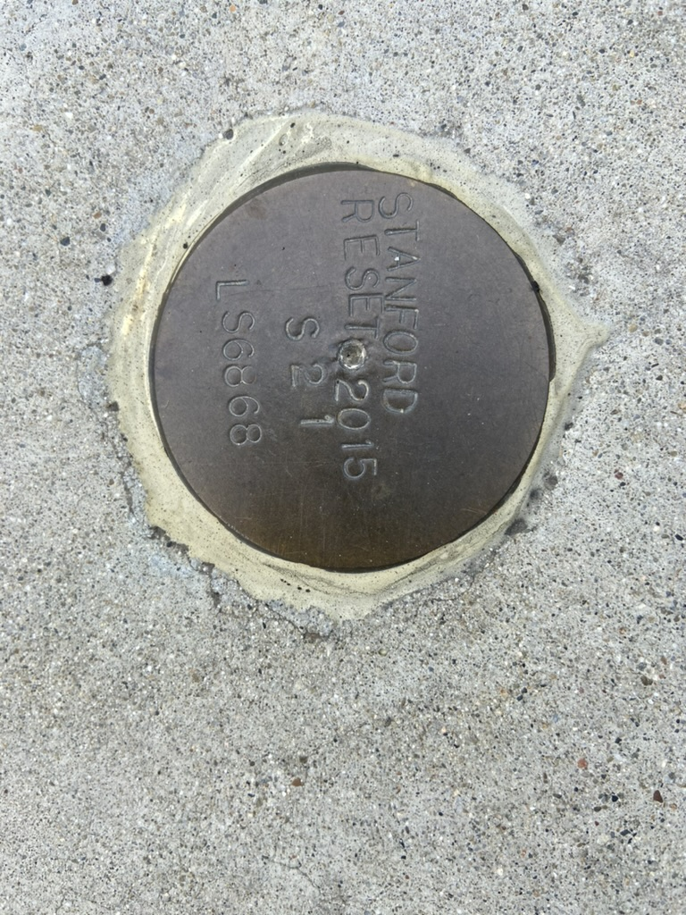
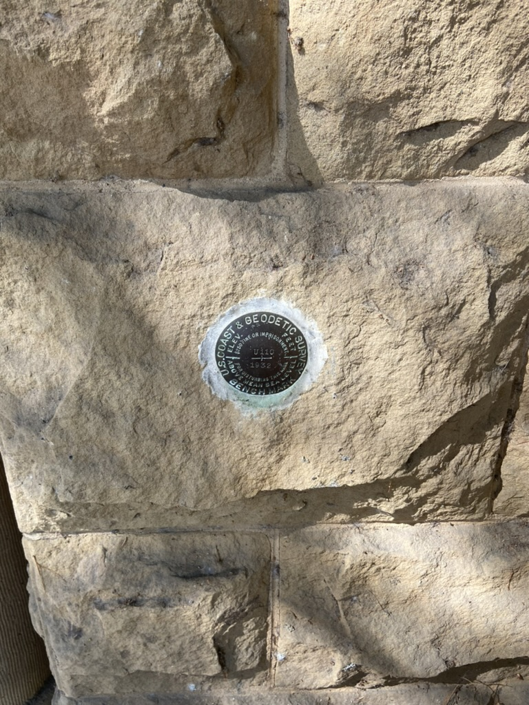
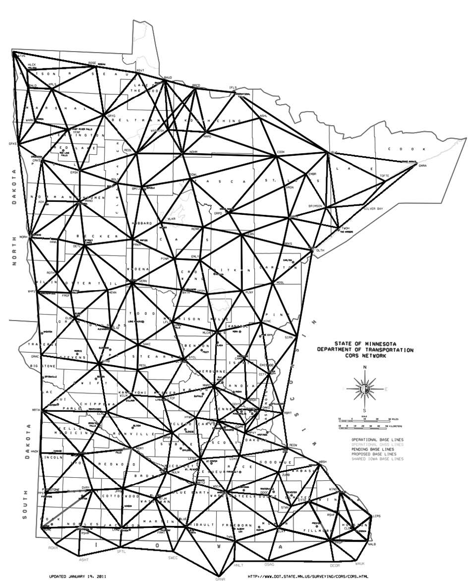
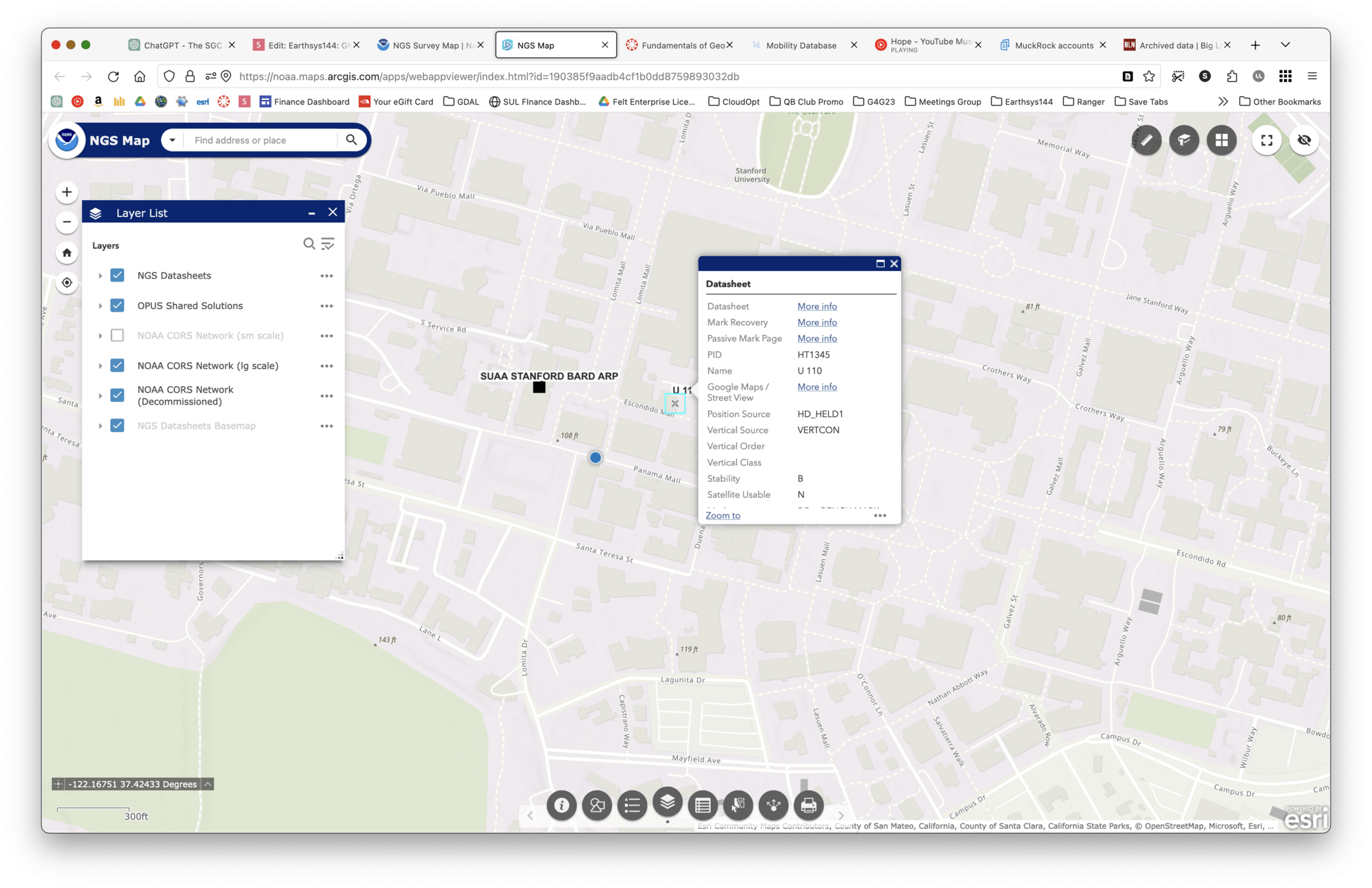
National Geodetic Survey (NGS)
Choosing Methods
GNSS vs Total Station
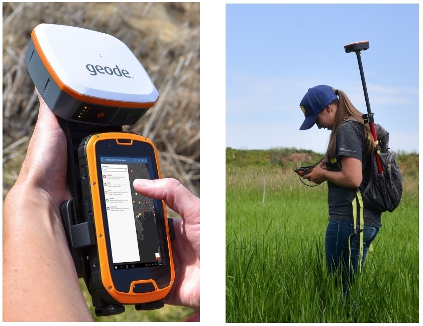
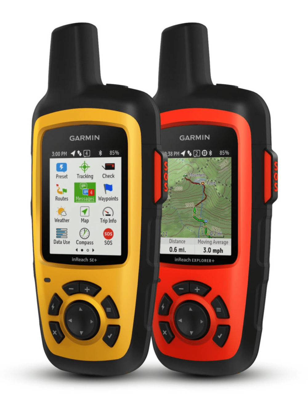
Choosing a GPS Unit
- Ruggedness
- Batteries
- Connectivity
- Functionality
Garmin vs Smartphones
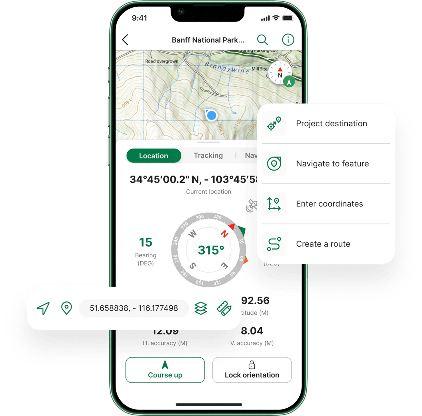
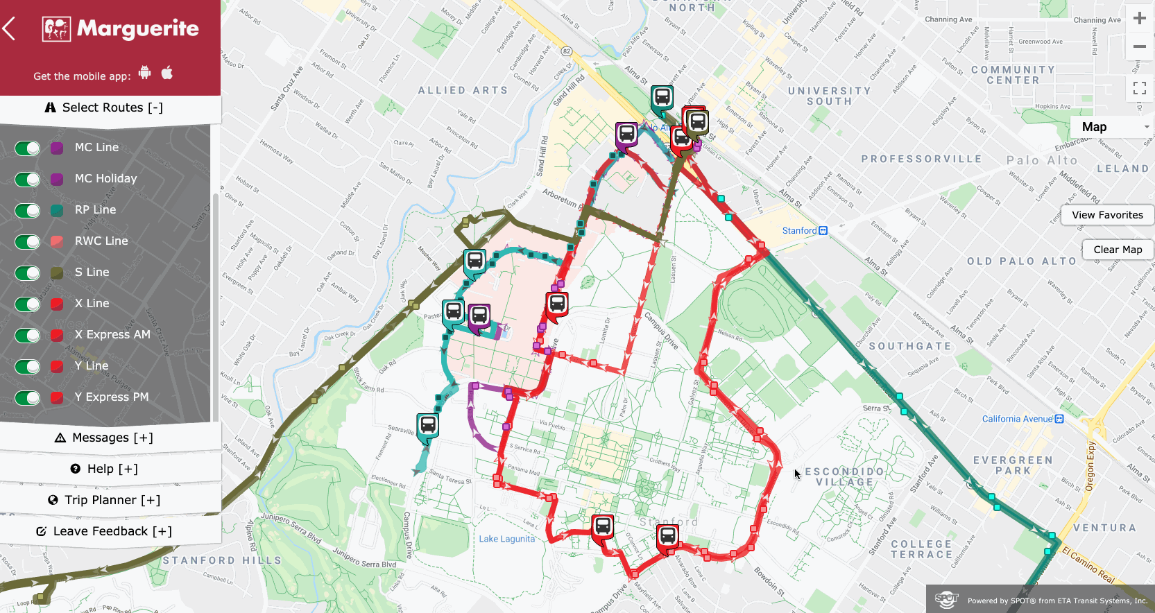
Choosing a GPS App
- Basemaps
- Offline functionality
- Tracklogging
- Export / Interoperability
- Multi User management
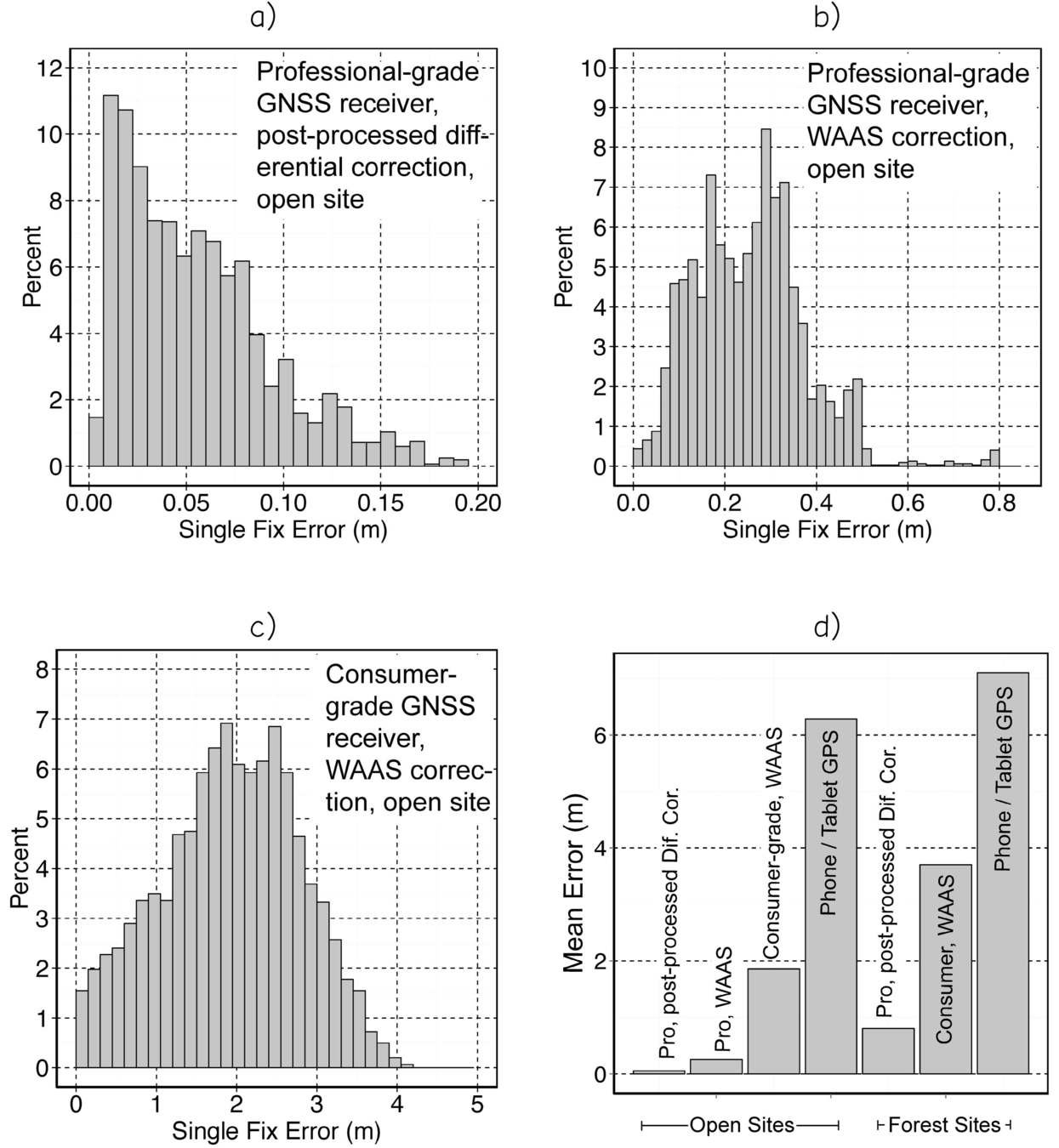
Pro GNSS vs Consumer GNSS
Planning a GPS Survey
- Trimble Planner
- Power
- Tracklogging
- Multi User management