Alexander Coley

Data Standards & Policy Manager (Defra)

@alexrcoley


[workshop A]


where next? 

opportunities to make the data we have more reusable & useful

some differing uses on gov.uk

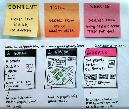
* image stolen from Paul Downey @psd

some questions for discussion

  • how can we maximise use and reuse the data?
  • data on government services or through others?
  • what helps others find our data?
  • what is the data that we always need?
  • what is missing?

  • what things from across public sector would we consolidate onto overview pages? should we?
  • what questions require consolidation?
  • what could be the common consolidation points?  
  • can we meet multiple uses?
  • what about look and feel and personalisation?
  • where are the opportunities for collaboration?

spatial data

quite simple & not so simple

points, lines & polygons


and...

coverages & grids

imagery

and so on


not always (directly) represented 
by coordinates 


e.g. addresses or regions

coordinate reference systems


as simple or as complex as you make it/need it*

OSGB, WGS84 & ETRS89


*and I'm not mentioning projections

formats & standards


INSPIRE (legislation)


(this is not a plug for but a recognition that 
there are some things we have to do)

WMS, WMTS, WCS, WFS
KML, GML, GeoJSON, CSV,

shapefiles, GeoTIFFs, MapInfoTAB, ASCII Grid, etc *


*there is a lot and some have traditionally had differing uses

what we have 

(not exhaustive)


widely reusable to very niche 

and maybe not that useful


4000+  

location datasets & services*


*on data.gov.uk & some double counting 

340+ WMS & WMTS 

services*


*on data.gov.uk & many with more than 1 layer

60+ WFS 

services*


*on data.gov.uk & much more due

50+ downloadable

spatial datasets*


*on data.gov.uk and gov.uk & much more due

1000's csv's 

with geo-referenceable information*


*on data.gov.uk and gov.uk

900+ public bodies

publishing spatial datasets*


*on data.gov.uk and gov.uk

base mapping services 

(in no particular order)


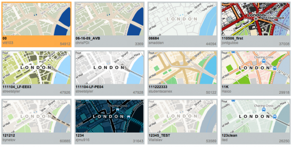
Ordnance Survey (including OnDemand),
Google, OpenStreetMap, CartoDB, 
MapBox, Bing, ESRI, etc...

reference data

underpinning, commonly used data or elements


consolidated data

things about place that could be brought together

consolidation around


home, street, property, community, points of interest,
catchmentsrivers, council and national park areas etc

what scenarios would lead to wanting consolidated data?


is my property (house, farm or business) at risk of flooding?

what do i need to do before I...?

etc

the discussion:


discussion points

  • how can we maximise use and reuse the data?
  • data on government services or through others?
  • what helps others find our data?
  • what is the data that we always need?
  • what is missing

 
  • what things from across public sector would we consolidate onto overview pages? Should we?
  • what questions require consolidation?
  • what could be the common consolidation points?
  • can we meet multiple uses?
  • what about look and feel and personalisation?
  • where are the opportunities for collaboration?


[blank for a reason] 


Alexander Coley

@alexrcoley


making the data usable and reusable

By Alex Coley

making the data usable and reusable

  • 2,019