ATLAS MODULE Project


Student : Alexis DUQUE
alexis.duque@openmrs.org
Mentor : Burke MAMLIN
burke.mamlin@openmrs.org

Developed by Victor Chircu during GSoC 2011
- A way for OpenMRS implementations around the world to create and maintain a marker on the OpenMRS Atlas.
-
Collects implementation information from administrators and send it every week to atlas server.
ATLAS MODULE
ATLAS SERVER
-
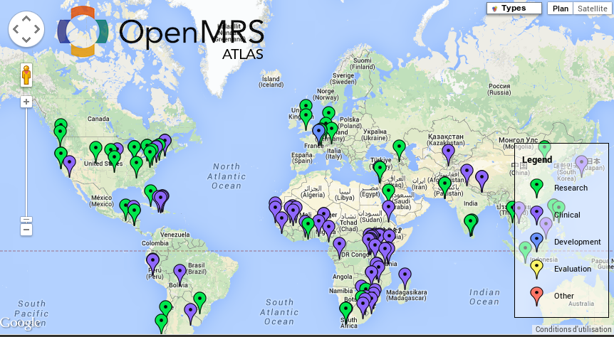
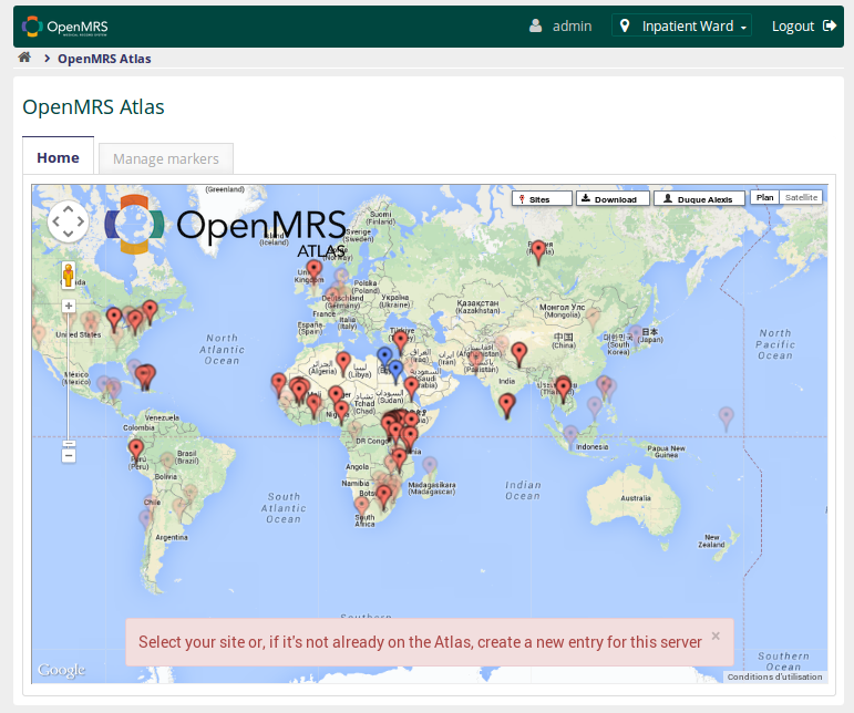
A way to visualize OpenMRS community members on the world map.
- Display markers created with the module.
Problems
- Creating or updating a marker depends on the module running in a production system connected to the public internet.
- The module has not been distributed as part of OpenMRS.
=> The module has not yet been widely adopted.
=> Some sites are not updated, or doesn't exists.
=> Community aspects of Atlas is not exploited.
PROJECT GOALS
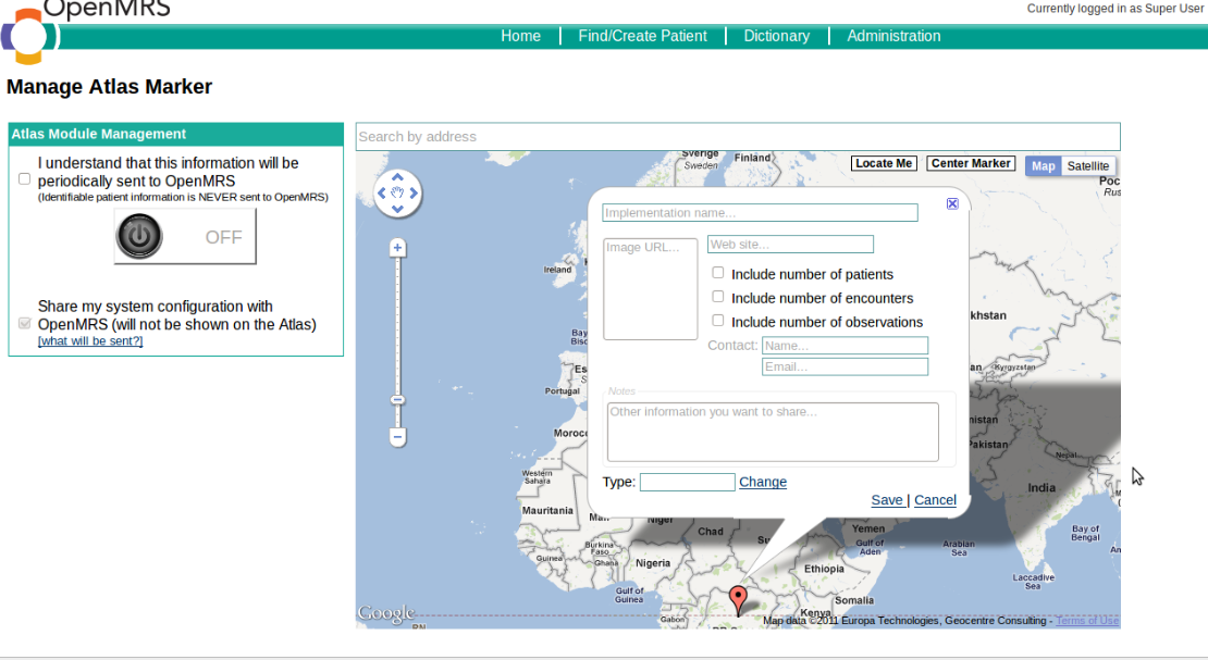
- Easily create and manage markers in Atlas Server.
- Associate a marker with an OpenMRS ID.
- Add nice functions to Atlas Server : marker filtering by type, OpenMRS version, fade marker overtime, download a screen capture ...
- Administration possibility.
-
Adapt the Atlas Module to run within OpenMRS 2.0
- Refactor API and web UI to take advantage of Atlas server improvements.
MID TERM PROGRESS
Atlas Server 2.0 is released and available soon at
atlas.openmrs.org with new features.
Atlas Module porting to OpenMRS 2.0
Todo :
Finish developing the new user interface for the module.
Finish developing the new user interface for the module.
Refactor module API.
Extra Feature !!
DEMO ?
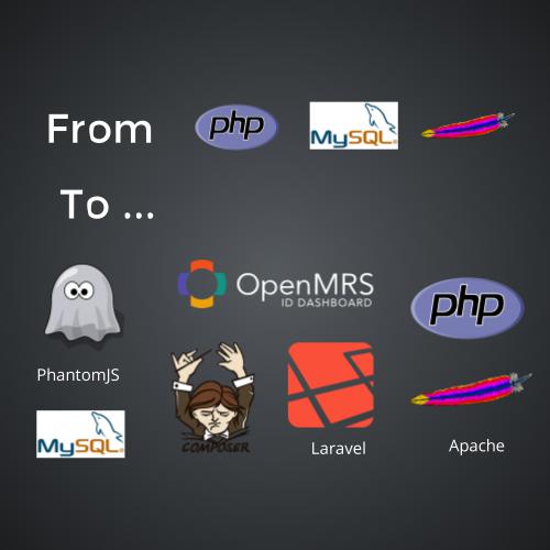
Atlas server STACK
PHP/JavaScript
PHP Framework : MVC architecture, routing, filtering
Google Maps Javascript API
DOM manipulation, event, AJAX calls
: DOM manipulation, events, AJAX calls

PhantomJS : Atlas screen capture
GOOGLE MAP API INTRO
1.
Create a map
<head>
  <script type="text/javascript" src="https://maps.google.com/maps/api/js?sensor=false">
  </script>
</head>
<body>
  <div id="map_canvas" style="width:100%; height:100%"></div>
</body>
function init () {
var options:{
zoom: 4,
mapTypeId: google.maps.MapTypeId.ROADMAP
};
var map = new google.maps.Map(
document.getElementById("map-canvas"),
options
);
}
google.maps.event.addDomListener(window, 'load', init);GOOGLE MAP API INTRO
2. Place a marker on the map
var marker = new google.maps.Marker({
    position: map.getCenter(),
    map: map,
    title: "New marker",
    icon: "http://maps.google.com/intl/en_us/mapfiles/ms/micons/red-dot.png",
    draggable: false,
    animation: google.maps.Animation.DROP,
});
3. Create and place a custom control
<!-- HTML Part -->
<div id="myControl" class="customStyle">Clean the map</div>
// Javascritpt
var control = document.getElementById("myControl");
map.controls[google.maps.ControlPosition.TOP_RIGHT].push(login)
COMING SOOn ....
Thanks for listening
Want to see more ?
Wiki https://wiki.openmrs.org/x/Y5GUAw
Blog http://alexisduque.github.io
Blog http://alexisduque.github.io
Repo https://github.com/openmrs/openmrs-contrib-atlas
https://github.com/openmrs/openmrs-module-atlas
IRC nick alexis_duque
ANY new FUNCTIONALITY yOu want to see on ATLAS ?
OpenMRS Atlas
By Alexis Duque