means to illuminate social and environmental injustices
co-construction of knowledge
promotion of self and critical awareness that leads to individual, collective social change
Participatory Action Research
Tell me, I forget.
Show me, I remember.
Involve me, I understand.
-Chinese Proverb (Paulos et al., 2009)
Photovoice
Purpose
Method by which participants identify, represent, and enhance their community through a specific photographic technique
- Identify community assets and deficits
- Use photography to draw attention to a social issue
- Induce change by informing policy makers


Participatory Mapping
Many Voices
Many forms

Medium influences who will participate
(Chambers 2006)
Knowledge Politics
Political Power
"...knowledge politics to be shaped by deeply institutionalized tendencies in planning and policy making to grant greater weight to knowledge expressed as quantitative data or represented in cartographic forms."
Data Driven Decision Making
(Elwood & Leszczynski, 2012: 545)
Spatial Media
Elwood & Leszczynski (2012) New spatial media, new knowledge politics. Transactions of the Institute of British Geographers (38): 544-559.
"Mediums or channels that extend our ability to interact with and create geographic information online" p 544
Maps --> Media
Applied
Quantitative
Theory
Qualitative


"moment of translation
transforming experiential, testimonial and qualitative forms of knowledge into quantitative aggregated or abstracted forms" (Elwood & Leszczynski , 2012: 548)
Digital Maps!
Digital Globes offer basemaps for participatory mapping. But they also control temporal and spatial resolution of those basemaps


How can we
harness the hype
of accessible technology
to make maps!

Hope
- Illuminate social and environmental injustice
- Relevant Temporal Resolution
- Enhanced Spatial Resolution
- Increased coverage
- Complement existing research methods
- Opportunity to establish good practice with community engagement


Google Earth date unknown
UAV imagery March 2015
Spatial Media: Aerial Photovoice Cinemtography
Aerial Photovoice
- evokes emotion
- representations of place
- What if we used it for something more important?
Organized #DronesforGood
- Digital Humanitarianism
- UAViators
- DIYDrones
- OpenDroneMap
- DroneAdventures
- Conservation Drones
- Drone Code
Taiwan’s National Cheng Kung University created this 3D model from aerial imagery captured by UAV.
Harmful Algal Blooms
Twin Lakes Home Owners Assiciation, Federal Way


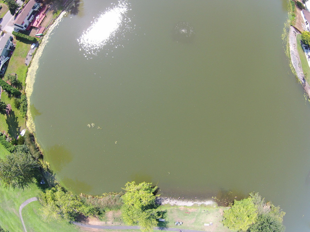
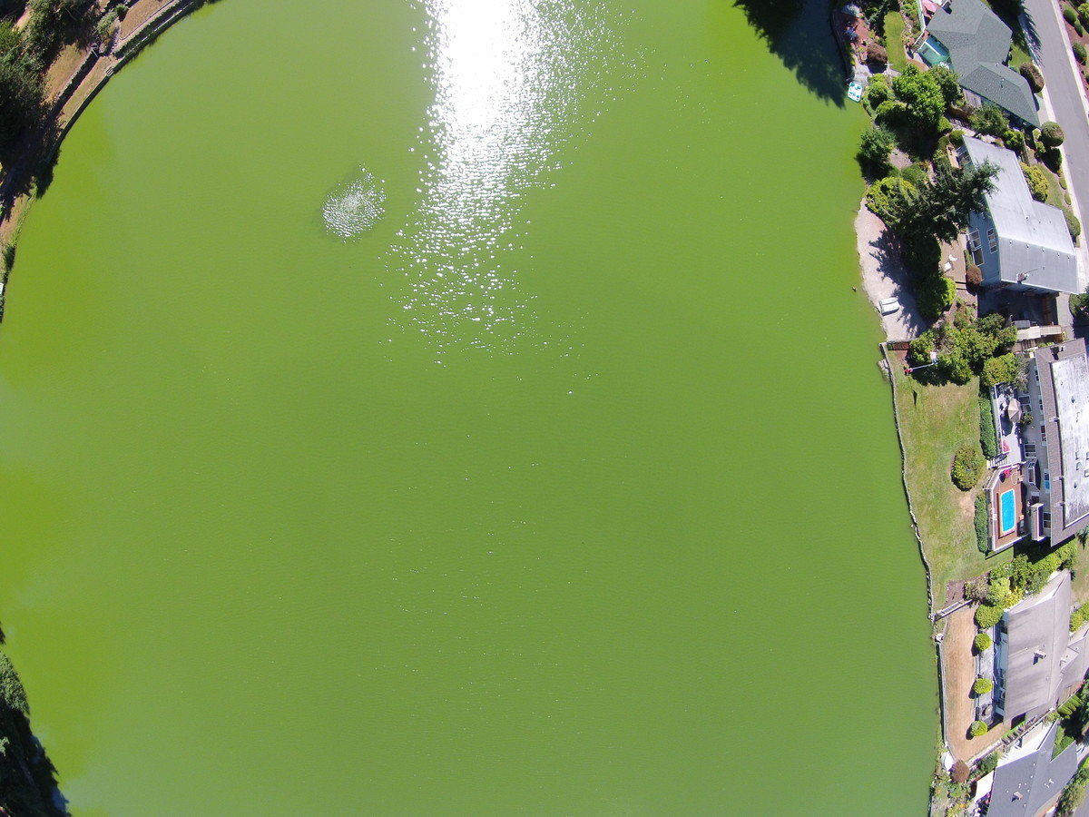
Lake Loreen
Lake Jean
Lake Loreen
Lake Loreen
Generate an Othophoto

2012
2015
Title Text
- Bullet One
- Bullet Two
- Bullet Three


Participation sparks critical thinking during each step of the process
Challenge
Illuminate methods in which to utilize these increasingly accessible technologies to edit your world, tell your truth,
share your experience in place.

Thank You.
@bricker
(Thanks Renee and Alan and all Mapathoners)

UAVs AAGs
By Britta Ricker


