Maps --> Media
Applied
Quantitative
Theory
Qualitative


means to illuminate social and environmental injustices
co-construction of knowledge
promotion of self and critical awareness that leads to individual, collective social change
Participatory Action Research
Photovoice
Purpose
Method by which participants identify, represent, and enhance their community through a specific photographic technique
- Identify community assets and deficits
- Use photography to draw attention to a social issue
- Induce change by informing policy makers


Participatory Mapping
Public Participatory Geographic Information Systems (PPGIS)


Many Voices
Many forms

Medium influences who will participate
(Chambers 2006)
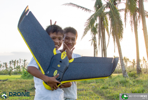
Unmanned Aerial Vehicle (UAV)

Organized #DronesforGood
- Digital Humanitarianism
- UAViators
- DIYDrones
- OpenDroneMap
- DroneAdventures
- Conservation Drones
- Drone Code
Taiwan’s National Cheng Kung University created this 3D model from aerial imagery captured by UAV.

Spatial Media: Aerial Photovoice Cinemtography
Aerial Photovoice
- evokes emotion
- representations of place
- What if we used it for something more important?
Aerial Photography


Harmful Algal Blooms
Twin Lakes Home Owners Assiciation, Federal Way


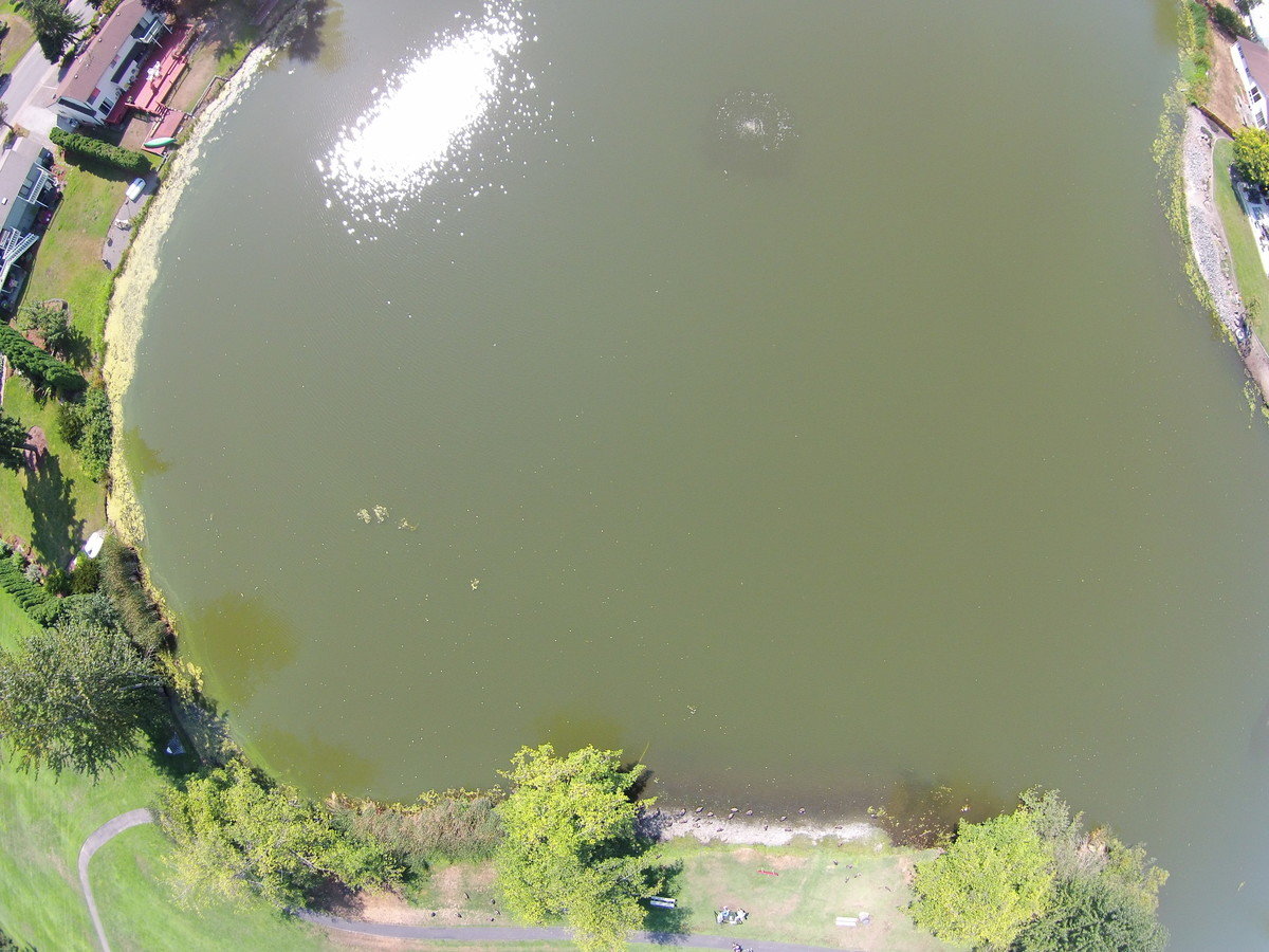
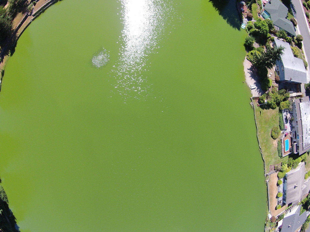
Lake Loreen
Lake Jean
Lake Loreen
Lake Loreen
Digital Maps!
Use of UAV could offer control of temporal and spatial resolution of base maps.
Putting a UAV in the hands of a community, could they monitor...
- Community changes through the course of a day, season, year...
- Acute changes - landslide event, urban encroachment
- Gradual changes - land use change, urban growth
- Ecosystem services
- Access to water resources, refugee camp movement
- Habitat loss...
- ?????
Steps
- Drone Selection Process
- Flight Practice and Planning
- Flying
- Data Processing

Drone Selection
(Eisenbeiss, 2011: 34)

Classified by takeoff and landing methods


DJI Phantom 2 Vision Plus
- 25 minute flight time
- Return home when battery is low
- Compass and GPS
- 14 mega pixel camera and Gimble
- ~$1200

Process
Flight Practice and Planning

Flying
Auto Pilot
Free Flight


Image Processing
Photography and Cinematography
Mapping


Image Processing
MapKnitter, Google Maps, MapBox, GeoServer + OpenLayers, ESRI Online
Manual Processing


Structure from Motion (SfM) software

Generate an Othophoto

2012
2015
Title Text
- Bullet One
- Bullet Two
- Bullet Three

77 photos to make this orthophoto in >one hour total
Social
Implications
Similar critiques of GIS
and mobile spatial media (Elwood, 2008; Thatcher, 2016)
Privacy (Curry, 1997)
- Geoweb transformation of the social contract around privacy – societal agreement (Elwood, 2015)
Access to technology (Obermeyer, 1995)
Risk of Re-enforcing inequality
Legality
- Decline of the public sector - private sector leading
- "Enthusiasts" can fly, not governments
- International regulations vary dramatically

Medium influences who will participate
(Chambers, 2006)

Comfort level when flying
Tacoma Professional
Tacoma Amateur
Only scratching the surface
Conclusion & Future
Maps are political
INVITE PARTICIPATION
Work with communities
Opportunity to establish ethical standards for UAV usage

Hope
- Illuminate social and environmental injustice
- Relevant Temporal Resolution
- Enhanced Spatial Resolution
- Increased coverage
- Complement existing research methods
- Opportunity to establish good practice with community engagement


Google Earth date unknown
UAV imagery March 2015

Participation sparks critical thinking during each step of the process
Challenge
to utilize these increasingly accessible technologies to edit your world, tell your truth,
share your experience in place.

Thank You.
http://faculty.washington.edu/bricker0/
@bricker
Acknowledgements: Ali Modarres, Anaid Yerena, Sarah Elwood, Kris Seymer, Chris Davidson, Mark Pendras, Jim Thatcher

Copy of UAV Dartmouth
By Britta Ricker
Copy of UAV Dartmouth
This presentation was given on April 8, 2016 at Dartmouth College


