Spatial Interpolation
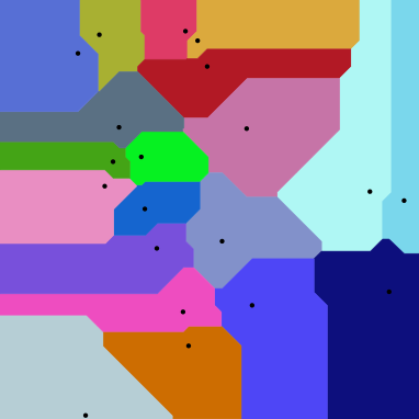
Voronoi polygons
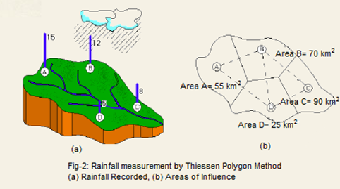
Thiessen polygons
Maps = Power

Waldseemüller map 1507
Gemma Frisius
(born Jemme Reinerszoon)
December 9, 1508 – May 25, 1555


Geographic Information Science
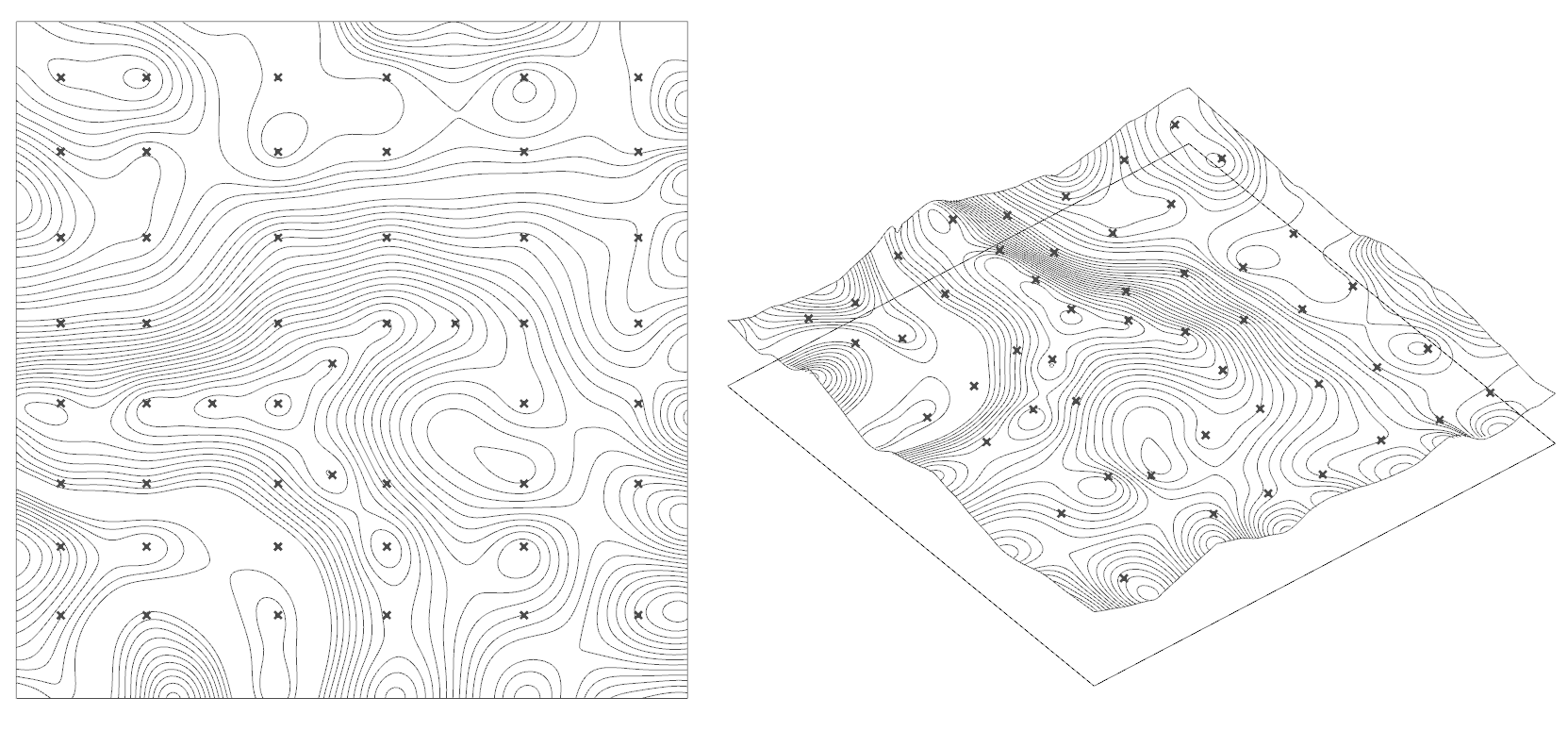
Interpolation
Voronoi polygons
Tessellation
Data = Confidence
Geographic
Information
Systems
Title Text


GIS Body of Knowledge
Foundational Concepts
Knowledge Economy
Data Capture and Management
Programming and Development
Analytics and Modeling
Cartography and Visualization
GIS&T Society
Domain Applications
What might we find here?
Tobler's First law of Geography:
Everything is related to everything else but
near things are more related than distant things.
interpolation
The estimation of surface values at unsampled points based on known surface values of surrounding points.
Interpolation
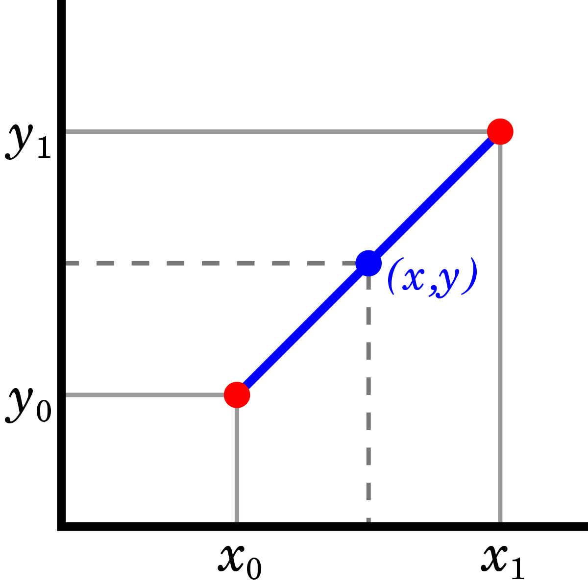
Think carefully about the data and real-life phenomena before you pick a specific interpolation method.
Geographic
Information
Science
Geographic Information Science
- The field that seeks to redefine geographic concepts and their use in the context of GIS.
- Interrogates fundamental themes traditionally found in spatially oriented fields
- Study the impacts of GIS on society and societies impacts on GIS (Mark, 2003)

from: MacEachren, Alan M. 1992. "Visualizing uncertain information." Cartographic Perspectives. 13: 10-19.
Clay soil
Clay soil
Clay soil
Clay soil
Wetland soil
High Active Clay soil
Organic soil
Wetland soil
Spodic soil
High Active Clay soil
?
Voronoi polygons
Draw a line equal distance between two points,
generating a cell around each point.


Control Points
hypothetical points within a polygon likely to share value with control point.
"Area of influence polygons"
Set of known points
Control points
example: Weather stations, soil samples

Tesselation

MC Escher. Two Fish (No. 41)
1941 Pencil, ink, watercolor. Improved 1963.
Nature


Social Science Examples
- social service access
- epidemiology
- marketing

London 1854
Red dots cholera deaths.
Blue dots water pumps.
John Snow maps entered into GIS by John Macdenzie
Other names for Voronoi diagrams include...
- Thiessen polygons
- Dirichlet tessellation
Many disciplines use voronoi and similar techniques
- geology
- computational geometry
- ecology
- archaeology
- meteorology
- video game design

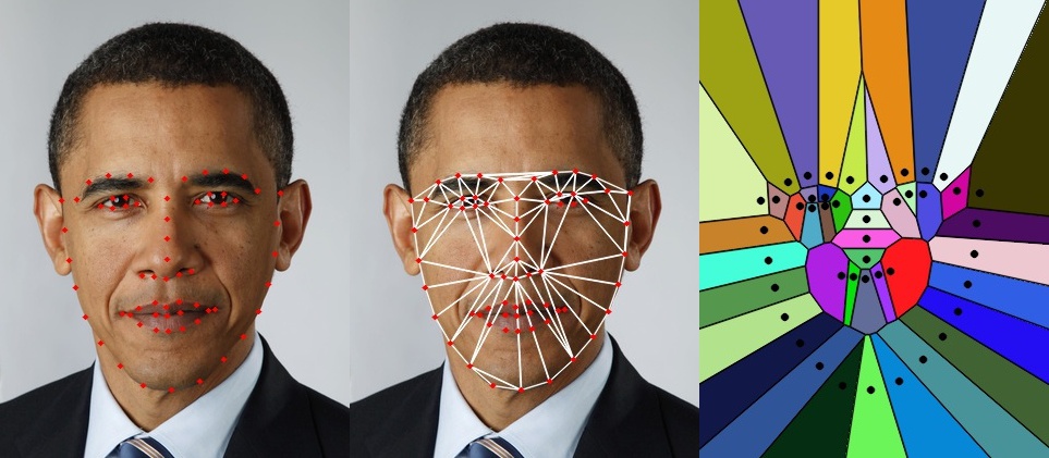

Computer Vision

Architecture

Geography

point-->surface
Isoline Map
Strengths
- relatively easy to interpret and execute
- 2D and 3D space
- irregular boundaries and edges
- does not take into account...
Weakness
Network Voronoi Diagram

Manhattan Distance
Future Lessons
Network analysis
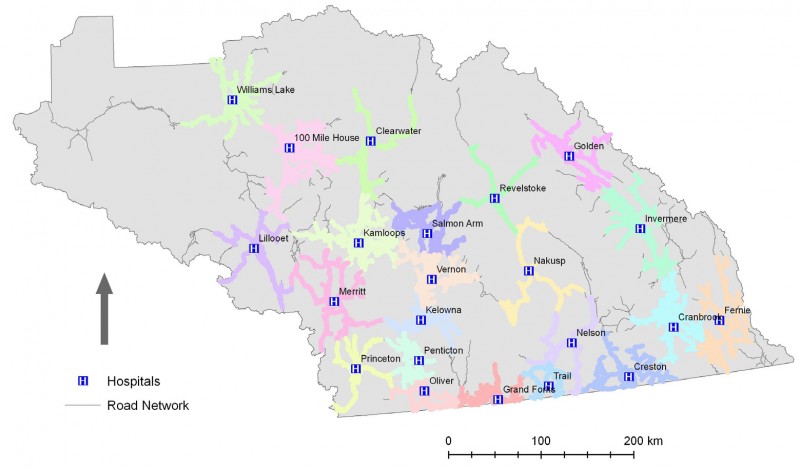
One hour service area, hospitals in rural British Columbia, Canada
Several interpolation methods used in GIS
Nearest Neighbor
Kringing
Spline
Inverse Distance Weight (IDW)

Inverse of Voronoi is Delaunay Triangulation
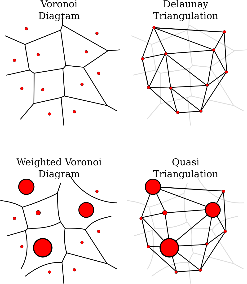
Delaunay Triangulation commonly used to make Triangulated Irregular Network (TIN)


Future Lessons
Learn from history
Apply to new forms of spatial media
Dank u wel.
Voronoi
By Britta Ricker
Voronoi
This presentation will introduce the interpolation method often known as Voronoi.


