
What is GeoServer?
- For sharing analyzing and editing spatial data
- Serves map (WMS) and feature (WFS) for sharing, analyzing, and editing geospatial data from spatial data sources using open standards
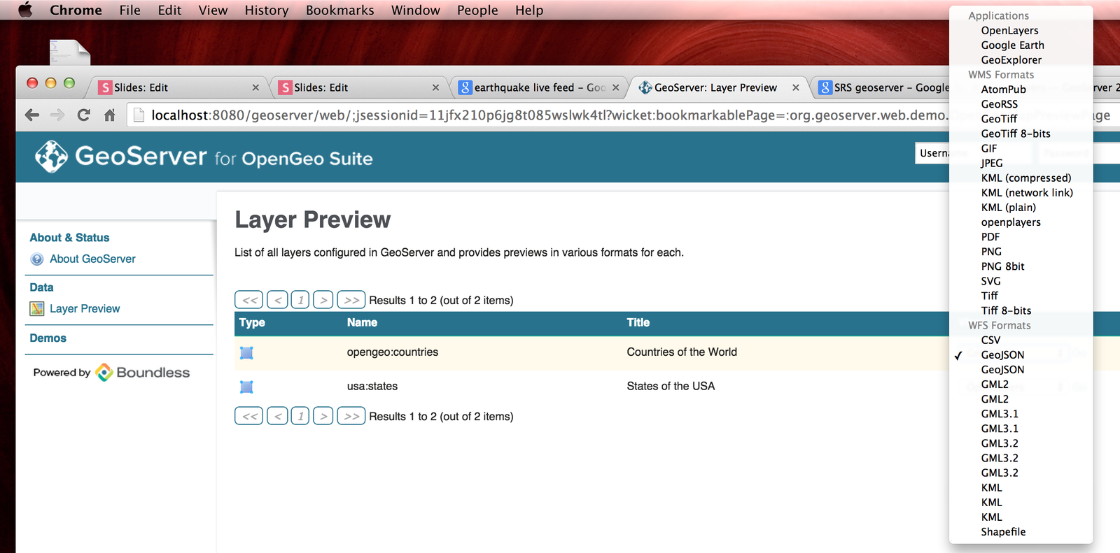
- Multiple output formats (Esri Shapefiles, KML, GML, GeoJSON, PNG, JPEG, TIFF, SVG, PDF, GeoRSS)
GeoServer
- Relational Database Management System
- Reduces spatial data to tables
- With a geometry column
- Integrates easily with QGIS
Relationship with PostGIS
PostGIS is an open source database based on PostgreSQL
add PostGIS to GeoServer
PostGIS can analyze data, store data, and manage data.
GeoServer simply stores data.
To install GeoServer
Download at BoundlessGeo
Register and they will send you an email to a link where you can then download OpenGeoSuite
You will need about 1 Gig of free space
You will install PostGIS, OpenLayers, GeoWebCache, along with GeoServer
Resources
- Boundless Online
- Boundless localhost:8080
- GeoServer.org
Read about GeoServer and follow directions provided by Boundless
There are lots of details in the README from the downloaded bundle from Boundless
To install on your machine...
choose the download package for your OS
Read through Quick Start Guide provided by GeoServer
Mistakes that I made
- Lost admin password
- Uninstalled and re installed GeoServer
VIP information (questions posed in homework)
Key Terms
See Homework Handout - answers to the questions posed in the HW can be found by reading content from the links provided above.
User Modifiable Content
The directories that do contain user-modifiable content are:
logs,
palettes,
templates,
user-projection,
www.
Several ways to
view and edit data on GeoServer
- GeoServer - previewer
- GeoExplorer - Web-based viewer for editing layers
- QGIS
- pgAdmin - query, edit and organize your data in tabular format
Several ways to
load data to GeoServer
- Directly with the directory
- Command Line
- GeoServer Layer Importer
- Accessed through Layer Importer REST API
- Or GeoServer Web interface
- QGIS + Suite QGIS Plugin
- pgShapeLoader
- Graphical tool to import and manage db and files in PostGIS
We are going to...
Install and get to know GeoServer
- View vector data
- Add vector data
- Create New Layer Group
...using GeoServer
Open OpenGeoSuite
Know that PostgreSQL runs on ports 8080 and 5432
Leave them as default
unless you know of any conflicts already
For directions on how to change the port see the README.pdf that came with install
This is what the dashboard will look like
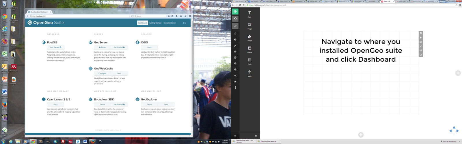
From the dashboard
Under GeoServer
Click Get Started-->
Read through the directions and be sure to
- Change the log in information
- Default log in found in ReadMe file
- Change contact info
before we load data know that
Defining Projection
is imperative
Spatial Reference System
SRS
Native SRS — Refers to the projection the layer is stored in. Clicking the projection link displays a description of the SRS.
Declared SRS — Refers to what GeoServer gives to clients
SRS Handling: — Determines how GeoServer should handle projection when the two SRS differ
1. View Data
Before we load data we need to learn about how it can be used.
Read through this information about what is required to load layers into GeoServer and how to make them editable
- Adding name and metadata
- Bounding box
- and more...
View the Demo
- Read through walkthrough here
- Then within GeoServer check out the demo
2. Add Data
- First you need to create:
- Create a New Workspace
- What services will you offer?
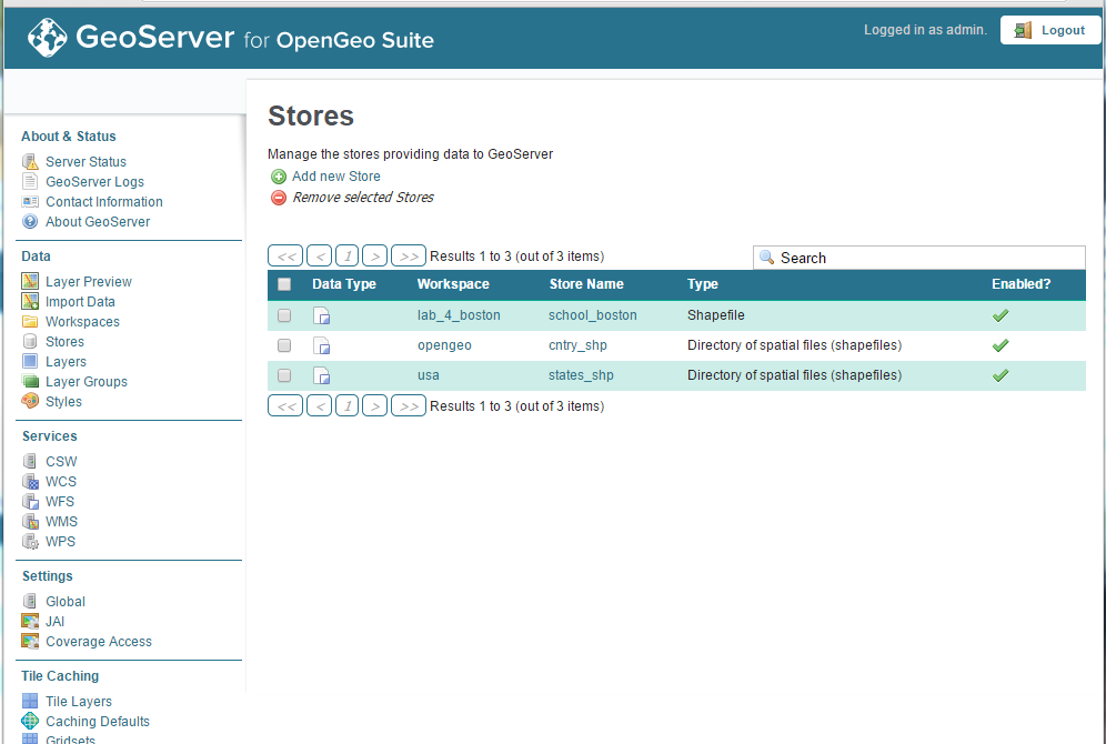
- Create New Store
- Create a New Workspace
2. Add a Data
After you have created a new data store and a new workspace, you are now ready to upload a .shp file
- From Geoserver -->Click Layers-->Import Data
- Select data source--> Spatial Files
- Navigate to the a directory and .shp file
- Select the newly created workspace and data store
- Click Next
2. Add a Data
You may have to modify the layer
- Add keywords associated with the data
- Set Coordinate Reference System
- You may have to look up the UTM code
- example: Bo
- You may have to set the bounding boxes - your choice on how to set it
- You may have to look up the UTM code
- Click Next
2. Backup plan
If you couldn't get your data to upload
You may use this example and data provided in this example
http://docs.geoserver.org/stable/en/user/gettingstarted/shapefile-quickstart/index.html
3. Create Layer Group
GeoServer
By Britta Ricker
GeoServer
This week we are going to set up a GeoServer!


