Peter Keum
GISP
WTD GIS Senior Specialist
Introduction of RPAS*
February 14, 2024
FAA Part 107 Certified Remote Pilot
Remotely Piloted Aircraft System
-
What is it?
-
How to Use it?
-
Why Use it?

So Let's Dive in!
-
What is it?
-
How to Use it?
-
Why Use it?
UAV - Unmanned Aerial Vehicle
FAA Definition: Unmanned Aircraft (UA) system that is operated by a pilot via ground control or on-board computer.


RPAS as Platform
Multi-rotors
Fixed-wing & VTOL

- Shorter flight time (< 45 min)
- Cover smaller area
- Highly maneuverable
- Less expensive
- Access to confined spaces
- Long flight time (+ 40min)
- Covers very large area

(vertical take-off & land)

Remotely Piloted Aircraft System
Sensors


Multi-spectral
Thermal Infrared

Lidar Camera

High resolution digital camera
1. Aircraft + Sensor (Data Collection)
2. Data Processing & Analyzing (GIS)
3. Information Products
=
+


- Economical
- Easy to use
- Quality data collection
- Consistency/accuracy

Why Now?
Cell Phone Technology + Lower $$
- Electronic Control System (ECS)
- Accelerometer & Gyroscope Chip
- GPS Chip
- Lithium Polymer (LiPo) Battery
- Motors


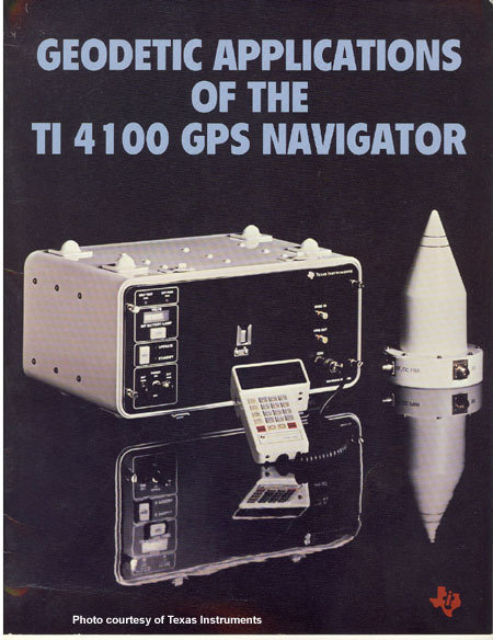
Integrated gyroscopic/GPS Chip in 2000's = $10,000
In 2017 = $3

1981 $120,000
2013
$5 - $15
It's just a toy...

2014-2017


It's just a toy...past examples of what used to be

It's just a toy...past examples of what used to be

It's just a toy...past examples of what used to be

It's just a toy...

It's just a toy...

Outdoor
Indoor
DJI Mavic 2 Pro < $1,800

DJI Mavic 2 Pro Ent. Adv ~ $6,500
DJI FPV w/ Modification ~ $1,300


Mavic 3 Ent
~ $3,800
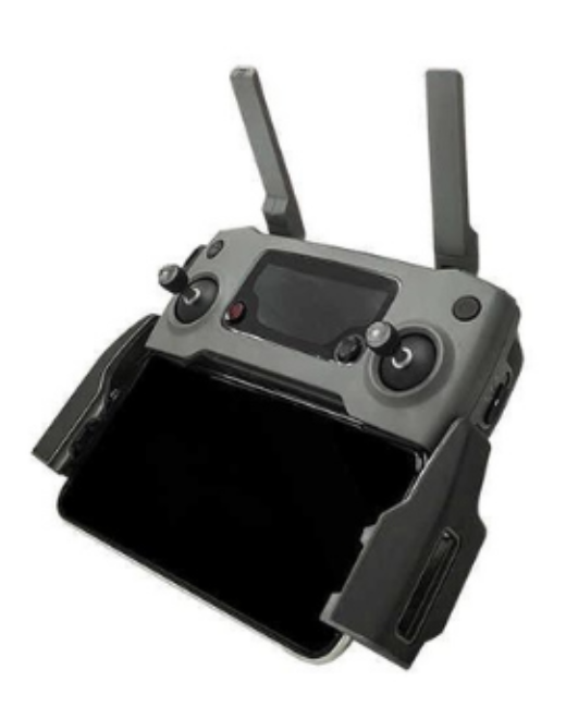
20 MP/ 56x zoom
20 MP
12 MP/ 32x zoom
+ Thermal


-
What is it?
-
How to Use it?
-
Why Use it?


FAA Regulations - Where are we now?

Regulations
Commercial/Governmental
FAA Part 107 Rule, July 2016
-
Need FAA Remote Pilot Certification (Pilot license NOT needed)
-
September 2017 -60,000 active remote pilot certificates
-
December 2023 - 368,000 active remote pilot certificates
-
Fly under 400 feet above ground level
-
Not to fly < 5 nautical miles around airport
-
Aircraft < 55 lbs.
-
Fly during daytime
-
Fly visual line of sight ( VLOS)
-
No flight over non-participating people
-
And many many more...
FAA Part 107 Rule
-
What is it?
-
How to Use it?
-
Why Use it?
Why Use Drones?
3 E's
-
Easy
-
Efficient
-
Effective
Why Use Drones?
1. Easy - Simple with little effort

Automatic
Repeatable
Flight Control App
- Automate Flight Planning - Fly Consistently for overlapping images
- Can fly manually but it's like mowing with scissors

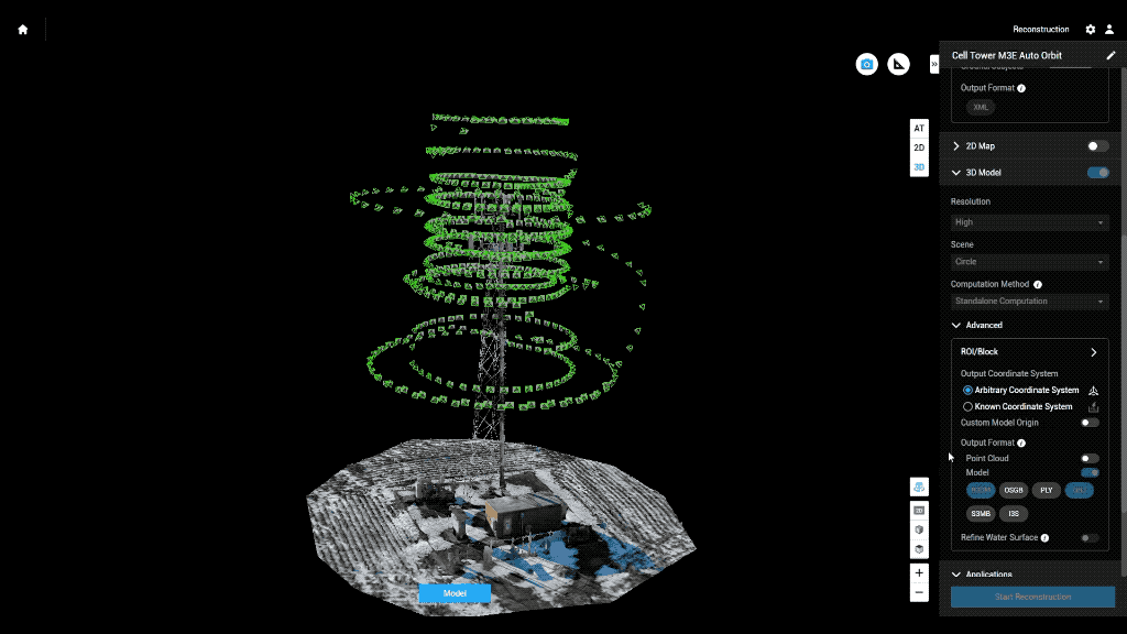
Example: Auto flight plan
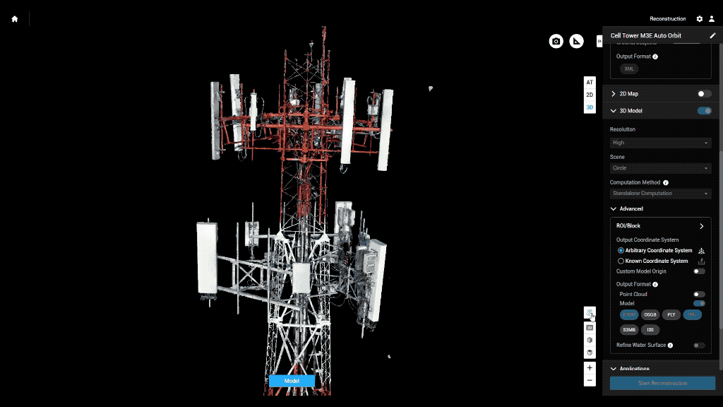
Result 3D Model
Why Use Drones?
2. Efficient - Results without waste
Safety of staffs
Save Time & $$

Data Processing - Efficient

- Cloud Storage & Cloud Data Processing
- Flight Planning from Desktop - fly on Mobile (controller)
- Cloud storage/Cloud Processing
- Centralized System
- Project Deliverables
Why Use Drones?
3. Effective - Producing Results


- Environmental Monitoring
Examples - Effective
August 2022
March 2022


April 2023
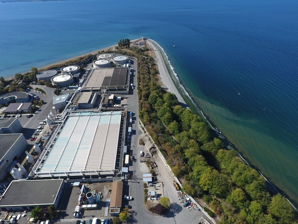
- Update 2D aerial map
Examples - Effective

- 1172 Photos
- 0.57in/px
- Update 2D aerial map
Examples - Effective


0.57 in/px
Sept 2023
3.0 in/px
2021 KC Aerial


END
for now
Thank You
peter.keum@kingcounty.gov
DroneSIG - Drone Summit Feb. 14, 2024
By Peter Keum
DroneSIG - Drone Summit Feb. 14, 2024
DroneSIG Drone Summit Feb 14, 2024, Primer for non-drone operator for beginning of the summit.


