Remotely Piloted Aerial System (RPAS)
What are they Good for?
May 21 , 2019
Peter Keum - WTD GIS Specialist, GISP
peter.keum@kingcounty.gov
Just another tool in the toolbox

@pkeum


CUGOS

Short Back Story

CUGOS April 2014

-
Introduction
-
FAA Regulations
-
Workflow
-
Examples


What's in the name?
FAA Definition: Unmanned Aircraft (UA) system that is operated by a pilot via ground control or on-board computer.


1. Introduction

What's in the name?
UAV = Unmanned Aerial Vehicle
UAS = Unmanned Aerial System
DRONE = Dynamic Remotely Operated Navigation Equipment
RPAS = Remotely Piloted Aircraft System
RPAS Categories

Small
- Size: 1 - 2 meters ( 3 ft - 6.5 ft), < 55 lbs.
- Control: Visual line of sight, Radio control
- DJI Phamtom, Mavic, ScanEagle
Medium
- Size: Equivalent to a car, ~ 1000 lbs.
- Control: Visual Line Of Sight (VLOS) & Beyond LOS, RC & Satellite
- General Atomics -MQ1 Predator
Large
- Size: > 30,000 lbs.
- Control: Visual Line Of Sight (VLOS) & Beyond LOS, RC & Satellite
- Northrop Grumman RQ-4 Global Hawk ~$222 Million


Different Shapes and Sizes

- Price /Performance
- Easy to use
- Quality data collection
- Adopting Rule by FAA

Why Now?
Cell Phone Technology + Lower $$
- Electronic Control System (ECS)
- Accelerometer & Gyroscope Chip
- GPS Chip
- Lithium Polymer (LiPo) Battery
- Motors


Integrated gyroscopic/GPS Chip in 2000's = $10,000
In 2017 = $3

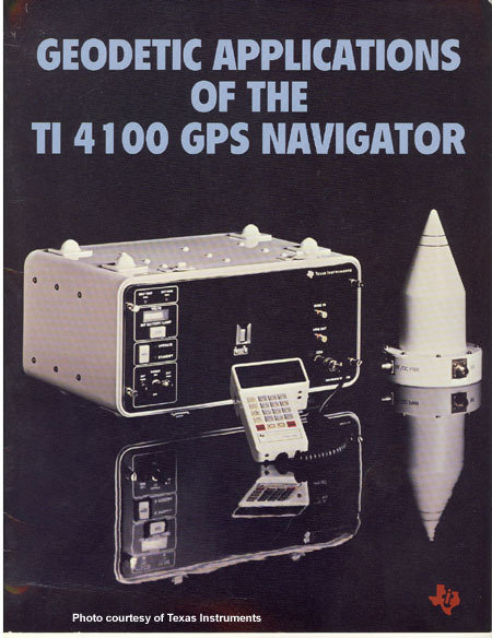
1981 $120,000
2013
$5 - $15
EXAMPLE

It's just a toy...past examples of what used to be


It's just a toy...


It's just a toy...

2017


FAA Regulations - Where are we now?

2. Regulations
Commercial/Governmental
-
Section 333 Exemption from FAA
-
SAC - Special Airworthiness Certificates from FAA
-
FAA 14 CFR Part 107 - July 2016
Commercial/Governmental
FAA 14 CFR Part 107 Rule, August 2016
-
Need FAA Remote Pilot Certification (Pilot license NOT needed)
-
Year 2017 - 60,000 active FAA remote pilot certificates
-
Year 2018 - 116,000 new remote pilot certificates
-
Year 2023 - FAA expect to grow to 350,000
-
Fly under 400 feet above ground level
-
Not to fly < 5 nautical miles around airport
-
Aircraft < 55 lbs.
-
Fly during daytime
-
Fly visual line of sight ( VLOS)
-
No flight over non-participating people
FAA 14 CFR Part 107 Rule
To be Certified
-
At least 16 years old
-
Pass aeronautical knowledge exam (Need at least 42 correct answer out of 60 questions, 70%) $150
-
Need to recertify every 24 months

1. Platform + Sensor (Data Collection)
2. Data Processing & Analyzing (GIS)
3. Information Products


3. Workflow
1. Platform + Sensor (Data Collection)


RPAS as Platform
Multi-rotors
Fixed wings

- Short flight time (< 30min)
- Cover small area
- Highly maneuverable
- Less expensive
- Access to confined spaces
- Long flight time (> 30min)
- Covers large area
- Larger selection of sensors

Sensors


Multi-spectral
Thermal Infrared

Lidar Camera

High resolution digital camera
2. Data Processing & Analyzing (GIS)
(Updated Jan 2019)


Airplane Orthophoto
Software processed Orthophoto from drone


1. Platform + Sensor (Data Collection)
2. Data Processing & Analyzing (GIS)
3. Information Products

Benefits
-
High Temporal Resolution
- Fly more often

-
High Spatial Resolution
- Fly same area
Benefits
-
Higher Spatial Resolution
- Monitor continuous changes
- High Spatial resolution than Satellite, Plane (smaller area)

Benefits
Offer decision makers with appropriate analytic information products
- Better Data -> More Knowledge -> Better Decision Making

Workflow Example 1
Whidbey Island, Langley Downtown example (Spring, 2014)


Step 1. Flight with Data Collection
- Collected 200 Images
- Using Agisoft PhotoScan to stich images
- Alt. Tool - Microsoft Image Composite Editor (ICE)

Step 2. Data Processing
- QGIS to georeference aerial imagery export to tiff file
- Using GDAL
- Or use mbutili to export into tiles
gdal2tiles.py --profile=mercator -z 1-22 yourmap.tif outputfolder
Step 3. Information Product: Web map
- Create web-map using GitHub's gh-page
git checkout gh-pages
git add outputfolder
git commit -m "Yes... TILE DATA"
git push
Step 3. Information Product: OpenStreetMap
- Using imagery to digitize street, add features to OSM
http://langleywa.github.io/gisdata/tiles/langley-2nd-street-2014-tms/{z}/{x}/{y}.png- Add below url into OpenStreetMap iD Editor
Workflow Example 2
KC Brightwater Treatment Plant
(odor control) &
KC Cedar River Revetment
(river bank protection)
3D Modeling

Example A: Brightwater TP Odor Control Units


PhotoScan Sparse Point Cloud

Dense Point Cloud

Textured Mesh
Result
Example B: Cedar River Revetment
Road Erosion Prevention Structure

Cedar River Revetment
Some Commercial Uses
4. Industry Examples


WTD Projects
-
West Point Treatment Plant Event
-
Floating Willow Raft (Brightwater TP)
-
West Point Treatment Aerial Photography


WTD Projects
-
West Point Treatment Plant Incident Feb, 2017

Seattle Times Headline
March 12, 2017
WTD Projects
-
West Point Treatment Plant Incident Feb, 2017
Drone Flights (March, 2017) - Soil Run-off Real cause of plume, not overflow


WTD Projects
-
West Point Treatment Plant Incident Feb, 2017
Drone Flights = Clarification

Photo from Seattle Times
KC WTD Drone Flight
March, 2017
WTD Projects
-
Floating Willow Raft - Mitigation & Monitoring Section: May - August 2017

Purpose: Willow growth shade analysis (1.5 acres)
Flight from May 2017
WTD Projects
-
Floating Willow Raft Shade Study

- 4 Flights 2017 : May, June, July & August
- Consultant flys and generate shade analysis & report
- KC staff as an observer and in-house expert to develop work order & product review
WTD Projects
-
West Point Treatment Plant Orthophoto

- October 2, 2017
- Over 600 images collected
- High Resolution 0.75 inch/piexel


Resources:
-
TV Washington: 1 hr video Drone Documentary
-
sUAS News
-
FAA Part 107
-
DJI - Ready to Fly Droe
-
3DR

END
for now
Thank You
peter.keum@kingcounty.gov
WA URISA GIS & DRONE Workshop Part I - May 21, 2019
By Peter Keum
WA URISA GIS & DRONE Workshop Part I - May 21, 2019
Overview of utilizing Drone and GIS as Part 1 of the workshop. Slide describes basic introduction of small drone hardwares and processing software and its workflow with various use cases.


