Urban & Regional Geospatial Analysis: URBDP 422
Peter Keum - peter.keum@kingcounty.gov
Shaun O'Neil - shaun.o'neil@kingcounty.gov
February 28, 2016


Part I: GIS in KC - WTD
Part II: Various Tools and Technologies
WTD Mission:
- Protect Public Health
- Enhance Environment by Treating & Reclaiming water, Recycling Solids & Generating Energy
- Database Development
- Cartographic Production
- Spatial Analysis Development
GIS in Wastewater Treatment Division
- 1.6 million people
- 420 square miles
- 391 miles sewer pipeline
- 72 facilities
- 38 CSO (Combined Sewer Overflow) Outfalls
- 5 Treatment plants : Avg 180 MGD , (max ~ 900 MGD)
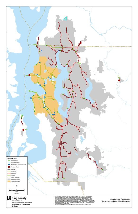
- Manholes (point) - 4403 items
- Sewer Pipe Sections (line) - 4550 items
- Modeling Basins (polygon)
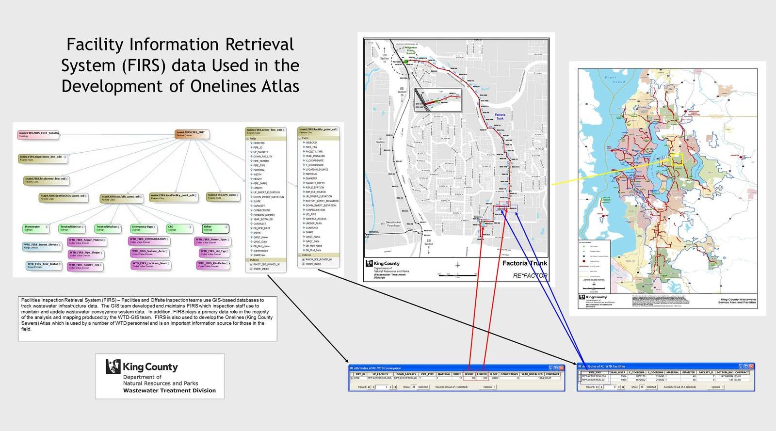
FIRS (Facility Information Retrieval System)
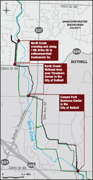
Example: North Creek Interceptor Sewer Project
Dong Hoi Presentation
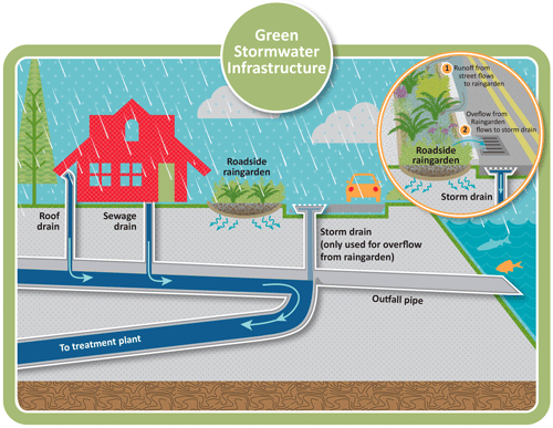
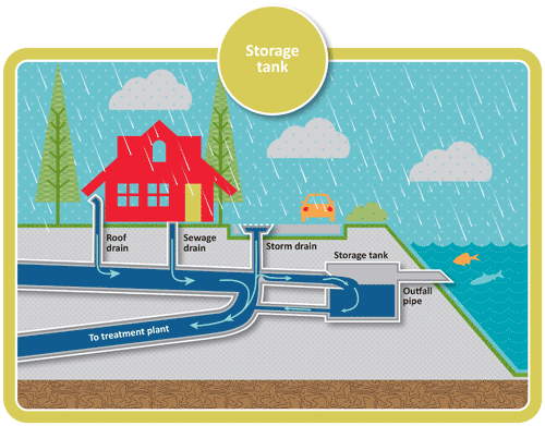
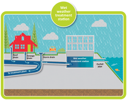
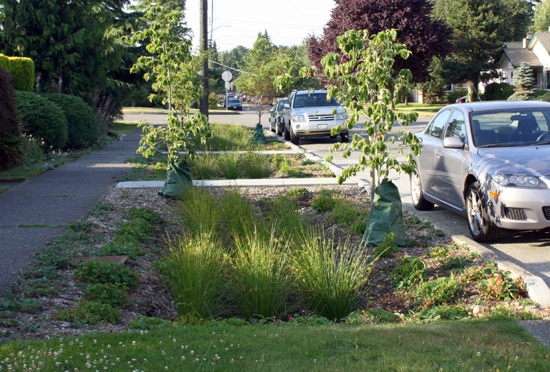
Combined Sewer Overflows (CSO) Green Storm Infrastructure Analysis

CSO = Stormwater (90%) + Sewer (10%)
Traditional
Method

OLD

NEW

-
ArcMap (Basemap)
- SVG
- Adobe Illustrator
-
Python
-
GitHub
- geoJson
-
Leaftlet JS
-
Javascript
- HTML
Putting Together GIS Jigsaw Puzzle
Essential Tools and Various Technologies


Text
Text
Cascadia Users of Geospatial Open Source
Learn and explore mapping technologies through tutorials

Thank You!
Questions / Discussion
Feb 28, 2016- Urban & Regional Geospatial Analysis URDPD422
By Peter Keum
Feb 28, 2016- Urban & Regional Geospatial Analysis URDPD422
UW presentation for URDPD 422 - Urban Planning Class


