Peter Keum, Senior GIS Specialist
KC Wastewater Treatment Division
peter.keum@kingcounty.gov
@pkeum
pkgeo.com
May 11th, 2023
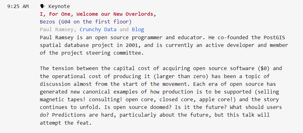
FOSS4G
Free and Open Source Software for Geospatial

After
Before
But Not THIS
Text
Text

Text


CUGOS


Cascadia Users of Geospatial Open Source

Cascadia Users of Geospatial Open Source
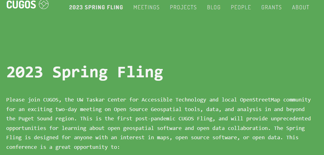

170+ members on cugos.slack.com
1. Free & Open Source Software (FOSS)
2. Free Open Source (OS) GIS
1. Free & Open Source Software (FOSS)

- Free to run it
- Free to modify it
- Free to share it
- Free to share your modification
Eric Raymond

Open Community
Free & Open Source Software (FOSS)
- Permissive - providing with few restrictions
- Protective - obligation to share improvements
Two Types of Licenses

"We share our work with you,
You share your work with us
and we all benefit."

Why Now?


Commons-Based Peer Production
Tools
Bandwidth
Interest

Using internet to build rich valuable collections of knowledge & products


Secondary Results

Mapbox
2. Free Open Source GIS Tools


Proprietary Software Licenses

Desktop
Database
Web Platform

ArcSDE
GDB
GeoJSON; Shape Files
Geopackages, WMS, WFS
+


Open Source GIS (FOSS4G)
Desktop
Cross Platform Software
- v 1.0 Released in 2009, v 3.28 now 2023
- 48 Languages translated
- Currently 426+ Plug-ins (software component that add specific feature)
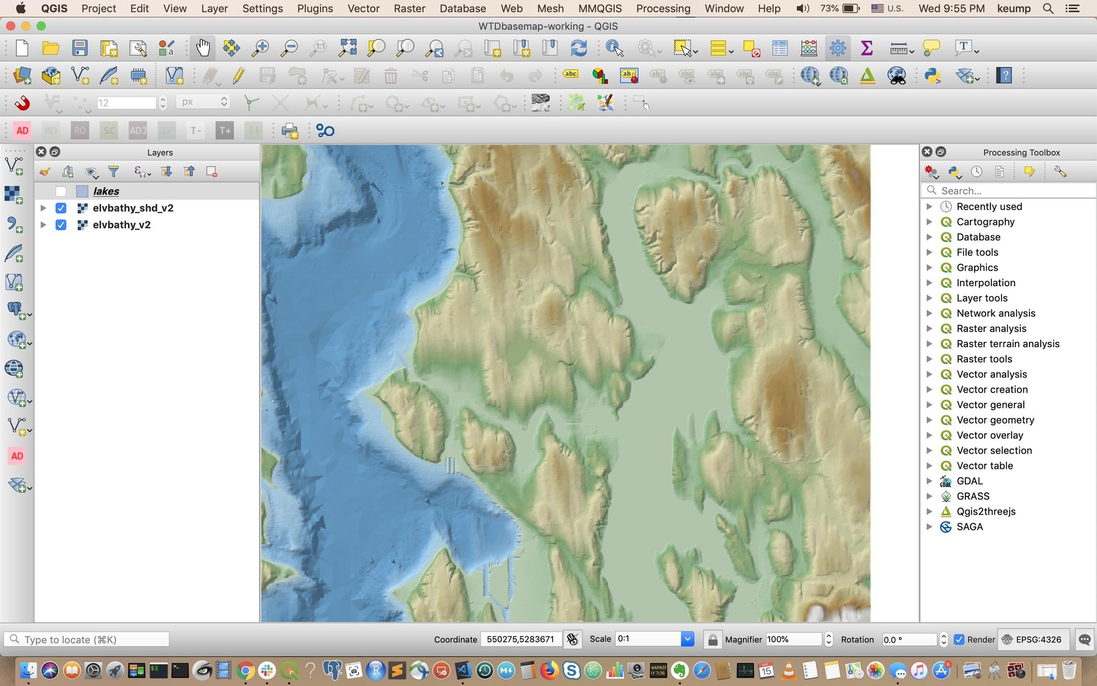
Looks Familiar!
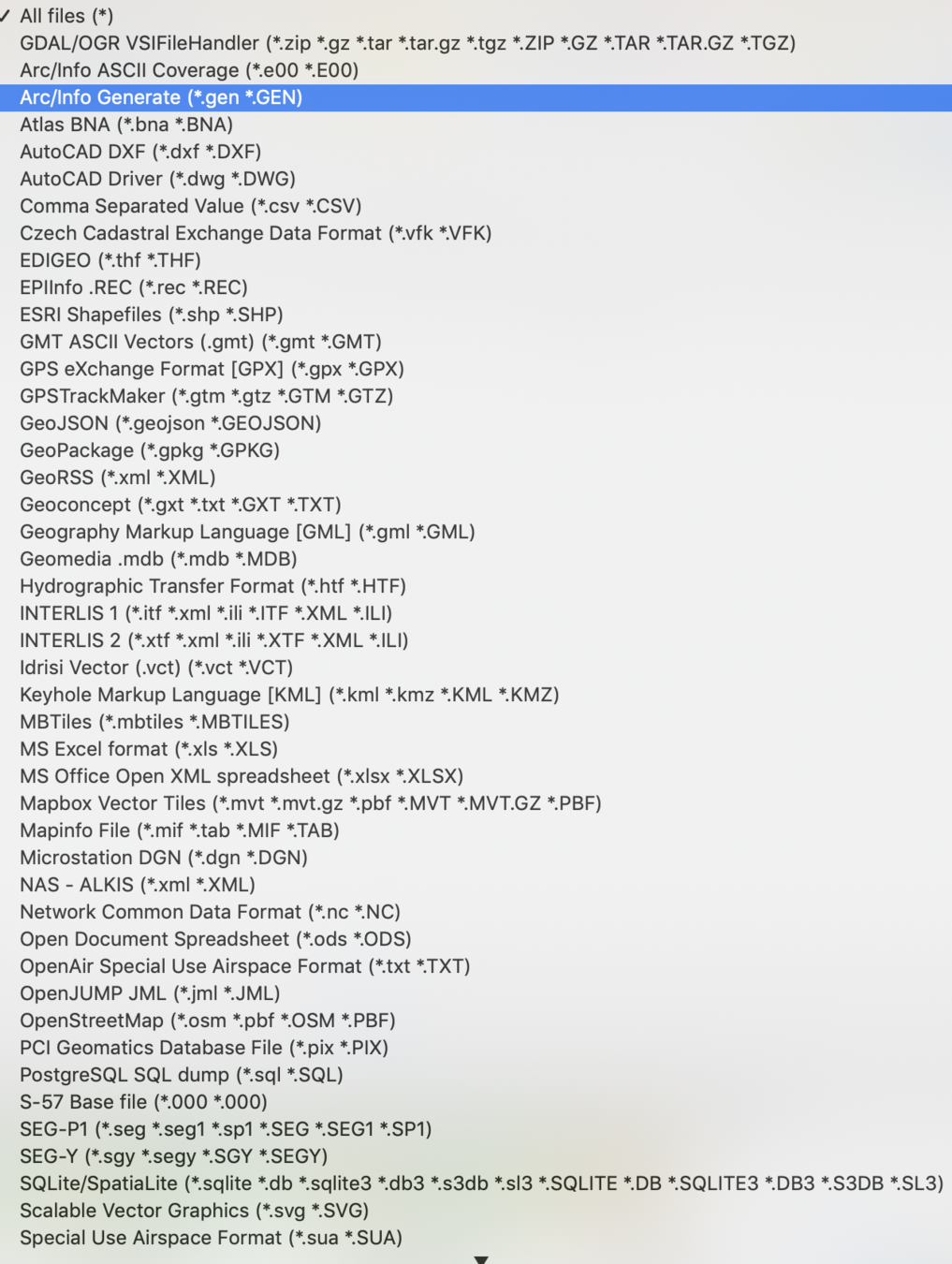
Vector Data
Format Types
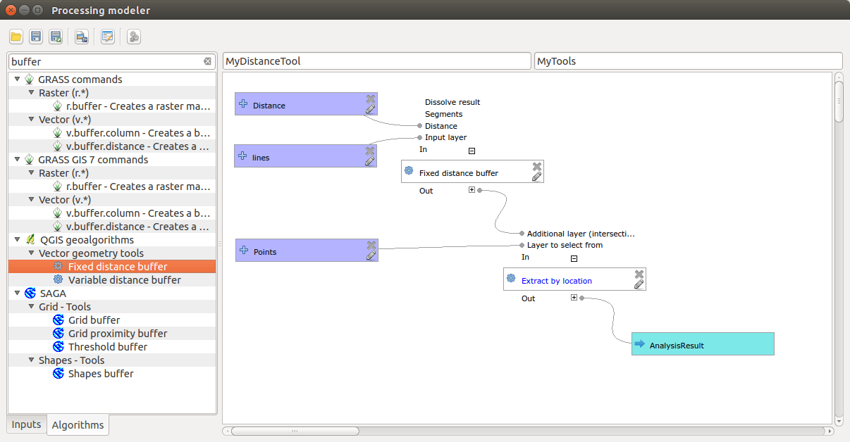
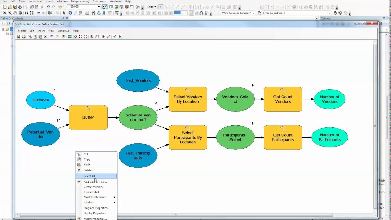
Model Builder
Esri
Model Builder
QGIS
Model Builder


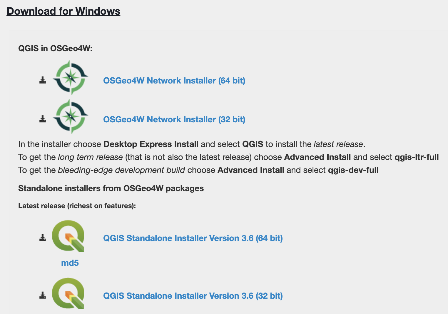
QGIS is ready for Prime Time
- User friendly Install and very stable
- Large community support
- Commercial support available
FOSS4G
Relational Database (RDBMS)
PostgresSQL
+


FOSS4G
Web Platform
JavaScript
Library

WA State: 3 Million Building Footprint ~ 675 MB in GeoJSON format
Tippecanoe
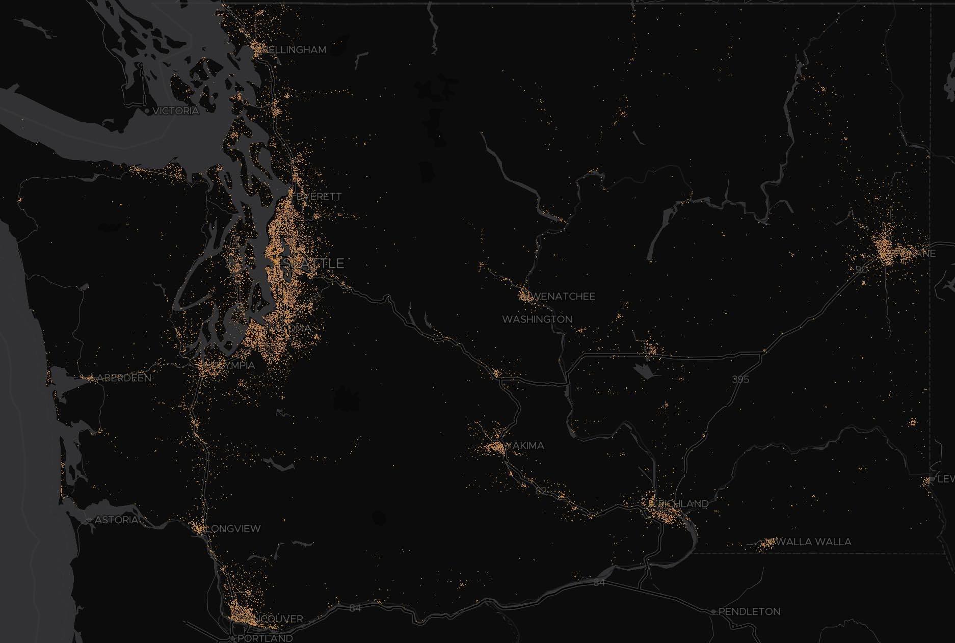
WA State: 3 Million Building Footprint ~ 675 MB in GeoJSON format
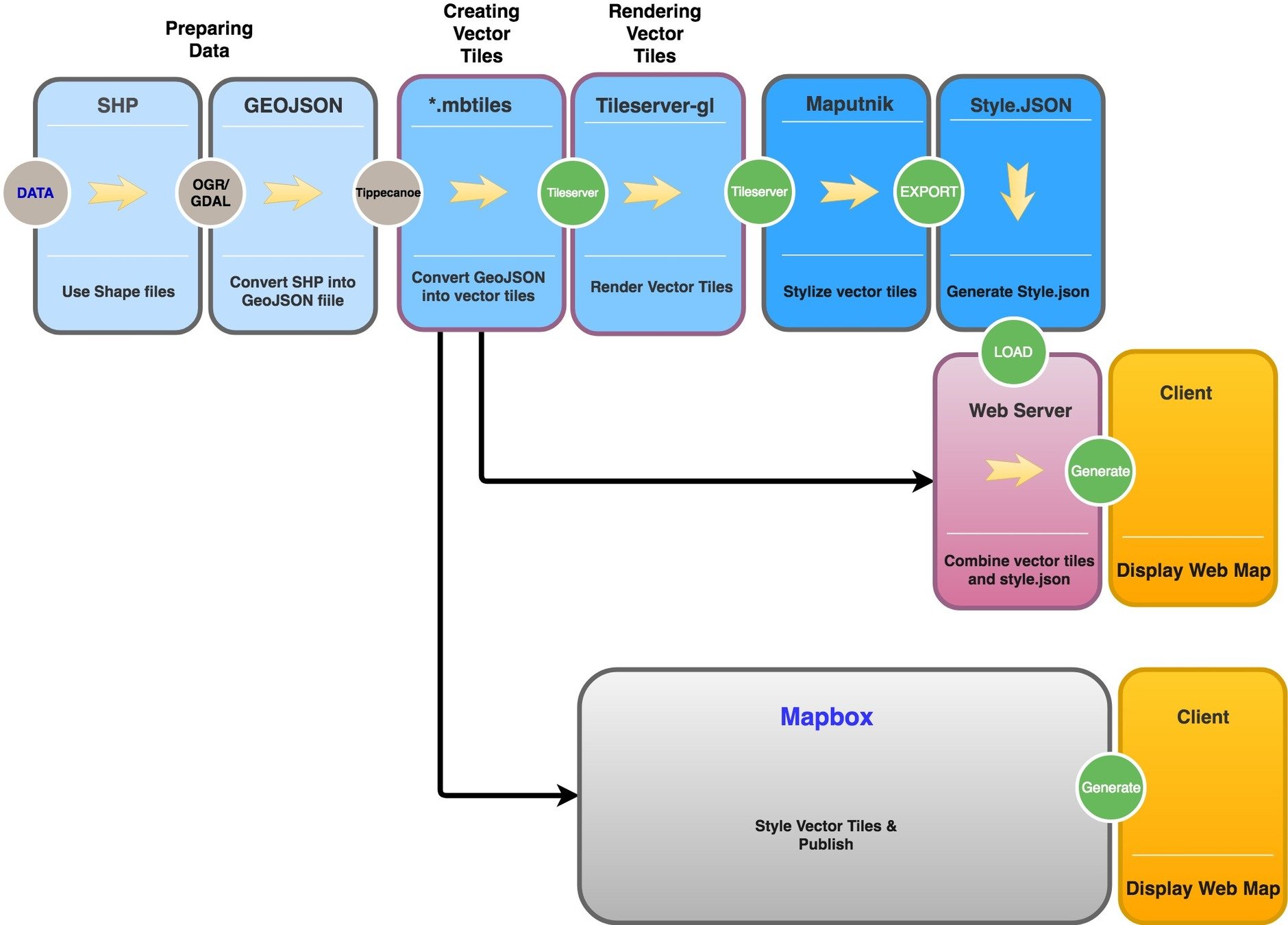
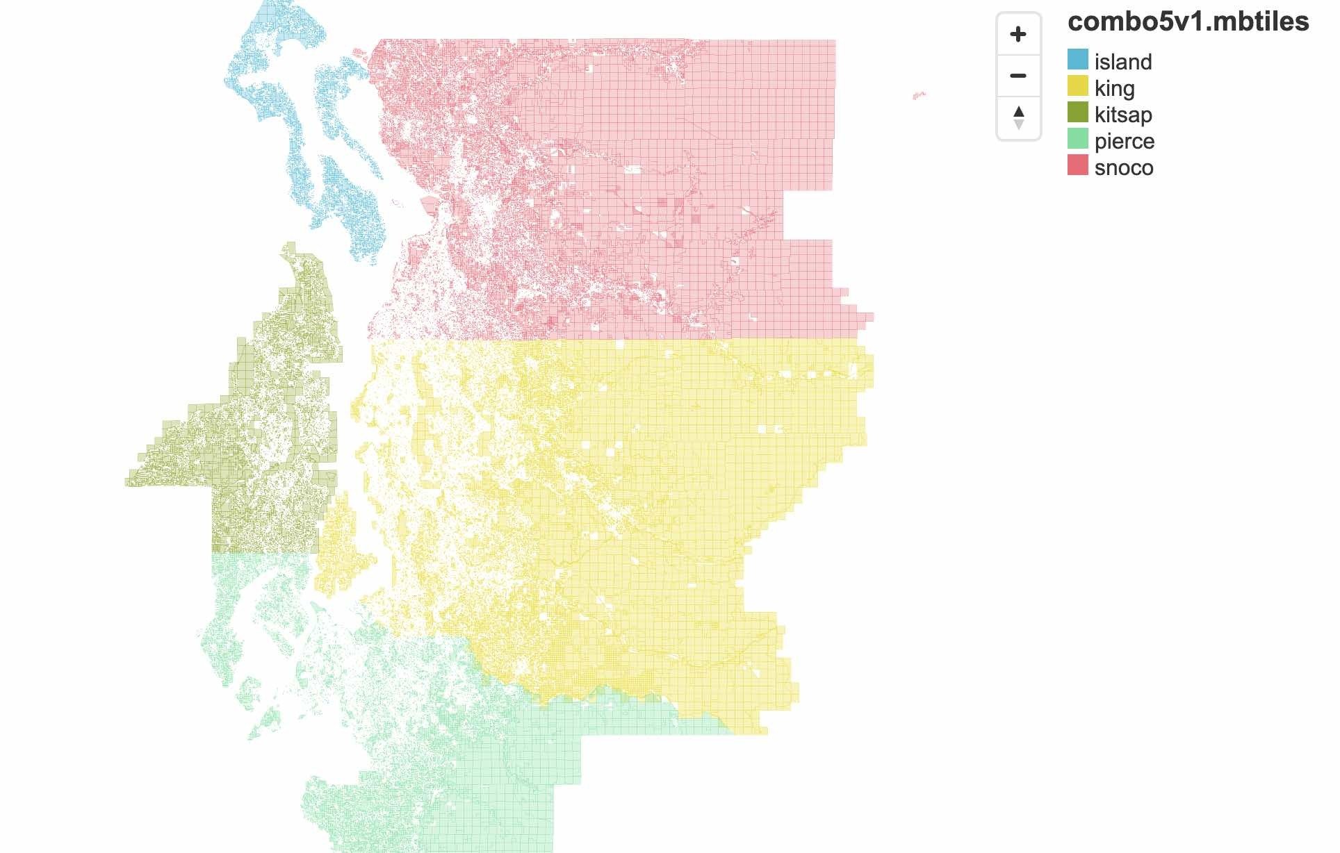
5 County Parcel Data
1.2 Million Polygon
730 MB Shape files
3.1 Million Polygon
3.3 GB Shape files
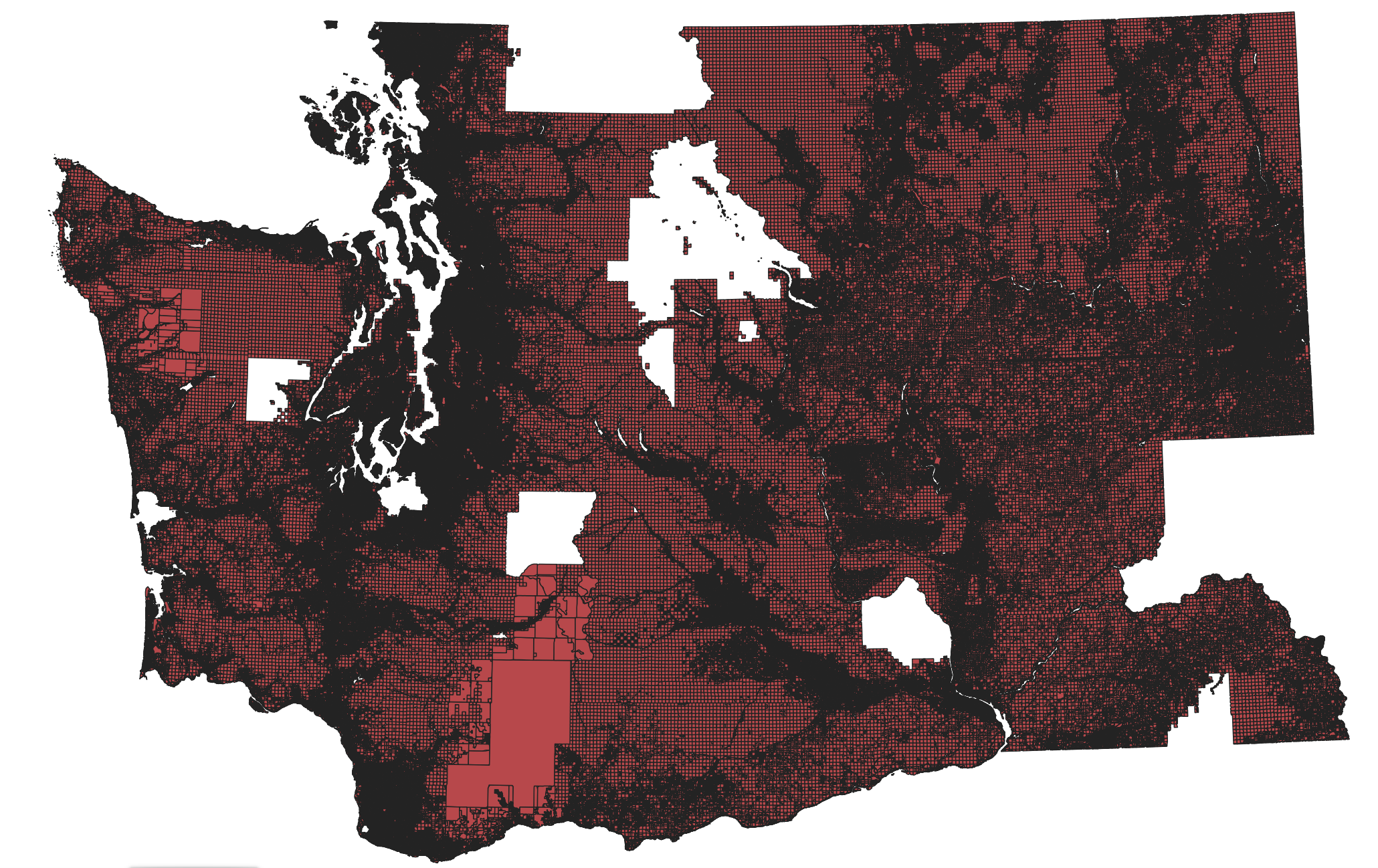
38 Counties
5.7 GB GeoJSON
1.44 GB mbtiles
Flexible

Easy

Homogenous systems and single vendor strategies can be convenient BUT comes with trade-off. Lack of flexibility for fast adoption
VS

(GIS Professionals)
"First do it, then do it right, then do it better."

Credit: Addy Osmani
Doing is Learning, but...

Doing with mistakes?

It's still learning!
A
B
L

C
Tobin Bradley, Mecklenburg County, NC
Community


Let's go make maps!
Thank You
peter.keum@kingcounty.gov

peter.keum@kingcounty.gov
UW GIS Certificate Program FOSS4G - May 11, 2023
By Peter Keum
UW GIS Certificate Program FOSS4G - May 11, 2023
Presentation on Open Source Software (FOSS4G) GIS. What is it and how its being used.


