Small Unmanned Aerial System (sUAS)
Dot Collectors vs. Dot Connectors
December 2, 2019
Peter Keum - WTD GIS Specialist, GISP
peter.keum@kingcounty.gov
Just another tool in the toolbox


WTD Mission:
Protect Public Health
Enhance Environment by Treating & Reclaiming water, Recycling Solids & Generating Energy

-
1.5 million people
-
420 square miles
-
391 miles sewer pipe
Seattle --> Medford, OR

-
Introduction - Hardware & Software
-
Regulations/Guideline - FAA & King County (WTD)
-
Applications & KC WTD Projects
-
What's Next?

small Unmanned Aerial Vehicle (sUAV) "Drone"
- Price /Performance
- Easy to use
- Quality data collection
- Adopting Rule by FAA

Why Now?
Cell Phone Technology + Lower $$
- Electronic Control System (ECS)
- Accelerometer & Gyroscope Chip
- GPS Chip
- Lithium Polymer (LiPo) Battery
- Motors


Integrated gyroscopic/GPS Chip in 2000's = $10,000
In 2017 = $3

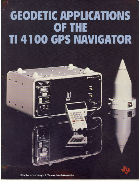
1981 $120,000
2013
$5 - $15

It's just a toy...past examples of what used to be


It's just a toy...


It's just a toy...
It's just a toy...

2016


UAV - Unmanned Aerial Vehicle
FAA Definition: Unmanned Aircraft (UA) system that is operated by a pilot via ground control or on-board computer.


1. Introduction
What's in the name?
UAV = Unmanned Aerial Vehicle
UAS = Unmanned Aerial System
DRONE = Dynamic Remotely Operated Navigation Equipment
RPAS = Remotely Piloted Aircraft System
RPAS Categories

Small
- Size: 1 - 2 meters ( 3 ft - 6.5 ft), < 55 lbs.
- Control: Visual line of sight, Radio control
- DJI Phamtom, Mavic, ScanEagle
Medium
- Size: Equivalent to a car, ~ 1000 lbs.
- Control: Visual Line Of Sight (VLOS) & Beyond LOS, RC & Satellite
- General Atomics -MQ1 Predator
Large
- Size: > 30,000 lbs.
- Control: Visual Line Of Sight (VLOS) & Beyond LOS, RC & Satellite
- Northrop Grumman RQ-4 Global Hawk ~$222 Million


sUAV as Platform
Multi-rotors
Fixed wings

- Short flight time (< 20min)
- Cover small area
- Highly maneuverable
- Less expensive
- Access to confined spaces
- Long flight time (+ 30min)
- Covers large area
- Larger selection of sensors


Sensors


Multi-spectral
Thermal Infrared

Lidar Camera

High resolution digital camera


Thermal Sensor


Inspection Use


Inspection Use

Inspection Use

Multispectral

Agriculture Use

Agriculture Use
FAA Regulations - Where are we now?

2. Regulations
Commercial/Governmental
FAA Part 107 Rule, July 2016
-
Need FAA Remote Pilot Certification (Pilot license NOT needed)
-
As of July of 2018 - 100,000+ active remote pilot certificates
-
Fly under 400 feet above ground level
-
Not to fly < 5 nautical miles around airport
-
Aircraft < 55 lbs.
-
Fly during daytime
-
Fly visual line of sight ( VLOS)
-
No flight over non-participating people
FAA Part 107 Rule
King County WTD
"Subject: WTD Policies on Use of Small Unmanned Aircraft Systems (Drones)
Managers/Supervisors: August, 2016
I’d like you to share the following policy guidance regarding the use of drones for work purposes with your staff as appropriate. The guidance specifically addresses the use of drones classified as small unmanned aircraft systems (UAS), which weigh less than 55 lbs."
- No owning or operating drones by WTD
- Manager/Supervisor review and require Division Director approval
- 3rd Party to meet KC Risk Management requirements
Workflow Example 1
Whidbey Island, Langley Downtown example (Spring, 2014)


3. Application Examples
Flight with Data Collection
- Collected 200 Images
- Using Agisoft PhotoScan to stich images
- Alt. Tool - Microsoft Image Composite Editor (ICE)

Information Product - OpenStreetMap
- Using imagery to digitize street, add features to OSM
http://langleywa.github.io/gisdata/tiles/langley-2nd-street-2014-tms/{z}/{x}/{y}.png- Add below url into OpenStreetMap iD Editor
Application Examples & WTD Projects
Proof-of-Concept
1. KC Brightwater Treatment Plant odor control building), 2014
2. Cedar River Revetment (river bank protection), 2015
3. West Point Treatment Plant - Blue Pumps

Flying Brightwater TP Odor Control Units
Result
Cedar River Revetment (May, 2015)
Pumps (2014)
Workflow
1. Aircraft + Sensor (Data Collection)
2. Data Processing & Analyzing (GIS)
3. Information Products

||
+
Benefits
-
Temporal Resolution
- Fly more often
Offer decision makers with appropriate analytic information products
-
Spatial Resolution
- Monitor continuous changes
- High Spatial resolution than Satellite, Plane
- More Data > More Knowledge > Better Decision Making
WTD Projects
-
West Point Treatment Plant Event
-
West Point Treatment Aerial Photography
-
Mitigation and Monitoring Program


WTD Projects
-
West Point Treatment Plant Incident Feb, 2017

Seattle Times Headline
March 12, 2017
WTD Projects
-
West Point Treatment Plant Incident Feb, 2017
Drone Flights (March, 2017) - Soil Run-off Real cause of plume, not overflow


WTD Projects
-
West Point Treatment Plant Incident Feb, 2017
Drone Flights = Clarification

Photo from Seattle Times
KC WTD Drone Flight
March, 2017
WTD Projects
-
Floating Willow Raft - Mitigation & Monitoring May 2017 - Present

Purpose: Willow growth shade analysis (1.5 acres)
Flight from May 2017
WTD Projects
-
West Point Treatment Plant Orthophoto

- October 2, 2017
- Over 600 images collected
- High Resolution 0.75 inch/piexel


4. So Where is it going...
-
Increase the use of Drone
-
Using it because it does the job better
-
-
Successful technology is not thrilling but becomes essential and accepted

GPT
General Purpose Technology


General Purpose Technology

+
=

+
=
sUAV as Platform
Multi-rotors
Fixed wings
- Short flight time (< 20min)
- Cover small area
- Highly maneuverable
- Less expensive
- Access to confined spaces
- Long flight time (+ 30min)
- Covers large area
- Larger selection of sensors
General Purpose Technology


Dot Collector


Dot Connector


Dot Collector
Dot Connector

END
for now
Thank You
peter.keum@kingcounty.gov
Raisbeck Aviation High School Presentation - Dec 2, 2019
By Peter Keum
Raisbeck Aviation High School Presentation - Dec 2, 2019
Presentation to Aviation High School (10 graders). Introduction to UAV and its use within KC WTD. Solving problem with technology


