Peter Keum
WTD GIS Senior Specialist
Use of RPAS for Wastewater Treatment Division
October 27th, 2021
FAA Part 107 Certified Remote Pilot
Remotely Piloted Aircraft System
WTD GIS Team

- Shaun O'Neil
- Shari Cross
- Patrick Sowers
- Crystal Bach
- Jim MacLachlan
Shaun
Shari
Patrick
Crystal
Jim
- What are drones?
- What can they do?
- How can they be used in WTD?

Lunch and Learn
Short Back Story

CUGOS April 2014

- Price /Performance
- Easy to use
- Quality data collection
- FAA new regulation

Why Now?
Popularity & Advancement of Drone
Cell Phone Technology + Lower $$
- Electronic Control System (ECS)
- Accelerometer & Gyroscope Chip
- GPS Chip
- Lithium Polymer (LiPo) Battery
- Motors


It's just a toy...

2016


It's just a toy...past examples of what used to be


It's just a toy...


So Where is it going...
-
Increase in Enterprise use of Drones
-
Using them because drones do job better
-
-
Successful technology is not thrill but becomes essential and accepted
RPAS - Remotely Piloted Aircraft System
FAA Definition: Remotely piloted Aircraft system operated by a pilot via ground control or on-board computer.


Background Information
FAA Categories

Small - $
- Size: 1 - 2 meters ( 3 ft - 6.5 ft), < 55 lbs.
- Control: Radio control
- $300 ~ $12 K
Medium
- Size: Equivalent to a car, ~ 1000 lbs.
- Control: Visual Line Of Sight (VLOS) & Beyond LOS, RC & Satellite ~ $$$
Large
- Size: > 30,000 lbs.
- Control: Visual Line Of Sight (VLOS) & Beyond LOS, RC & Satellite ~ $$$$


RPAS as Platform
Multi-rotors
Fixed-wing & VTOL

- Shorter flight time (< 30 min)
- Cover smaller area
- Highly maneuverable
- Access to confined spaces
- Less expensive
- Long flight time (+ 40min)
- Covers large area
- Larger selection of sensors (used to be, not anymore)

(vertical take-off & land)

Multi-rotors examples
- Shorter flight time (< 35 min)

Sensors Payload

Multi-spectral
Thermal Infrared

Lidar Camera

High resolution digital camera (100 MP)

Methane Gas Detector

Sensors Payload
High resolution digital camera


Sensors Payload
LiDAR Sensor - aka Laser Scanning
Two Spaces for Drone


Outdoor
- GPS Signal
- Automated Planning and Flight
- Even, Diffuse lighting
- Open space
Indoor
- No GPS signal
- Limits on speed and motion
- Manual flight control
- Tight spaces
Outdoor
Indoor


DJI Air & Mavic 2 Pro < $1800
Aertos 120 $25,000 +
Eilos 2 $48,000 +
DJI Matrice 300 $12,000 +


1. Platform + Sensor (Data Collection)
2. Data Processing & Analyzing (GIS)
3. Information Products


Data Processing & Analyzing (GIS)
(Updated Jan 2020)

Airplane Orthophoto
Software processed Orthophoto from drone
Benefits
- High Temporal Resolution
- High Spatial Resolution
- Fly Same area many times

Benefits
-
Higher Spatial Resolution
- Monitor continuous changes
- Higher Spatial resolution than Satellite, Airplane

Benefits
Give decision makers appropriate analytic information products
- Better Data -> More Knowledge -> Better Decision Making


Benefits


Drone

GIS
Great Combo?
&
Great combo !
GIS & DRONE


FAA Regulations - Where are we now?

Regulations
Commercial/Governmental
FAA Part 107 Rule, July 2016
-
Need FAA Remote Pilot Certification (Pilot license NOT needed)
-
~250,000 - Remote pilots certified (2021)
-
441,709 - Commercial Drones Registered
-
Fly under 400 feet above ground level
-
Not to fly < 5 nautical miles around airport
-
Aircraft < 55 lbs.
-
Fly during daytime or night time operation with appropriate lighting
-
Fly visual line of sight ( VLOS)
-
No flight over non-participating people
FAA Part 107 Rule
King County WTD
August 2016: Approval to use 3rd party drone vendor
- Support Mitigation & Monitoring Program
June 2018: Implementation of simple contract method for 3rd party vendor

- 27 Successful Drone Flights
King County WTD
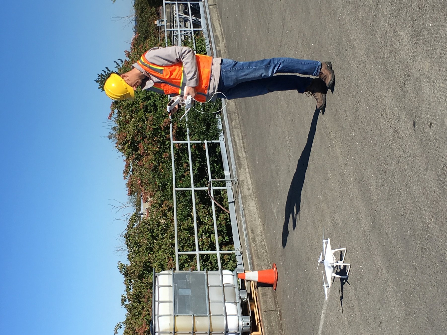
April 2021: Approval from WTD Management for WTD staff to use drone technology
June 2021: Purchase of Mavic Pro 2 Drone!


- Pam Erstad - Mitigation & Monitoring
- Chad Merrill - Project Resource
- Mike Sands - CIFM
- Sue Kaufman-Una /Mark Buscher - PPD Planning
- Shaun O'Neil - GIS & many others for encouragements
- 5 Missions flown with in-house staff June - October, 2021
WTD Projects
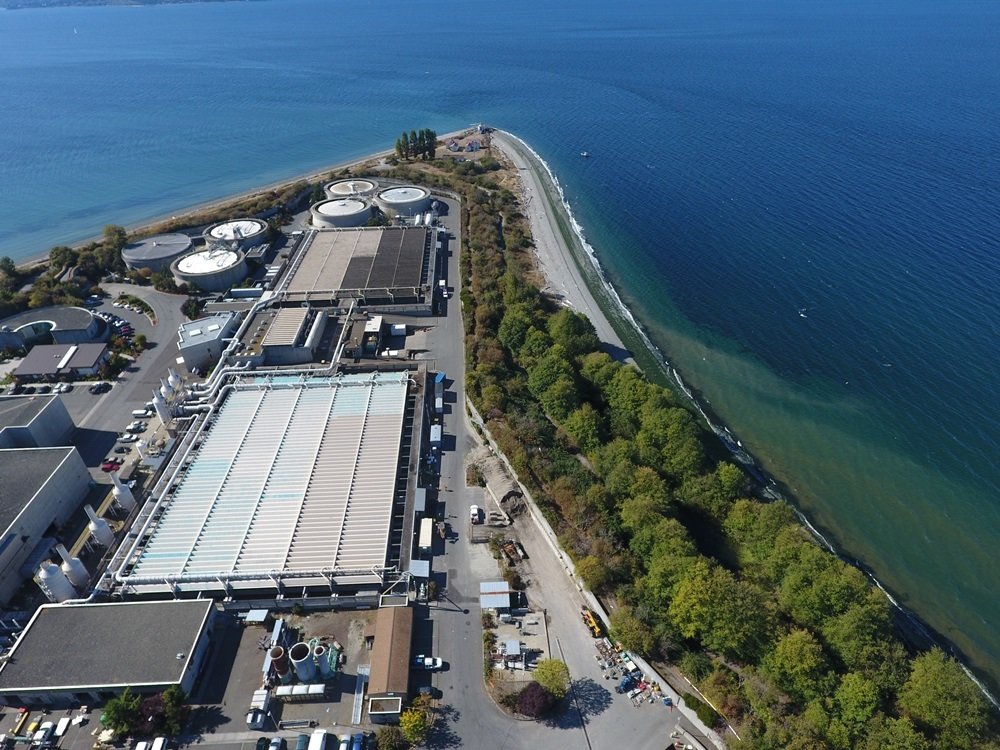
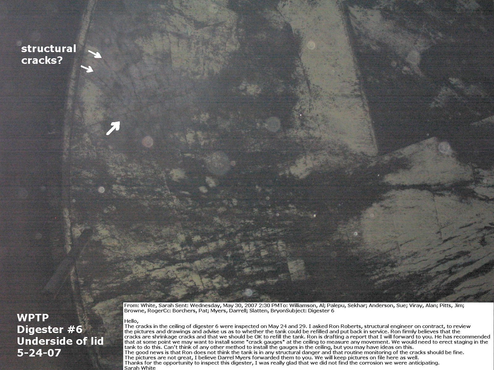
-
West Point Treatment Plant Incident Feb, 2017

Seattle Times Headline
March 12, 2017
WTD Projects
-
West Point Treatment Plant Incident Feb, 2017
Drone Flights (March, 2017) - Soil Run-off Real cause of plume, not overflow


WTD Projects
-
Mitigation & Monitoring Group - 36 flights since 2017
-
Denny Regulator Station Erosion Project - 3D Model


WTD Projects
-
Mitigation & Monitoring Group - Sunset Hill PS for regulatory reporting


Why Use Drones?
-
Increase safety for staff
-
Avoid hazardous conditions
-
Precision data collection
-
Repeatable & recordable & searchable
-
Higher efficiency of data collection improves product development & analytical capabilities
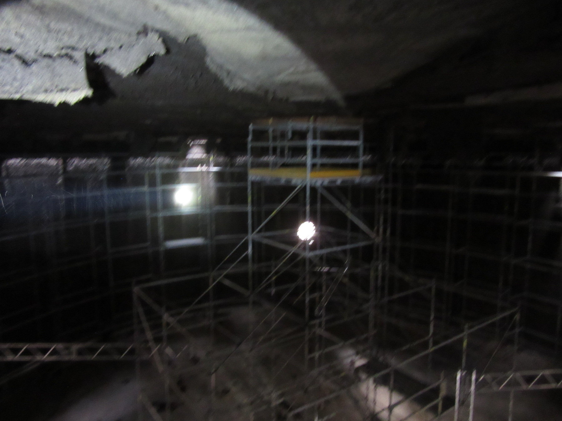
Avoid Hazardous Conditions Like These
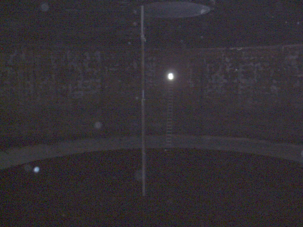


West Point TP - Digester
Manual Data Collection
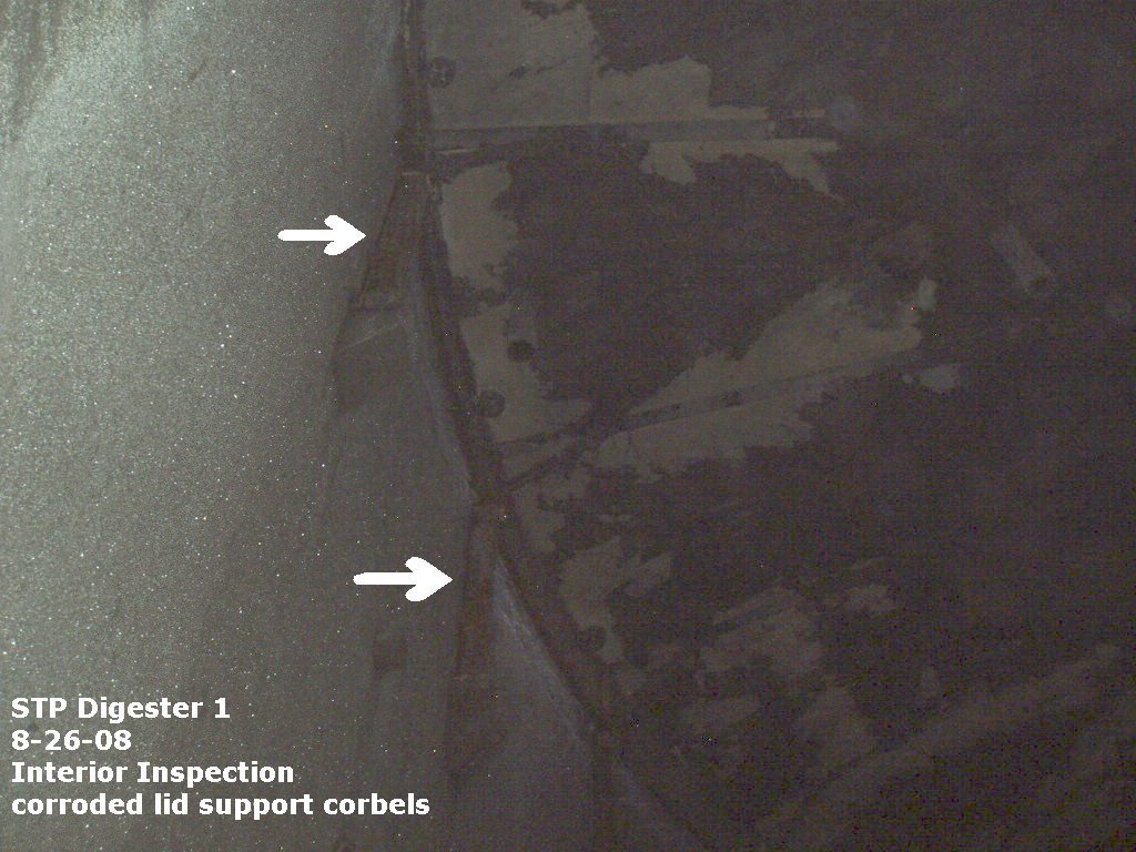


Sample of Drone Data Collection


credit: Terra-inspectioneering.com
Text
Text
Text
Ultrasonic NDT 9 (Non-Destructive Testing)
Visual Inspection


Standard Drone Workflow

WTD PM Workflow

KC or Vendor

Memo Template
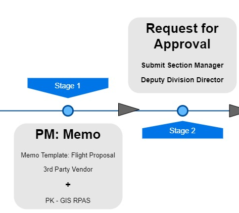
Simple Contract Template (3rd Party Use)

GIS Products


Where are we now?

Where are we heading?

People
+
Technology
+
Organization
=
Drone Program
Benefits
Drones, What are they Good for?
peter.keum@kingcounty.gov
Just another tool in the toolbox

Let's Go collect the Data
&
Find Solutions
There's More!
Live Demo
M&M - Sites (Kenmore & Sunset Hill PS)
West Point - Clarifier Pano
BW BOC - Roof & Pano
BW - Digester 3D model
Integration of 3D model with AGO 3D scene viewer
Questions?

peter.keum@kingcounty.gov
WTD RPAS Program Presentation for Lunch & Learn - 10/27/21
By Peter Keum
WTD RPAS Program Presentation for Lunch & Learn - 10/27/21
Modified WTD Drone Presentation from PM with more general information for WTD in-house staff Lunch & Learn


