Current Architecture
- File-Based GIS Data Structure
- Esri ArcMap & ArcGIS Pro Desktop GIS Software
- $1,845/YR in Esri Software Licensing Fees
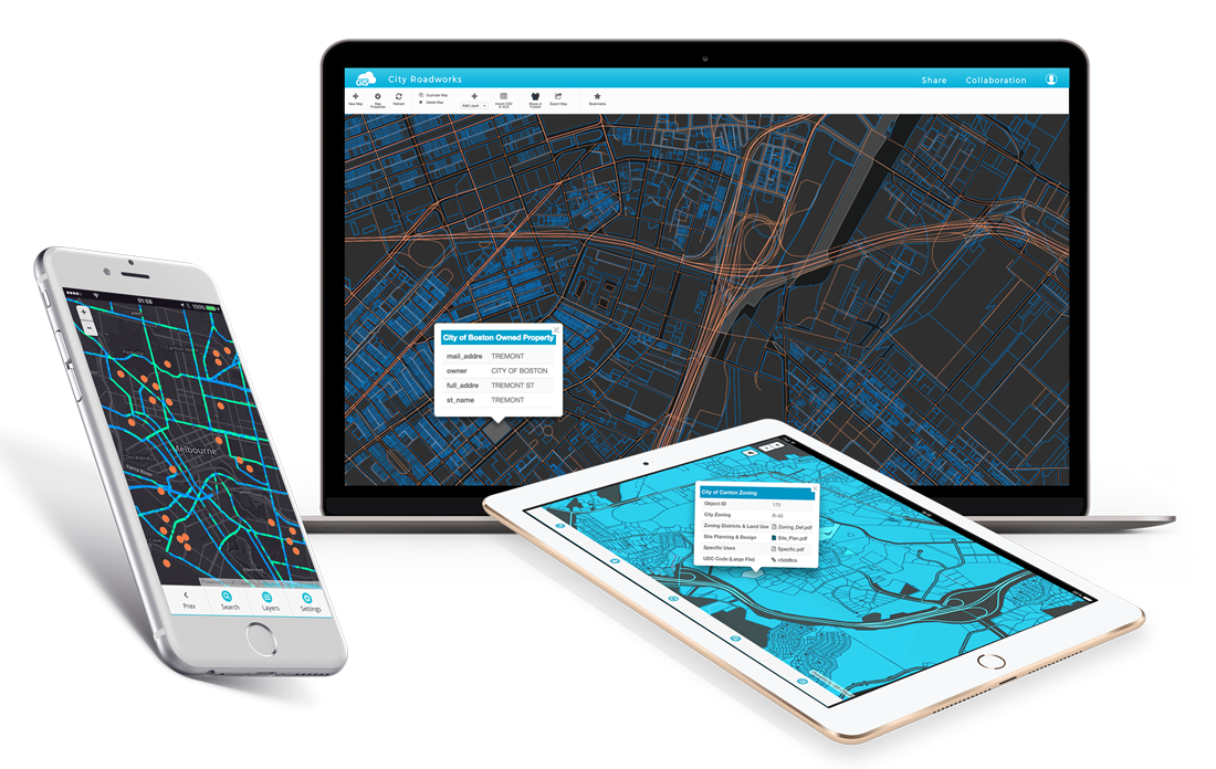
- gis.coz.org - Custom-built Read-Only Web GIS Applications
- Testing Use of Community Supported GIS Software
Fragmented GIS Local File Hosting & GIS Web Data Hosting
No Field GIS Editors or Web-based Editing Applications in use
Current GIS Applications
-
Desktop GIS - ArcMap, ArcGIS Pro, & QGIS
-
Original Imagery, Files, Photos, Plans, etc on IT Server
-
Dynamic GIS Data Storage on IT Server
-
-
Web Host - Netlify (Free Tier) - gis.coz.org
-
File Hosting (Images and Documents linked to Assets)
-
Web GIS Data Hosting
-
-
Data Host - Mapbox (Free Tier, costs could change)
-
Web GIS Data Hosting
-
-
App, Web & Data Host - Esri ArcGIS Online (Limited Use)
-
Collector & Workforce Apps - Field Editing & Work Orders
-
Web GIS Data Hosting
-
GIS Looking Ahead
- 2 New GPS Units coming soon (1 water, 1 engineering)
-
Storm sewer asset collection should start July 2019 - ?
- First use of ArcGIS Collector for Asset Collection
- Water data will be delivered summer/fall 2019
- GIS solution for tracking water/sewer field work
- Esri Collector, Workforce, Survey123, or Third Party
- Mapillary street view imagery collection Fall 2019
- Research & testing of GIS server solutions to consolidate web-hosted GIS data and potentially replace internal IT server for GIS data storage
Storm Sewer Asset Collection
- Trimble R2 high accuracy GPS device (coming soon)
- Use Esri's Solution to jump start the data schema
- Use Esri's "Collector" Application for Android/iOS/Windows (app is free)
- Need a minimum of 3 additional AGOL Editors @$350/yr
- Data stored on Esri's cloud - ArcGIS Online
- (minimal if any cost)
- Data can be edited in Collector or ArcMap in real-time
- Data can be viewed publicly as read-only - available on gis.coz.org/internal/storm-sewer (not yet live)
Text
Other options being considered
Storm Sewer Asset Collection Cont.
- Start with a small area and collect all assets - points & lines with Malcolm and Scott's field crew
- Once complete, evaluate the process to determine if the field crew can collect on their own, at least for point-based data
- Evaluate sewer camera software & GIS integration
- Revisit if Mapillary asset extraction would be helpful
IT File Server
Netlify & Mapbox Web Hosts
gis.coz.org
GIS Desktop (ArcMap)
Cloud Real-Time Database
Field Collection Application
GIS Database
Web Server
gis.coz.org
Esri GIS Server
ArcMap, Collector & Workforce
QGIS
ArcGIS Online
QField or Custom Mobile App
Storm Sewer Asset Collection Tasks
- Tweak & Test Collector App - GIS
- Test out the GPS unit - GIS
- Finalize collection parameters - Malcolm/Scott
- Choose camera software - Scott
Path Forward
Host Once - Available Everywhere
-
IT File Server
-
Original Ortho Imagery, Files, Photos, Plans, 3rd Party GIS Data
-
-
GIS Database & Web Server
-
GIS Website
- GIS Database Storage
- Web GIS Data Hosting
-
Web File Hosting & Ortho Image Hosting for web maps
-
- App, Web & Data Host - Esri ArcGIS Online (Limited Use)
- Collector & Workforce Apps - Field Editing & Work Orders
- Web GIS Data Hosting
Minimum Upgrade Requirements
Cloud-Hosted GIS Database
Dedicated GIS Web Server - Maintained by GIS or IT
- Could add on to current Netlify with Pro plan $45/mo
- Adds Basic Authentication
Cost Estimate
$600 - $1200/YR
GIS Database
Web Server
gis.coz.org
QGIS
ArcMap, Collector & Workforce
ArcGIS Online
QField or Custom Mobile App
GIS Database
Web Server
gis.coz.org
Esri GIS Server
ArcMap, Collector & Workforce
QGIS
ArcGIS Online
QField or Custom Mobile App
What's Missing?
Seamless Editing from the Desktop to the Cloud
- Use QGIS (or ArcMap via sync)
- Purchase Esri ArcGIS Enterprise or an ELA
Workforce Management App & Dashboard
- Custom or Third Party Solution
- Purchase Esri ArcGIS Enterprise or an ELA
Integrated Field Data Editing Solution
- Custom Editing App
- Use GIS Cloud
- Use ArcGIS Online (via sync)
- QGIS or QField
- Purchase Esri ArcGIS Enterprise or an ELA
Starting Point: Edit Locally & Cloud Hosting
- Edit data locally then push edits to an internally managed cloud infrastructure for public consumption
- Field collection using AGOL Collector
- Other options
- QGIS or QField
- GIS Cloud
- Develop a custom field editing web application
- Other options
Additional Cost Estimate
$0 + Field Editing Solution
Pros
-
Full control over Web Applications
-
Unlimited Private Viewers
-
Unlimited Field Editors with Custom App
-
Potential Cost Savings
-
Co-Exist with Esri Solutions
-
Good Starting Point
Cons
-
No direct GIS Database Editing with ArcMap (push and pull edits)
-
No direct GIS Database Editing with ArcGIS Collector (field app)
ArcGIS Online Collector & More
Collector - Mobile Field Editing App
Workforce - Work Order Management
Survey123 - Form-based field data collection
Currently we have 3 licenses, more at $350/yr
Additional Cost Estimate
$1,050+ (3 Editors for Field Collection)*

*Additional $$ might be needed for ortho image hosting & basemap hosting
Pros
-
One-to-many relationships
-
Survey/Form Builder
-
Cross-Platform
-
Simple App and Configuration
-
Add Photos or File Attachments
Cons
-
No Direct Editing to the cloud-based GIS Database without ArcGIS Enterprise
-
All users need a license for "private" data, even viewers
Vendor Solution
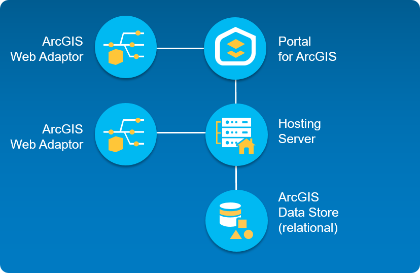
ArcGIS Enterprise
Esri ArcGIS Enterprise Standard License & Maintenance
- A New, Dedicated Server for the “Base Deployment”
- Direct Editing in ArcMap Desktop & Collector Mobile App
- 8 Field Editor Licenses, more at $350/editor
- Unlimited Internal Viewer Licenses for Private Data
Additional Cost Estimate
$18,000 YR1 | $7,000 YRS 2+
GIS Database
Web Server
gis.coz.org
Esri GIS Server
ArcMap, Collector & Workforce
QGIS
ArcGIS Online
QField or Custom Mobile App
Pros
-
All GIS data stored in one place
-
Seamless Editing with ArcMap
-
Versioned Editing
-
Interface with other services that require ArcGIS Server
-
Out-of-the box web applications
-
Utility Network Analyst (Paid add on)
Cons
-
Cost
-
Extremely complex server setup and deployment
-
Being dependent on a ‘black box’ GIS solution
All-In on Esri
Esri ELA
Esri ArcGIS Enterprise License Agreement
- A New, Dedicated Server for the “Base Deployment”
- Direct Editing in ArcMap Desktop & Collector Mobile App
- 50-100 Field Editor Licenses, more at $350/editor
- Workforce
- Unlimited Viewer Licenses
- Unlimited Desktop GIS Installations
Additional Cost Estimate
$25-35,000/YR
Additional ELA Details
Newark & Lancaster both have an ELA
One-Click Web Applications & Dashboards - "Sites"
Additional ArcGIS Desktop "Extensions"
Insights for ArcGIS - Statistical Exploratory Data Analysis
Workforce Integration with the 50-100 Field Editors
Number of Tickets to the Esri Party in San Diego - 3
Biggest Drawbacks
Putting all our 🥚in One 🗑️
Investing in a Legacy Software Company
Cost $$$
Discussion
Esri's Focus is on Large Enterprise Customers
New GIS Solutions have a Wider Audience
searches for arcgis server
arcgis enterprise
searches for mapbox
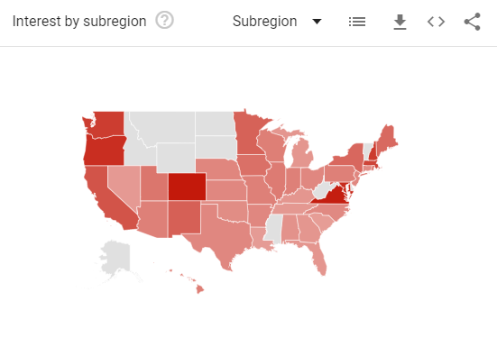
searches for Leaflet
Adoption of Custom GIS Applications

ArcGIS Workgroup
Server Only
Limited Enterprise Environment
- A New, Dedicated Server for the “Base Deployment”
- Direct Editing in ArcMap Desktop & Collector Mobile App
- Limited to 10 Simultaneous Users
- SQL Express Database
- Hard to come up with this scenario
Additional Cost Estimate
$4,000 + $1,300/YR
Add-Ons
GIS Cloud
Direct cloud-based GIS Database Field Editing App for iOS & Android
Additional Cost Estimate
$4,000/YR
8 Field Editor Licenses, more at $240/editor
Pros
-
Jump-start Field Collection
-
Vendor-backed Field Editing Solution
-
Survey/Form Builder
-
Hands-On Support
-
Cost savings vs Third Party App Development
Cons
-
No Workforce Solution
-
Limited Market Adoption
-
One-to-many relationships not built-in
GIS Upgrade Options
By Malcolm Meyer
GIS Upgrade Options
CIty of Zanesville


