Geo formats

A presetation by Moritz Klack


History of Maps

Sant Sever Beatus,  1050


Pietro Vesconte's World Maps, 1321


T-O Maps


Sebastian Münster, 1546


Geographic Information System - GIS

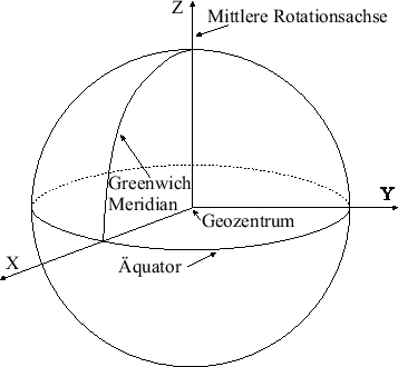
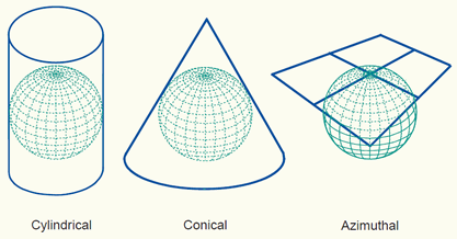
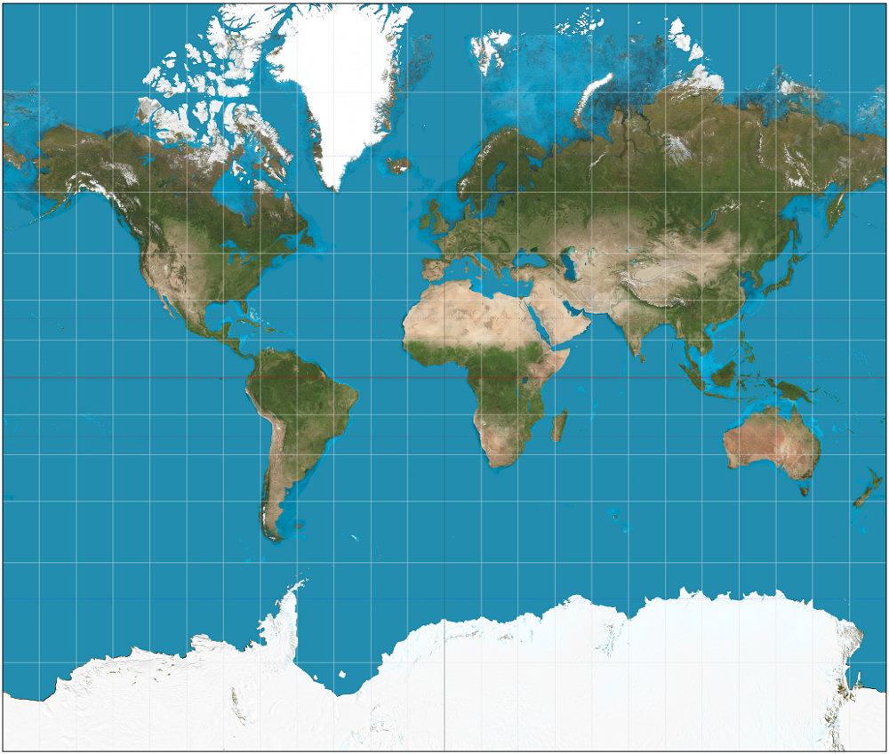
 a system designed to capture, store, manipulate, analyze, manage, and present all types of geographical data


File Formats

FORMATS

  • Shapefile (*.shp)
  • Keyhole  Markup Language (*.kml)
  • GeoJSON (*.geojson/*.json)
  • TopoJSON (*.topojson/*.json)

ShapeFIle

  • quasi standard in open and proprietary GIS
  • requiered files:
    • .shp - geometry
    • .shx - link between data and geometry
    • .dbf - stores data
  • contains vector features
    • points
    • lines
    • polygons
  • Berlin districts: ~1MB

KML

  • used by Google Maps, Google Earth, Here Maps
  • most GIS support KML
  • XML-sytnax
  • contains features
    • place marks
    • images
    • polygons
    • 3D models 
    • textual descriptions
  • Berlin districts: ~1.6MB

KML EXAMPLE

  • <?xml version="1.0" encoding="UTF-8"?>
    <kml xmlns="http://www.opengis.net/kml/2.2">...
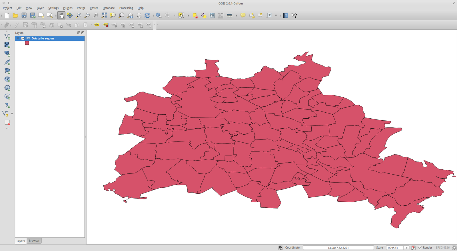
    <Document id="Ortsteile_region">
    ...<name>Ortsteile_region</name> <Placemark id="ID_00000"> <name>Mitte</name><MultiGeometry> <Polygon>
    <coordinates>13.37362286299343,52.52791796547066,0 13.37364518620253,52.52792475364288,0 13.37365435328787,52.52791569606663,0 13.37366296142388,52.52791930937661,0 13.37366822862658,52.5279121307976,0 13.37382440080229,52.5277002744215,0 13.37383713712033,52.52768340550835,0

GEOJSON

  • based on JSON
  • Berlin districts: ~1MB
{
"type": FeatureCollection",                                                                      
"features": [{ 
	"type": "Feature", 
	"id": 0, 
	"properties": { "Name": "Mitte"}, 
	"geometry": { 
		"type": "Polygon", 
		"coordinates": [ [ [ 13.40352847102303, 52.54021229004892, 0.0 ], [ 13.404195042442391, 52.540401557443609, 0.0 ], [ 13.40470464073112, 52.540187628057957, 0.0 ], [ 13.405134295149891, 52.539286920086013, 0.0 ]
... 

TOPOJSON

  • Extension of GeoJSON
  • Very small filesize
  • New Feature: Topology
  • works with a boundary mesh rather than seperated polygons
  • "uses fixed-precision delta-encoding for interger coordinates" [9]
  • Berlin districts: ~150kB

TOPOJSON EXAMPLE

World GEODETIC SYSTEM - WGS

  • global standard for cartography and navigation
  • position information for the earth and space 
  • current  standard: "WGS 84 : EPSG:4326"
  • used by GPS


WGS

WGS EXAMPLE

Kottbusser Tor:
Latitude: E 52°29'56. 616" = 52° 29.943600' =  52.49906°
Longitude:  N 13°29'5.5632" = 13° 25.092720' =  13.418212°

Projections

  • map locations of a sphere to a plane
  • no projection without distortion
  • mapping with the help of a plane,cylinder or cone

Mercator Projection


ALBERS PROJECTION


AZIMUTHAL PROJECTION


PROJECTION EXAMPLE


Thanks

Moritz Klack

Sources

Geo Formats

By Moritz

Geo Formats

Short overview of geo formats.

  • 1,973