To support the use of geospatial data & technology in research and teaching at Stanford
(whatever that means at any given time)
Treat geospatial technology awareness as information literacy and research skills
We deliver "small bite" targeted services (training, support, consulting, software provisioing, data services), with the objective of building research skills among our users that maximize the use of our data collections, particularly those we spend annual budgets on.
I'd like to do network analysis of optimal delivery routes, based upon rail and navigable waterways...
How do we capture the home locations of cholera patients who live in villages that aren't on the map?
How do I display a photo collection on a web map when there are 170,000 photos in the collection?
I've got a database of 100 million global business addresses. How do I geocode that?
geospatial data is different
it has geometry
and scale
and extent
and temporality
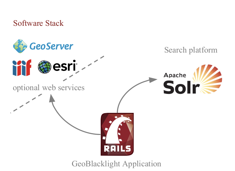
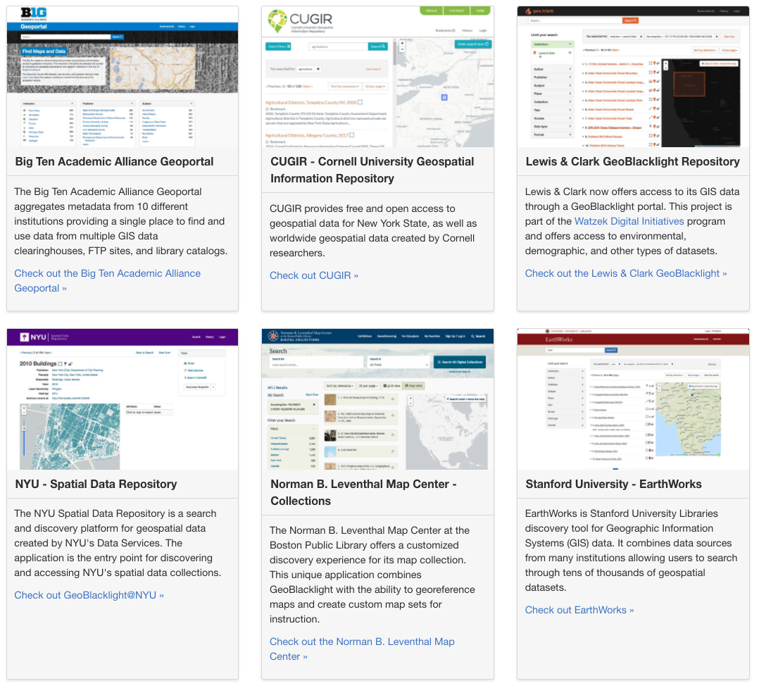
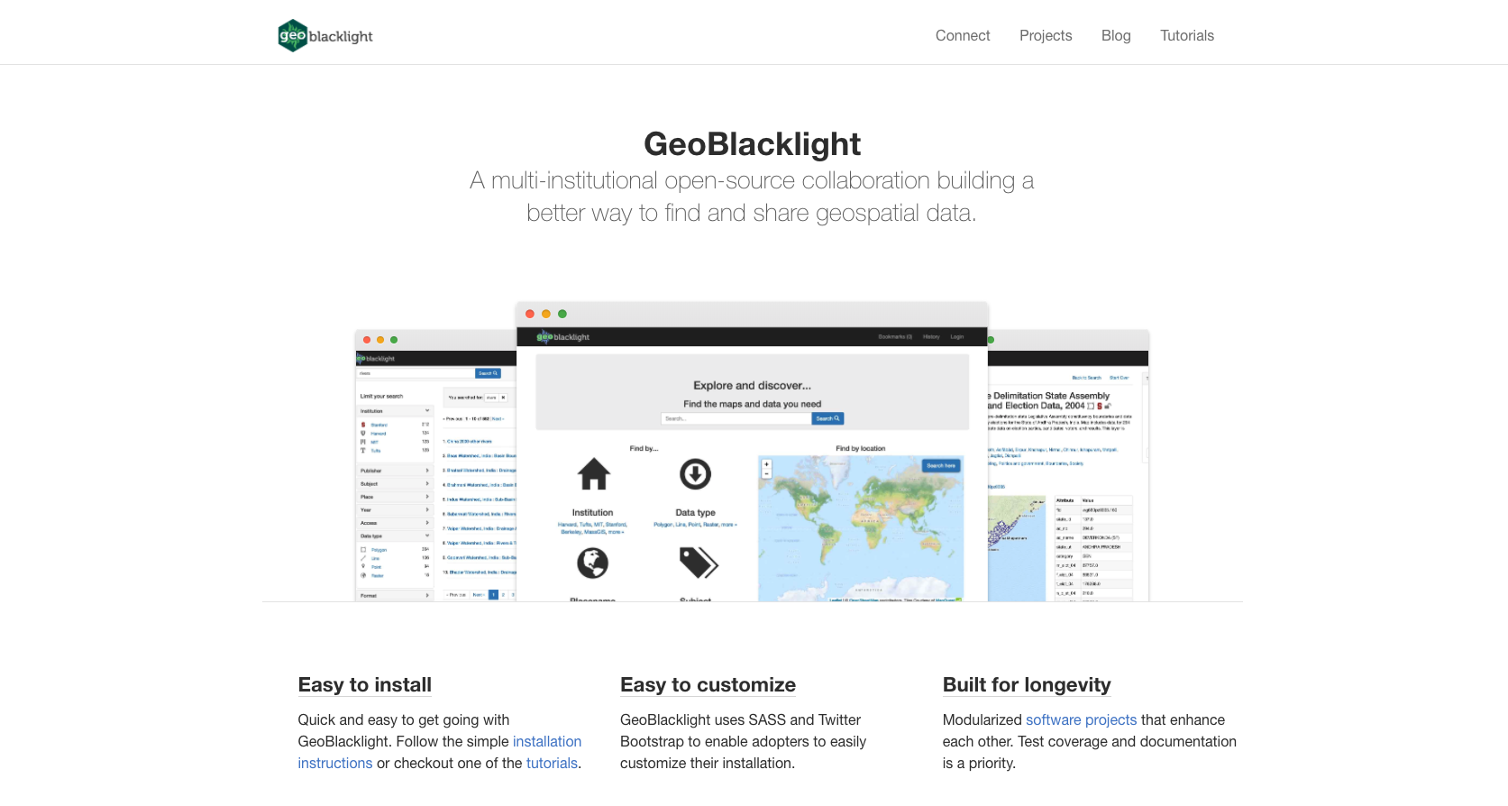
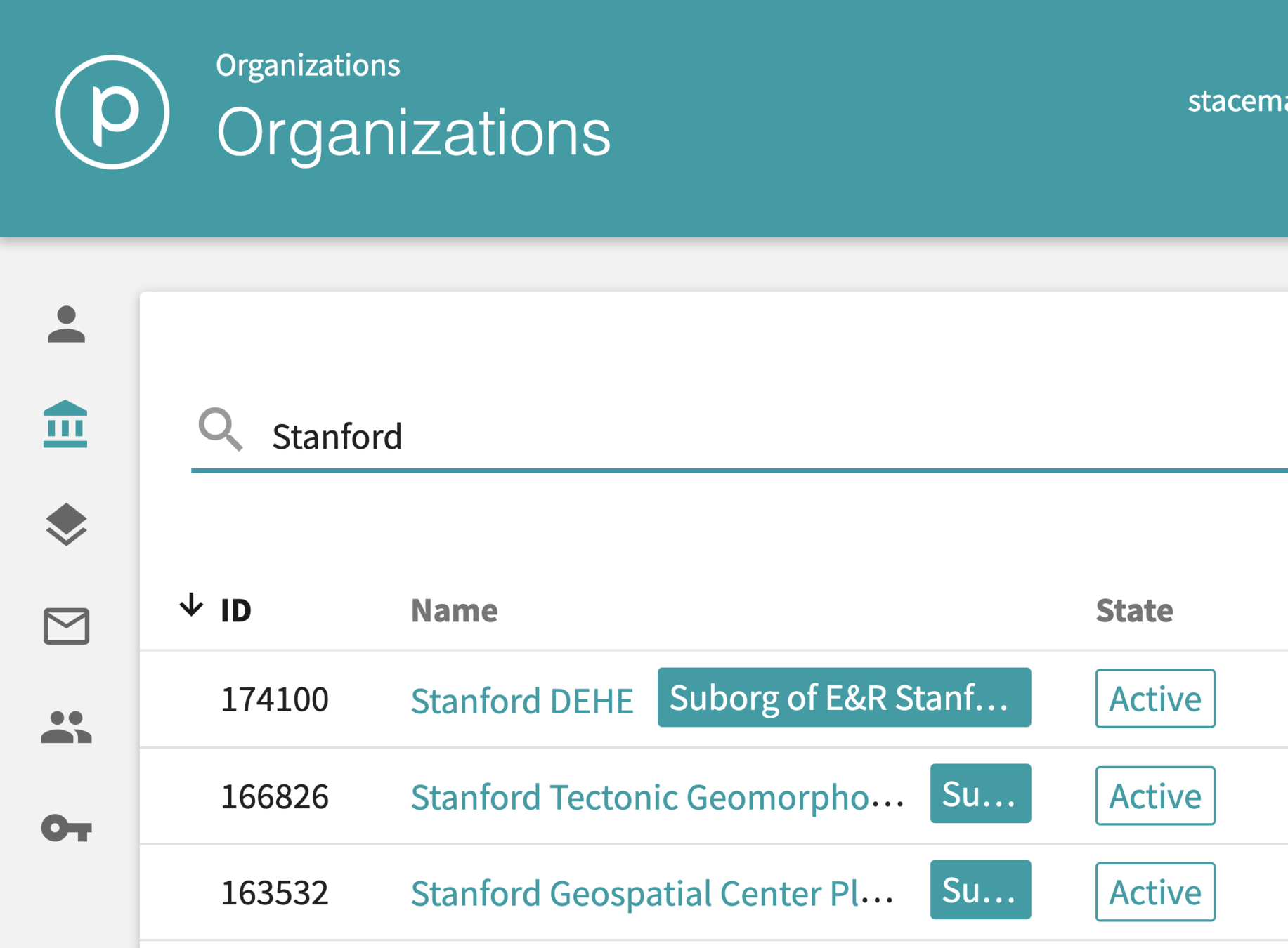
GeoBlacklight
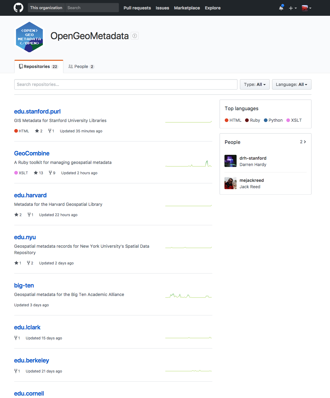
OpenGeoMetadata
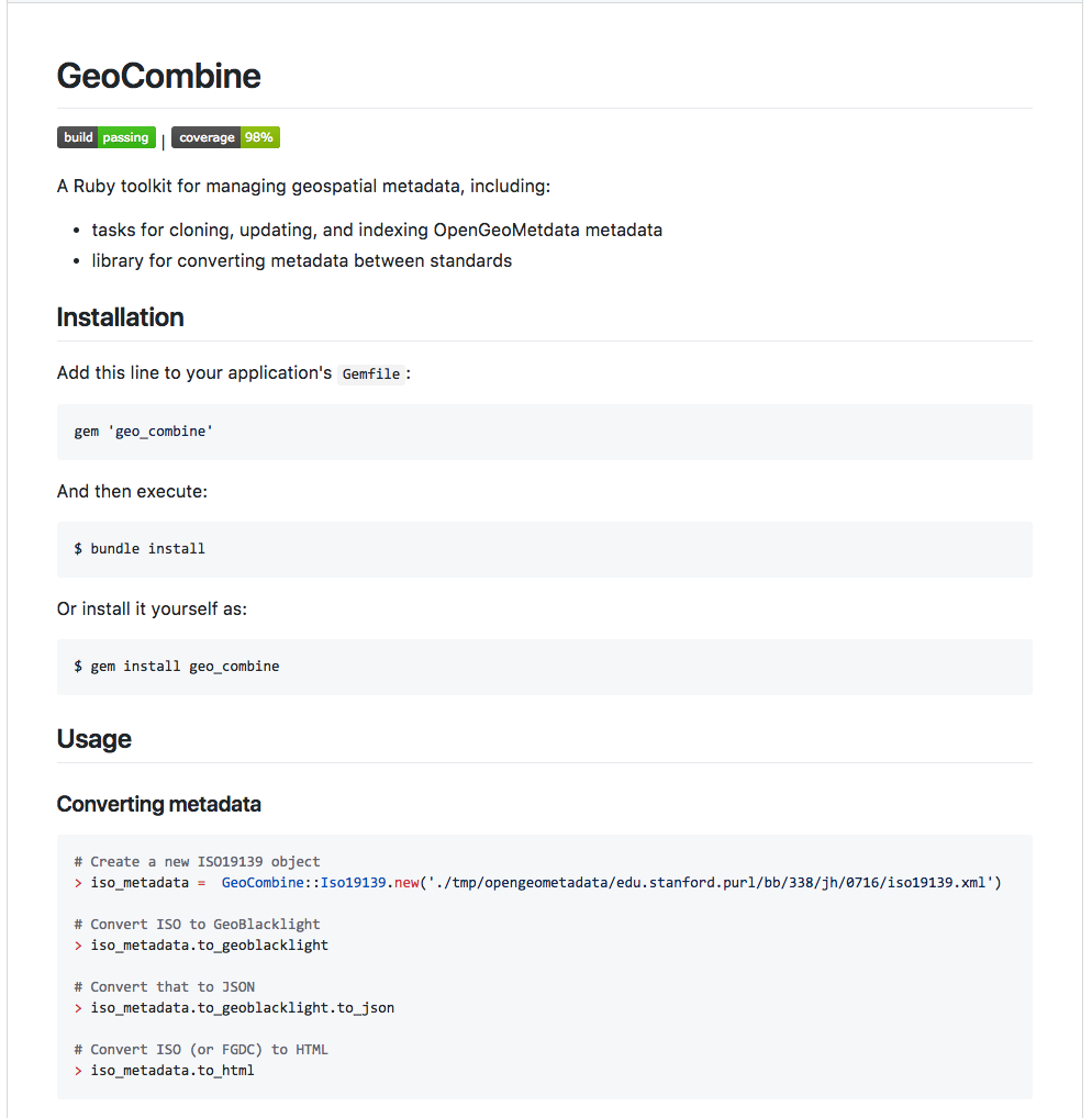
GeoCombine
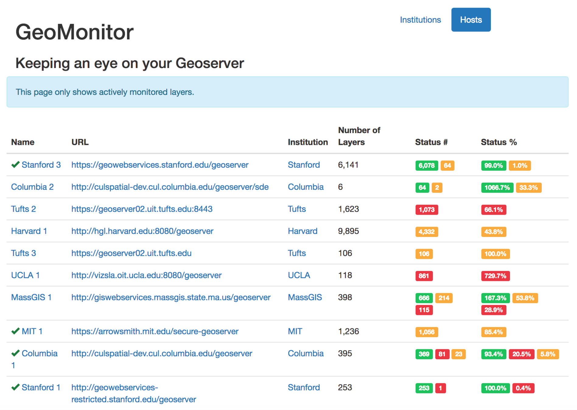
GeoMonitor
Stanford Digital Repository
Stanford Spatial Data Infrastructure
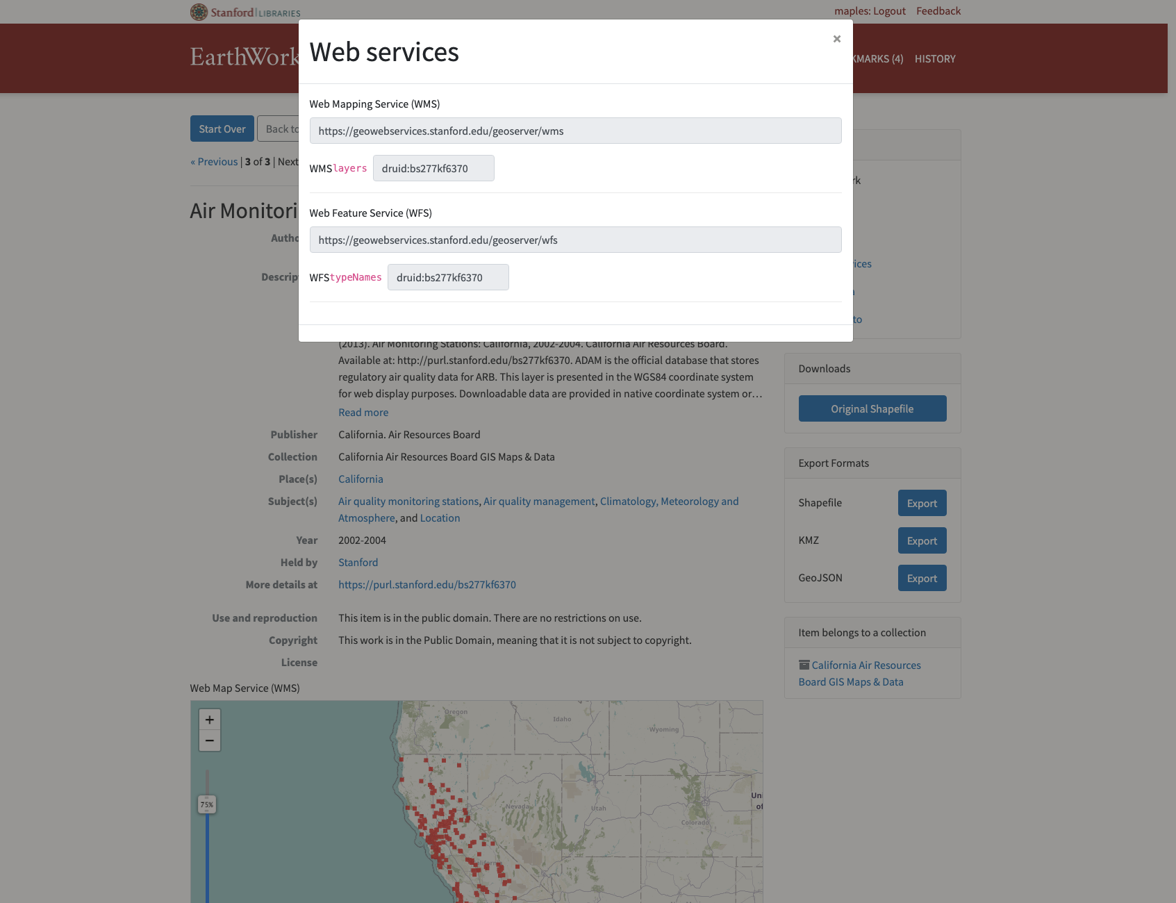
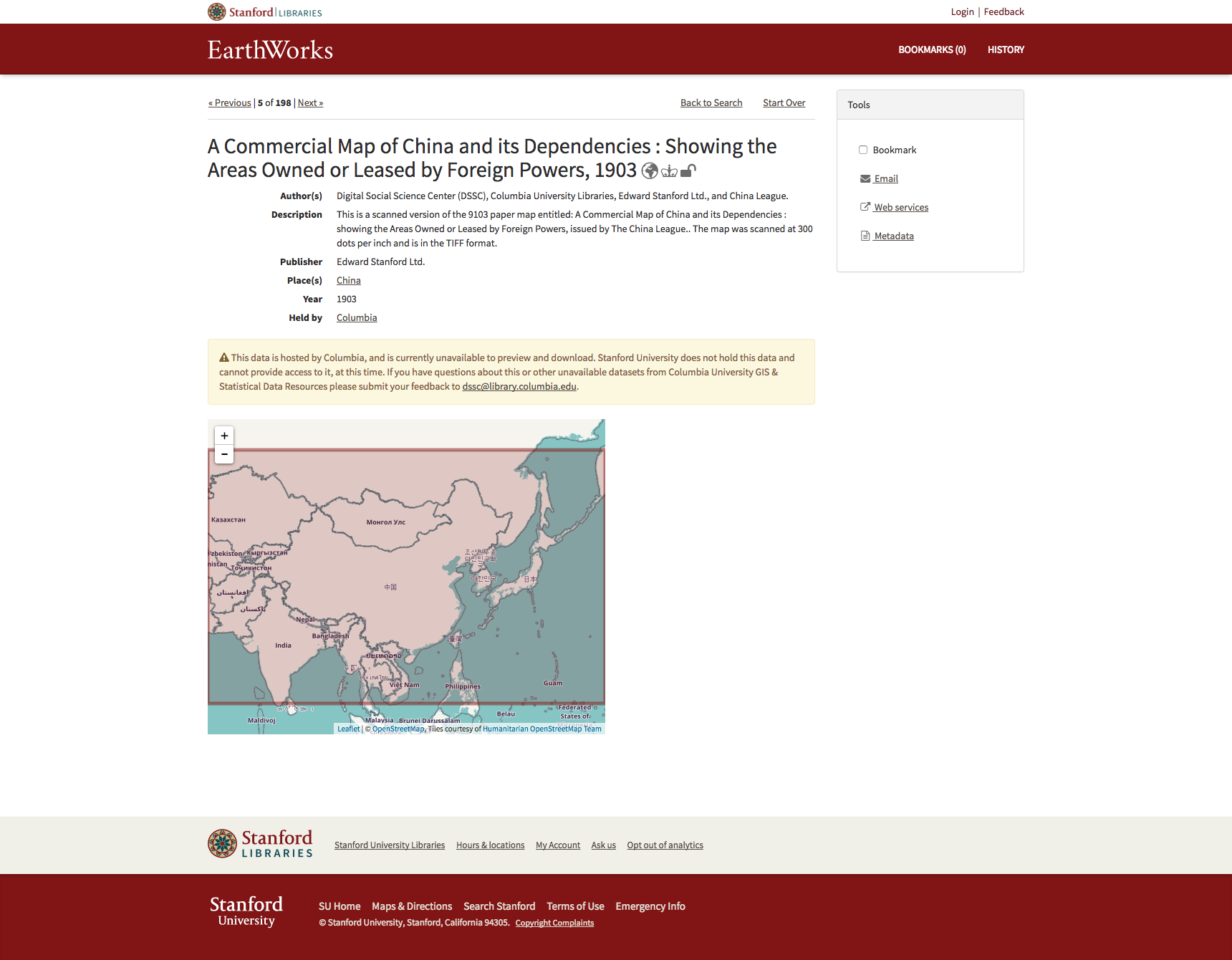
Earthworks
- Introduces the Map as search facet
- metadata schema designed specifically for discovery and access of
spatialdata - Inspect - Preview - Download data
- Provides Reverse-ETL
- Stable search URLs & Unique resource URLs
- JSON API
- Built upon Blacklight
- Extendable
Earthworks
- Monitors health and availability of distributed services
- Is repository/storage agnostic
- Provides authentication for licensed and sensitive content
- Provides federated search among more than 20 partner institutions
- 90k+ datasets, over 60k public datasets
- Backed by a community of developers
- Born at Stanford
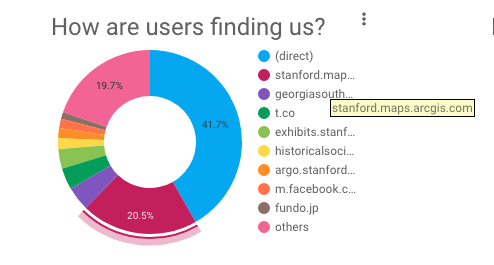
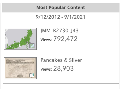
Earthworks.stanford.edu
is powered by the Stanford Digital Repository (SDR) and The Stanford Spatial Data Infrastructure (SSDI)
The SSDI exposes the live OGC spatial data services that power Earthworks fuctionality
(WFS, WMS, etc...)

A geocoding service provides augmentation services for data. Input implicit locations and it returns explicit locations
A geocoding and routing services are some of the most sought after augmentation services in data science. They turn implicitly spatial data into explicitly spatial data
locator.stanford.edu an highly performant geocoding service, based upon Esri's ArcGIS for Enterprise Server
locator.stanford.edu/arcgis
- North & South American Coverage
- Processing of ~ 1 million per hour
- REST API for direct integration
- Multiple inputs:
- Street Addresses
- Administrative boundaries
- Geographic Placenames
- Multiple outputs
- Geographic coordinates
- Administrative geographies
- Normalized inputs
- Uncertainty values
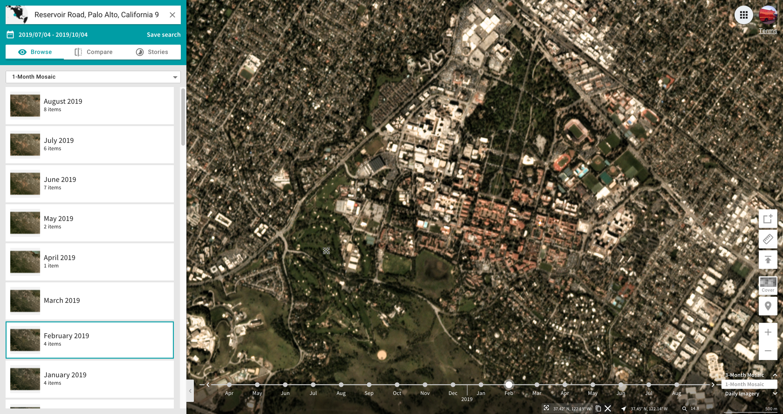
planet.com
Planet is a 3m image of the Earth, every day.
where is your data? gis.stanford.edu
where is your data? gis.stanford.edu
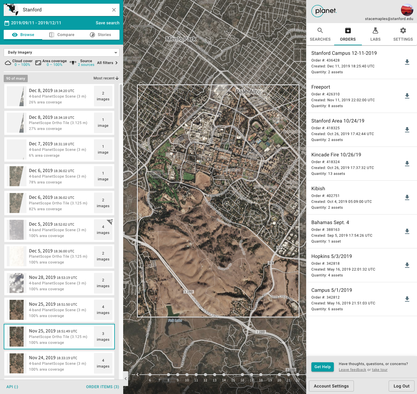
Planet Explorer
- GUI for searching by:
- Area of Interest
- Data Type (Scenes vs Basemaps)
- Metadata: Cloud Cover, % Coverage, Off-Nadir Angle, etc...
- Submit "Orders" for download
- "Orders" notified through email
bit.ly/planetstanford
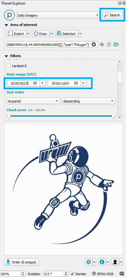
API
bit.ly/planetstanford
- Search for imagery
- Location, Date, Cloud Cover, etc...
- Download imagery
- Single Image
- Parallelized bulk download
- API Tile Service
- Returns TIMS XYZ Tile Services
- XYZ TMS & WMTS (Monthly & Quarterly Composites
ArcGIS Pro & QGIS Plug-ins
bit.ly/planetstanford
- Search for imagery
- Location, Date, CloudCover, etc...
- Download imagery
- Preview Imagery
- Single Image
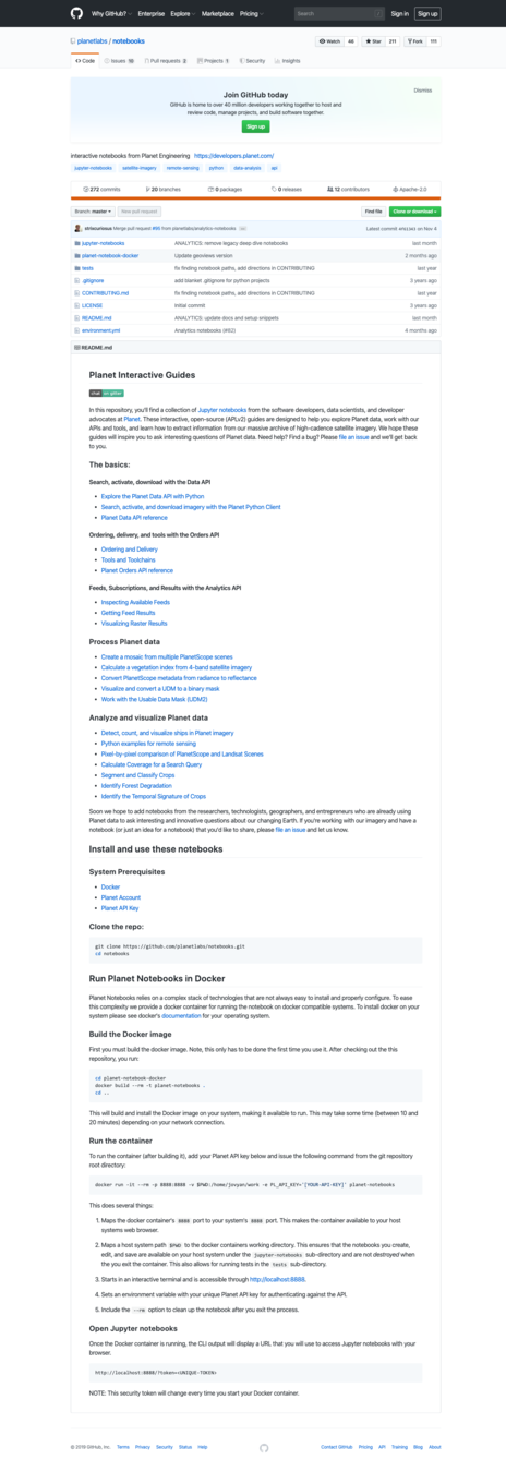
Python Notebooks
bit.ly/planetstanford

-
Search, activate, download with the Data API
-
Ordering, delivery, and tools with the Orders API
-
Feeds, Subscriptions, and Results with the Analytics API
-
Process Planet data
-
Analyze and visualize Planet data
Licensing
- I'm Planet.com E&R user #001
- Stanford is E&R Enterprise Customer #002
- 1.5 years of work to subscribe
- Cost-sharing with Lobell & NatCap
- Subscription access to ~.5 petabytes of imagery, annually renewed
-
Planet.com's first Education licensing negotiations:
-
unmetered re-downloads
-
Research imagery can be archived in perpetuity
-
Right to publish derivative products (training data, classifications, etc...)
-
Direct API and integrations access for researchers
-
Privacy issues
-
- 3rd year of subscription
"Stanford used more Planet imagery than NASA last year..."
Joe Mascaro - Director of E&R Planet.com
What can you do with Planet.com data?
bit.ly/planetstanford
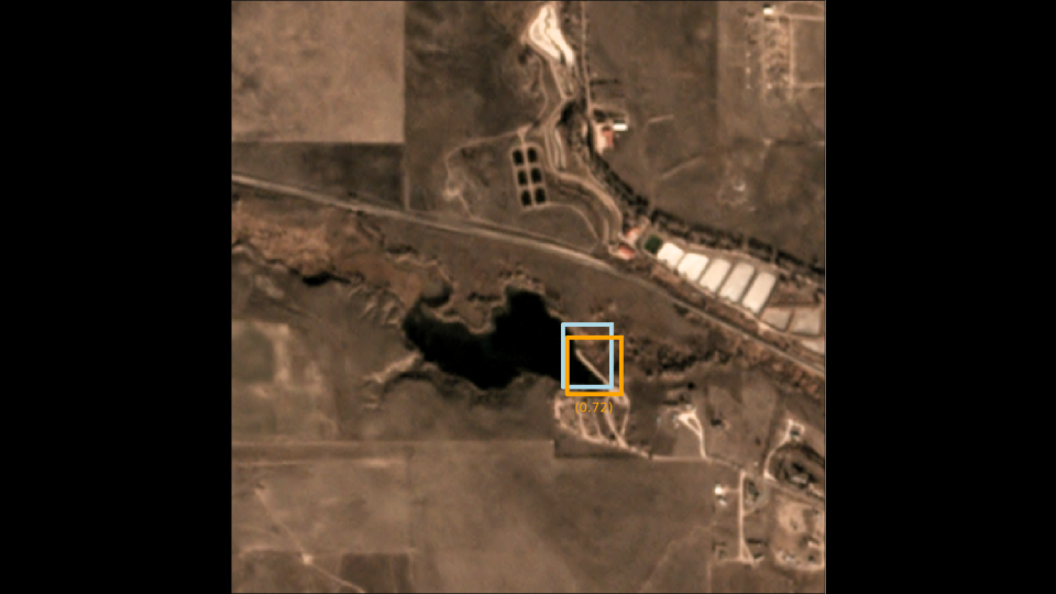
Create a complete catalog of all dams, on Earth
Charlotte Weil - Natural Capital

bit.ly/planetstanford
bit.ly/planetstanford
Detecting Ancient Reservoirs
Andrew Bauer & Claudia Engel, Stanford Anthropology
bit.ly/planetstanford
bit.ly/planetstanford
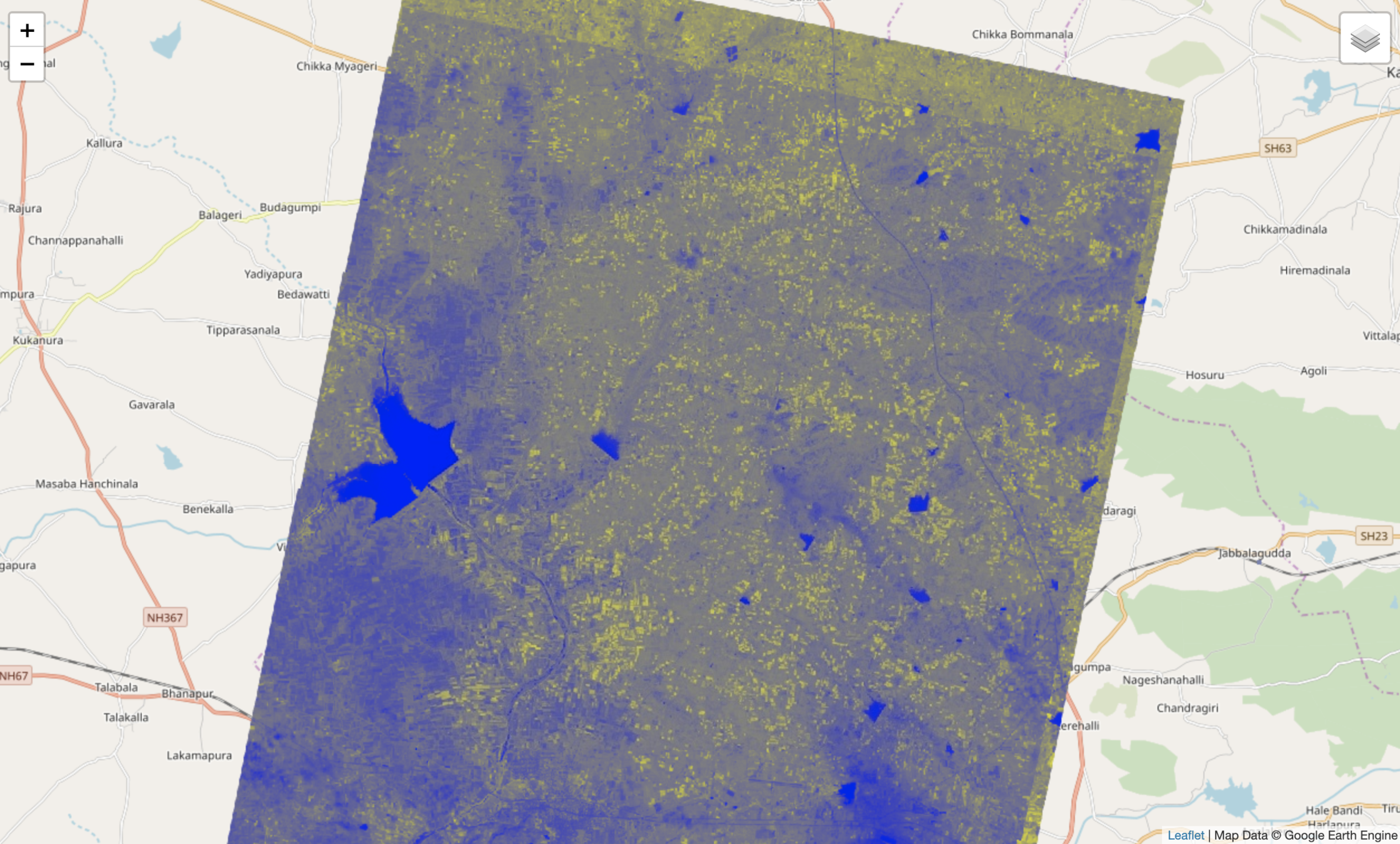
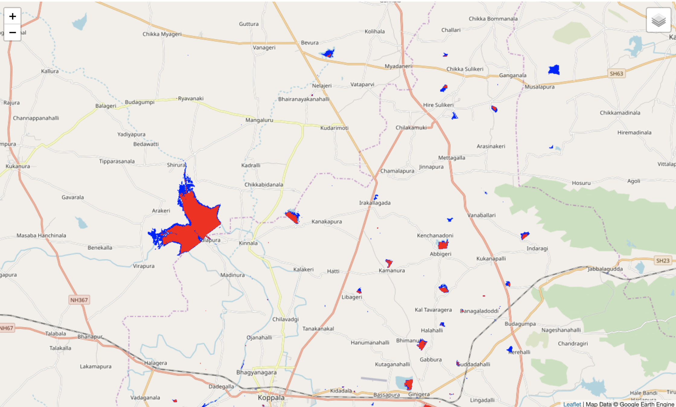
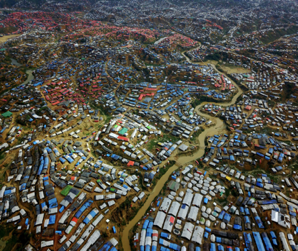
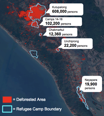
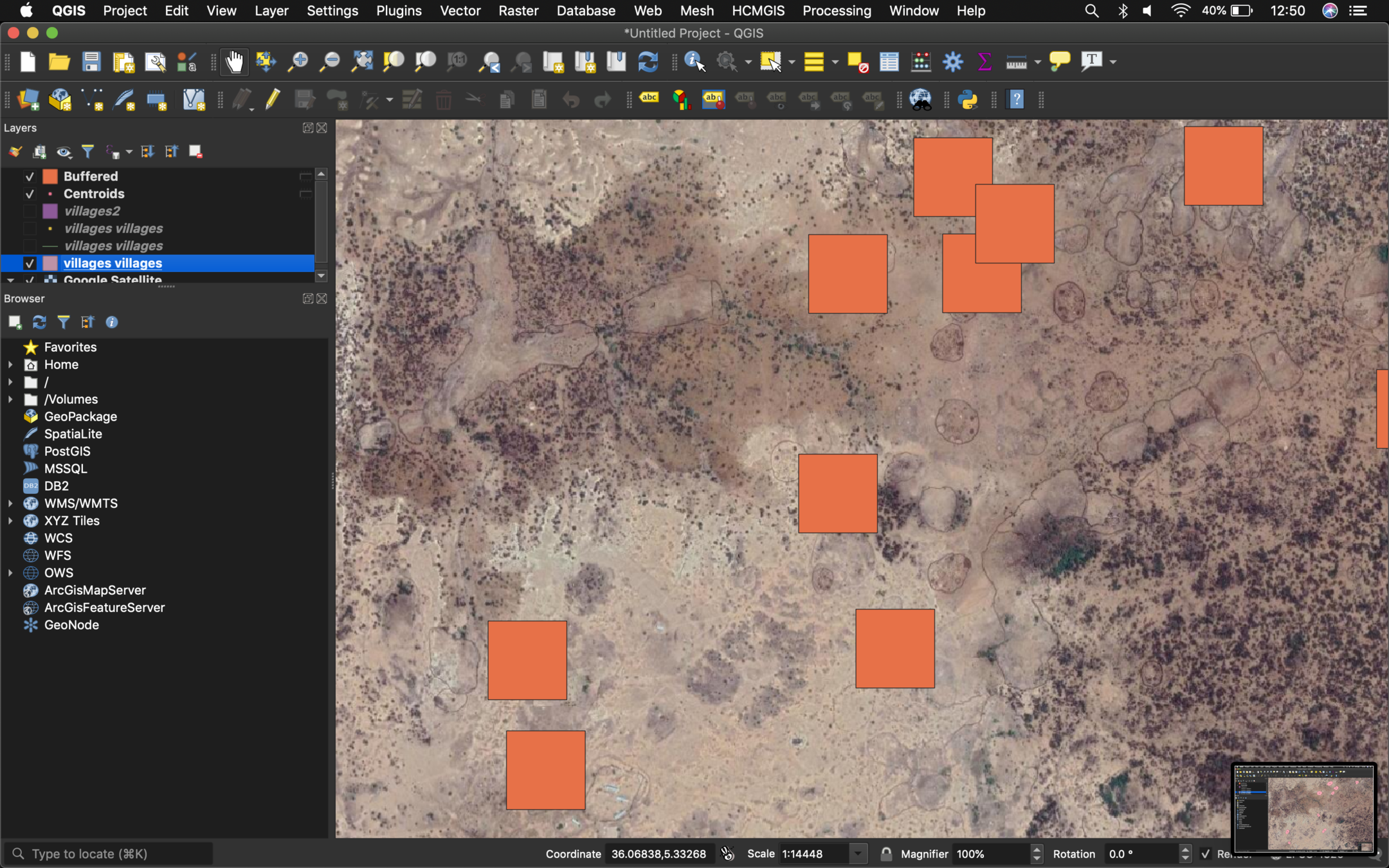
Assess impact of fuel aid distributed to refugee settlements
Chris LeBoa
bit.ly/planetstanford
bit.ly/planetstanford
Making Pastoralists Count
Hannah Binzen Wild & Stace Maples
Stanford School of Medicine

bit.ly/planetstanford

bit.ly/planetstanford
bit.ly/planetstanford
bit.ly/planetstanford
Opportunities...
Evolving Earthworks
"Spatial" Data is...
- Tabular data
- Vector data
- Pixel data
- Relational data
- Text-based data
- Temporal data
- Complex data objects & formats
In short, if you can make spatial data discoverable, you're already making most data types discoverable.
Services and Access designed in partnership with the people who work directly with our researchers

...for non-librarians.
More
"data literacy"
instruction
If we want to be "the face" of data science support and services at Stanford University, we've got to get facetime with data scientists!
Academic Licensing
Data Support at SGC for LEG
By Stace Maples


