3D City Database v3.0
Felix Kunde
fkunde@virtualcitysystems.de

Shortly
"The award winning 3D City Database is a free 3D geo database to store,
represent, and manage virtual 3D city models on top of a standard
spatial relational database. The database model contains semantically
rich, hierarchically structured, multi-scale urban objects facilitating
complex GIS modeling and analysis tasks, far beyond visualization" (http://www.3dcitydb.net)
OpenSource under LGPL v3.0
History
2003 - 2005:
-
v1.0 developed
within a pilot project funded by the European Union at the University of Bonn (supported DBMS: Oracle, PostgreSQL)
2007 - 2008:
- v2.0 developed within the framework Europäische Fonds für regionale Entwicklung (EFRE II) the project Geodatenmanagement in der Berliner Verwaltung – Amtliches 3D-Stadtmodell für Berlin at Technsiche Universität Berlin (supported DBMS: Oracle)
2012:
- Oracle Spatial Excellence Award in the field 'Research and education'
- v2.0 ported towards PostgreSQL/PostGIS (http://opus.kobv.de/ubp/volltexte/2013/6365/)
Since 2013:
- Cooperation agreement between TU Munich (new chair of T.H.Kolbe a.k.a. godfather of the 3DCityDB), virtualcitySYSTEMS and M.O.S.S. about the further development
- Steering committee between the three partners takes decisions on the future roadmap
- Cooperation is open for new partners who are using the 3DCityDB and want to develop new features and tools

Managing 3D City Models

Why CityGML?
Other standardization processes for data models concerning 3D buildings like IMGeo (NL), INSPIRE (EU), Adv-Profil (D) etc. are closely related to CityGML. And it's getting more and more...

Why CityGML?
Rich in semantics compared to other 3D formats. Objects know where they are and WHAT they are.

Source: Stadler 2008
Semantic model based on ISO 19109
Geometric model based on ISO 19107
Geometric model based on ISO 19107
Why CityGML?
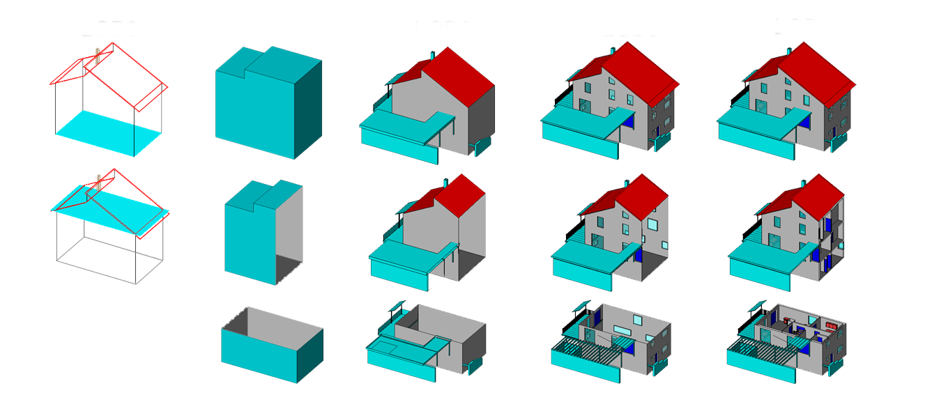
Hierarchical structure of features and 1 to 5
diffenrent levels of detail (LoD) for each feature. Applicable for many
different scenarios in 3D city modelling.
Why CityGML?
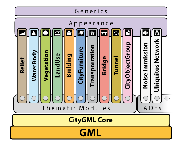
Modular structure of thematic models. Thus users and developers might use only the parts they need. PLUS: The model is extendable via application domain extension (ADE).
NEW: CityGML 2.0.0 support


http://www.opengis.net/citygml/bridge/2.0
http://www.opengis.net/citygml/tunnel/2.0
Lessons learned
- Schema enhancements to make spatial queries easier
- No more ORDImage data type to store texture files. Instead: BLOB. >> Better support for Oracle Locator.
- Binary data of texture files seperated from surface data information (more suitable for texture atlases)
- Improved stored procedures
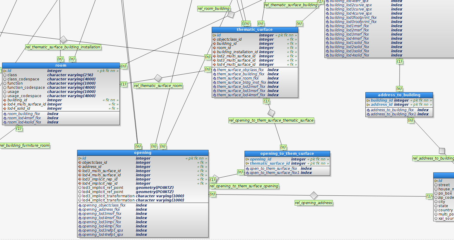
Tables and references
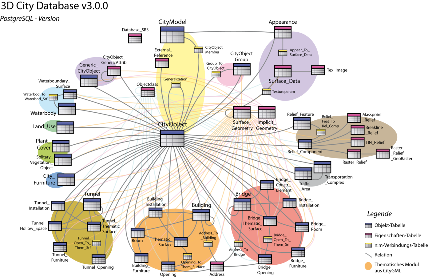
Geometry storage
- Most Objects can be described by
- a boundary representation
-
NEW: a solid representation (3D)
- an implicit geometry with reference point and transformation matrix (for prototype objects)
- Other geometry types:
- Terrain intersection curves as MultiLinestring
- Masspoint relief as MultiPoint (maybe Pointcloud type in the future)
- Point, Linestring and Collections
Importer/Exporter

- NEW: CityGML 2.0.0 support
-
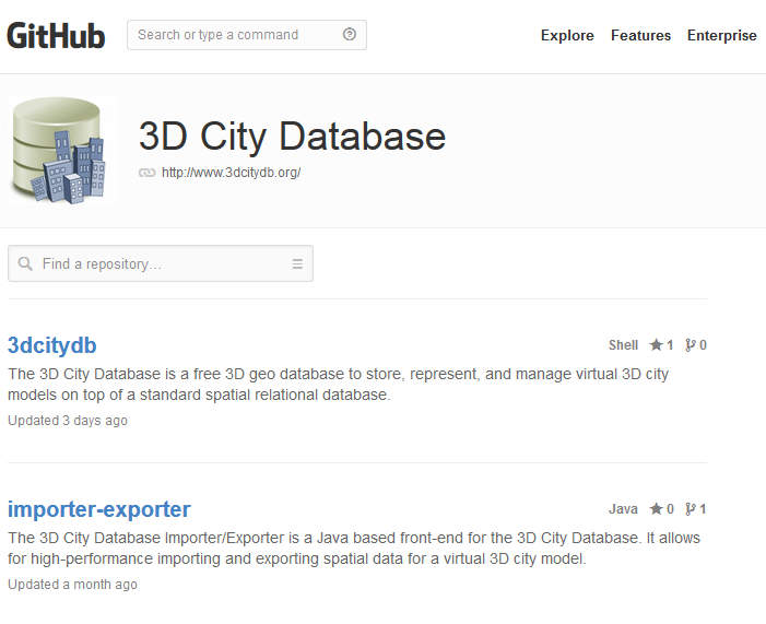
NEW: Parallel development of Oracle and Postgres branch merged into one master (https://github.com/3dcitydb/importer-exporter)
-
NEW: One adapter interface for databases. Additional support for other DMBS would be more easy to develop
Technical details
- XML binding by citygml4j (https://github.com/citygml4j)
- Database access via JDBC and Tomcat connection pool
- Texture Atlas Creator, a standalone tool and API for creating texture atlases for CityGML files or a set of input images https://github.com/3dcitydb/texture-atlas-creator
- Plugin API to facilitate the development of additional database management functionalities
NEW: Follow us on GitHub
NEW: Create your own database scripts
Oracle > JDeveloper PostgreSQL > pgModeler
NEW: WFS
- Database access via Simple Web Feature Service 2.0 (Basic Conformance Class)
-
Important for INSPIRE-conformant services
- Delivers CityGML v1.0.0 and v2.0.0 documents
-
Accepts only gml:id filtering. More features to come in the future. (And yes, we are talking about WFS-T here!)
NEW: New History Management
exclusively for PostgreSQL
- Logging all changes in a separate table
- Recreate a table or database state with entries of the log table and push it back to your production state
- Runs only on PostgreSQL 9.3+ because of built-in JSON functions
-
Written in PL/pgSQL (get it from github.com/fxku/audit)
Plans for 2014/15
- Complex filtering for imports and exports and extended filter possibilities for WFS
- Support for raster data
- Concepts for an generic CityGML-ADE support
-
Reworked Planning Manager (to manage planning alternatives of a city model)
Showtime!
3D City Database
By fxku


