Processing marine DTM’s - like a boss!
Gareth Grewcock (Sam Franklin - stand in)
gareth.grewock@lr-senergy.com


Purpose
We set out to take "standard workflows" for visualising marine Digital Terrain Model (DTMs) using proprietary software and replicate using FOSS

Overview
- Background
- XYZ challenges
- Hillshading
- End-to-end workflow
- Results
- Deployment/community

about
LR Survey & GeoEngineering
- Offshore Project Management of "Geo" surveys
- Geoscience/Geospatial/Engineering Consultancy
- Operational Support





Topography (land)
Bathymetry - seabed
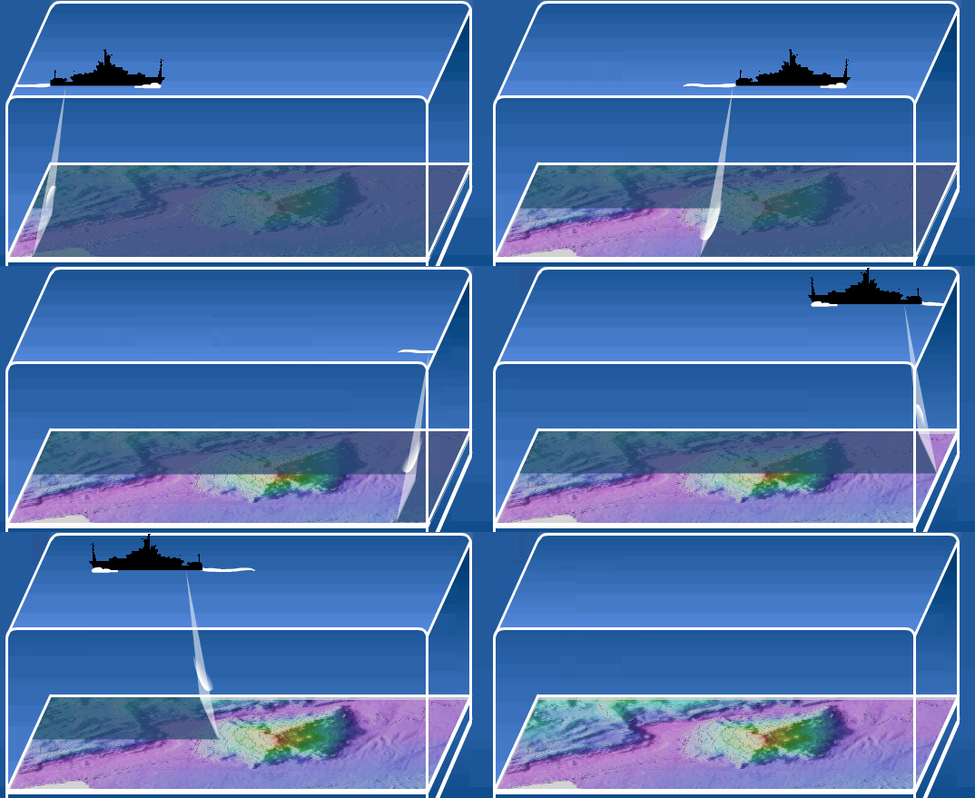
Bathymetry Acquisition
- Multibeam Echosounder (MBES) systems
- Acquired by survey contractors at significant expense
- MH370 search = $130M


Receive latest bathymetry data from vessel daily
Onshore support for 24/7 vessel operations
Applications
Dredging Operations
Pipeline Burial
Receive bathymetry data from the vessel
Process for project status for data collection to date
“Industry standard” | Hydrographic survey format XYZ`
Ungridded or scatter data requires either extrapolation or interpolation to fill areas of no-data.


490313 5718729 -36.239
490348 5718738 -36.282
490359 5718720 -36.315
490361 5718705 -36.337
490314 5718651 -36.361
490308 5718728 -36.334
490353 5718661 -36.331
490358 5718700 -36.333
490308 5718721 -36.363
490312 5718741 -36.386
490313 5718702 -36.433
3-column ungridded XYZ file
“Industry standard” | Hydrographic survey format XYZ`
3-column gridded XYZ file types
XYZ without delete values
490300.00 5718650.00 -36.239
490301.00 5718650.00 -36.282
490302.00 5718650.00 -36.315
490303.00 5718650.00 -36.337
490304.00 5718650.00 -36.361
490305.00 5718650.00 -36.334
490306.00 5718650.00 -36.331
490307.00 5718650.00 -36.333
490308.00 5718650.00 -36.363
490309.00 5718650.00 -36.386
490310.00 5718650.00 -36.433

“Industry standard” | Hydrographic survey format XYZ`
XYZ file format is consistent across surveys however, the spatial extent and file size differ depending on survey contractor and job
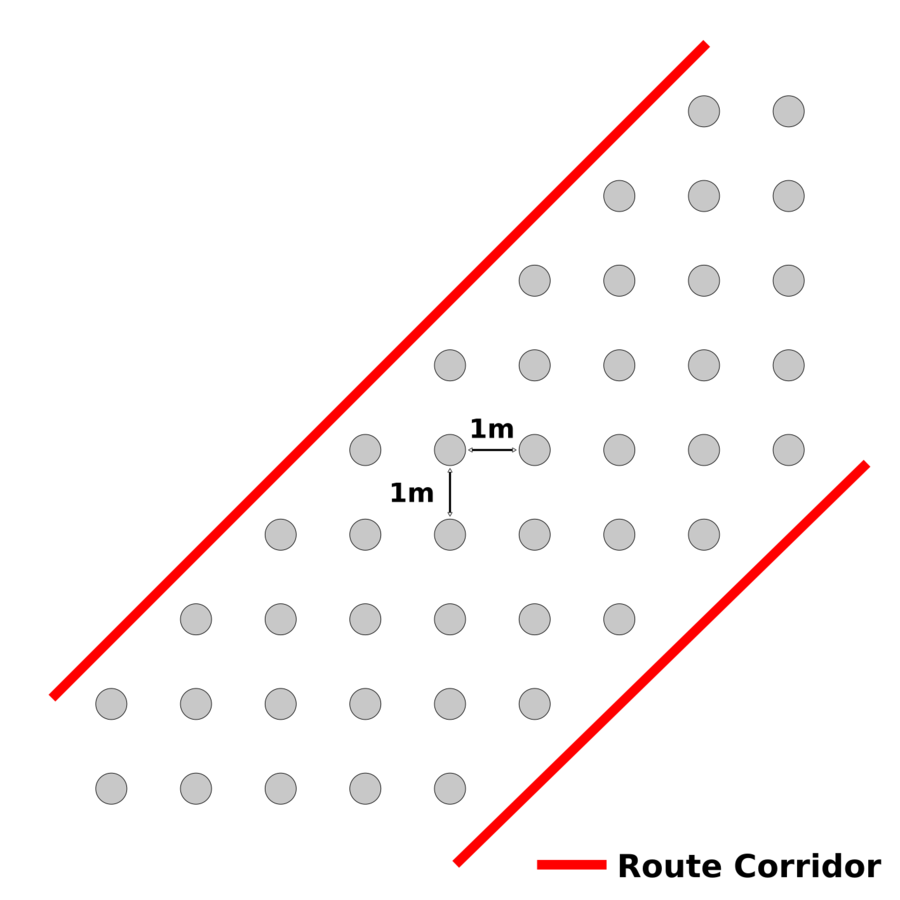
For example,
25km pipeline route XYZ deliverable:
1 x XYZ file @ >5GB
OR
25 x XYZ files @ 200MB
end-to-end workflow

the composite hillshade relief - WHY?

A false colour shaded image assists geoscientists with interpretation
current workflow


Good visual results from proprietary solutions ...
But ...
The need for an alternative?
- Manual Workflow --> need to automate
- 2GB Output limit --> Need more flexible option
- Network licence only --> need offline mode
- Only 1 licence seat --> locking issues / service restarts
- Generally, was an opportunity learn more about FOSS workflows and then share that knowledge with the marine GIS sector

There are numerous workflows which work with 'XYZ' data however, there are few which handle the gridded, "multi-block" hydrographic XYZ file format

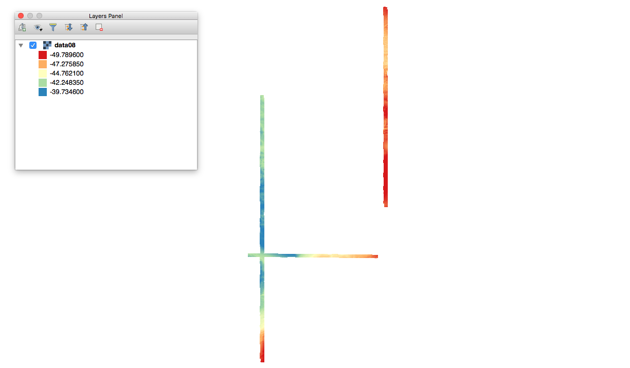
reading the XYZ = stuck!
The power of the community!

Chance meeting @
finding the right tool...

we can build on top of GMT using core functionality from other FOSS tools and bring together into one end-to-end workflow
What we need:
A command line tool with the ability to handle gridded hydrographic XYZ file format
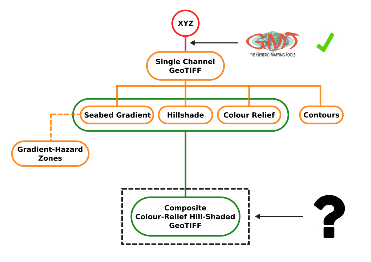

the bench mark
How do we achieve the same output?
uncharted waters
Combining the hillshade with colour relief

- Comparable output?
- Extensible?
- Deployment?


r.shade - Drapes a color raster over an shaded relief or aspect map.
r.shaded.relief - Creates shaded relief map from an elevation map (DEM).
altitude= Altitude of the sun
azimuth=Azimuth of the sun
zmult=Exaggerate Z value
=
PyGRASS
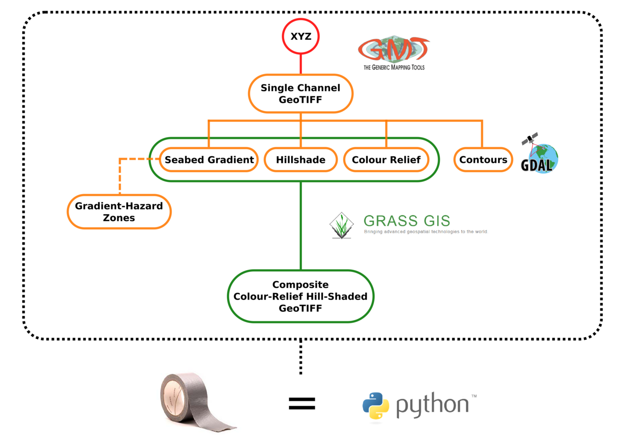
the ignition
workflow fed by input CSV config file
- Input XYZ file directory
- XYZ Cell Size
- EPSG Dataset Reference
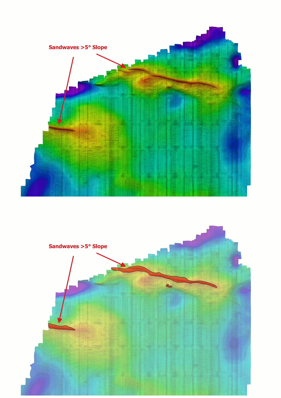
- Invert Z Value | YES/NO Flag
- Seabed Gradient Threshold
- Contour | YES/NO Flag
- Min/Max Contour Values
- Contour Resample Value
- Output Image Format | RGB or Color Paletted
input CSV config file pathway is added to python script
All input XYZ files must be the same cell size and EPSG ref
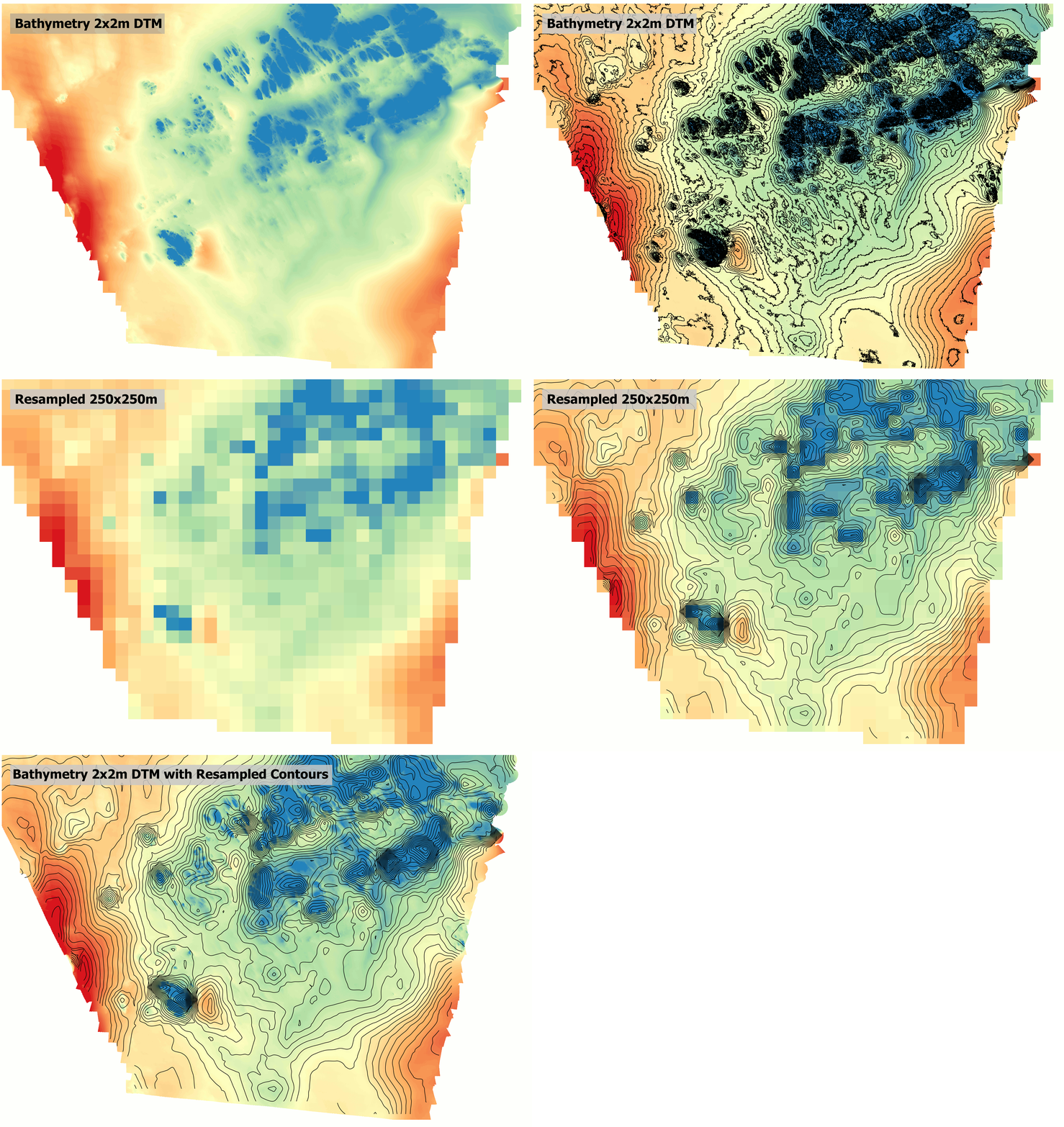
contour smooth
resample the raster to achieve smooth contours
seabed gradient analysis
gdal_calc
gdal_polygonize

back. of. the. net!
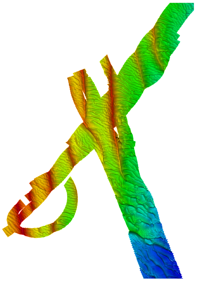
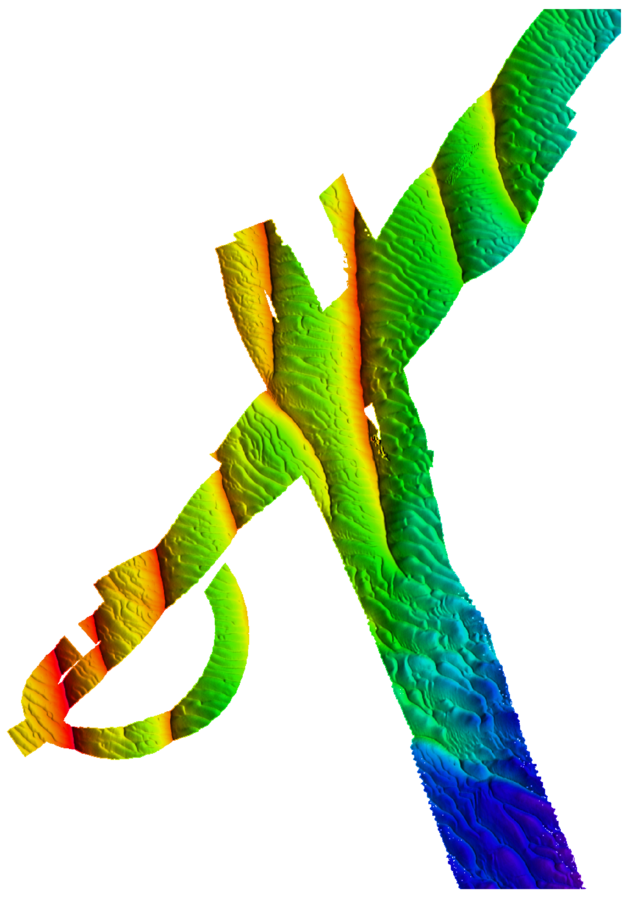
slope enhanced composite relief
hillshade composite relief

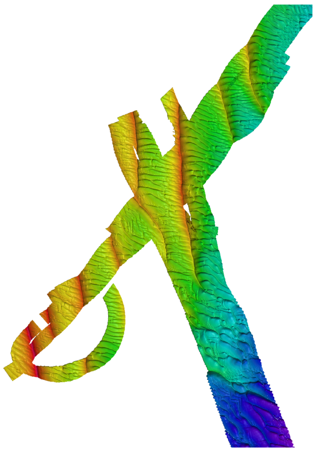
composite colour-relief hillshade
existing
xyz processor
Existing
"xyz processor"
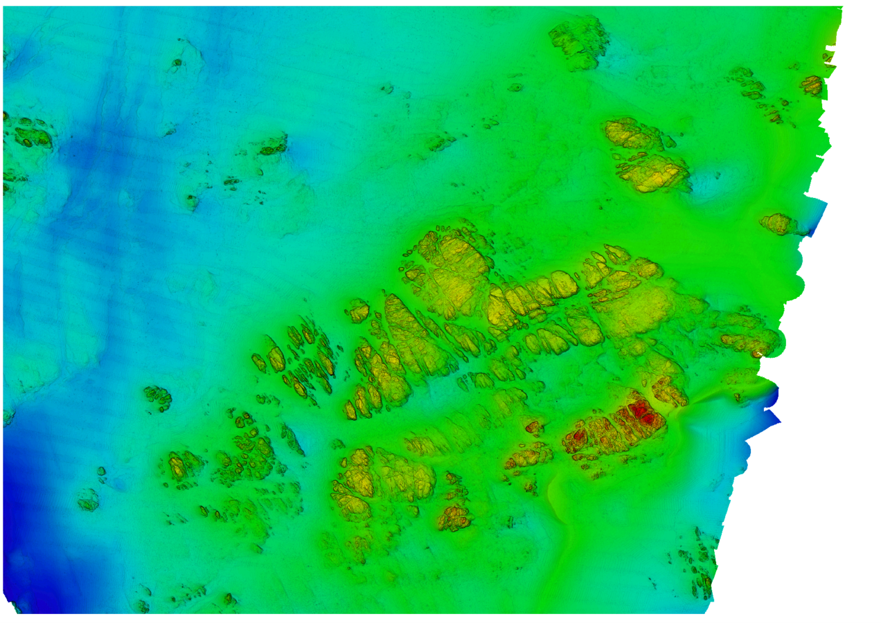
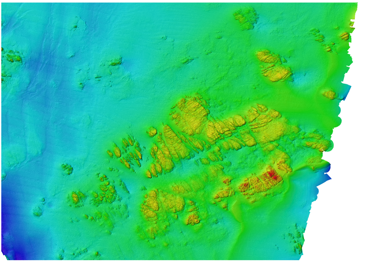
Existing
"xyz processor"
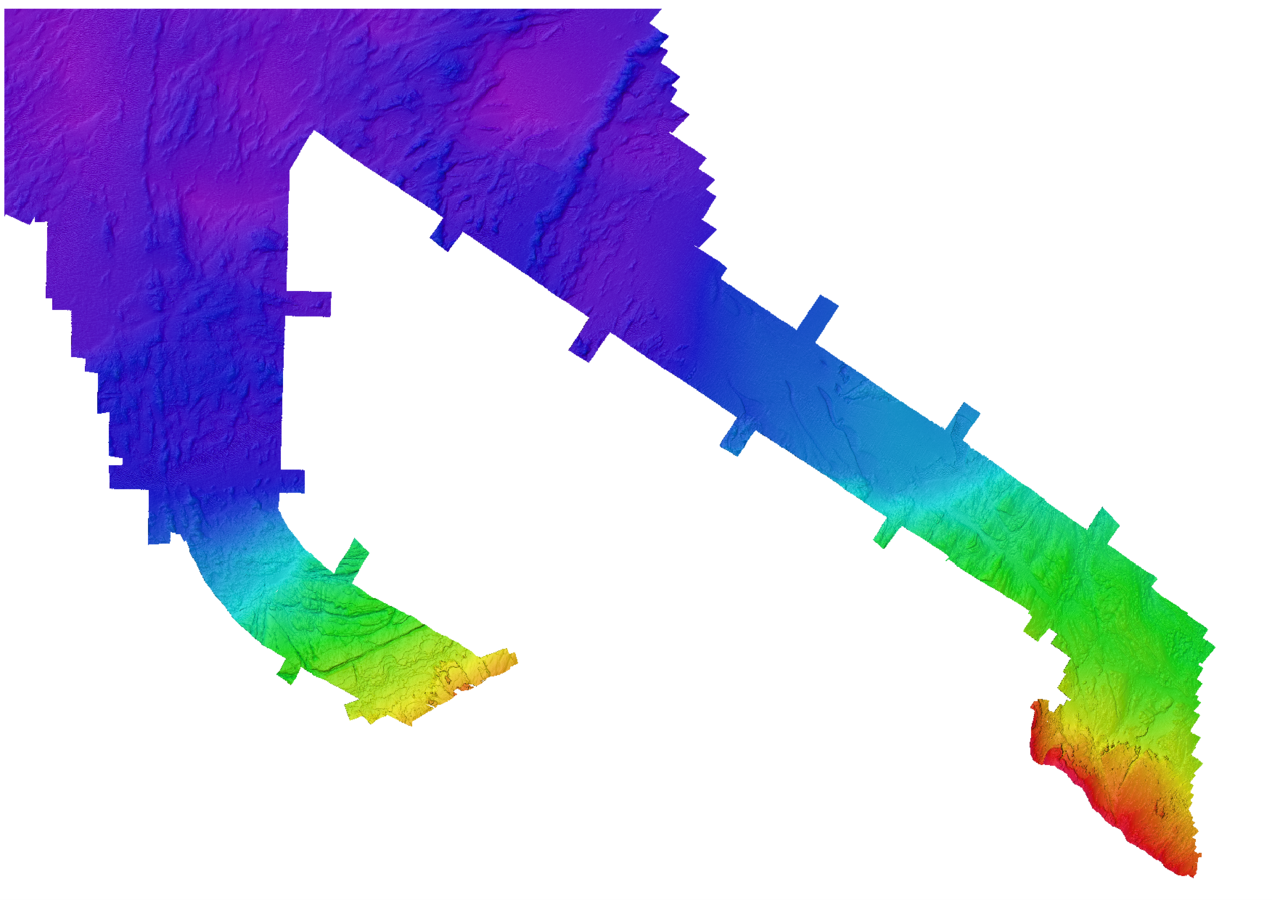
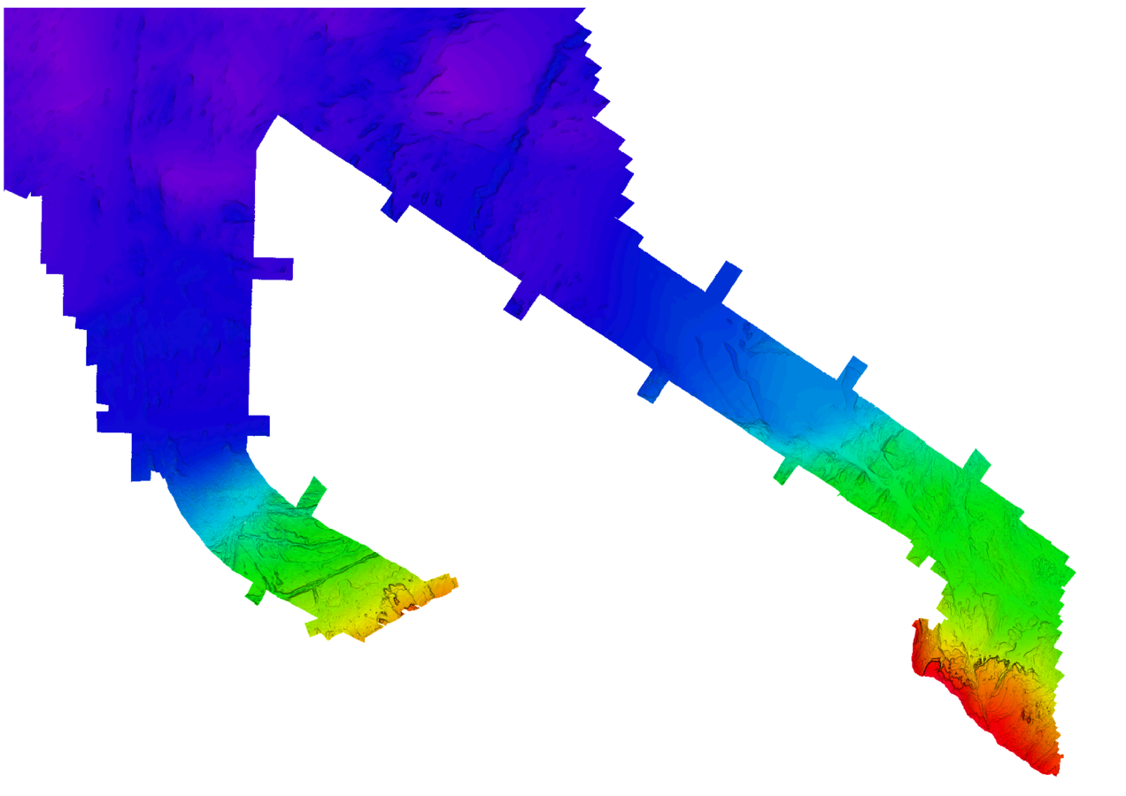
Food for thought
-
Slope+Colour-relief only? Or Slope+Hillshade+colour-relief
-
BUT Matched output = achievement unlocked!
-
False-colour = subjective
-
Each XYZ is different and requires different hill-shading parameters to draw out features from the seabed
-
It is up to the geophysicists really !

- Mailing list
- Forums/StackExchange
- Google+
- Here Today!!
the FOSS community giveth ...


'You will find that help will always
be given at Hogwarts to those who ask for it.'
the FOSS community takeith away (JOKE!)
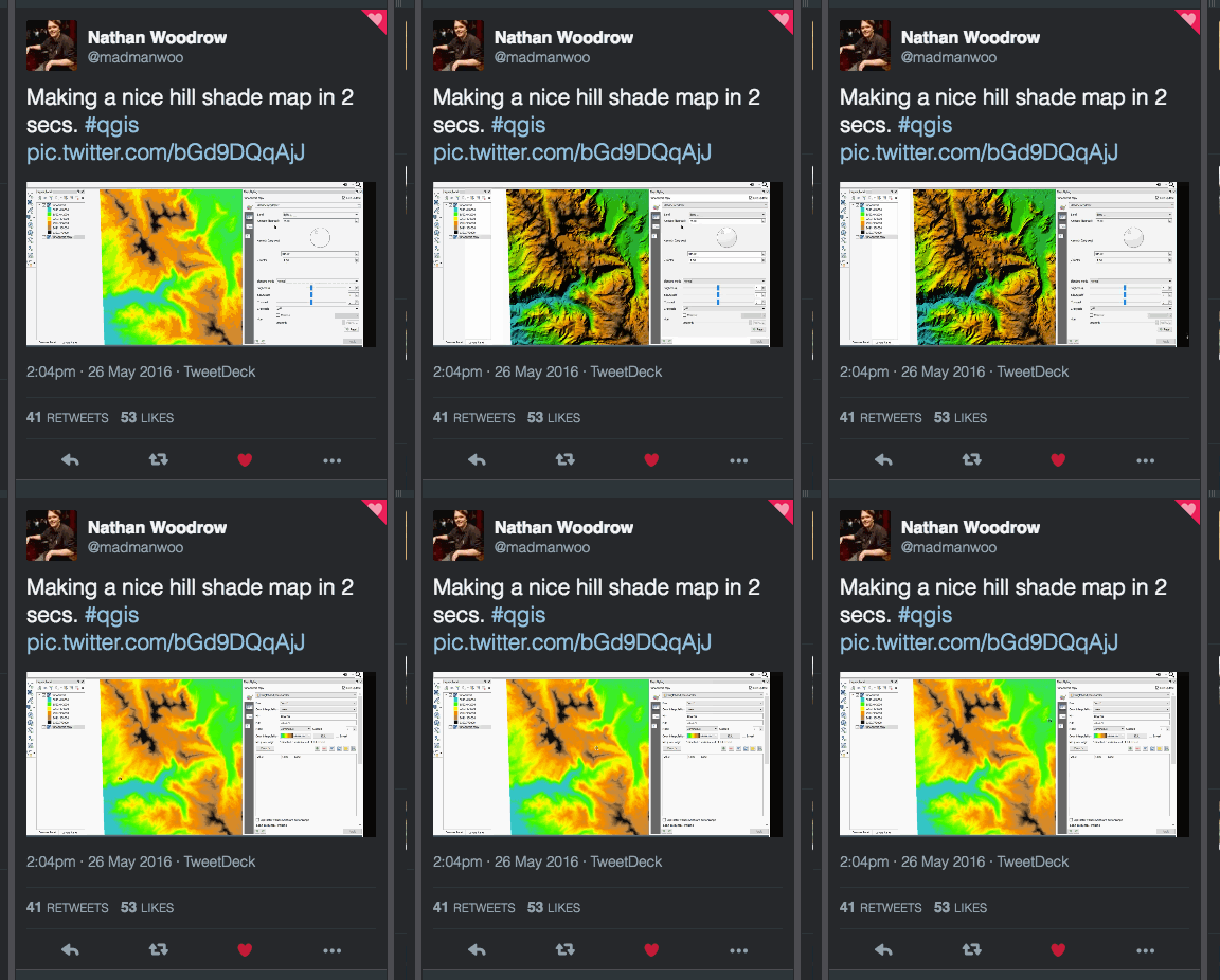
- Add slope-enhanced shading option to this new QGIS feature?
- No GMT, so won't deal with hydro-XYZ either.
- Will vow to work with GDAL devs on this
deployment &
release
Phase 1 Rollout internally, OSGeo4W + GMT
In progress/Testing
Phase 2 DTM Cheat Sheet
https://github.com/senergyworld/dtm-cheat-sheet
Phase 3 XYZ Processor Python (MIT licence)
Coming Soon (Gareth!)

Thanks!

Gareth Grewcock (Sam Franklin - stand in)
gareth.grewock@lr-senergy.com

Processing marine DTM’s - like a boss!
By garethgrewcock
Processing marine DTM’s - like a boss!
- 3,966
