
Kim Sundeen
GIS Developer and all-around map nerd. I develop user-focused and client solutions to help automate, analyze, and strategize data, mapping, and workflow needs.
Kim Sundeen
GIS Specialist, City of Duluth, MN
work: 218-730-5082
work: ksundeen [at] duluthmn.gov
personal: kim.h.sundeen [at] gmail.com
@KSundeen
**I share the full report & results are shared on last slide.
Recall...
Implementation Plan Sources:
http://www.brighthubpm.com/project-planning/87423-putting-together-a-project-implementation-plan/;
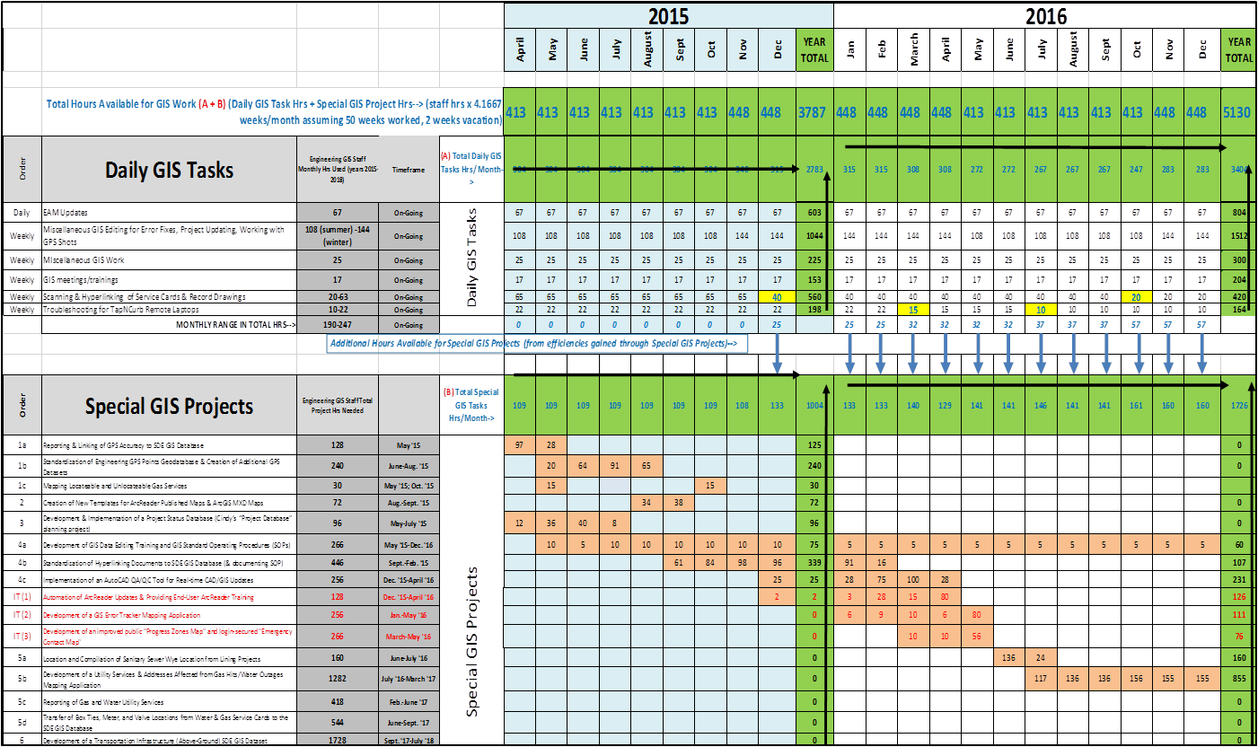
2. Establish timelines with Milestones
Kim Sundeen
GIS Specialist, City of Duluth, MN
work: 218-730-5082
work: ksundeen [at] duluthmn.gov
personal: kim.h.sundeen [at] gmail.com
@KSundeen
By Kim Sundeen
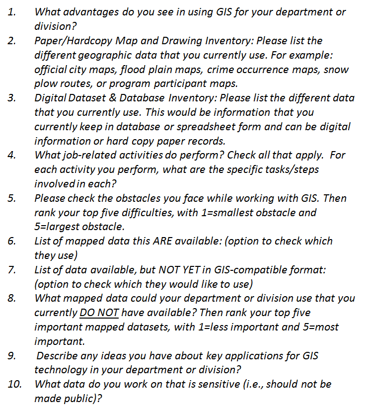
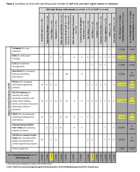
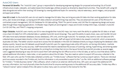
Ever wonder how to figure out how your GIS users use GIS, what other apps or training they need? You could spend $50k on a consultant's perspective or you could use this "homegrown" approach to a GIS User Needs Assessment and get more useful, insightful, and applicable results in 1-2 months. We overview the process used by the City of Duluth's Public Works & Utilities Department for identifying major obstacles that GIS users face through iterative interviews, scoping creative projects, prioritizing and then implementing those projects as solutions for your GIS users!

