The History of Information Graphics
Lesson 5
- Special edition - elections
Armand Joseph Frére de Montizon - Carte Figurative de la France Politique 1834, BNF

Armand Joseph Frére de Montizon - Carte Figurative de la France Politique 1839, BNF

Armand Joseph Frére de Montizon - Carte Figurative de la France Politique 1839, BNF

Léon Montigny - Election Map of Paris, 1869

Léon Montigny - Election Map of Paris (detail), 1869
Walter R. Houghton - Presidential Elections 1883, David Rumsey Map Collection
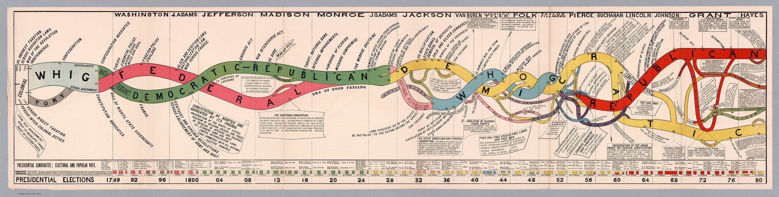
Walter R. Houghton - Presidential Elections 1883, David Rumsey Map Collection
Walter R. Houghton - Presidential Elections 1883, David Rumsey Map Collection
Henry Gannett and Fletscher Willis Hewes - Supremacy of Parties, 1883

Henry Gannett and Fletscher Willis Hewes - Supremacy of Parties, 1883
Walter R. Houghton - Presidential Elections 1880, David Rumsey Map Collection

Henry Gannett - Presidential Elections, 1883

Henry Gannett - Presidential Elections, 1883
New York Times 1889, February 23.

New York Times 1889, February 23.

New York Times 1896

New York Times 1929

Rudolf Mayer - The First Ordinary German Elections, 1918, David Rumsey Map Collection

Rudolf Mayer - The First Ordinary German Elections, 1918, David Rumsey Map Collection
Rudolf Mayer - The First Ordinary German Elections, 1918, David Rumsey Map Collection
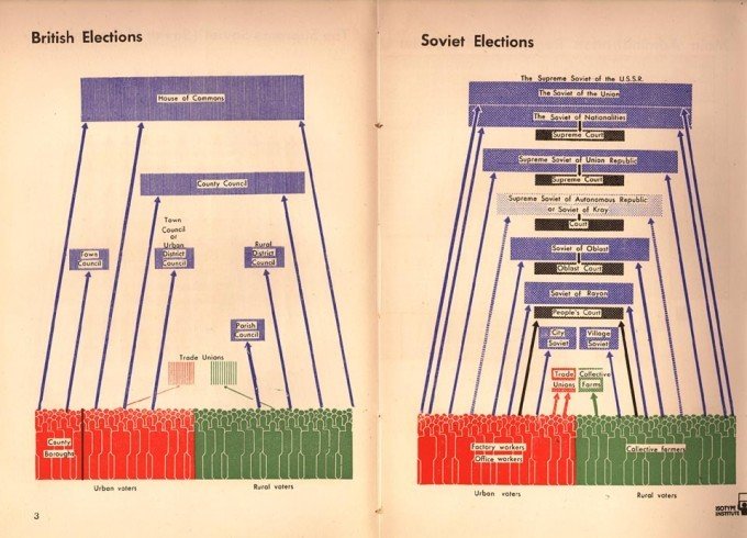
KB Smellie, 1944
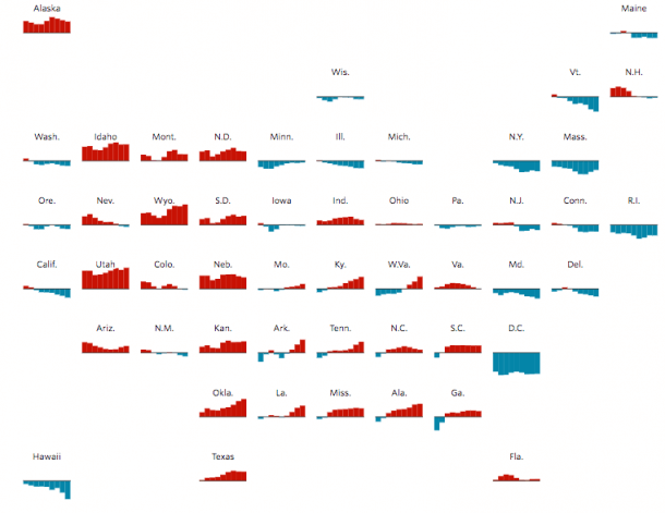
Trump's 2016 Presidential Election Map

NYT

NYT

NYT

WaPo

WaPo

FiveThirtyEight

FiveThirtyEight

WSJ
WSJ

LSO

Guardian

NYT

NYT

FiveThirtyEight

FiveThirtyEight

History of Information Graphics 5 - Special edition - elections
By Attila Bátorfy


