Brian Capouch
Quick Resume
- Grew up on a mint/vegetable muck farm
- Spanish major in college "soy bilingüe"
- Did ag tech consulting and owned a soil test lab
- Bought a microcomputer in 1978
- Taught CS at Saint Joseph's1982-2016
- Since 2003 a history freak
- I own several historic structures in Medaryville
- Presentations on a variety of local historical topics
- 2018: The Sunny Crest miracle occurred
I'm omitting more material than I am going to be showing you
Plan
- Geological formation
- Partial anthropological history
- Draining and Channeling Timeline
- The river today
Timelines are of the essence
I. Geological History
i.e., What caused such a special and unique place?
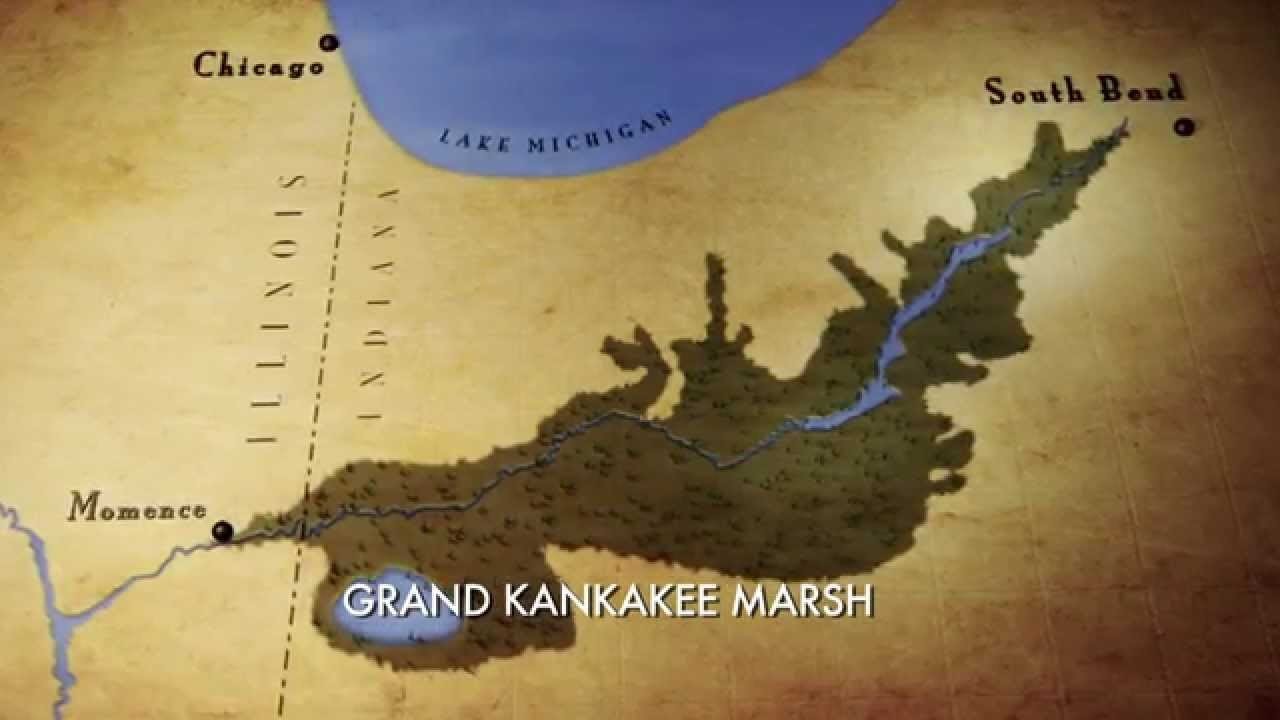
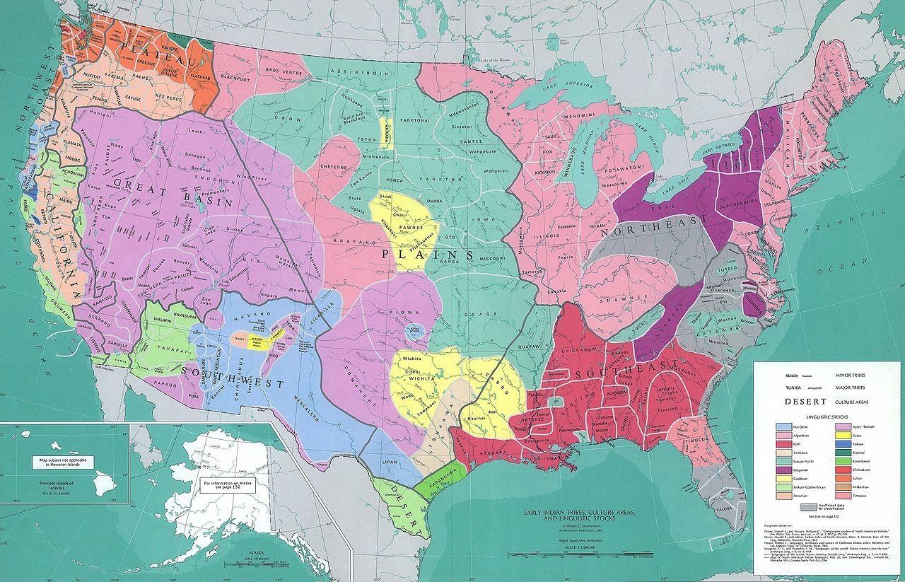
What do I mean "Kankakee?"
- The Kankakee Valley proper
- Iroquois and Yellow Rivers are tributaries
- Iroquois/Pinkamink "sort of" the same
- Big Monon Creek (tributary of the Tippecanoe)
My headwaters past
-
Gehring Farms
- Pinkamink/Iroquois
- Elmer Gumz Farms
- Kankakee
- Arthur Gumz/Danny Overmyer
- Big Monon Creek
Soil-forming forces in nature
- Glacial movement
- Fluvial (Flowing water)
- Lacustrine (Lakebeds)
- Aeolian (Wind)
Let's look at some recent history . . .
The Wisconsin glaciation began about 75,000 years ago
Reaching its maximum extent about 22,000 years ago

Each "lobe" of the glacier got a name
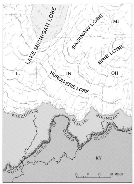
Glaciers advanced and retreated as the climate cooled and warmed
When glaciers stop, they leave end moraines

By this time the glacier's long gone
Materials in inconceivable quantities are moved as till, also creating ground moraines
Ground moraines, also known as till plains, refers to the material under the glacier
It is called "till" because the glaciers act like mammoth bulldozers
Huge amounts of meltwater were discharged below the end moraines
The meltwater carried with it materials swept up by the advance of the glacier
The material moved by glacial drainage is called outwash, and creates outwash plains

A glacier gone as far as it can go
The sandy outwash in the Kankakee Valley is notable for its massive extent
The meltwater also created many glacial lakes
The "lower" banks of glacial lakes were often formed by older end moraines
The Kankakee Torrent was a catastrophic flood ca 19,000 years ago
It was caused by a sudden breach in glacial Lake Chicago, precursor to Lake Michigan
It formed the basins for the later channels of the Kankakee and Illinois rivers
The canyons in Starved Rock State Park were formed by the Torrent

Meltwater then created Lake Kankakee about 14,000 years ago
Its bounds were (roughly) the Valparaiso Moraine to the north, and Iroquois Moraine to the south
The flat Kankakee's discharge was "dammed" by a limestone ridge near Momence, Illinois
It drained about 13,000 years ago after the further retreat of the glaciers


Till plains and outwash plains were both initially scoured of all vegetation
Lack of vegetation left the soil subject to erosion--just like it does now--but far worse
Finer soil particles washed into the lake and "graded" themselves as they settled
Sand dunes formed along the south-ish and east-ish banks of the lake
Summary of specialness
- Geologically recent
- The torrent was responsible for basic shape of basin
- All four soil-forming processes played a part
- The vast amount of sandy outwash was highly permeable
- The glacial lakebeds were almost flat
- The rock ledge held back the water to create the marsh
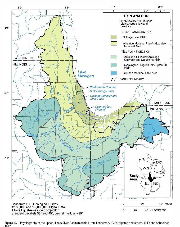


Kankakee River/Marsh Stats
- Original fall approx 6" per mile
- Over 2000 bends, oxbows, and meanders, etc.
- Approx. 85 miles as the crow flies
- ~250 miles counting all the bends
- Marsh extent 400,000 acres (or more)
- 3-5 miles wide
II. Anthropological History
After glacial retreat, a series of native peoples populated the Kankakee Valley
The dominant native people in the Valley were Potawatomi and Miami*
*Just ahead of the settlement period
As colonization proceeded, this area was claimed by the French

After the American Revolution the people of the United States looked west to expand
In 1816, the then-westernmost state was admitted, primarily consisting of lands belonging to the native tribes

Treaties in quick sequence transferred land rights to the new settlers

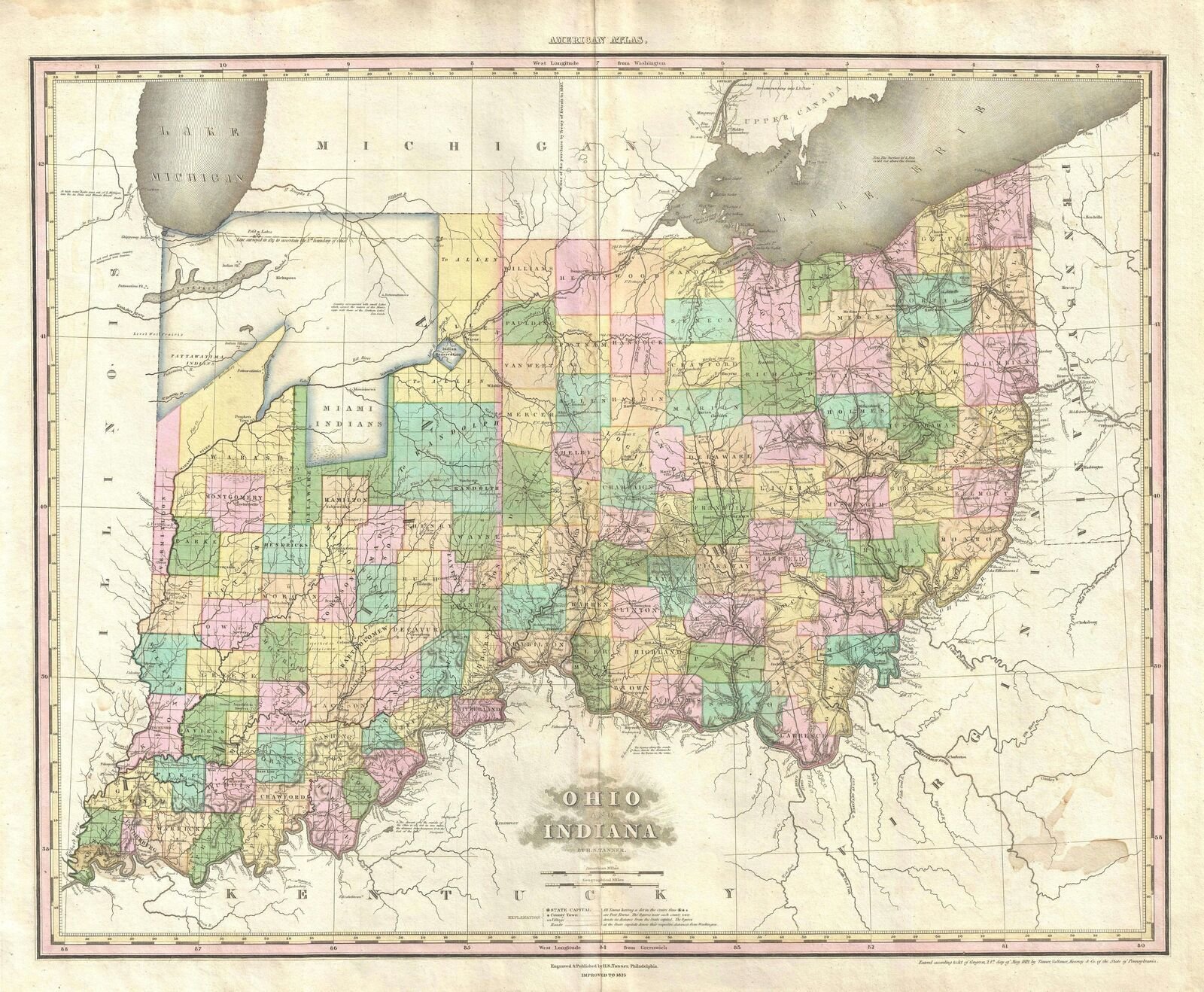
Tanner's maps chronicle the changes


So what became of the Potawatomi?
Potawatomi Survival Strategies
- Fight
- Hide
- Flee
- Wait and hope
- Assimilate
Menominee was a Potawatomi chief who chose to try to assimilate

Chief Menominee by James O. Lewis
His tactic was to support the Americans, and try to adopt their religion and ways
He was baptized as a Catholic in 1834, and took the Christian name Alexis
His base became Twin Lakes (Chi-Chi-Pe Ou-Ti-Pe), a village near present-day Plymouth

Twin Lakes was on the Yellow River, a major tributary of the Kankakee
The Indian Removal Act of 1830, required natives depart for the West by August 30, 1838
Menominee and his 859 followers refused to abandon their homes
On September 4, 1838, Gen. Tipton, under a ruse, lured Menominee into a "council"


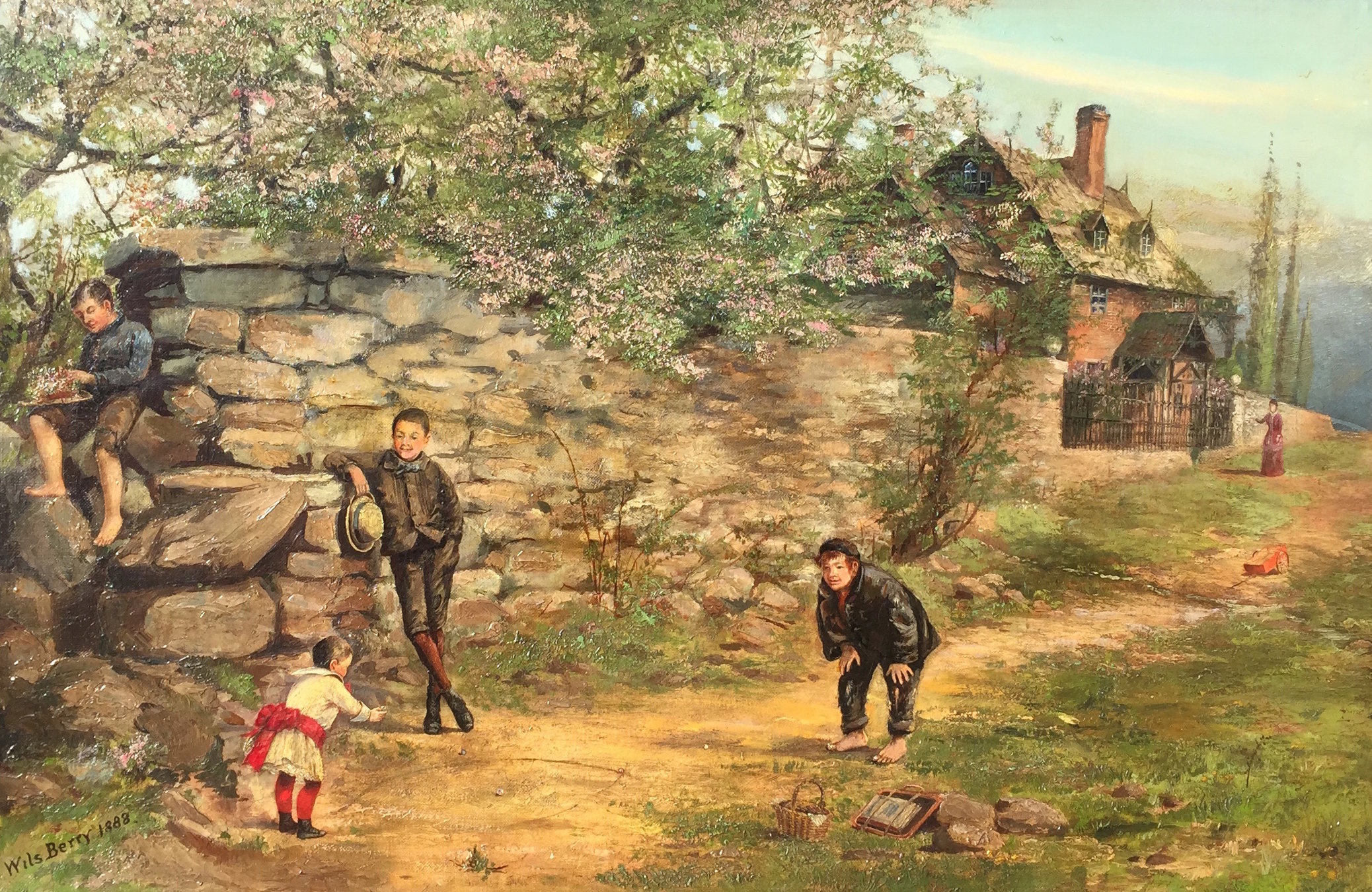
Painting by Wils Berry
While the natives were at the council, Tipton's troops burned the entire village, and destroyed their crops
Menominee and his band were then forcibly removed and marched to Kansas the infamous "Trail of Death"

The Potawatomi Division
- Citizens Band - Shawnee, OK
- Prairie Band - *Jackson County KS
*Endpoint of 1838 "Trail of Death"
In 1909, Indiana became the first state to erect a statue in honor of a Native American thanks to newspaperman Daniel McDonald

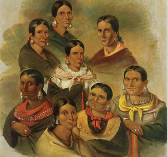
Some Potawatomi Images


Title Text


Woodrow Wilson Crumbo (1912-1989)
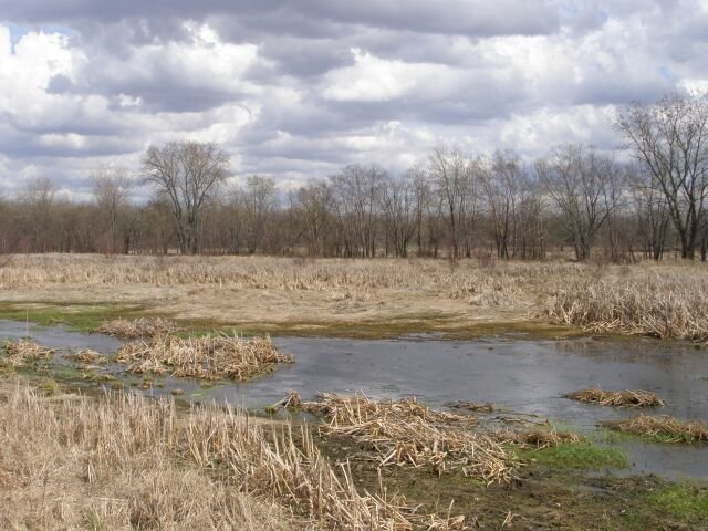
Life on the "unreclaimed" marsh was difficult
The early marsh residents were hardy folk, primarily hunters and trappers

The marsh was generally considered dangerous, pestiferous, and uninhabitable
It also became famous as hideouts for thieves, bandits, and counterfeiters
Pressure mounted from many quarters to drain the marsh
III. Draining and Channeling
In 1850, Congress passed the Swamp Land Act, the first of a series of such laws
It gave ownership of the swamp lands to the states, and made provisions for the swamps to be drained
In Indiana, widespread, notorious scandals resulted in virtually nothing done
Jasper County was the poster child for this corruption
In 1870, The Kankakee River Draining Company was formed

Short bio of Fr. Stephan
- Immigrated from Germany in 1847
- Went to the seminary in Cinncinatti
- Came to Indiana in 1858, founded All Saints Catholic Church
- In 1870 became chief engineer of the draining company
- Helped found the Saint Joseph's school in Rensselaer
- 1870s served as a missionary in the Dakota Territory
- 1884 became head of Bureau of Catholic Indian Missions
Fr. Stephan was responsible for all the early surveying work done on the Kankakee
In 1882, John L. Campbell, Indiana's Chief Engineer, issued a report on the river

The biggest impediment was the Momence Ledge
But Indiana had no sovereignty there
In 1889 and 1890, $65,000 in state funds were allocated for removing the Ledge
A complex, contentious project
- Illinois asserted sovereignty, Indiana's locals revolted
- Various remonstrances, bills, lawsuits, etc.
- Indiana quietly bought easements in Illinois
- The ledge was finally cleared in 1893
- 8649' x 300' x 2.5'
- 66247 cubic yards of rock removed
The first 7 miles at the headlands were straightened in 1896, by private parties
The Upper Valley drained by 1906
- 1896: 7 mi. privately done
- Miller Ditch 7.75 mi.
- Kankakee Improvement Co. 5.5 mi.
- Place Ditch 9.1
- 1906: Kankakee River Reclamation Co. 16.7 mi.
The cutoff was the western boundaries of Starke and Laporte counties
In 1909, C. G. Elliott of the USDA reported on the situation

In the report, he noted on a situation that constituted a practical emergency
One map in the report depicted the work done on the Upper Valley

Another map laid out the proposed new straightening and channeling in detail

Work was completed to the Illinois line by 1918
- Original 250 miles -> 80 miles river length
- 400,000 acres -> 30,000 marshland
- Illinois was hostile; left their side untouched


The situation today
The dredged channel is stable; feared return to meanders etc. didn't occur
Huge amounts of sand are being eroded downstream
Most worrisome, severe flooding has become a problem
- Formed by Indiana legislature in 1977
- Representatives of all 8 counties in the basin
- Recently were proposed an "action plan"
- Delicate and complex, like all things Kankakee
Illinois and Indiana, for the first time, are now committed to working together
One year ago next week, the Kankakee suffered from record flooding


Frequently flooded areas on the Kankakee
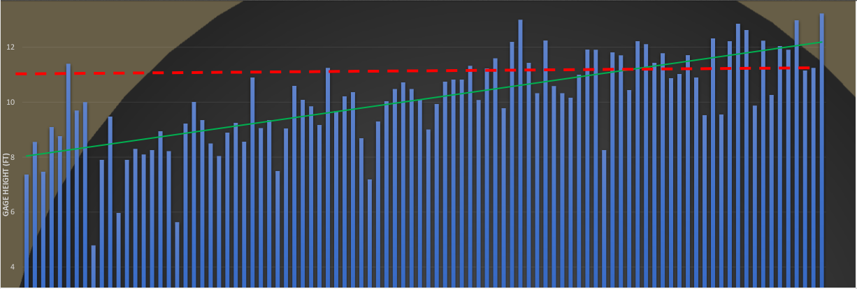
Gauge heights @Shelby, 1923-present
Gist of the proposed plan
- Bank stabilization, esp. on Yellow River
- NO new channelization!!!!
- Flood "easements" on existing farmland
- States would buy "right to flood"
- Landowners would retain title
- Land could not be used for farming
- Cost will be high; the cost of flooding is high too
What I'm not going to be talking about
Points of Interest
- Kankakee Mill Race/Coquillard's Folly
- English Lake
- Dunn's Bridge
- The impassable marsh
- Potawatomi Ford
- Grape Island/Indian Gardens
- Beaver Lake/Bogus Island
- The Momence Arch
My ongoing projects
- Get up to speed on Baum's Bridge
- Discover the details on Dunn's Bridge
- I reconnected with his family
- Visit the "Iroquois County Twin"
- Propagate grapes from Grape Island
- Visit Art Tanner's cabin
Thank you!!!
- Mark Kingma
- Steve Shook
- Jerry Hammes
- Siavash Beik - Christopher B. Burke Engineering
- James Sweeney, Jr.
- Dr. Terry West, Purdue Dept. Geology
Kankakee: Three-Part Presentation
By capouch
Kankakee: Three-Part Presentation
Slides for a presentation to be given to the Midwest Mint Growers Association on February 21, 2019


